
Updated on March 21, 2022
Day 1 of 2020 Idaho Trip, Twin Falls
First day of my Idaho trip. With more than enough time to make the drive from Boise to Hailey, I decided to take a detour to visit the city of Twin Falls, with its many waterfalls along Snake River.

Shoshone Falls
With more than 8 hours of daylight from my flight touchdown to sunset, I thought in addition to driving from Boise to Hailey there could be more activities for my first afternoon in Idaho. There were a few hiking trails near the city of Boise, but I thought after a long flight from East coast, watching waterfalls was a more relaxing way to fill the day with activities (another advantage being that western flow of Snake River meant the waterfalls would be facing afternoon sun, ideal for photography).
Before my visit, the only waterfall in the region that I knew was Shoshone Falls, dubbed “Niagara of the West” (spoiler: it’s not nearly as impressive). Then I came across the region’s tourism website (visitsouthidaho.com/waterfalls/), and found out there were a lot of waterfalls in the region. So I picked a few along the way and packed my afternoon itinerary.
The city of Boise left me all but good impressions the moment I stepped out of its airport: pleasant temperature with breeze, bright sunshine from cloudless skies. Above all, just like the weather, the people seemed buoyant and uplifting. After getting onto the Lyft to downtown rental car store (so that I didn’t have to pay exorbitant airport surcharges), the gentleman driver greeted me with a professional tone to “take me there as safely and quickly as possible”. The youngling at rental store admired my “beautiful” Maryland license and compared it to his “dull and boring” Idaho one, and wished me good luck on my conquest of Mt. Borah while providing suggestions on other hiking trails nearby. These made me a nice and refreshing start of my trip despite weariness from hours of flying.
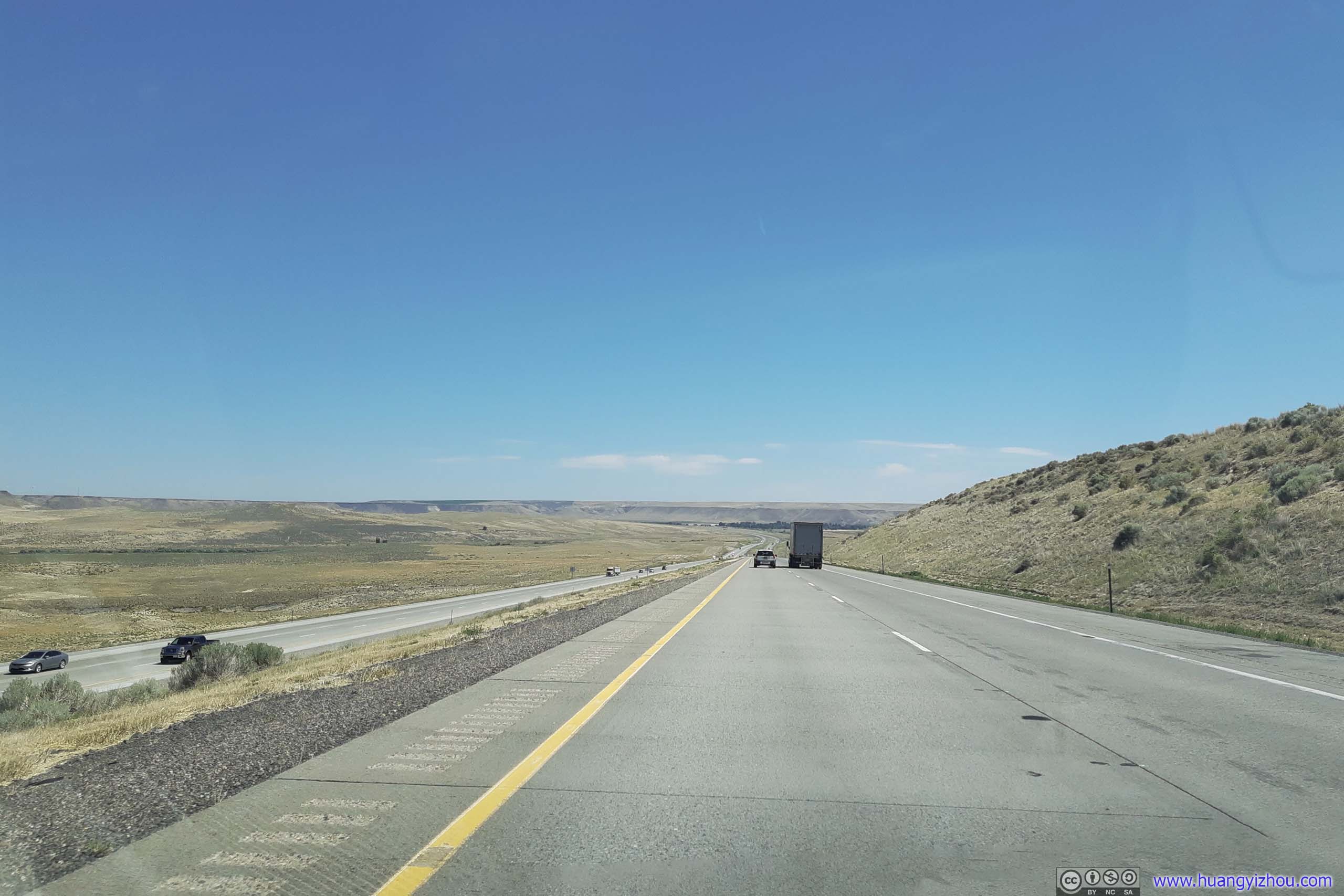
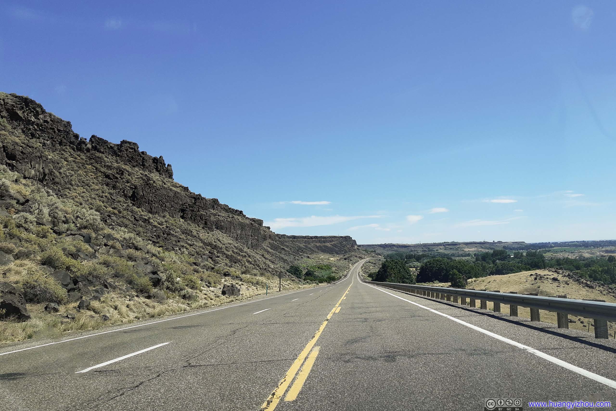 Highway and Country RoadAs I drove towards Malad River Gorge Dam.
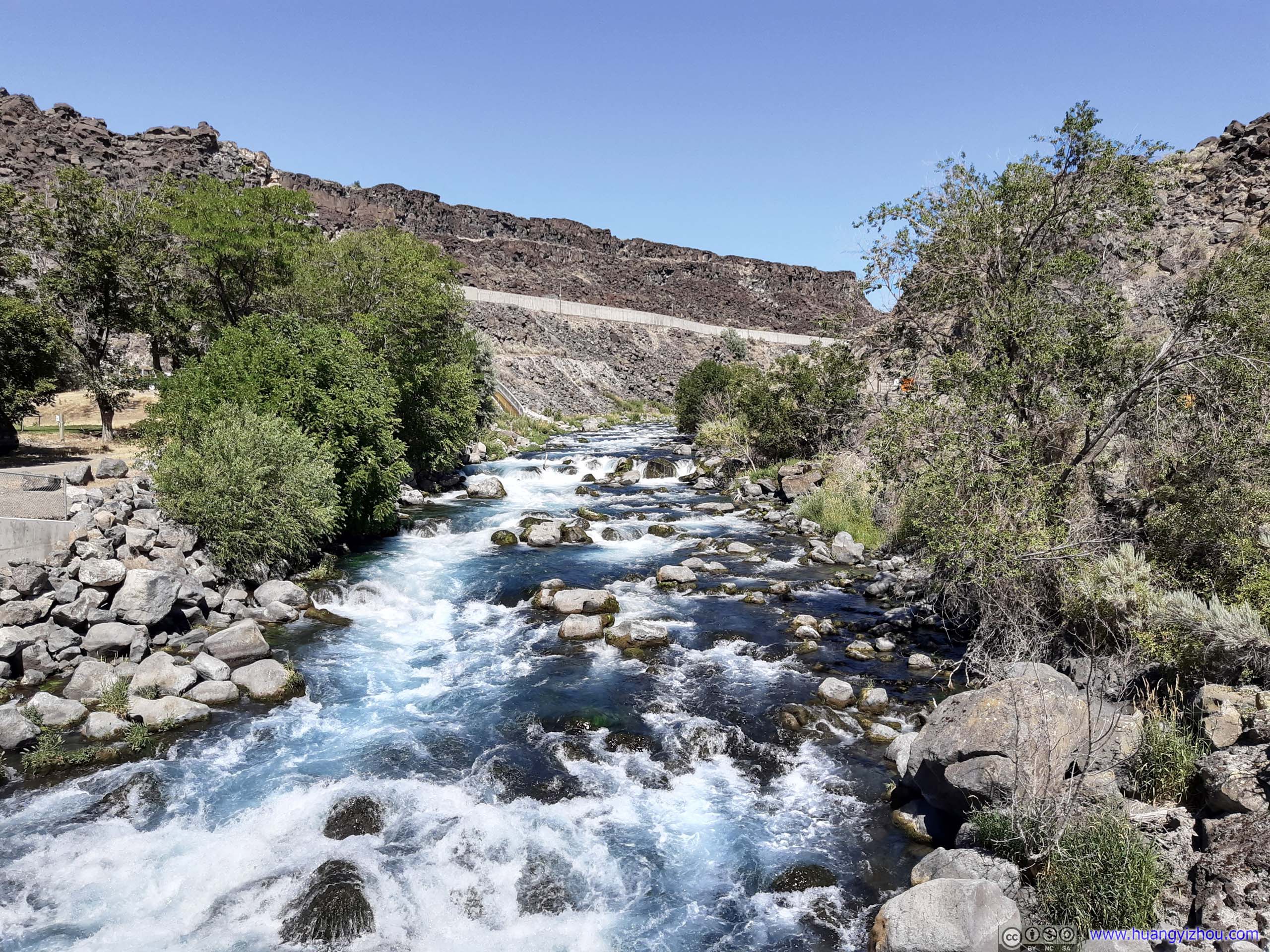
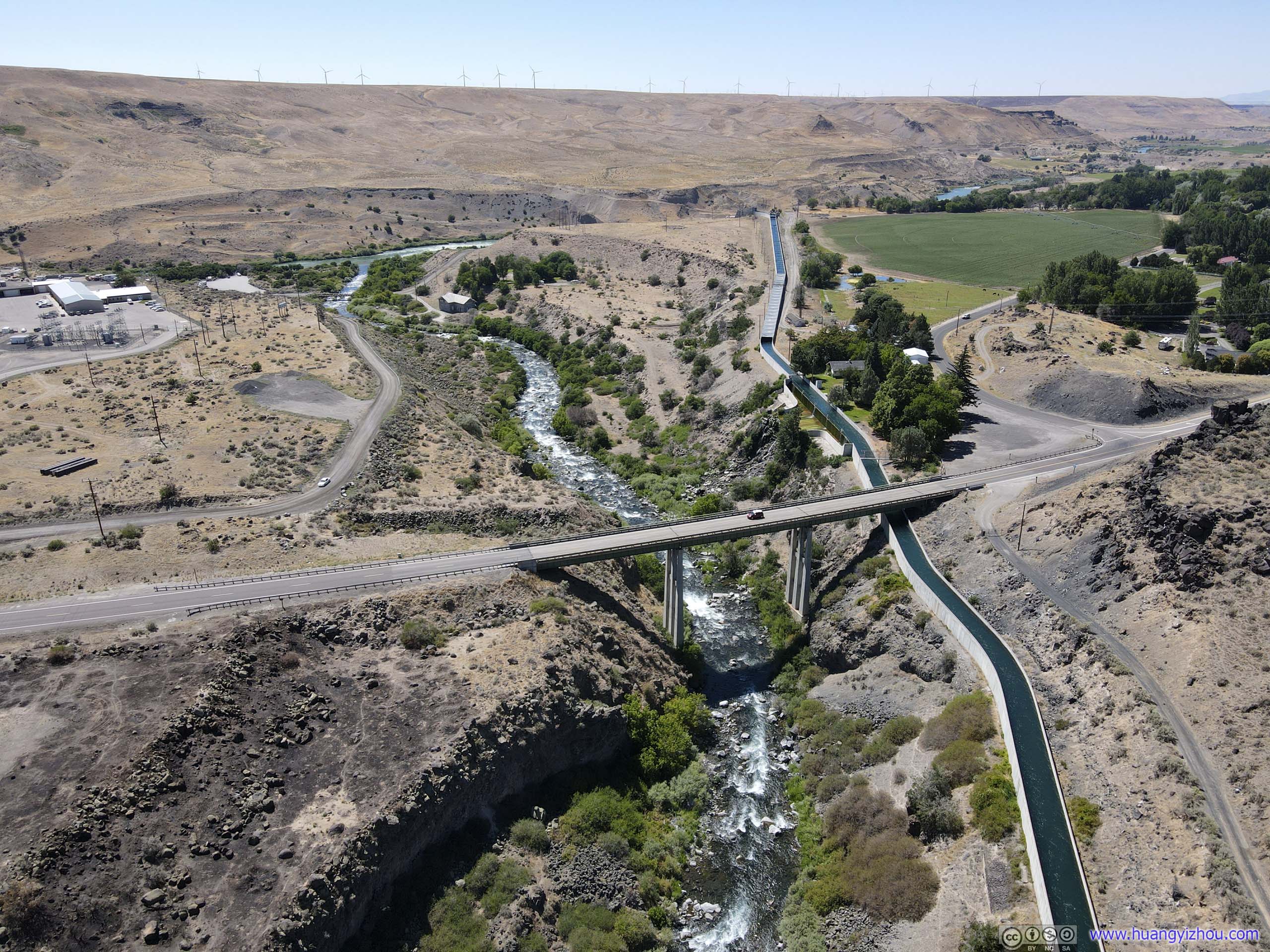
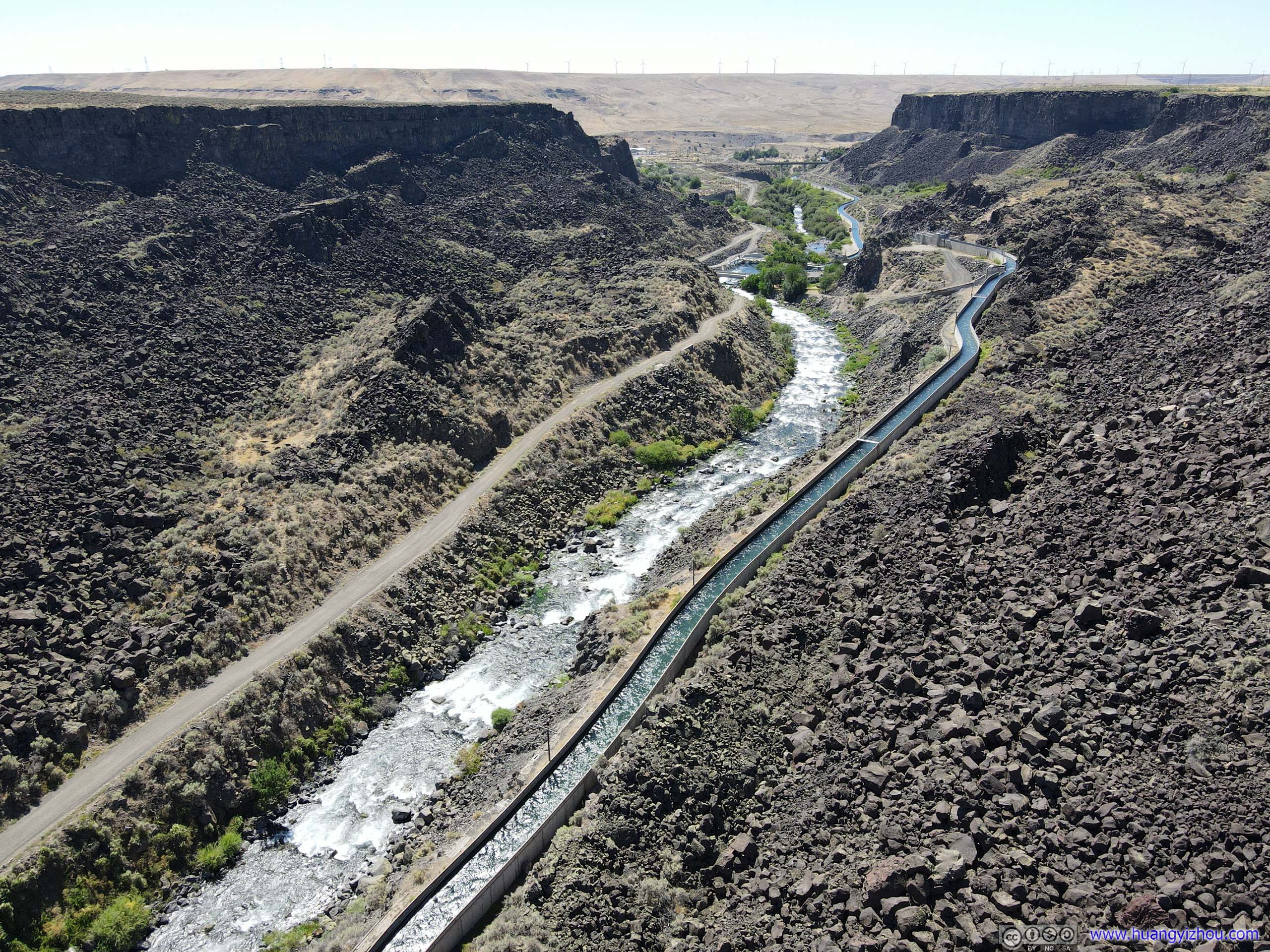
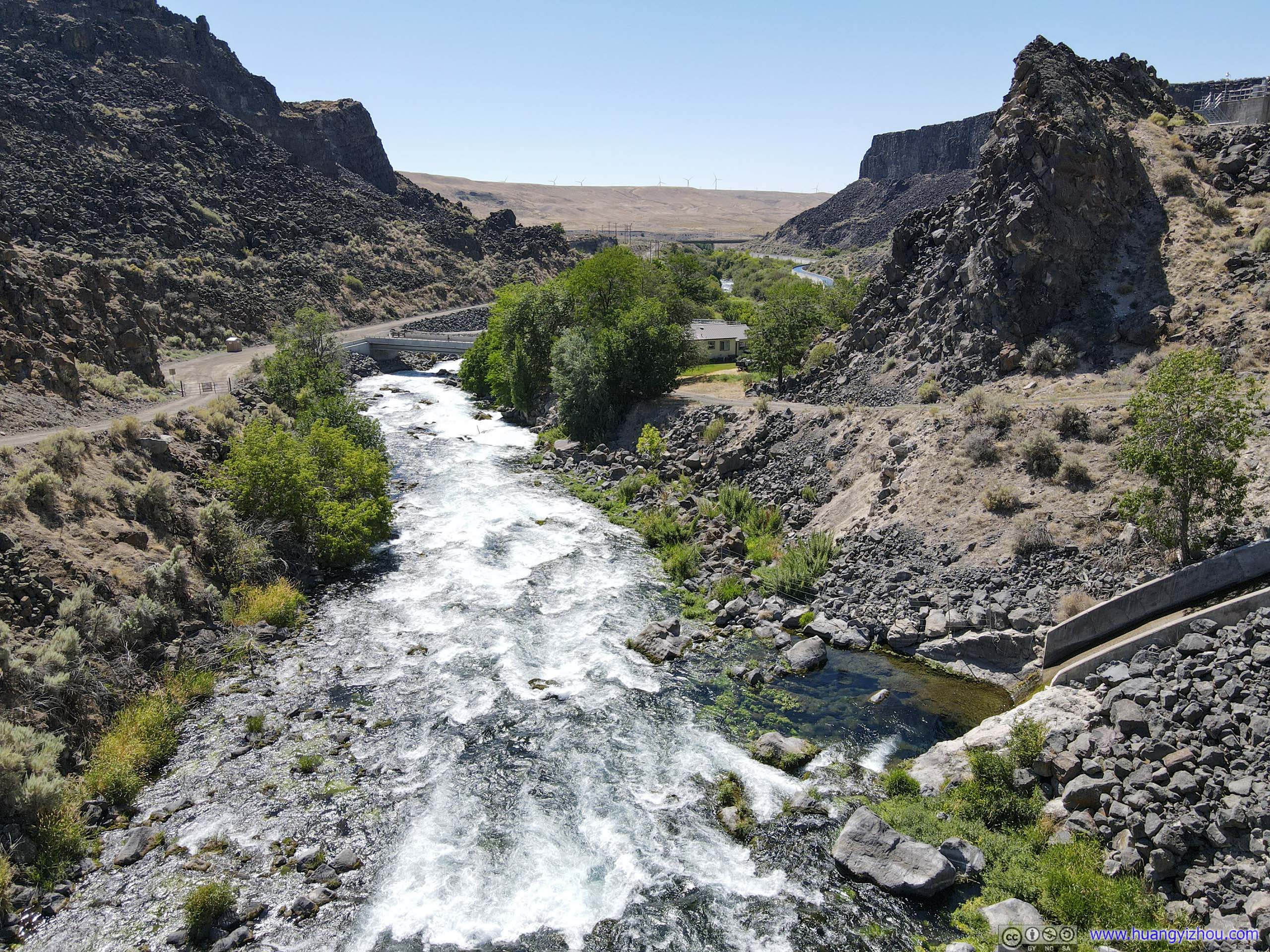
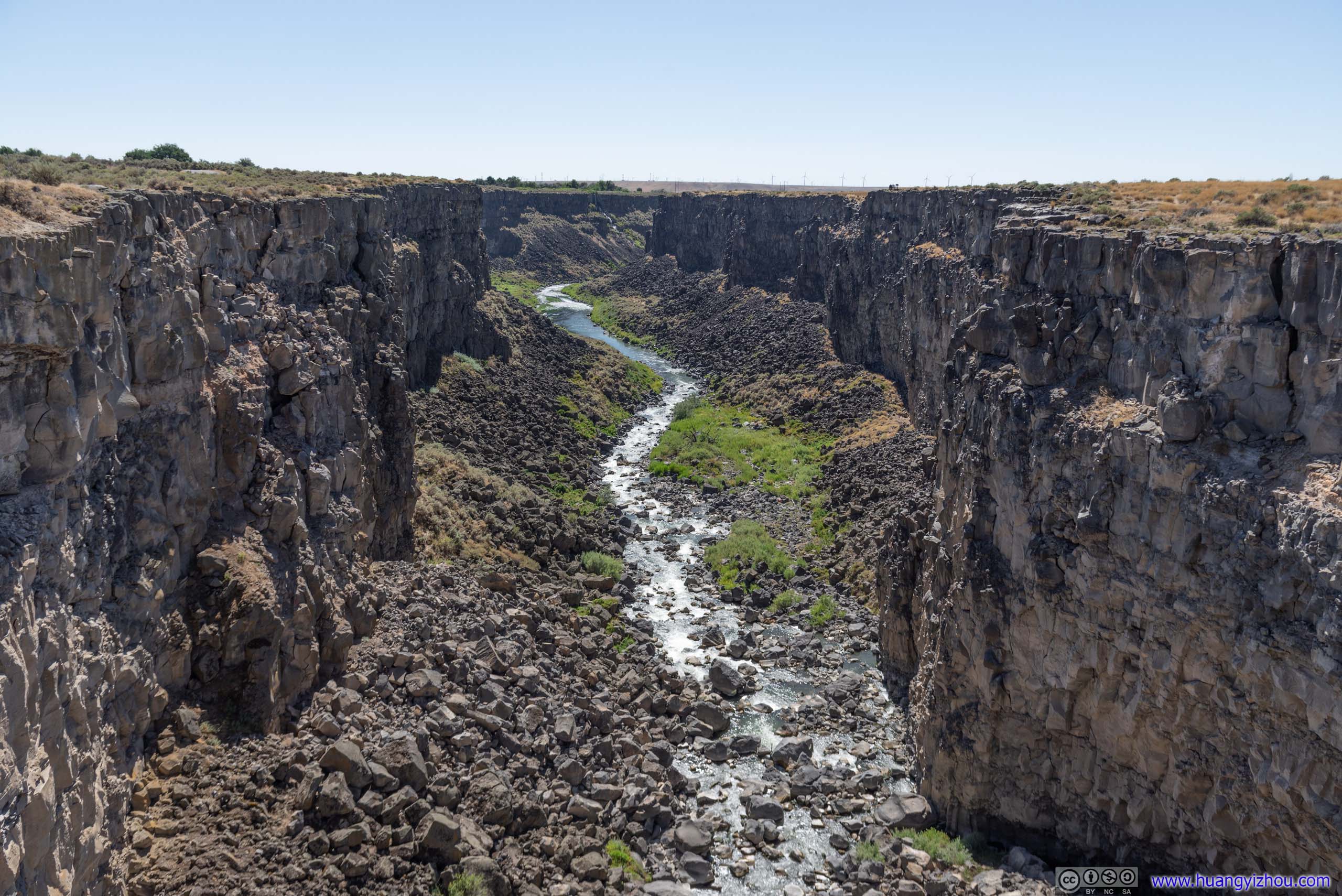
Malad River
The tourism promotion website seemed to have two spots marked along Malad River, one was “Malad River Gorge Dam”, and the other was “Malad Gorge Walking Bridge”, I visited the former spot first.
The Gorge Dam was located 0.6mi from US30 through an unpaved road. Besides a few office buildings, there didn’t seem to be any recreational facility, and the following ripples were all the scenery it could offer.
 Malad River
But since it was located in a straight gorge, I could launch my drone without worrying about signal blockage, and took an aerial tour of it.

 Malad River
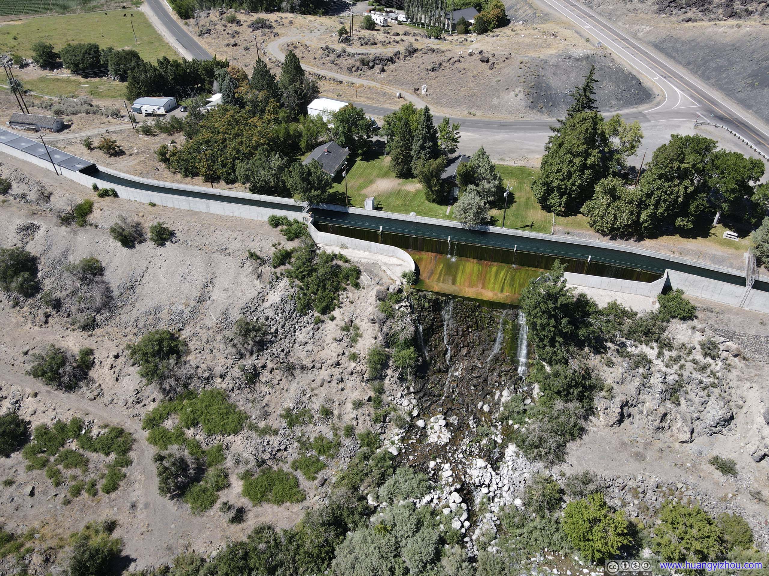
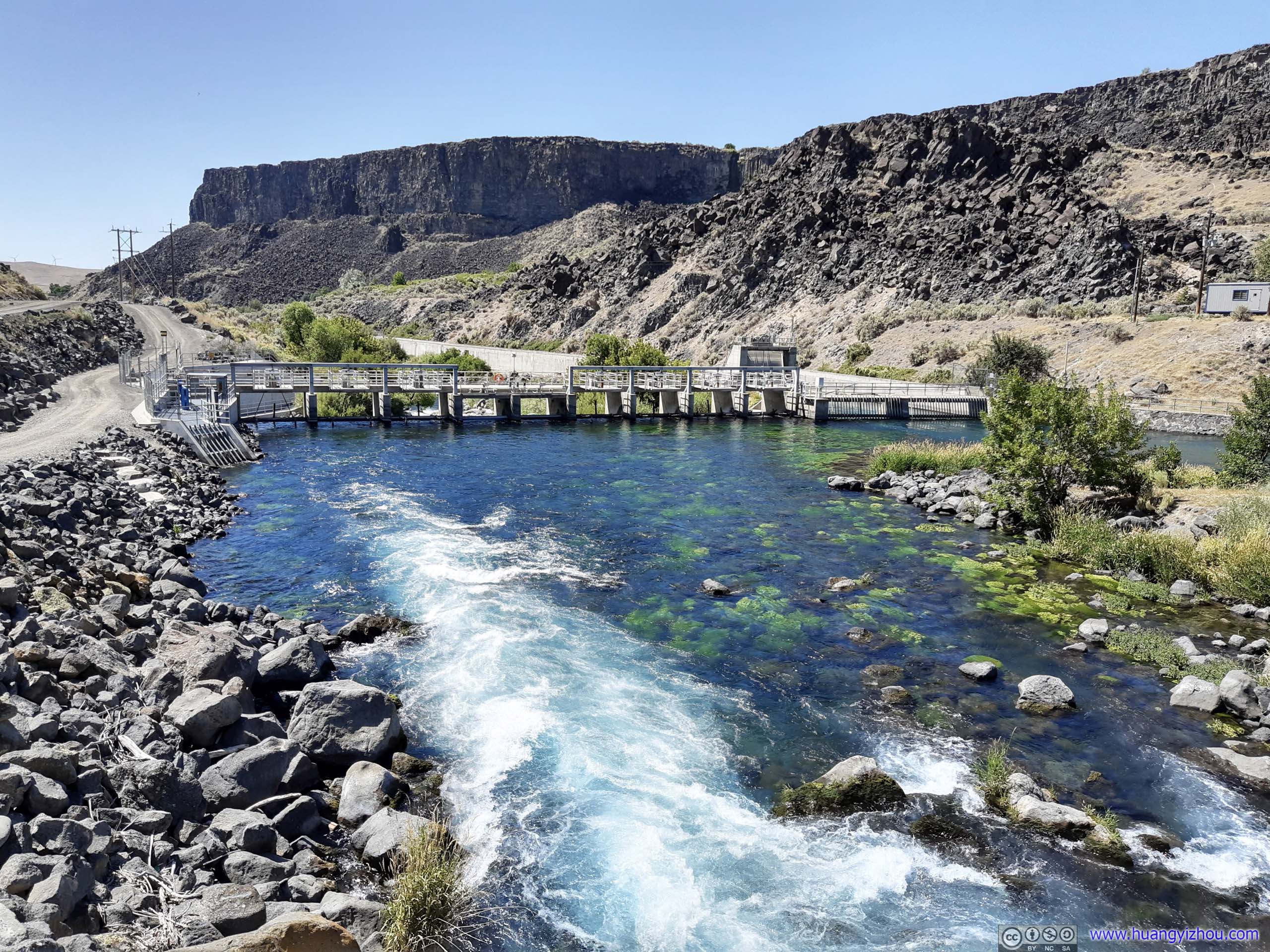
SpillageI wasn’t too sure why this aqueduct would spill over back to the river.
After that, I drove to Malad Gorge Walking Bridge. The bridge was located right alongside Interstate 84, but the nearest exit was 0.8mi away. It’s technically part of Thousand Springs State Park, so there’s a 5-dollar per vehicle entrance fee, honor system in place.
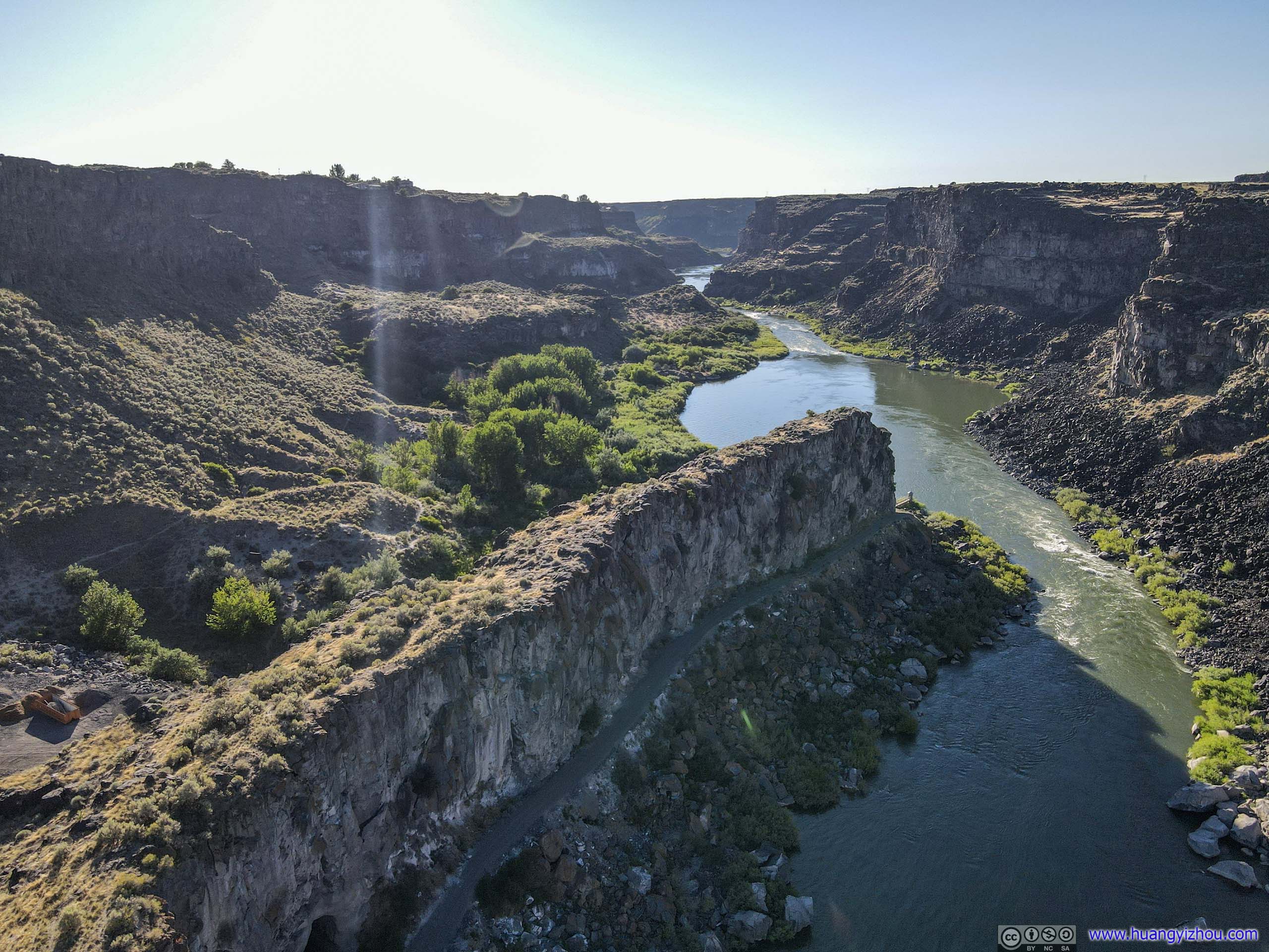
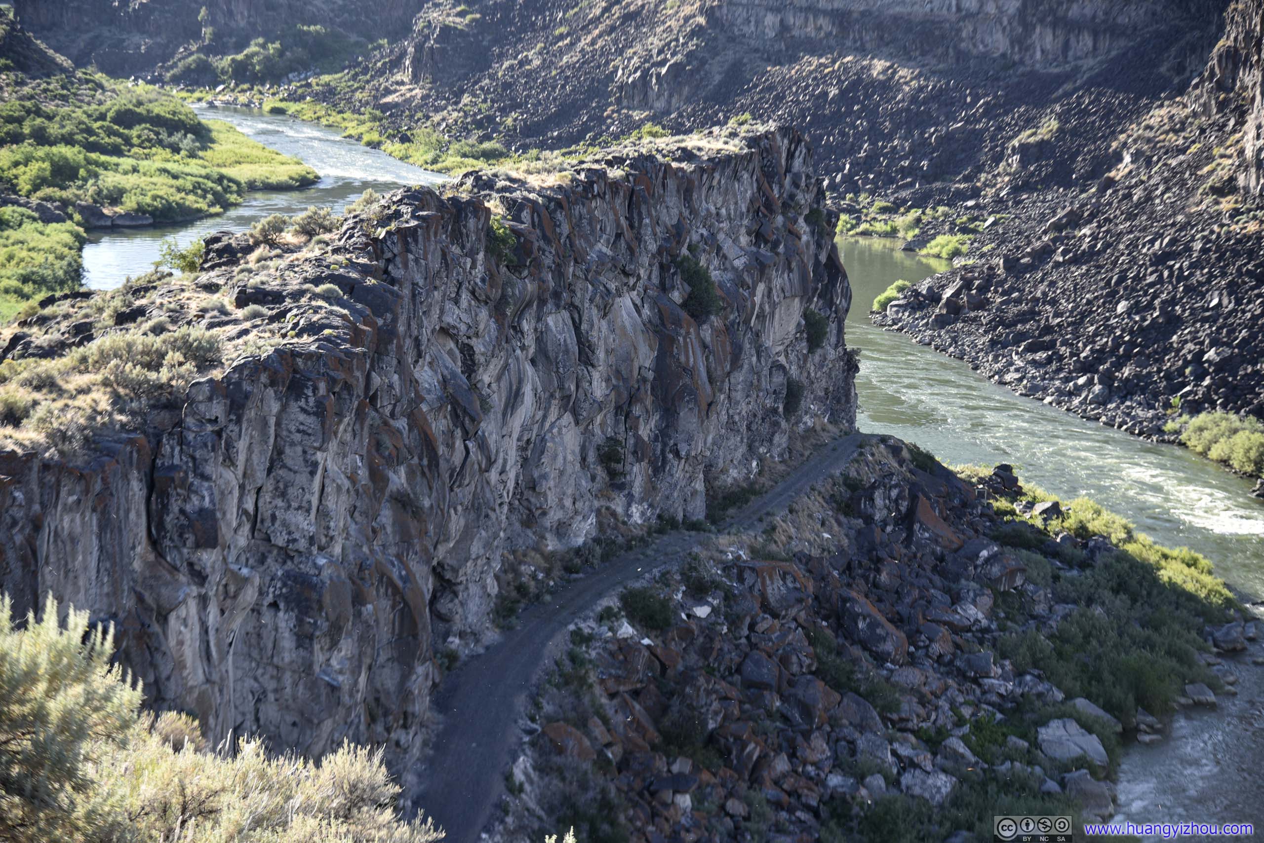
To the West of walking bridge, Malad River wound its way in some magnificent gorges.
Malad River Gorge
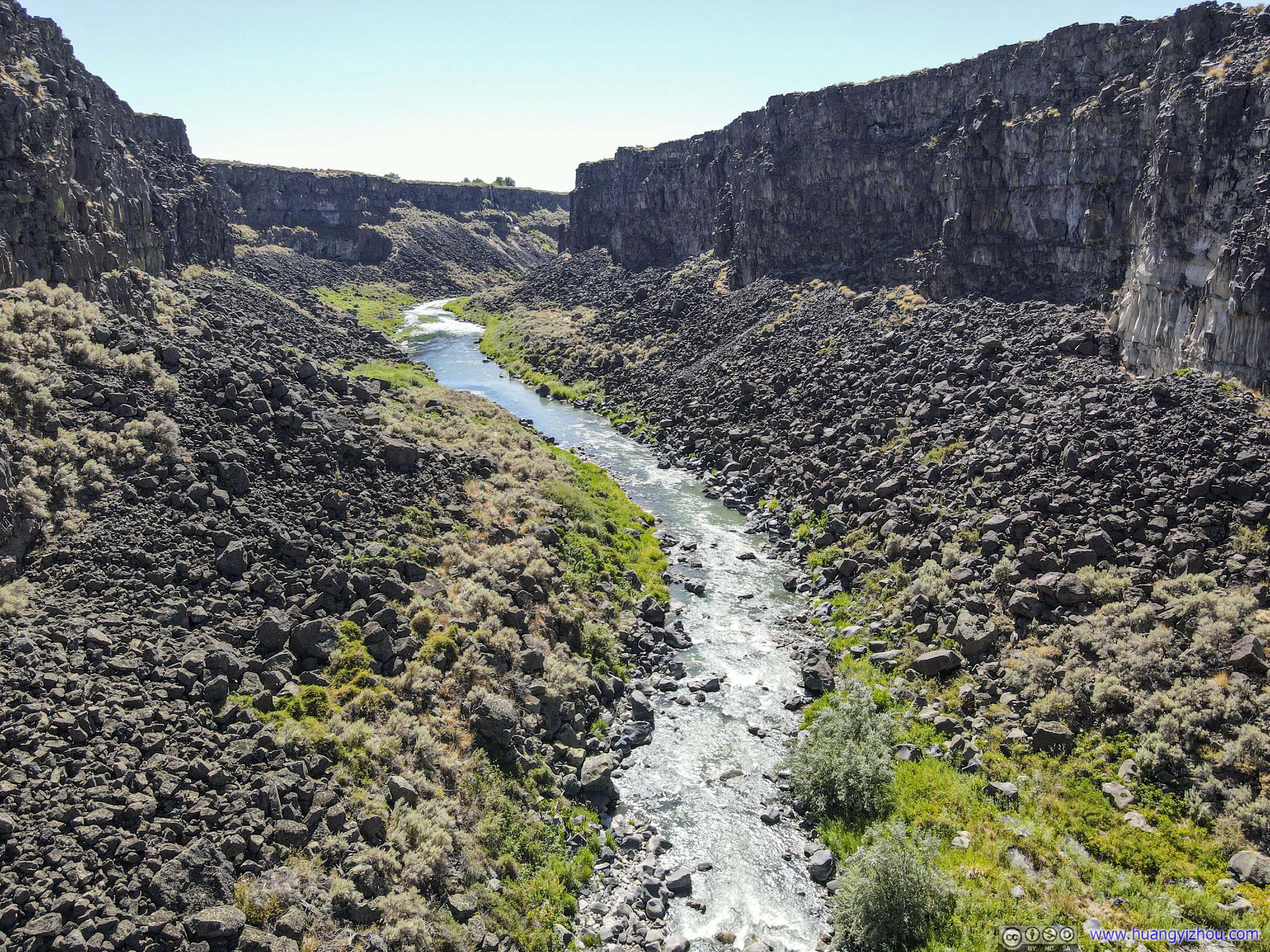
 Malad River
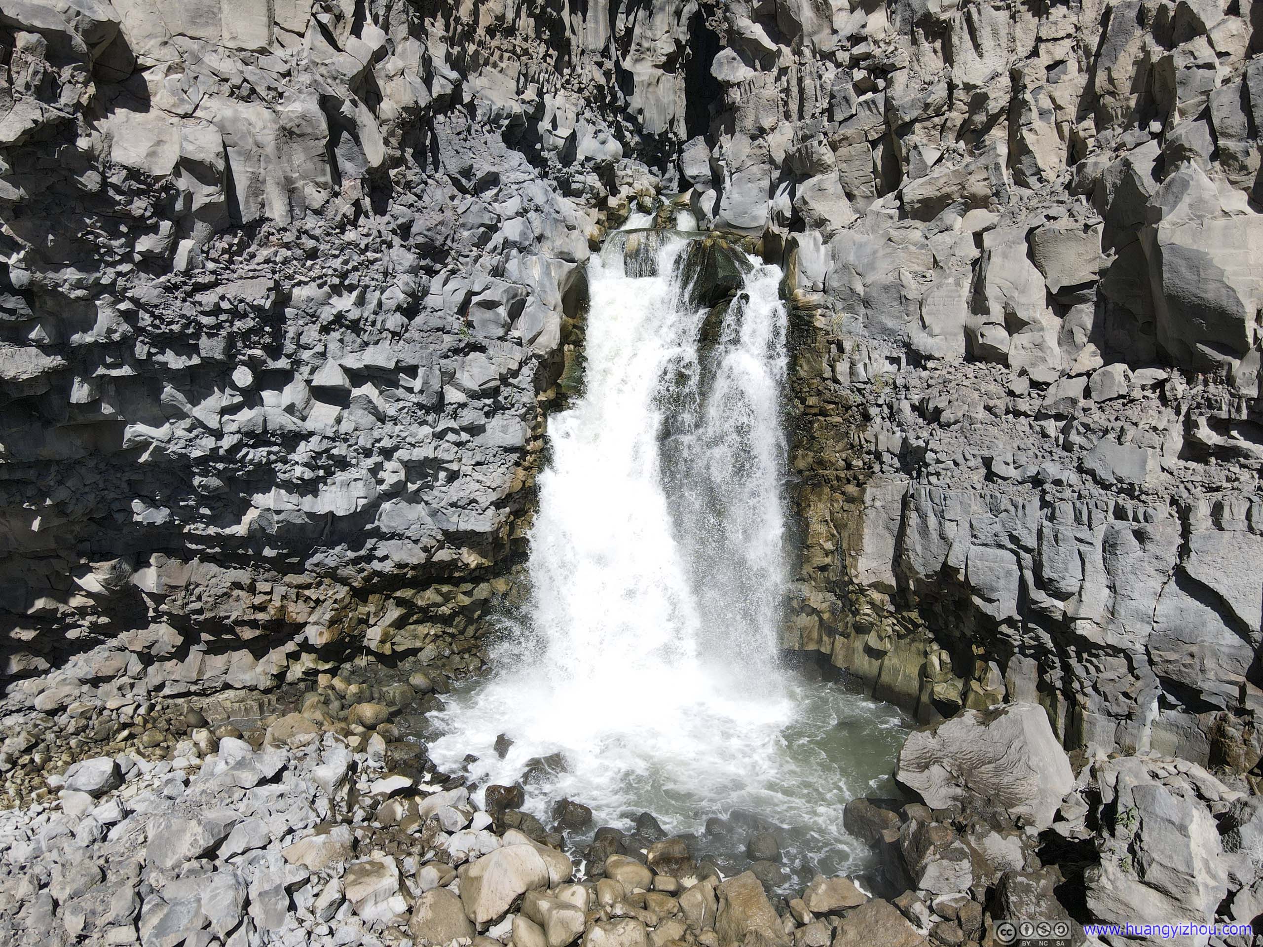
Waterfall along Malad RiverA small one just below the walking bridge, only visible from drone.
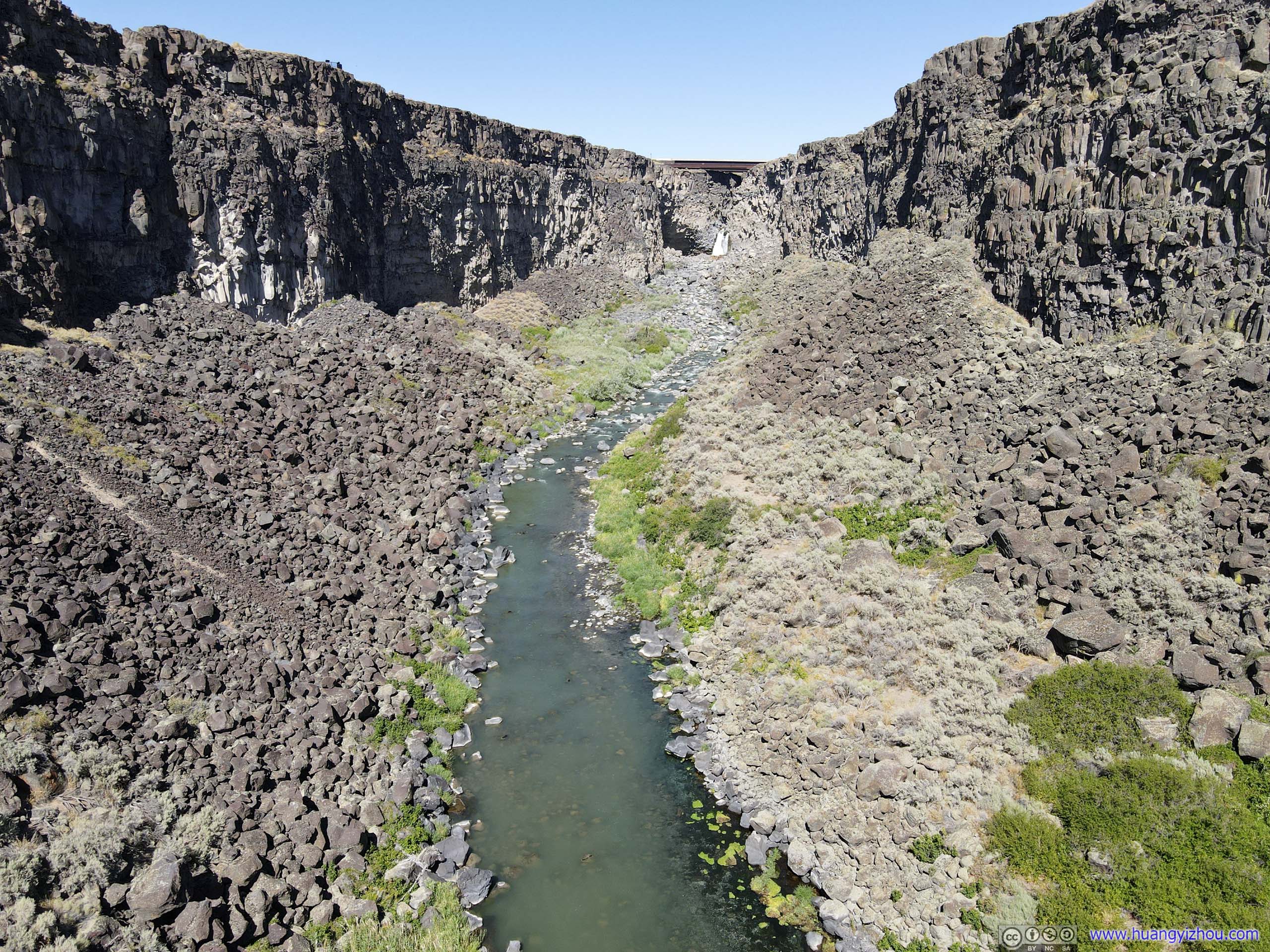
On the other side, the gorge narrowed to only a few meters in width. Interstate 84 crossed Malad River at this very narrow gorge, that’s where I thought flying my drone through would be interesting.
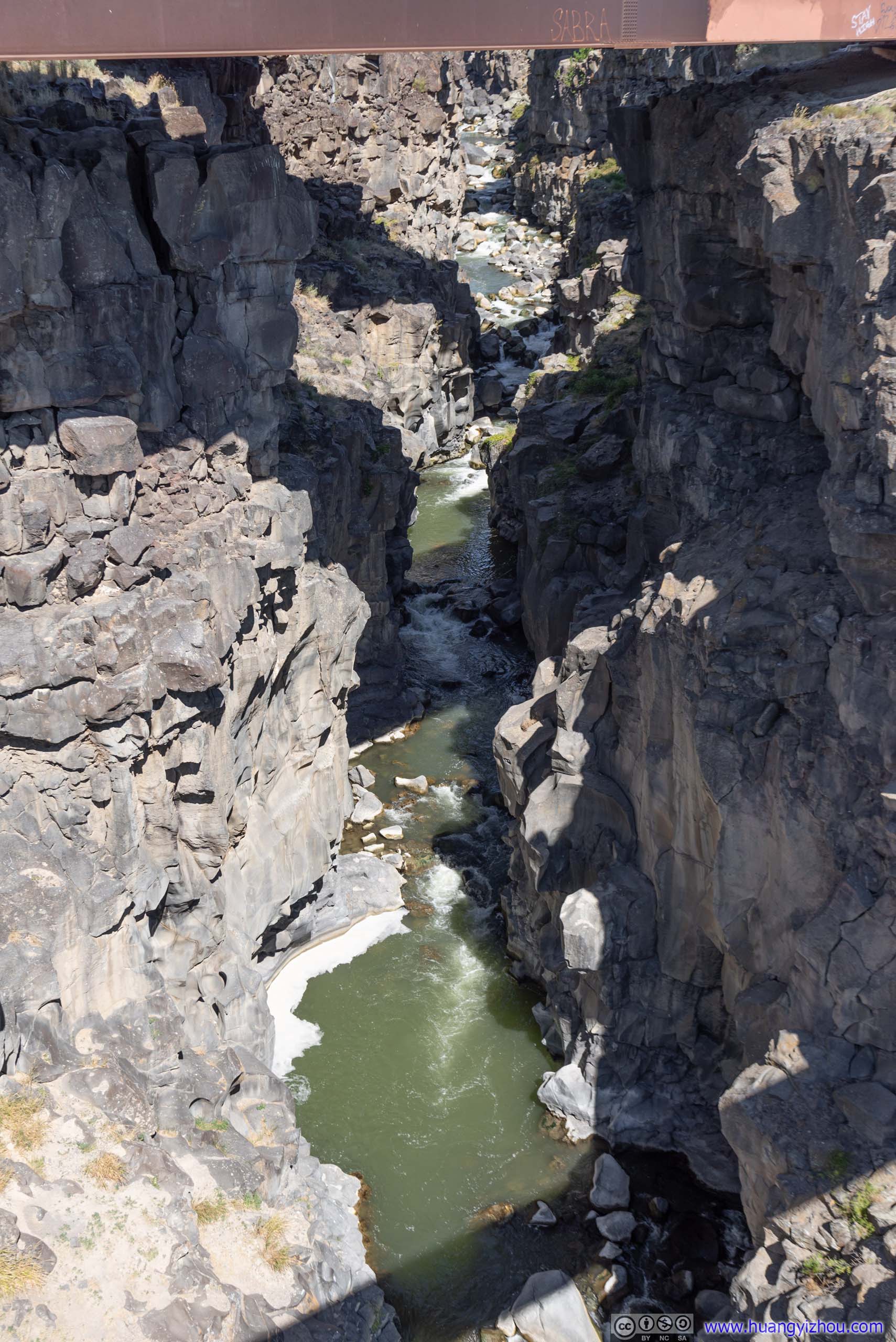
Malad River Gorge
And here’s my drone video, both from the dam and from the walk bridge. I had to say flying underneath the interstate bridge with the gorge at its narrowest was both thrilling and scary, since my drone didn’t have side obstacle detection.

Bridge PiersIt seemed that there used to be a bridge crossing Malad River here that got removed. I guessed that’s railway?

Highways across Malad River
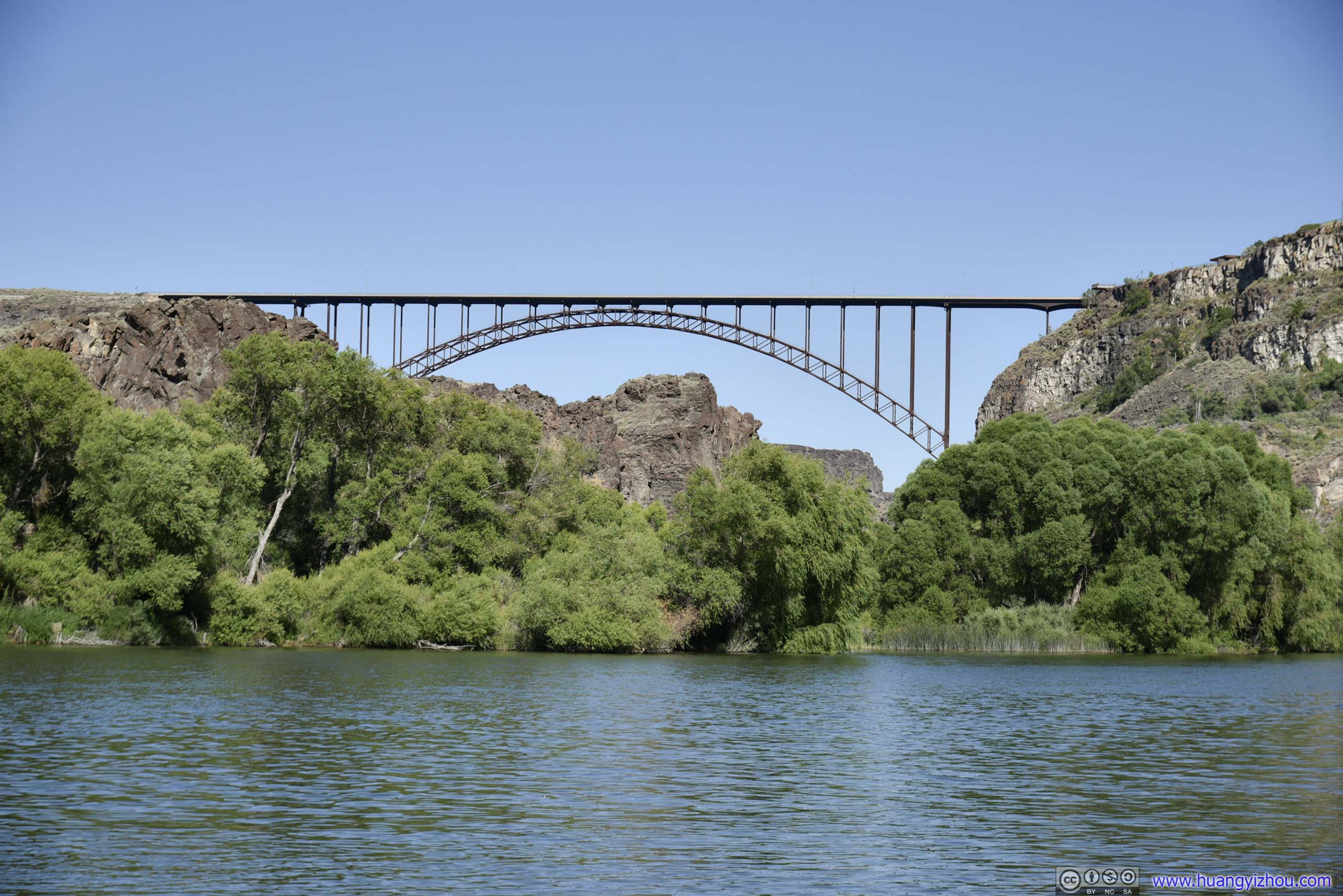
Perrine Memorial Bridge
My next stop of the day was Perrine Memorial Bridge, gateway to the city of Twin Falls from the North.
The current bridge was finished in 1976, replacing an old bridge built in 1927. There were turnouts on both directions North of the bridge, for motorists to stop and talk a look at this magnificent structure.

Perrine Memorial Bridge
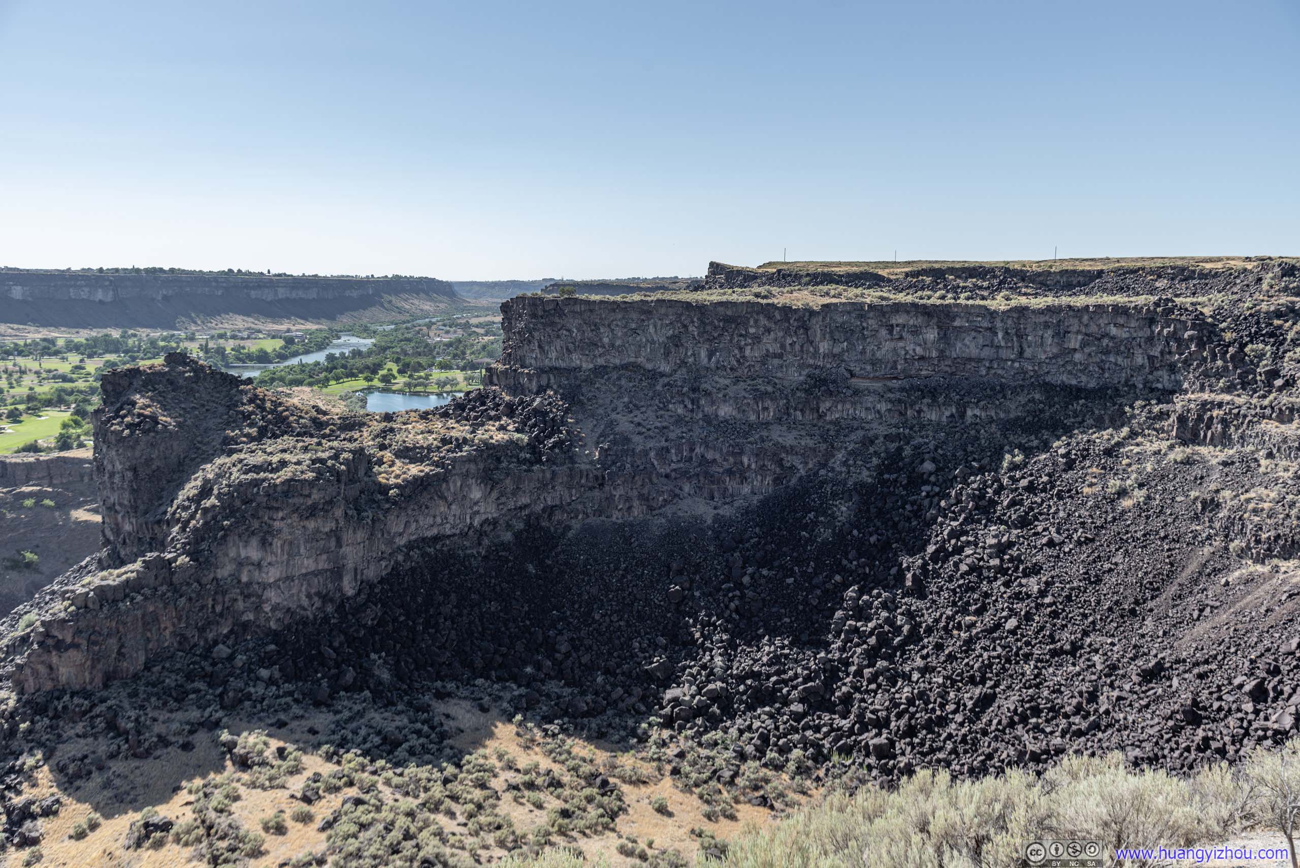
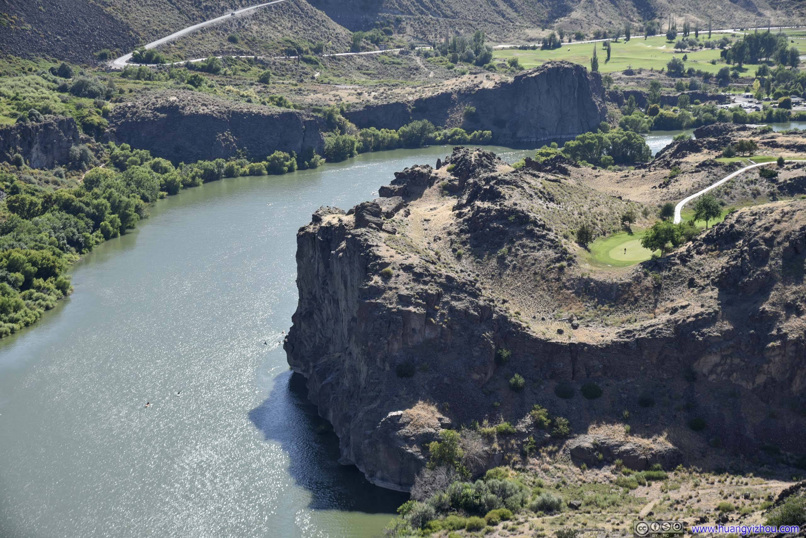
Canyon
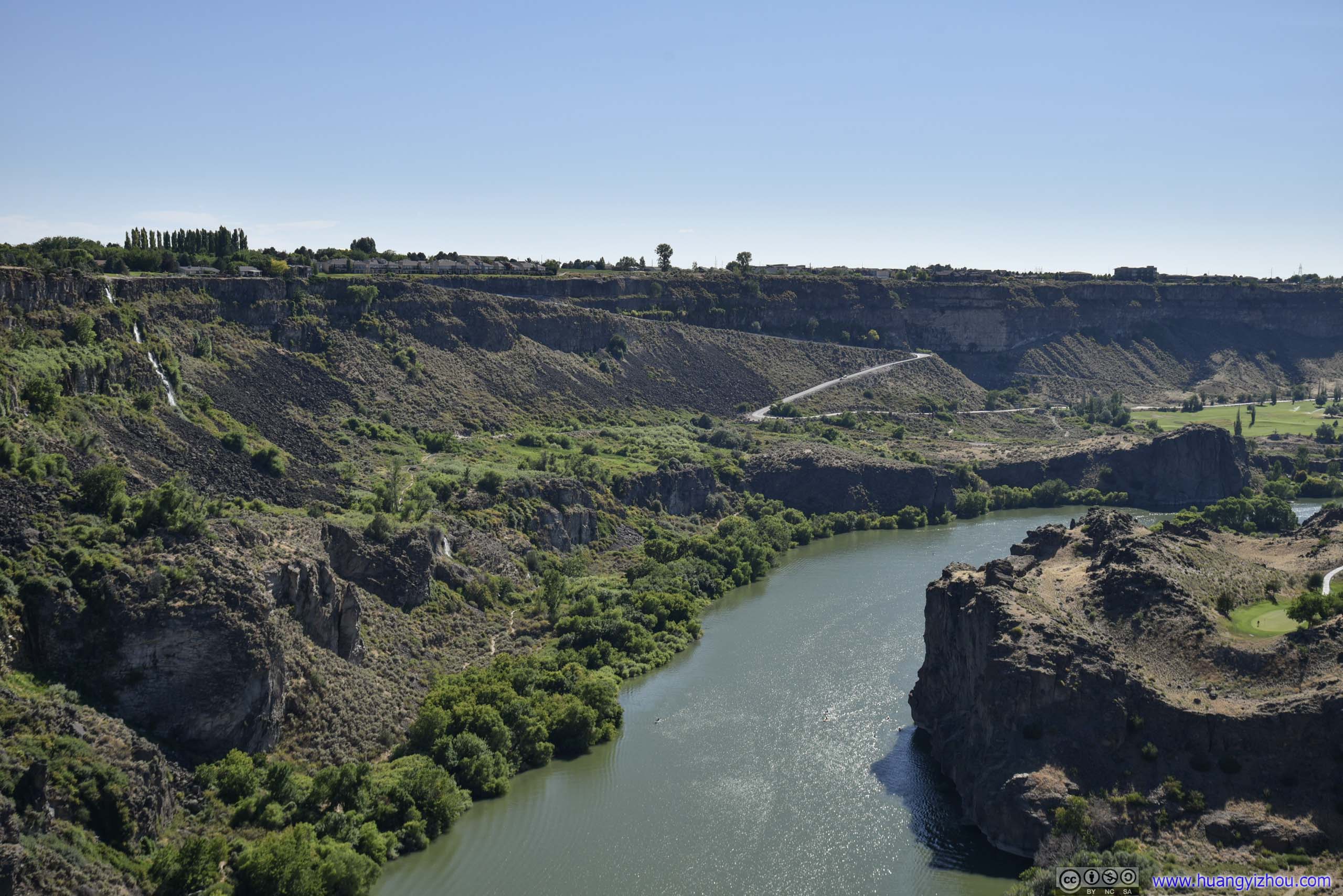
 Snake RiverA rather precarious location of golf course on its northern cliff.
And of course, this was a good spot to play with my drone.
Perrine Memorial Bridge
Overlooking Perrine Memorial Bridge
WaterfallFrom the roadside turnout (and from my drone) I spotted such a waterfall to the West, which I thought was Perrine Coulee Waterfall, my next destination. For a moment I was quite excited by this discovery. It turned out to be some nameless waterfall along the cliff overlooking Snake River, with the actual Perrine Coulee Waterfall farther to the West.
Overlooking Snake River
And in line with my mood of flying drone underneath things today, I flew it under Perrine Memorial Bridge, which was much easier due to its enormous span. Here’s the video:
Perrine Coulee Waterfall
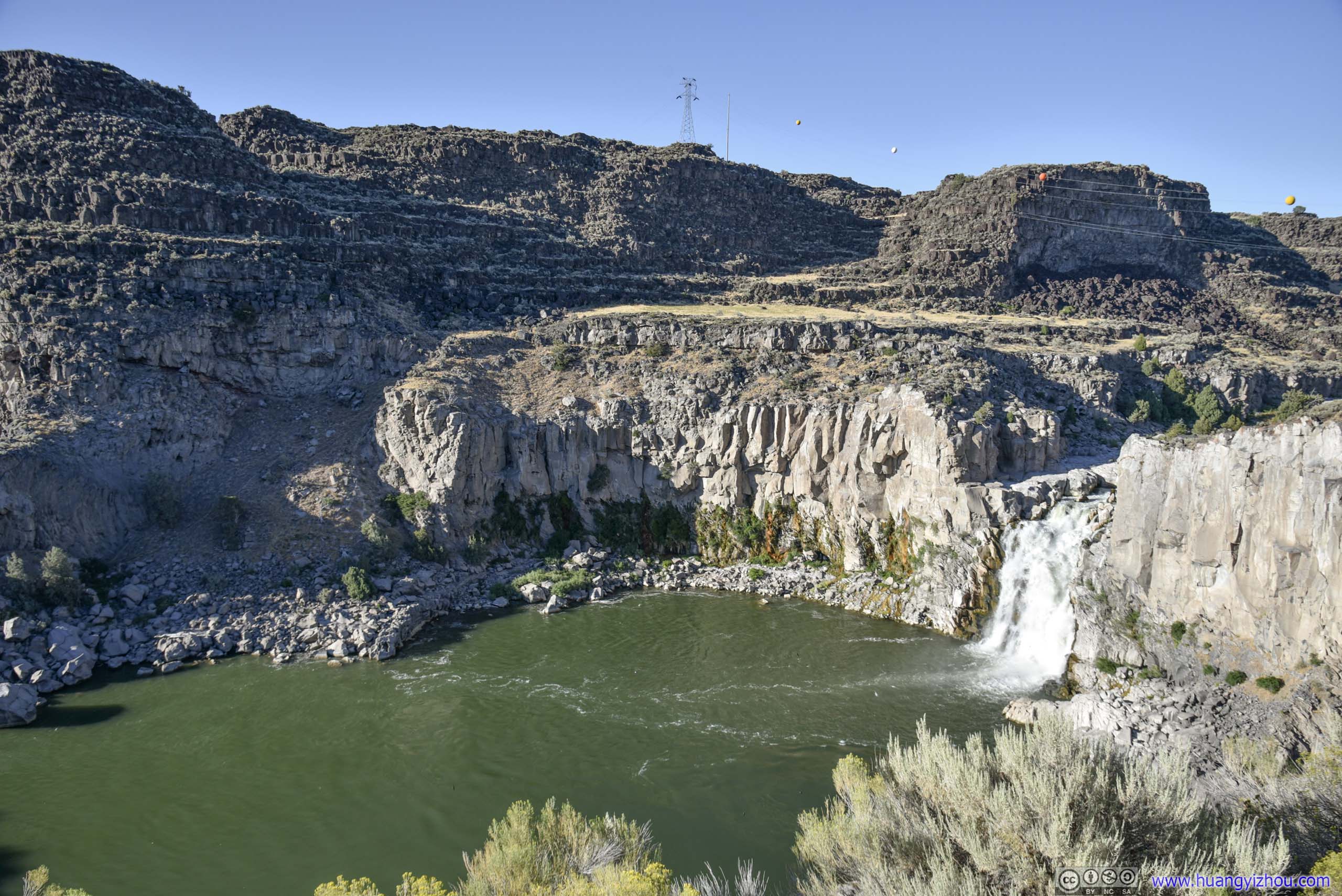
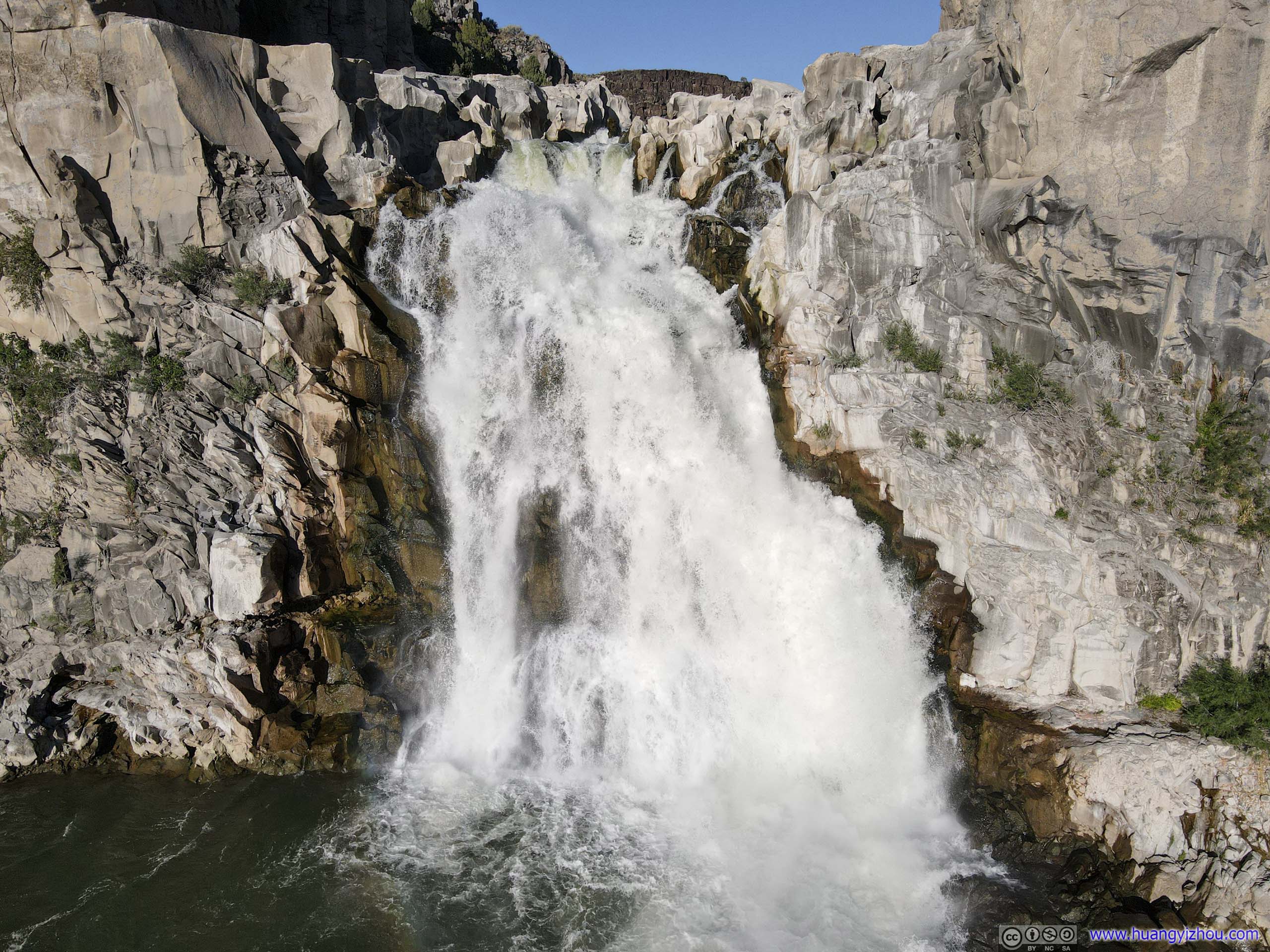
Next stop on my list was Perrine Coulee Waterfall, located a short drive away down the canyon. It’s believed to be the only waterfall in the county to have year-round flow.
There was a short hiking trail leading from the small roadside parking lot to the waterfall, where adventurous souls could experience its drenching power. I was a little bit pressed on time, and I didn’t want my lens to get wet, so I stayed at a safe distance with these photos.
 Perrine Coulee Waterfall
Down the canyon road was Centennial Waterfront Park, which was a famous spot for locals to go swimming or boating on Snake River. I had to say kayaking along such impressive gorge must be quite the getaway, if I lived nearby.
 Perrine Memorial BridgeTaken at the park’s boat launch (left) and along canyon road (right).
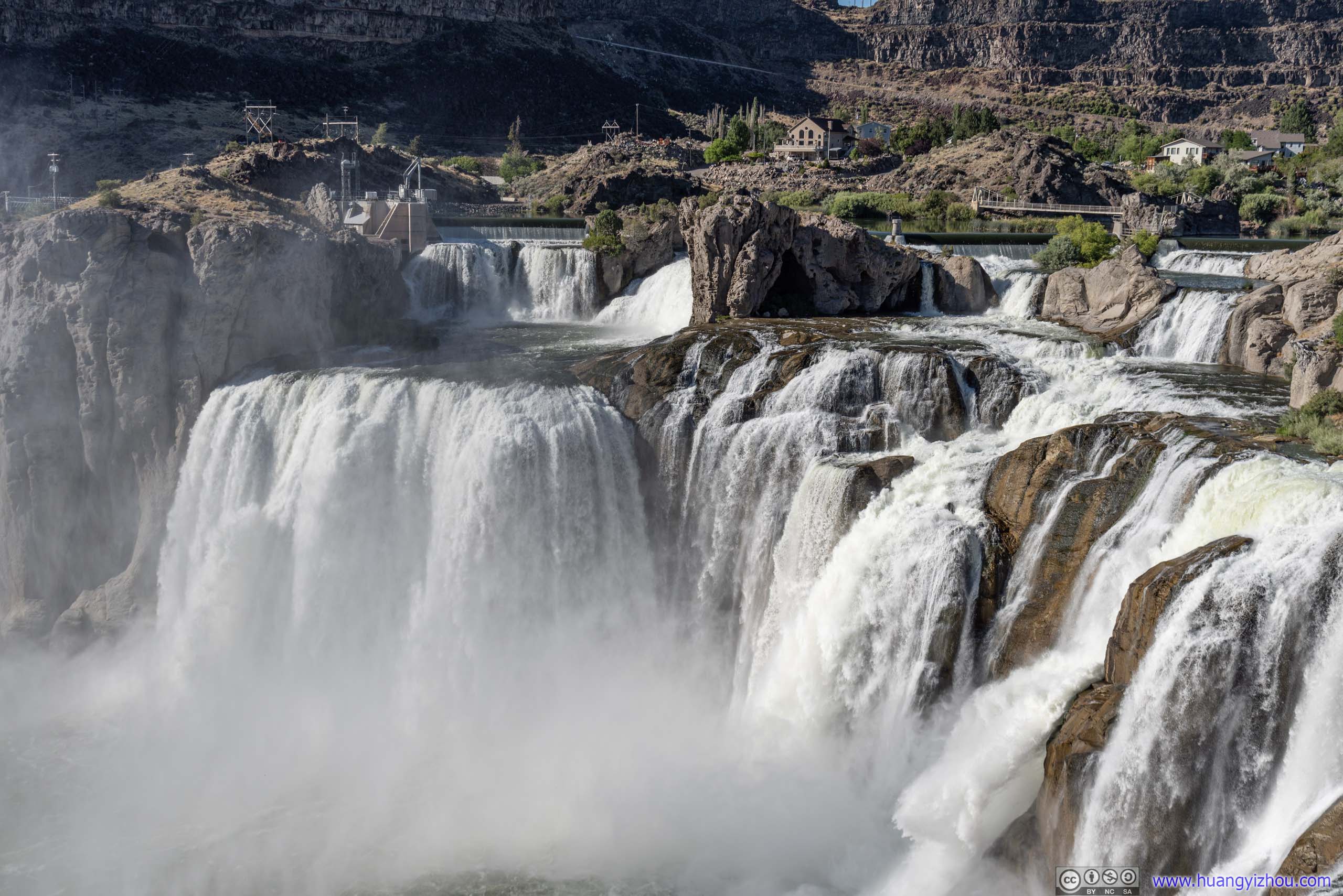
Shoshone Falls
My next stop of the day was Shoshone Falls, “Niagara of the West”.
Probably since it’s a popular destination, there’s a lady at the entrance enforcing the 5-dollar-per-vehicle entrance fee (most other locations run honor system). She also confirmed to me that they were okay with drones.
The park built a metal overlook into the canyon, where I captured these shots of the roaring cascade.
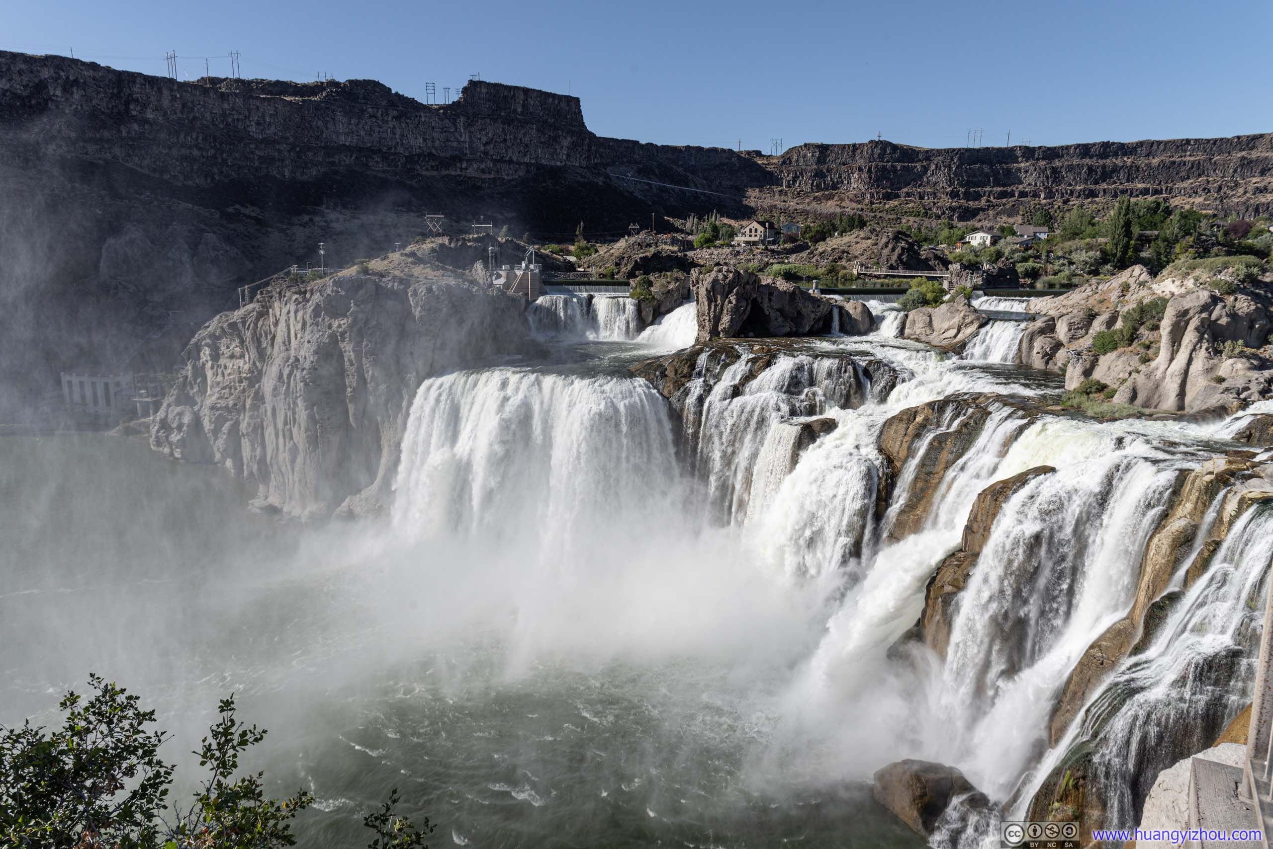
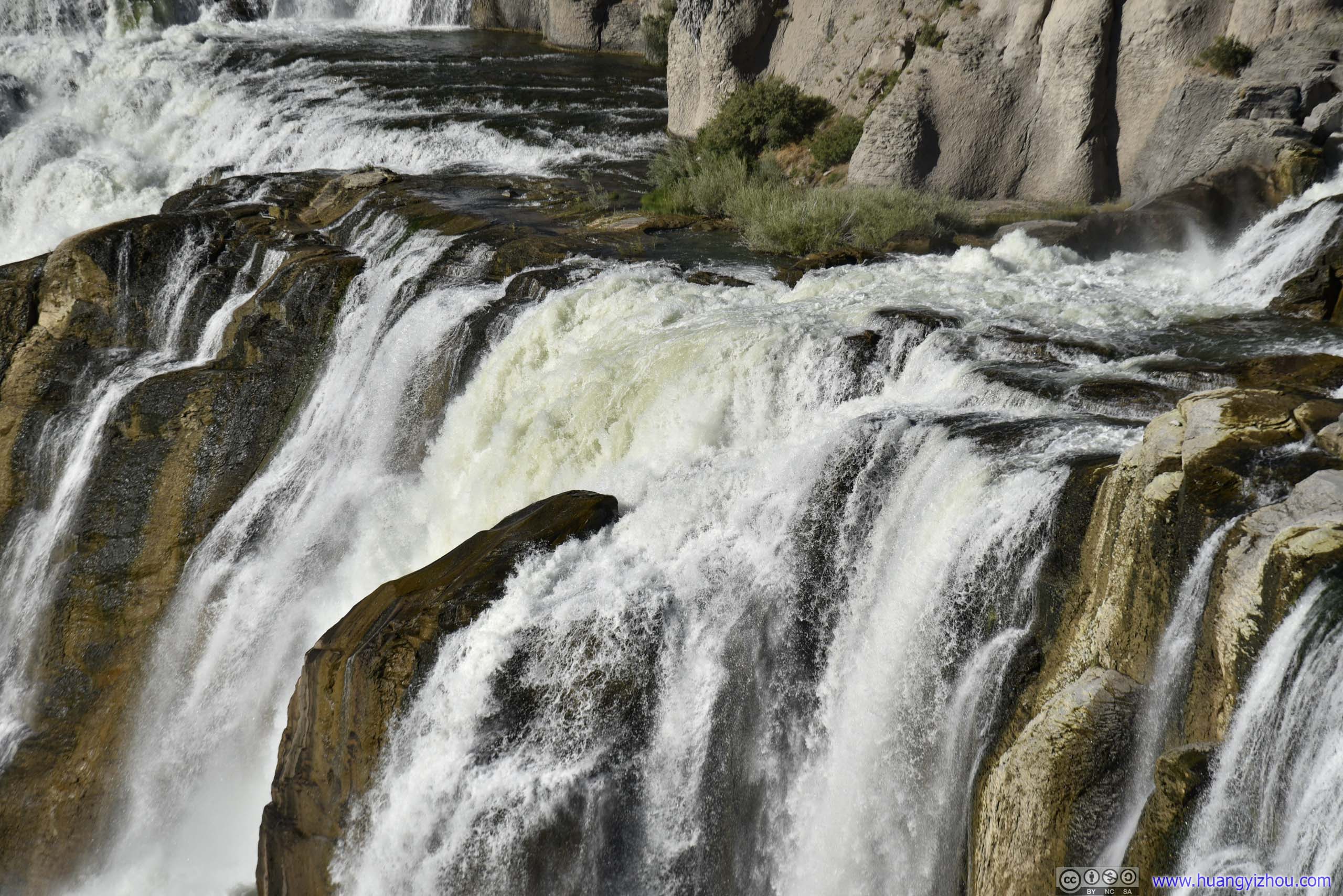 Shoshone Falls
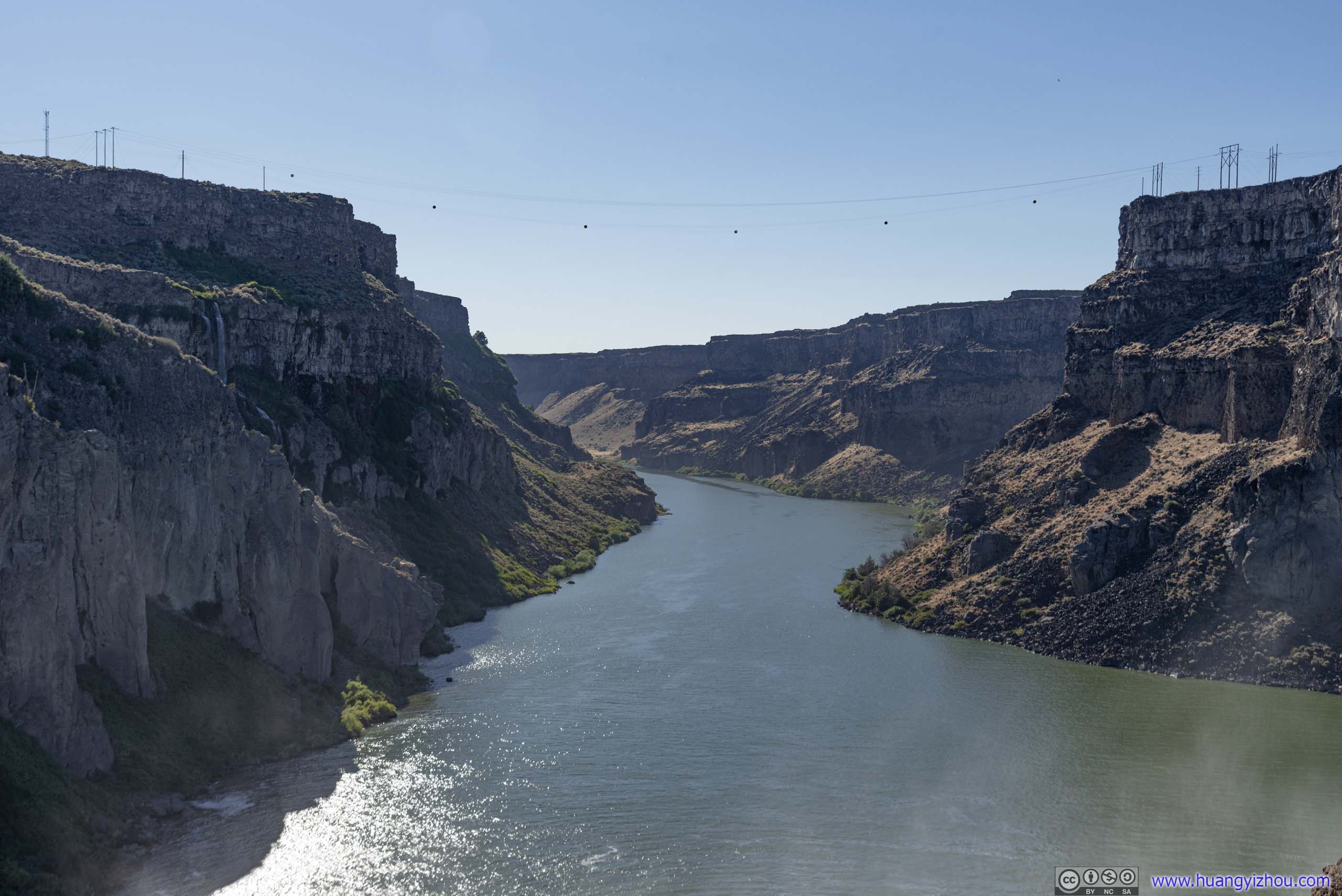
Snake River
Of course, my drone won’t miss this scene.
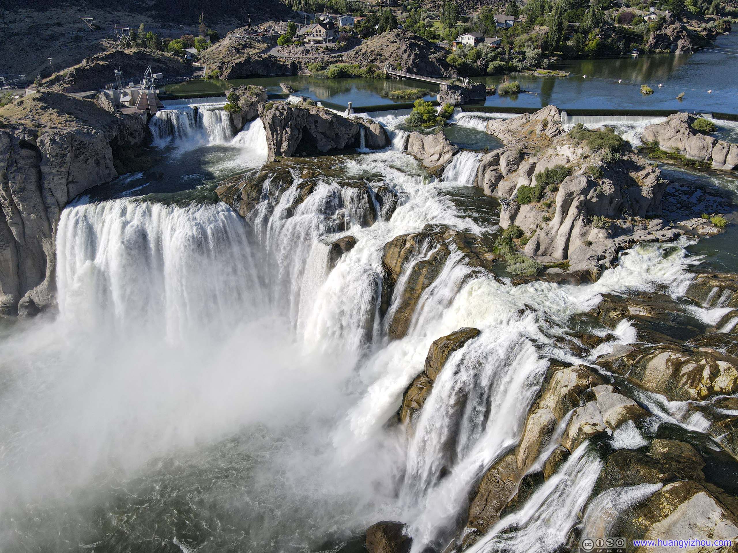
Shoshone Falls
Most captivating of all, a drone enabled me to view the waterfall from a different angle, where moisture from the waterfall gave rise to rainbows.
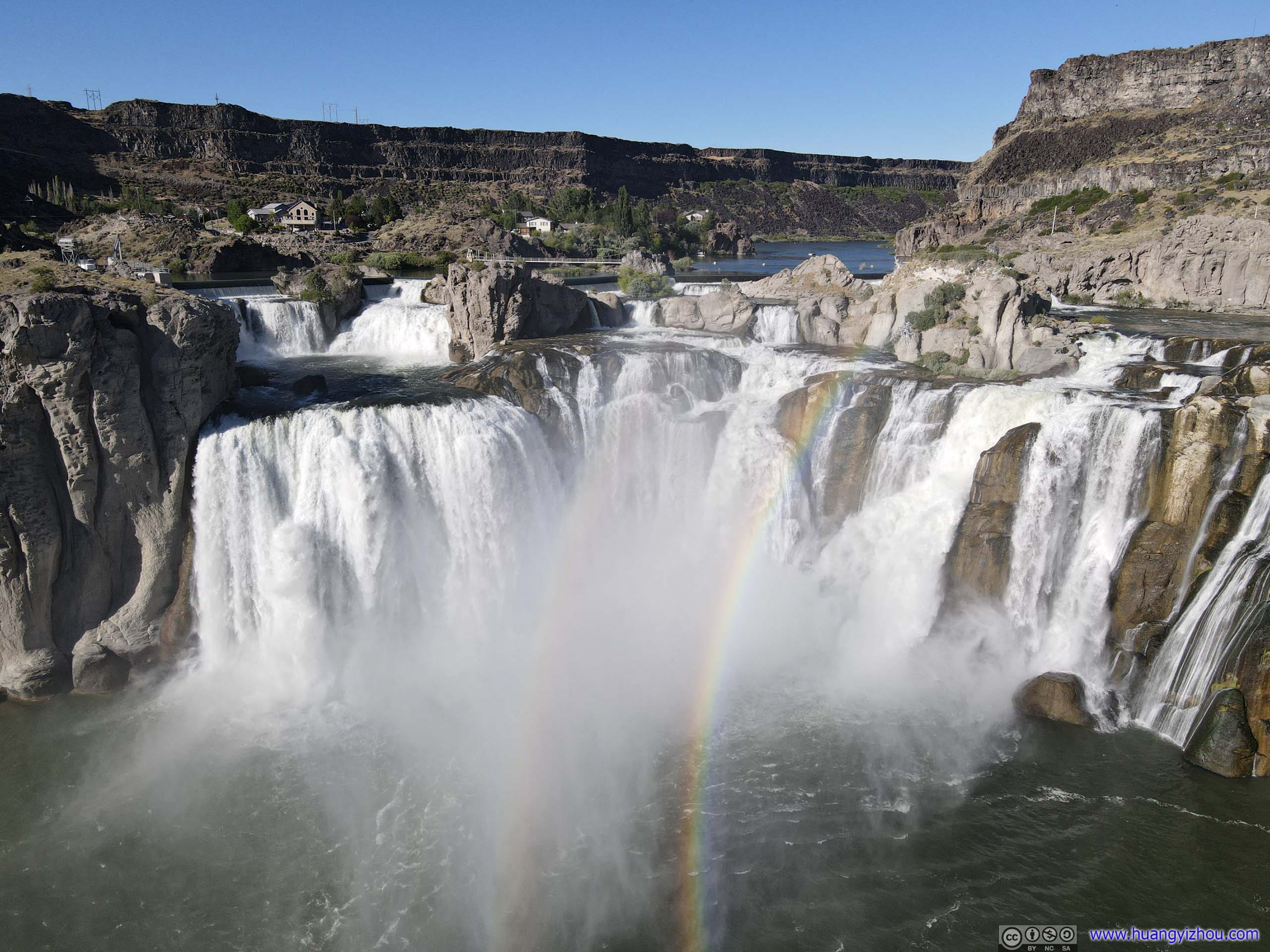
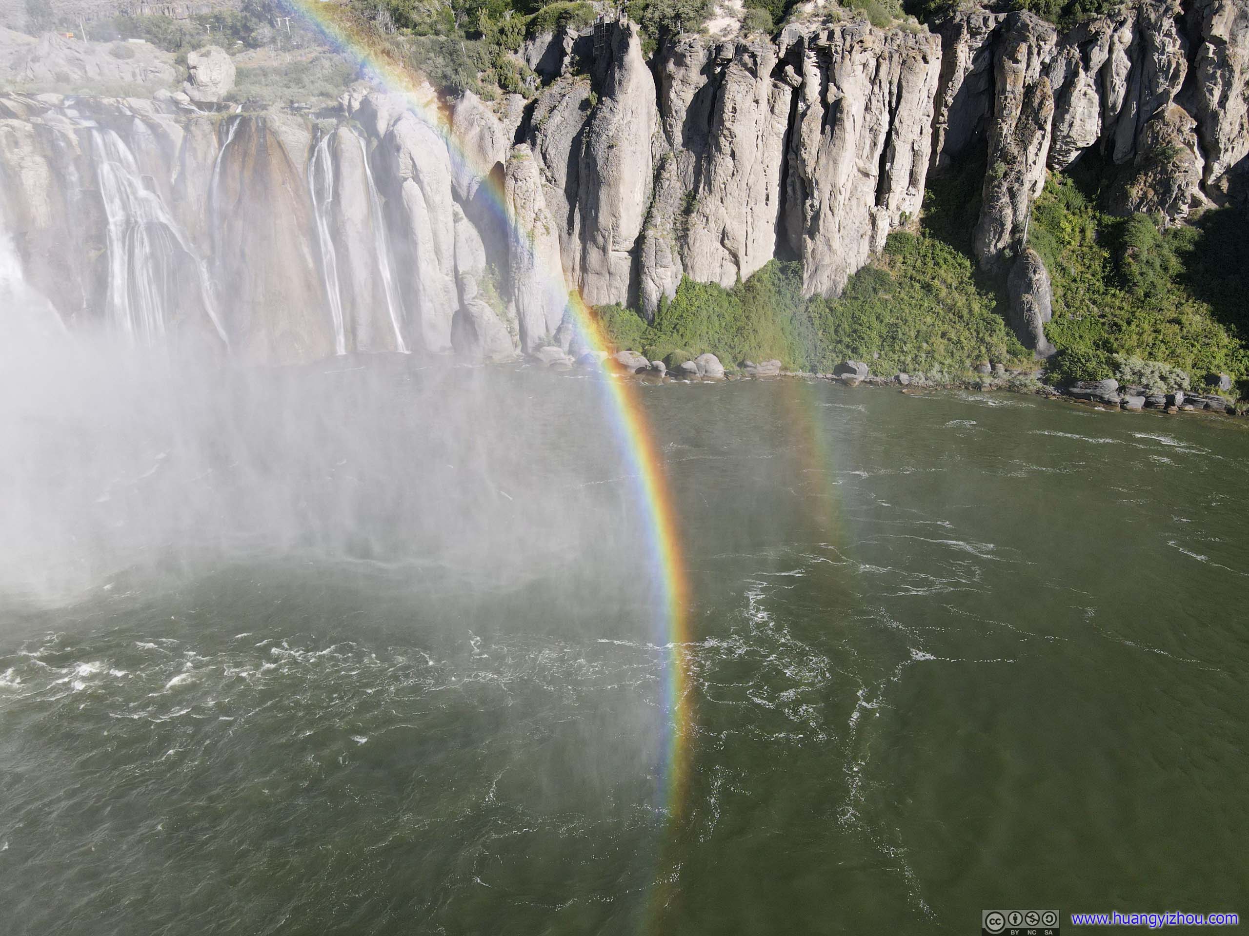
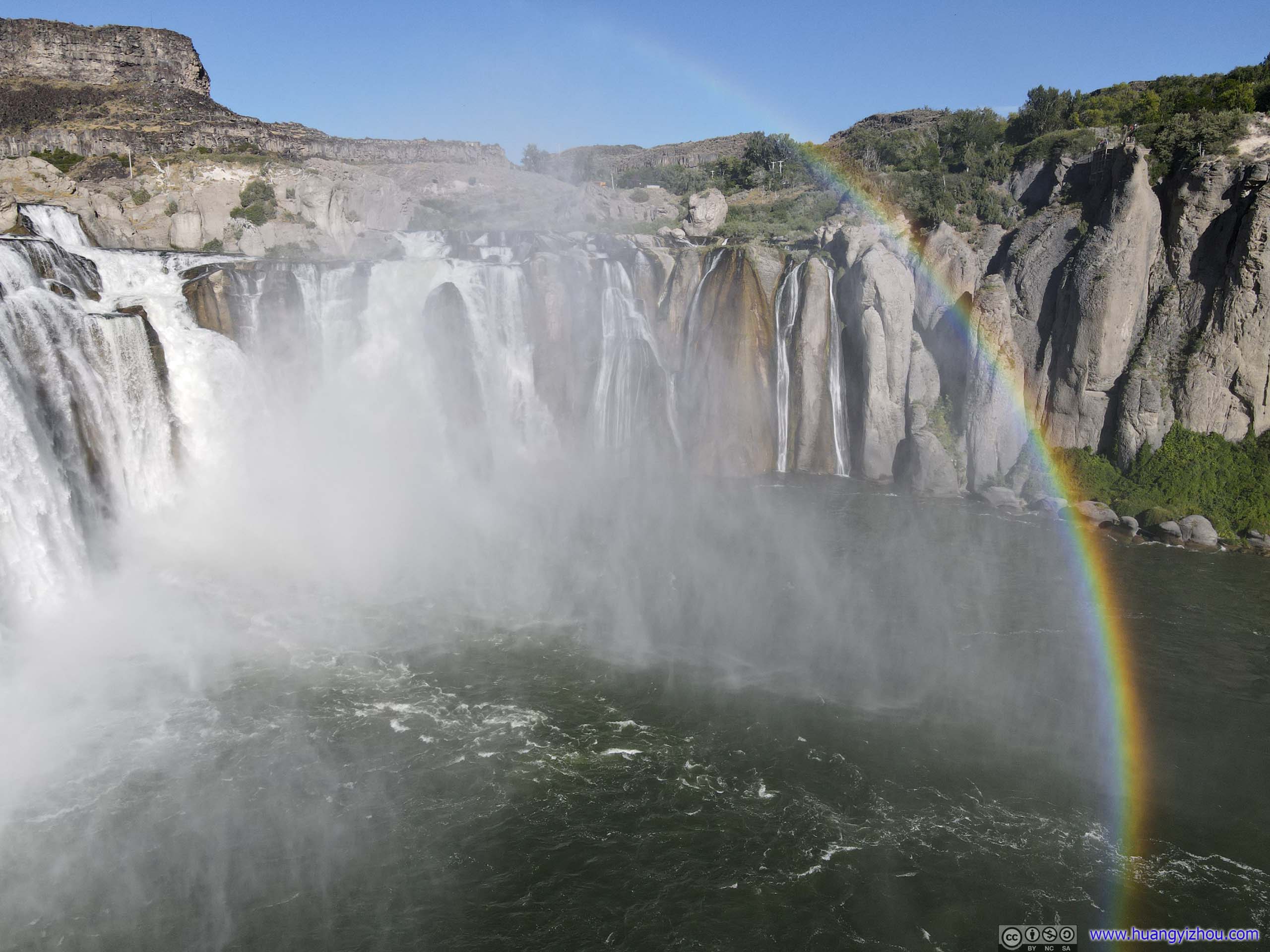
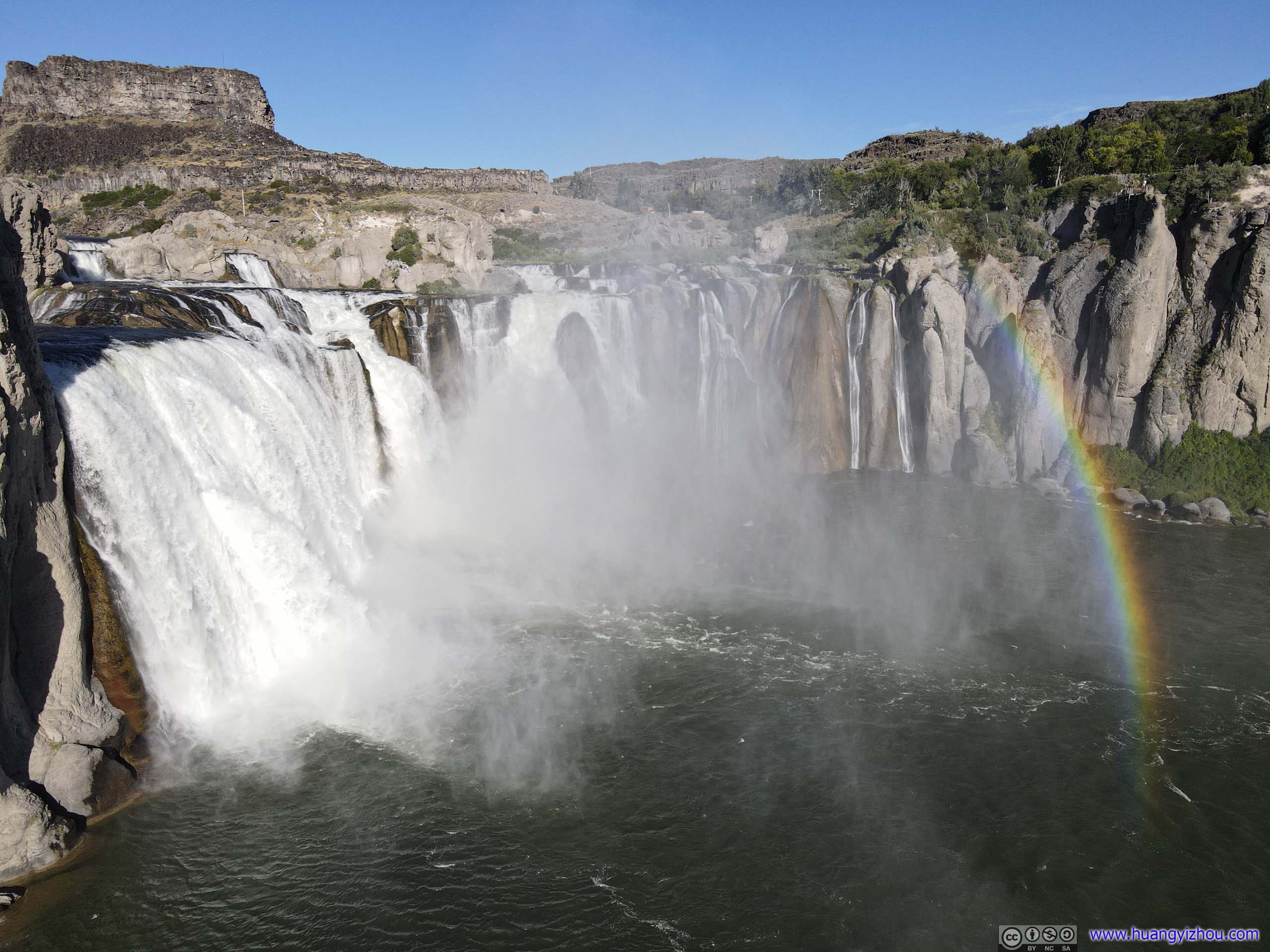 Rainbow by Shoshone Falls
Small WaterfallOpposite of Shoshone Falls on the southern cliff, if not for my drone it would be unreachable.
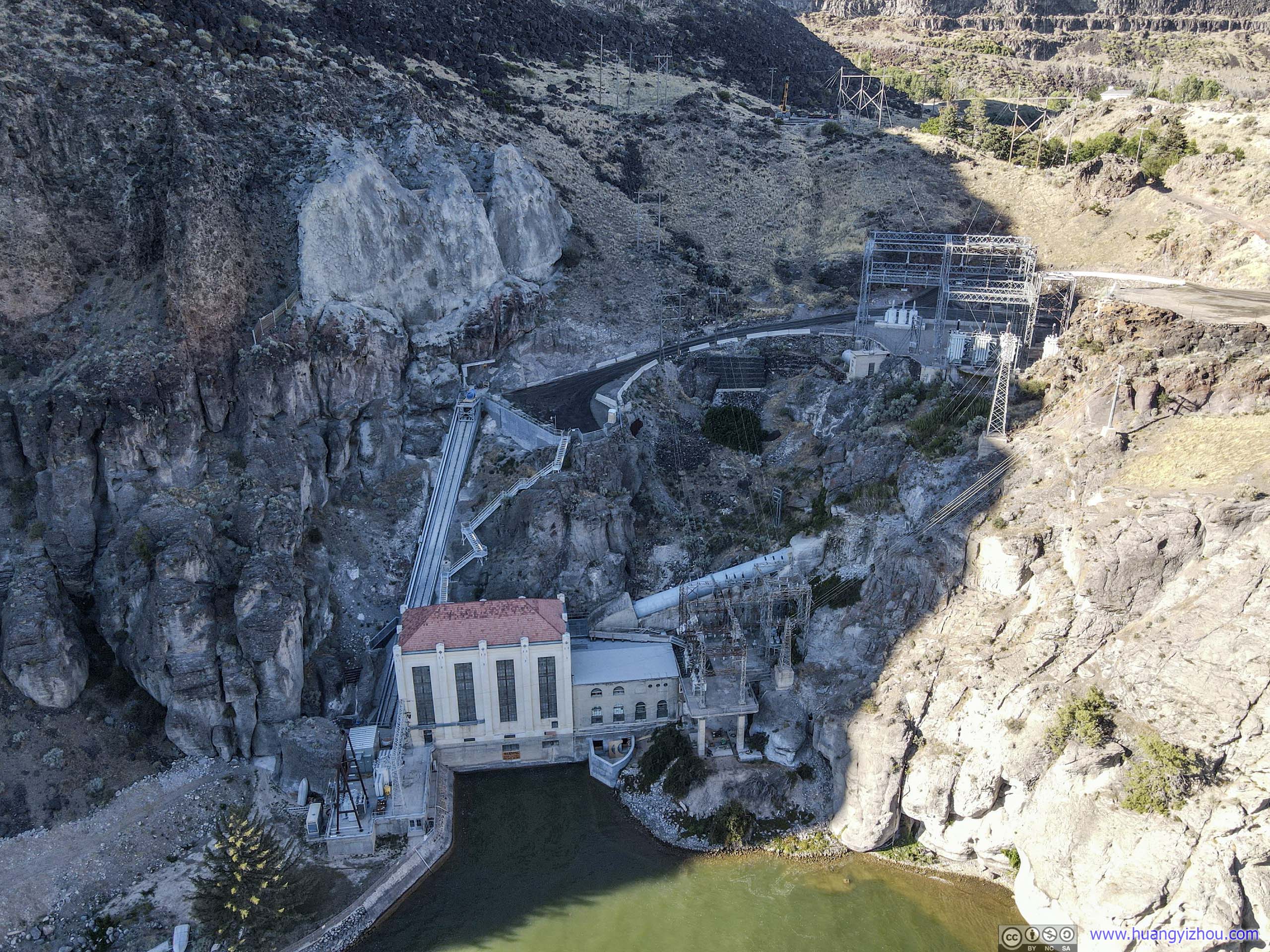
Power Plant
Here’s a video:
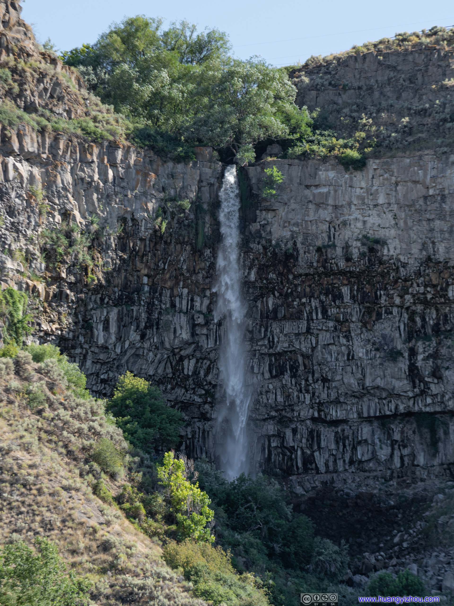
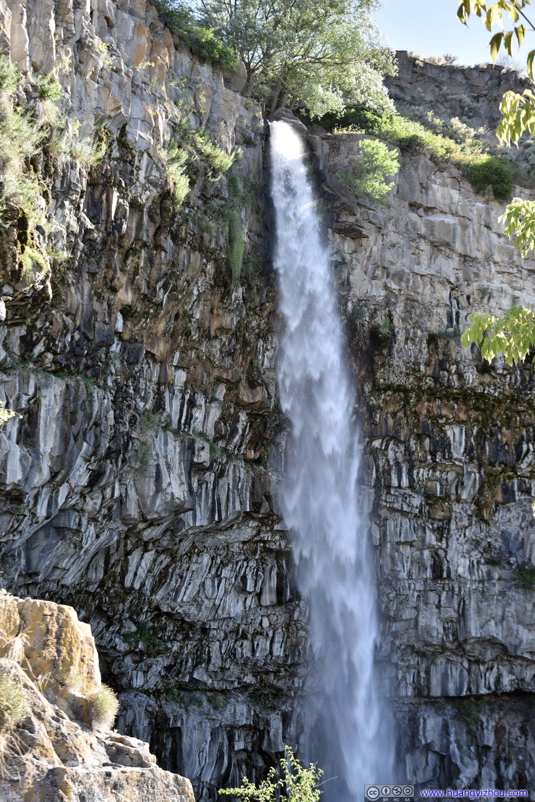
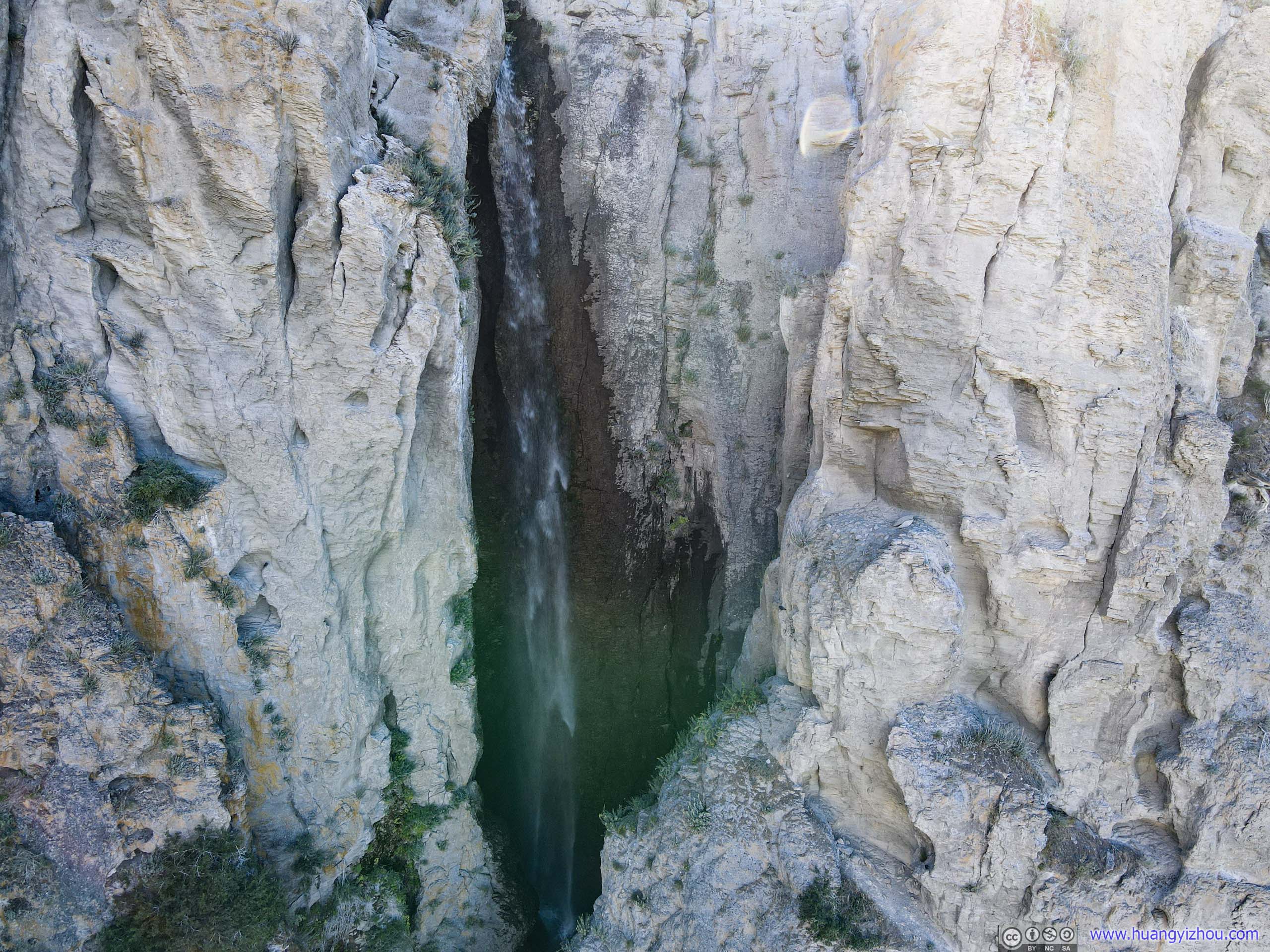
Twin Falls
Farther upstream of Snake River was Twin Falls, which the city was named upon. Unfortunately and ironically, construction of a power plant diverted water, leaving behind a (much less imposing) single waterfall.

Waterfall
 Waterfall
 Ridge by Snake River
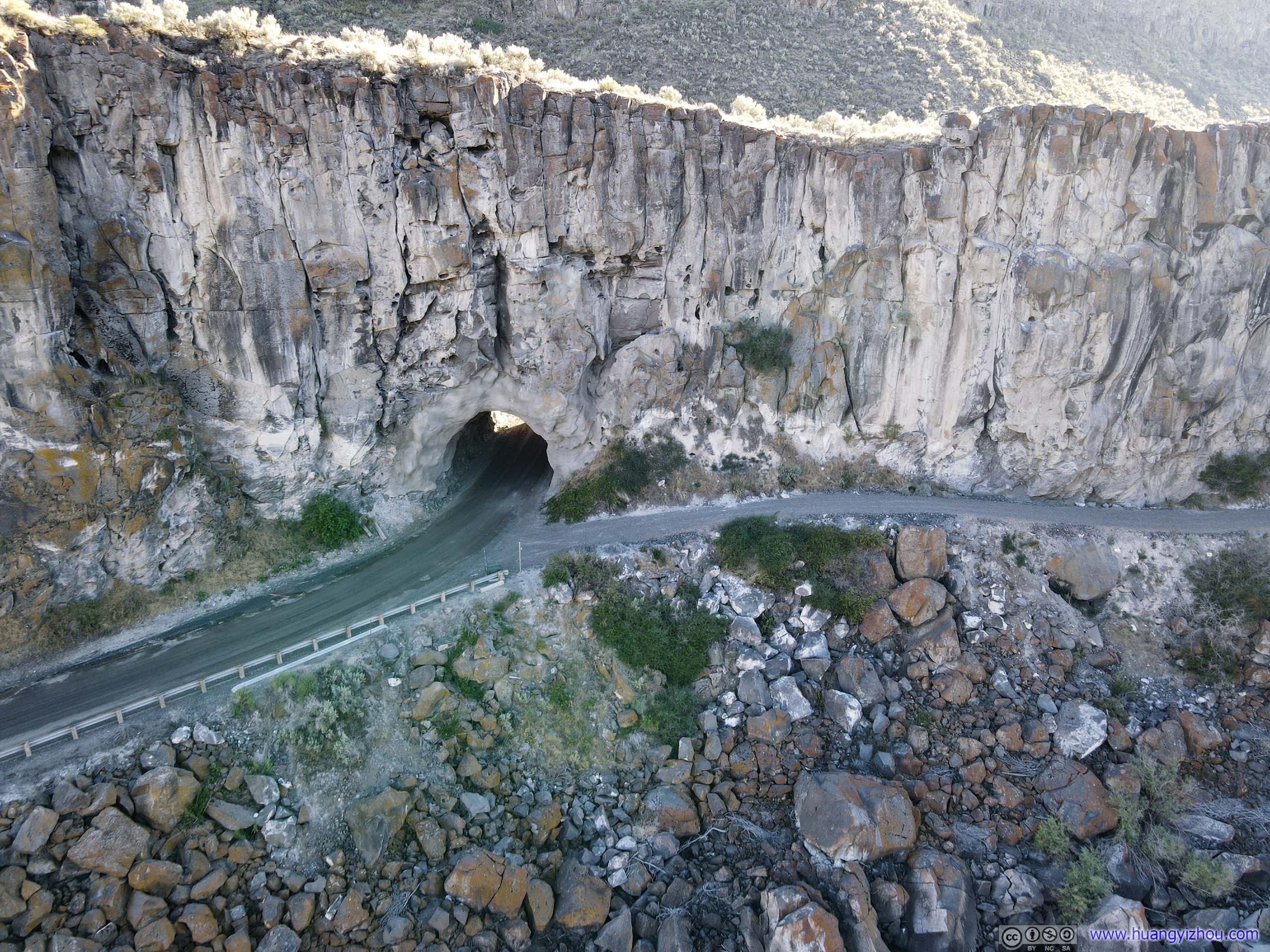
Tunnel in RidgeA restricted access road to the lower power plant area.
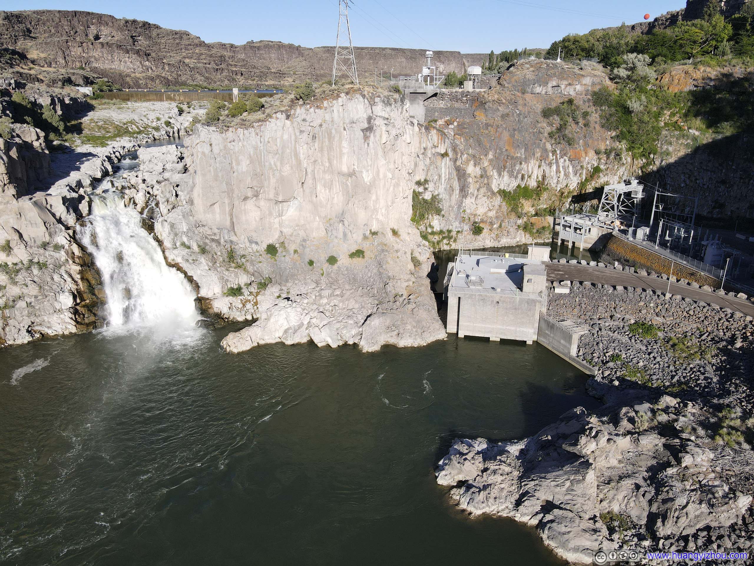
Waterfall and Power PlantsThe new power plant in the foreground, the old one in the back.
Here’s my drone’s video:
It’s 7:30pm by the time I left Twin Falls Park. After that, it took me about an hour and 30 minutes to reach my overnight Airbnb in Hailey, as I prepared for tomorrow’s venture to Hyndman Peak.
END
![]() Day 1 of 2020 Idaho Trip, Twin Falls by Huang's Site is licensed under a Creative Commons Attribution-NonCommercial-ShareAlike 4.0 International License.
Day 1 of 2020 Idaho Trip, Twin Falls by Huang's Site is licensed under a Creative Commons Attribution-NonCommercial-ShareAlike 4.0 International License.