
Updated on July 4, 2019
Day 2 of Carolinas Vacation, Outer Banks Day 1
Second day of our road trip to the Carolinas, as we left Norfolk, Virginia and set off for the Outer Banks.
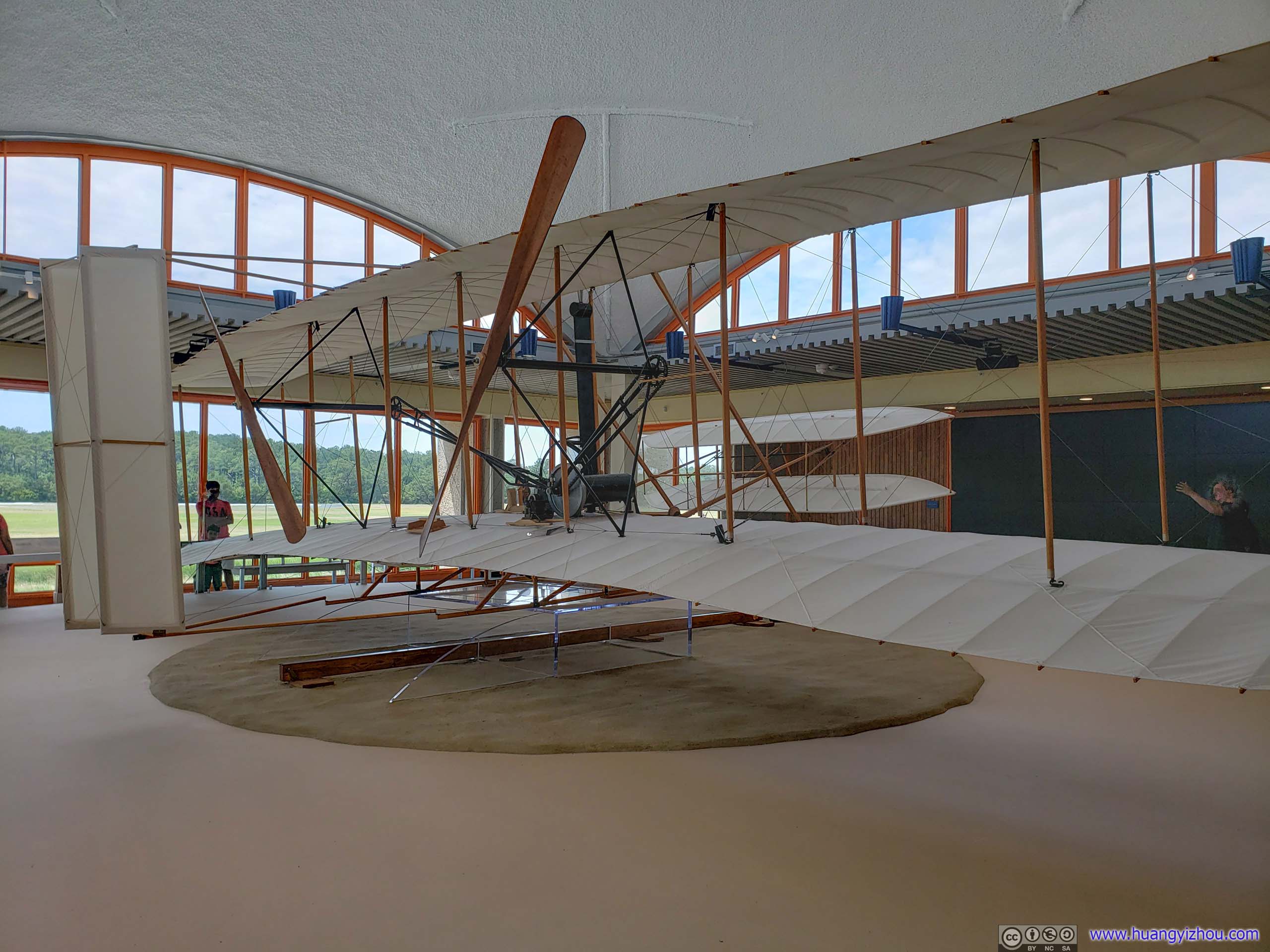
Model of Wright Brothers’ Plane
Unfortunately, the first morning of June wasn’t the most pleasant to us, and I would trace this misery to a few days ago when I was trying to find an overnight lodge in Norfolk. Back then Google’s weather forecast for Norfolk was not that bad, with at most 40% probability to have maximum an hour of rain overnight, so I decided camping in First Landing State Park might be a good idea. However, those numbers had been suddenly on the rise since the moment I hit that “book” button.
So we left Yorktown National Battlefield at 19:30 and a casual check of cell phone brought us the horrid news, that while Waze told me it’s a 80-minute drive to campground in traffic (no, Yorktown didn’t look that far away from Norfolk on the map, not to me), AccuWeather’s minutecast said a thunderstorm and heavy rain would hit Norfolk in 70 minutes.
So it came to a race against time (and cumulonimbus) to reach the campground. Luckily, our campground was 15 miles from downtown Norfolk, which was the closest place AccureWeather provided some sort of forecast, and in a bay area that’s enough distance for two different worlds, weather wise.
Thus, although I was watching a spectacular play of thunders roaring in the distance as we crossed Chesapeake Bay, it was still a light drizzle by the time we reached our campground. We even had time to buy ourselves some snacks from a nearby McDonald’s afterwards. The downside? We ran out of daylight due to traffic and maybe my not-so-ideal planning and sense of distance, so we had to set up tent in the dark, that meant battling with swarms bugs and mosquitos way beyond the best repellent spray can handle.
 Beaches of First Landing State Park
So my friend and I woke up next morning to the Park’s eight-o’clock national anthem accompanied by sound of rain drops on our tent. After checking out radar map on my cell phone to the discouraging news that an ominous patch of rain was lingering just over us but not downtown Norfolk (wait, as a T-Mobile user should I be grateful that I had internet in a “park” in the first place?), we decided there’s no hope waiting it out and we should pack and leave anyways.
Thus we set off for Outer Banks, sort of sad that we didn’t check out the (fabulous)hiking trails and beaches of First Landing State Park.
It was another two hours’ drive to Kitty Hawk, the northern gateway to Outer Banks. Weirdly enough, not long after we left Norfolk the skies cleared up and we found ourselves driving through some beautiful farmland.
A little more than a century ago Wright brothers were studying weather patterns across the country and they picked Kitty Hawk, North Carolina to test their model airplanes due to its calm weather and steady wind. After a distressful night by the Chesapeake Bay, I could certainly attest to the first point.
Wright Brothers National Memorial
A place that commemorates mankind’s first successful, sustained, powered flights in a heavier-than-air machine.
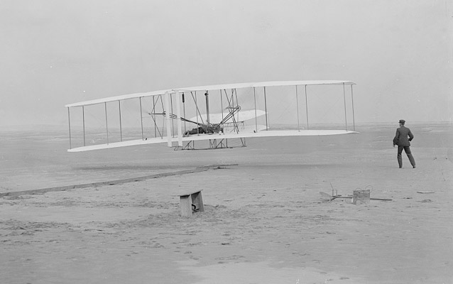
10:35 AM. The Wright Flyer lifts off for the first time. Orville is at the controls with Wilbur running alongside. One of the most iconic photographs ever taken. Kitty Hawk, 1903Photo Source: National Park Services
North Carolinians were certainly fond of this event that they put “First in Flight” on their license plates, despite the fact that Wright brothers were from Dayton Ohio, where license plates read “Birthplace of Aviation”. #Vendetta
As for the memorial itself, there were some exhibition rooms and it was a hot day so we were drawn to their air-conditioning first.
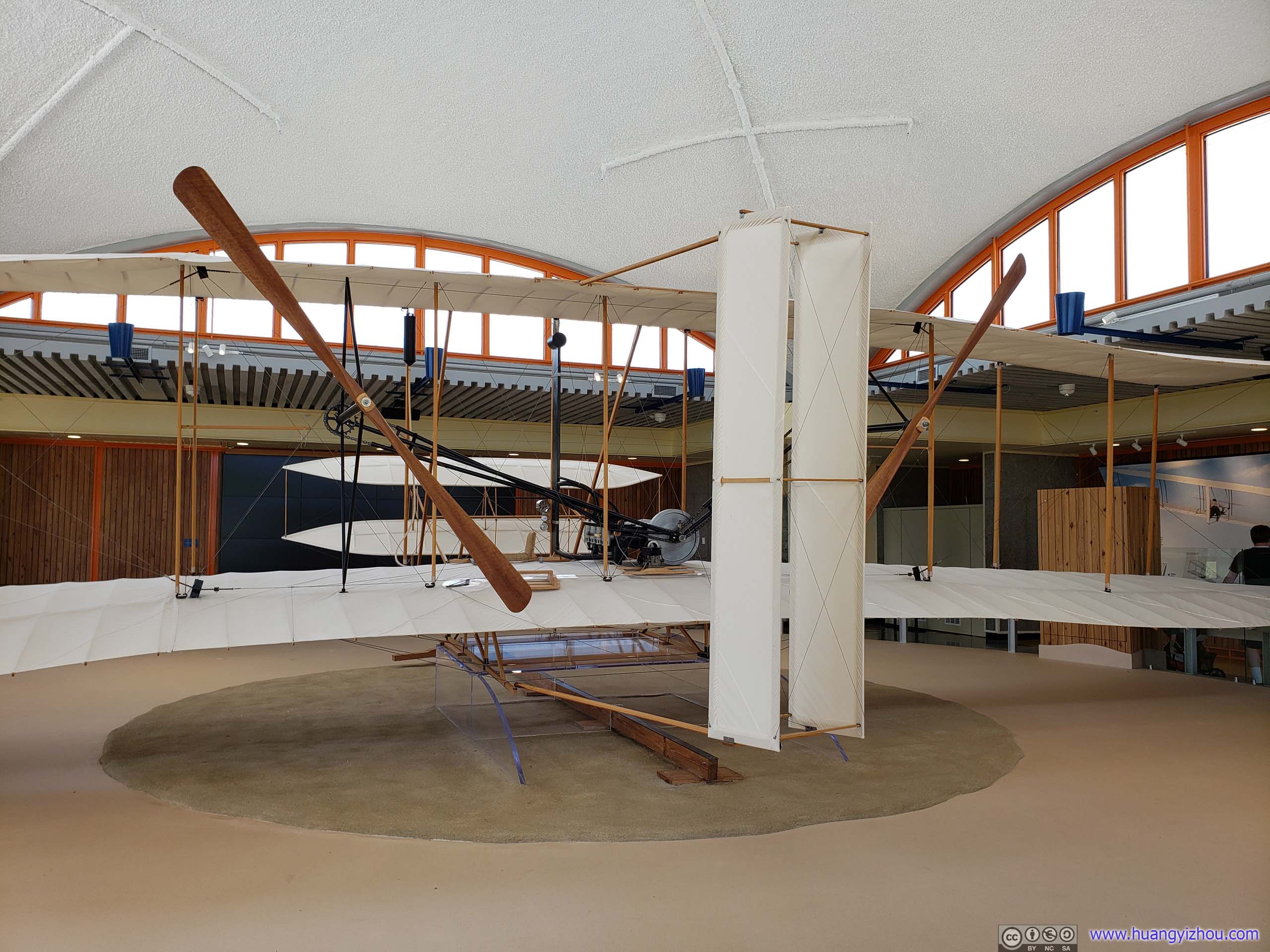
Model of Wright Brothers’ Plane
Since I had just been to Smithsonian National Air and Space Museum in DC, I could quickly tell that the model plane was missing some control columns. I guess NPS just didn’t expect its average visitors to be that hard-core, so they scrambled most of a plane and that’s it. However, although Wright brothers crashed their original plane after the fourth flight attempt, parts of it remained and was on display.
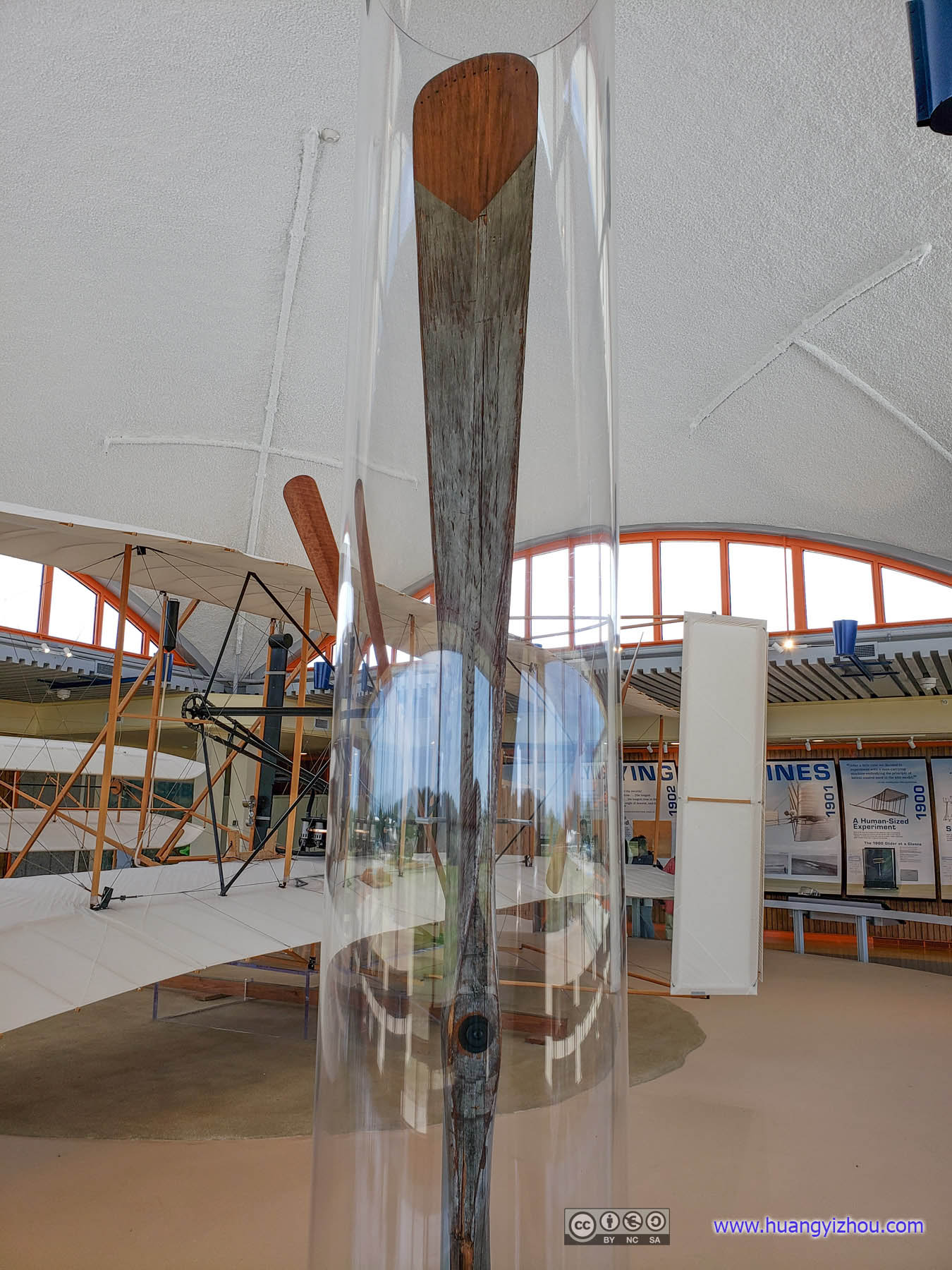
Original Fan Blade

Part of Original Engine
Having enjoyed enough air conditioning, we headed outside for the flight field.

Hangar ReconstructionThroughout three testing seasons Wrights’ flyers got bigger and bigger, so they built another bigger hangar by the side and used this one as living quarters
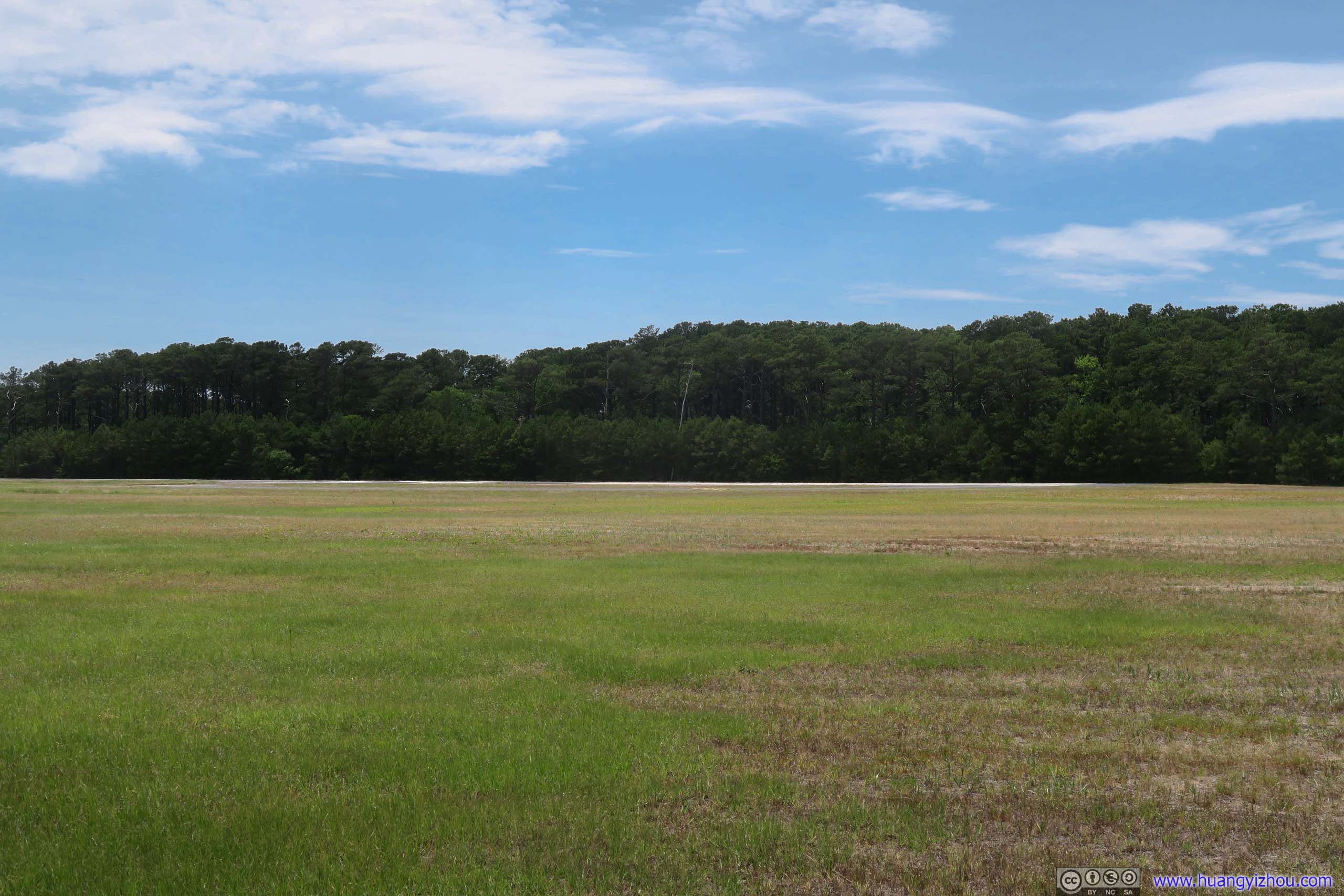
On the morning of December 17, 1903, Wright Brothers took turns to make four short flights, each longer than the previous one with four stones nowadays marking the distance of their flights. Their longest one was 59 seconds and 260 meters.
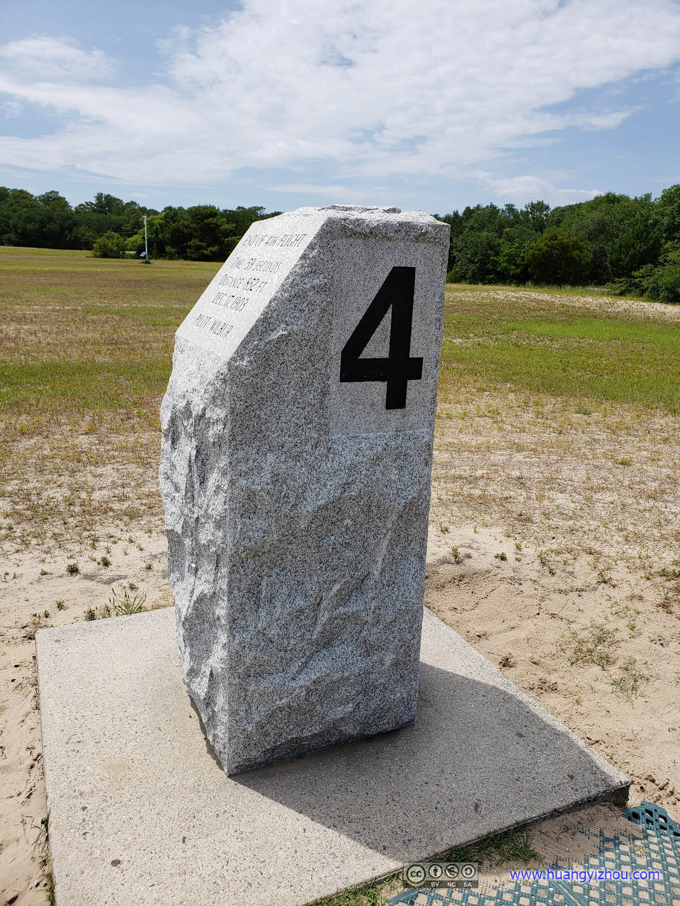
Stone Marking Final Flight
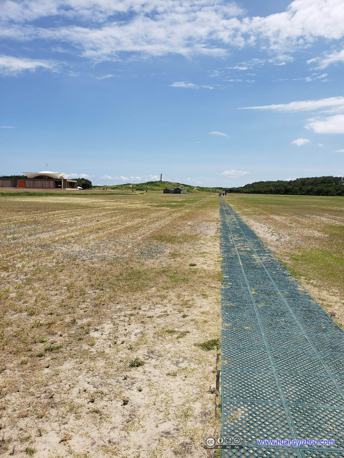
Path of Flight
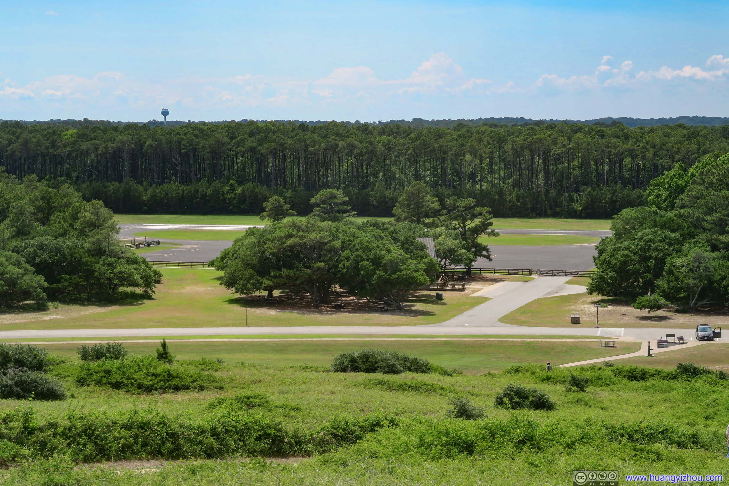
Just next to the Wright Brothers’ flight paths was First Flight Airport, an operational general aviation airport. It’s sort of unbelievable that there’s no barrier stopping people from wandering onto the airport runway.
Runway End of First Flight Airport
North of the flight paths used to be a sand dune called “Kill Devil Hills”, from which Wright brothers launched their test gliders and learned glider control. Nearby, abundance of sand acted as cushion for crash landings. I had no idea how this hill got such a not-so-attractive name, but thanks to the Wright brothers, it’s now the name of the nearby town.
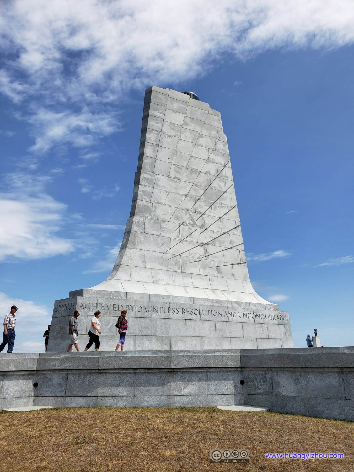
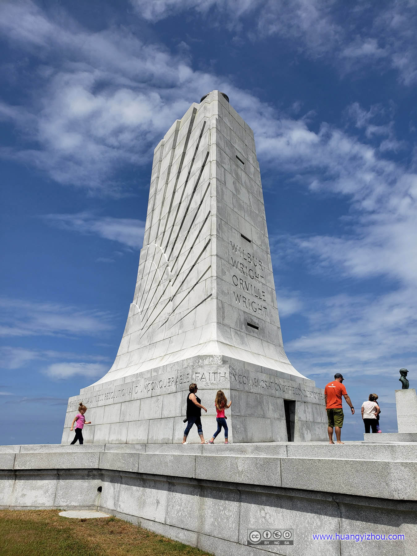 Wright Brothers Monument
And then there’s this monument on top of it. Lots of landscaping work went into place to make sure the sandy hill won’t give in to the weight of the monument, and that’s why it’s dedicated in 1932, almost 30 years after the flight.
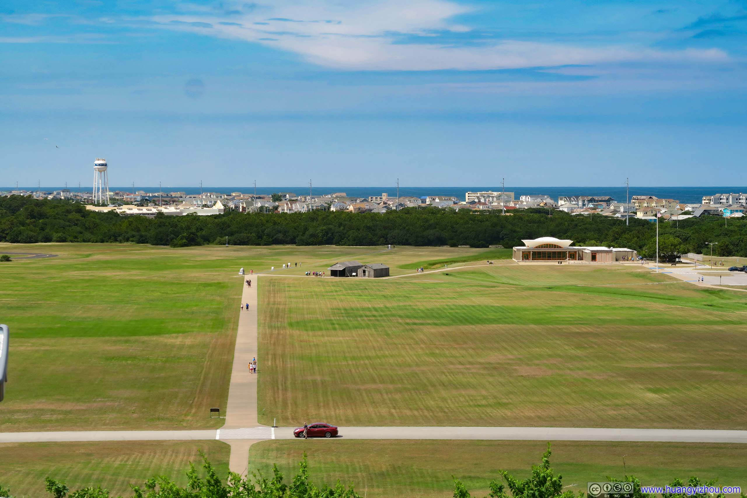
Kill Devil Hills Overlooking Test Fields
First Flight Airport Apron
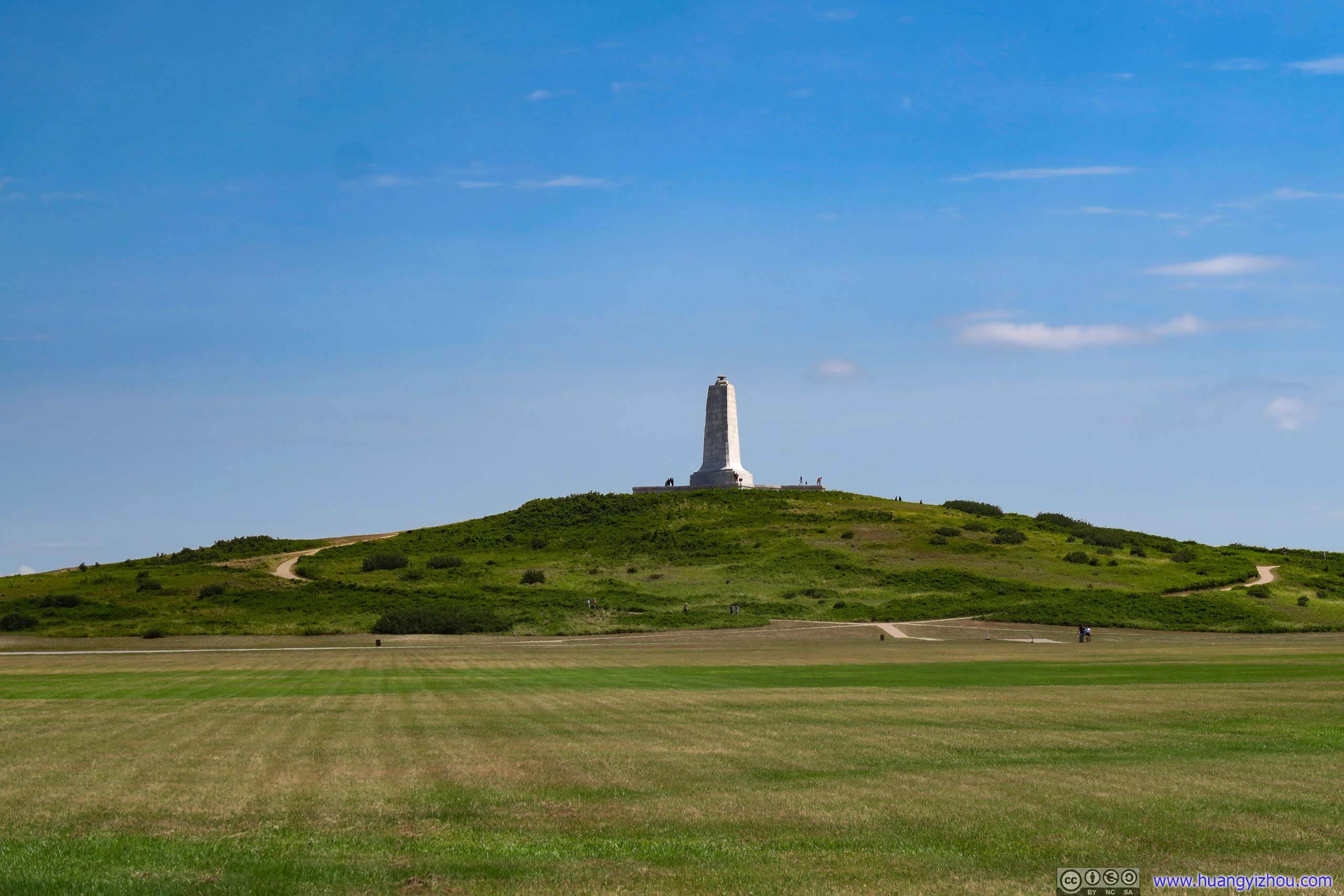
Wright Brothers Monument on Kill Devil Hills
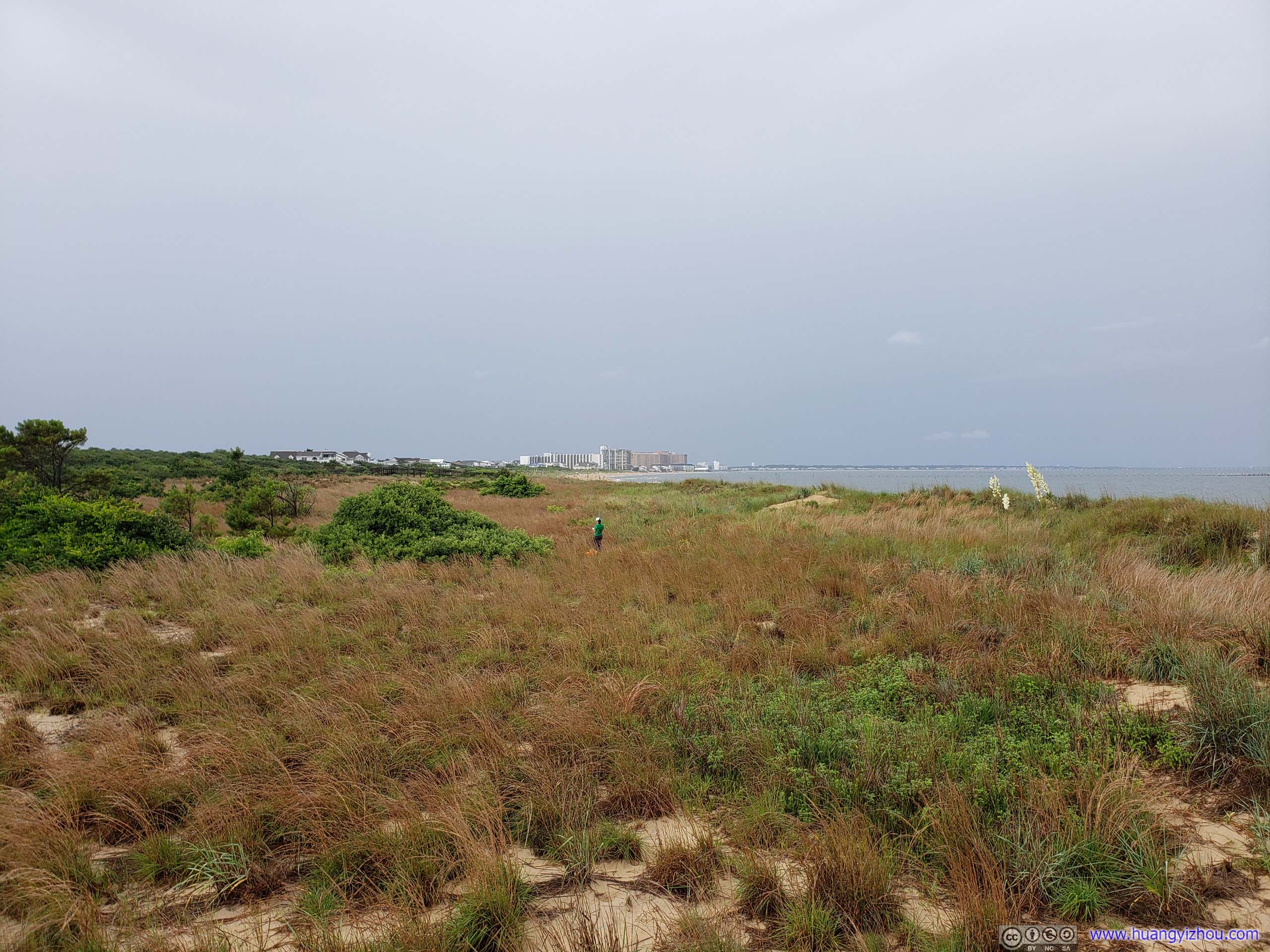
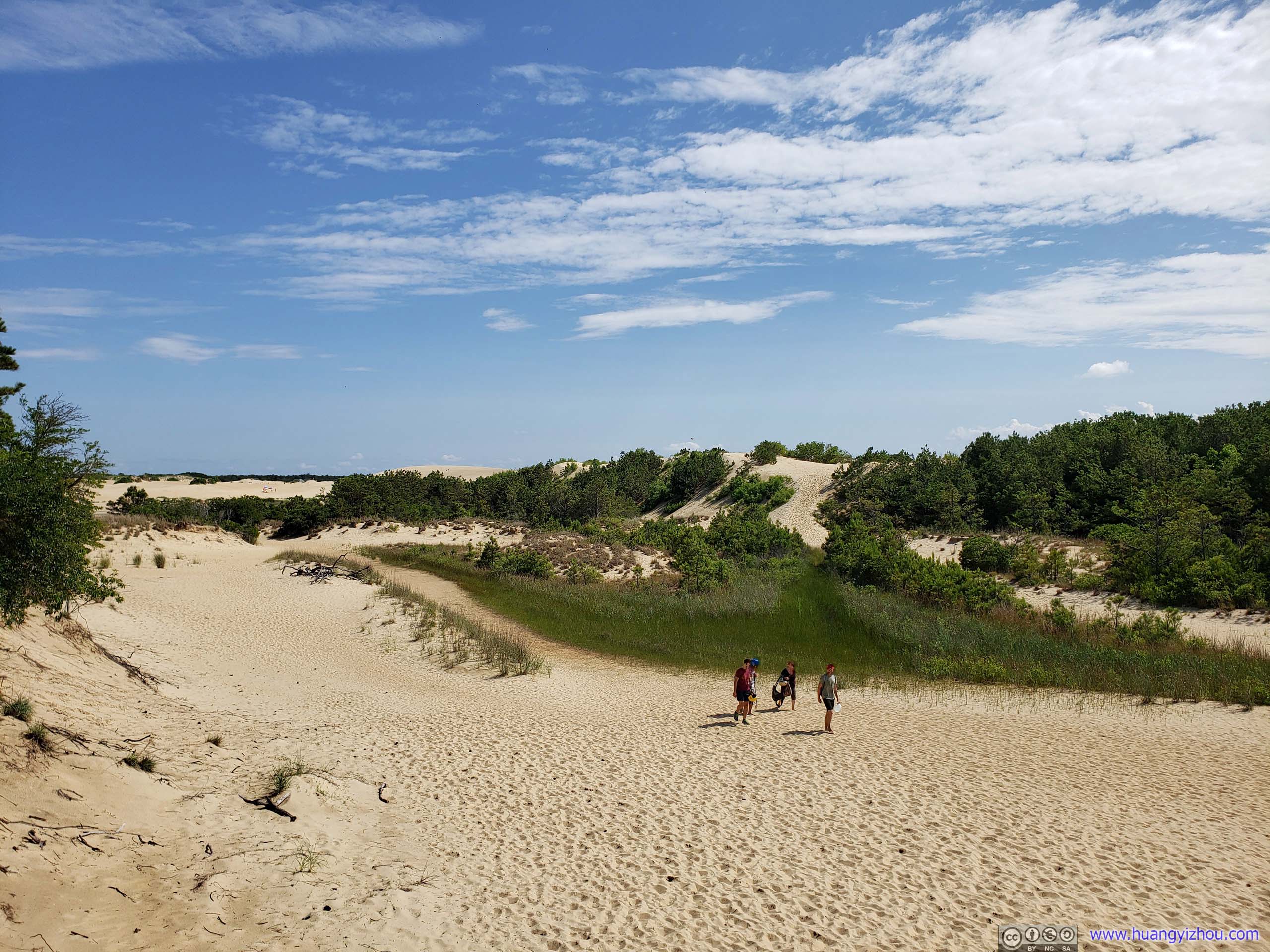
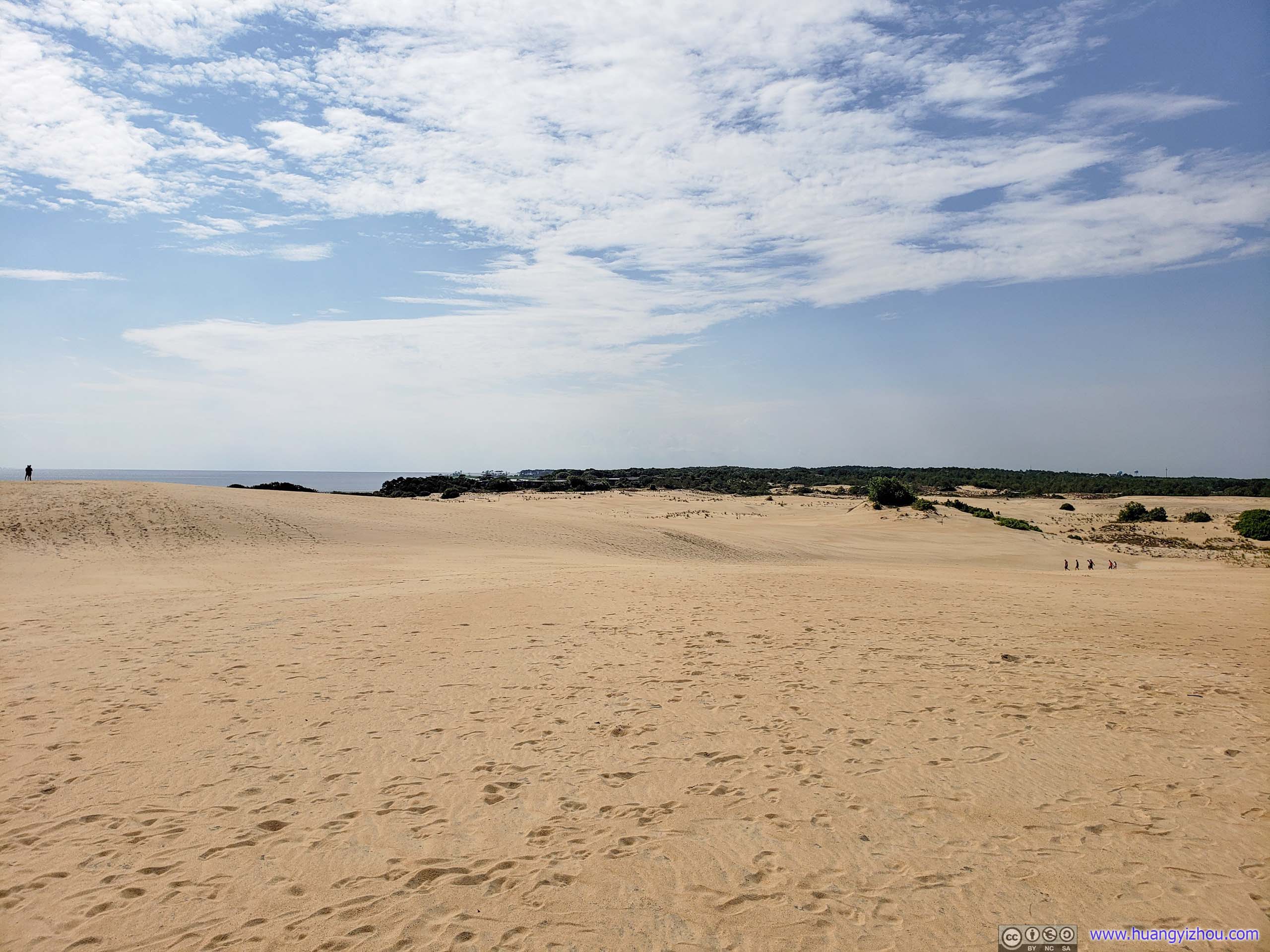
Next, we headed for Jockey’s Ridge, the largest natural sand dune on US east coast.
Jockey’s Ridge
Sand on Jockey’s Ridge was shifted constantly by wind, so although the park provided some official trails, we quickly lost track of them as there were footprints basically everywhere.
…Most geologists believe that the dune was formed by strong water currents caused by hurricanes and strong storms which washed sand from large offshore shoals onto the beaches. Over many years, the wind moved this sand inland. Shifting maritime winds blow billions of grains of sand in varying directions, constantly changing both the shape and size of the dune.
From official information board.
 Jockey’s Ridge
A pretty amazing fact of Jockey’s Ridge was that, although sand was constantly baked by sunshine, there were patches of sand that felt wet when stepped on. This wasn’t confined to the valleys of sand dunes but also on top of the ridge, and my friend and I just had no idea how such sand dunes were able to hold water from gravity so well.
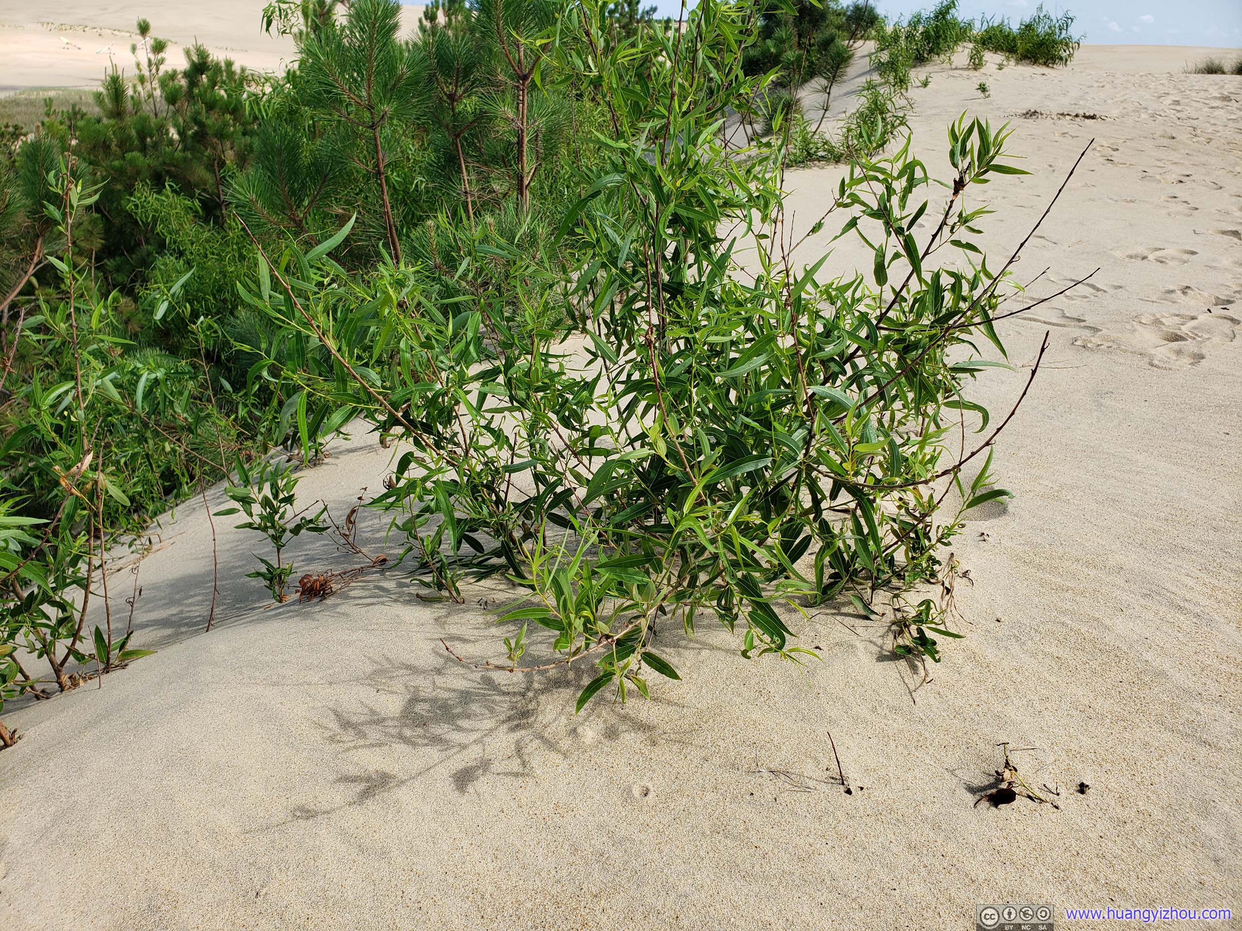
PlantsThese plants were on top of the sand dunes, so there must be some surface water not much farther down, which was amazing.
 Jockey’s Ridge
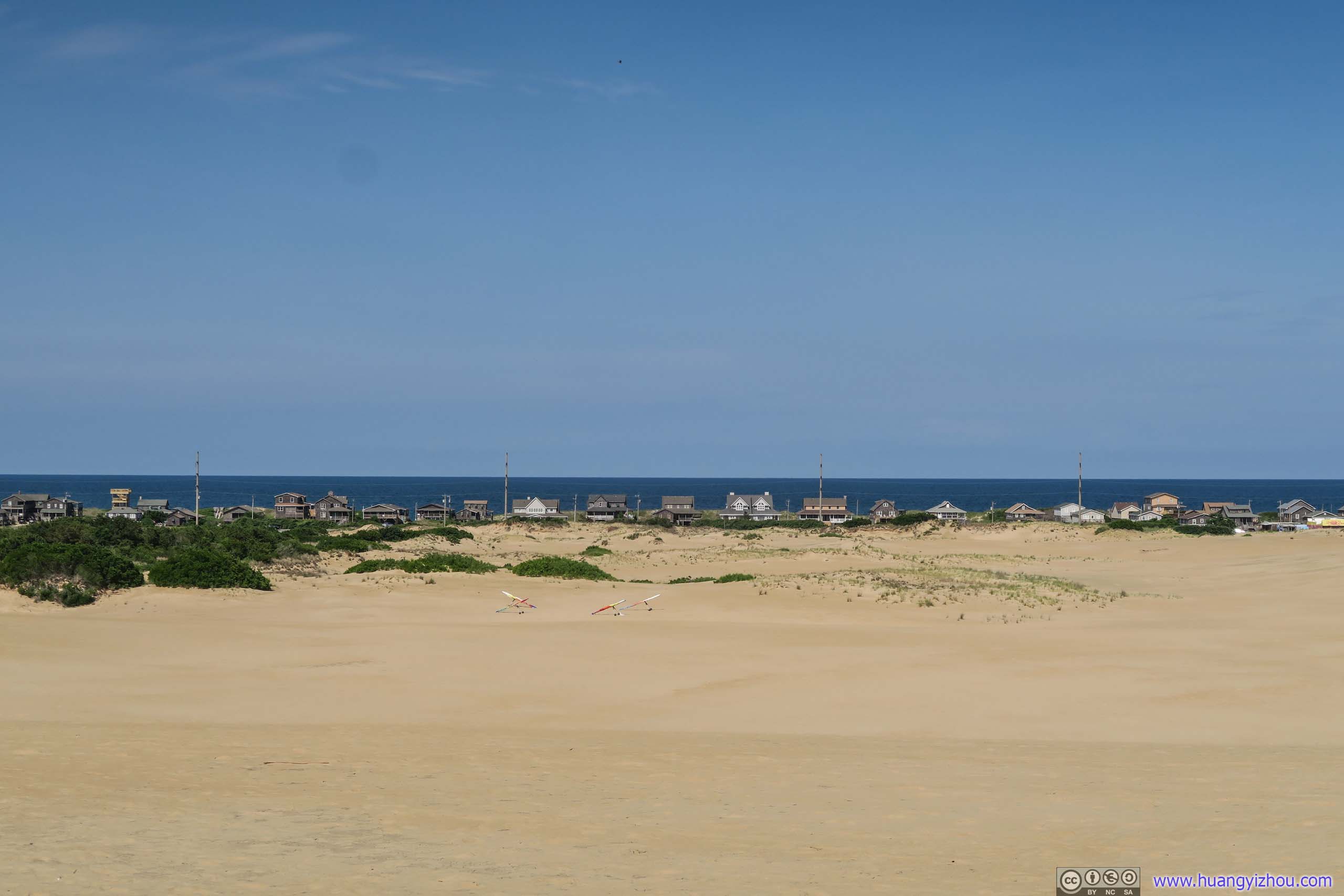
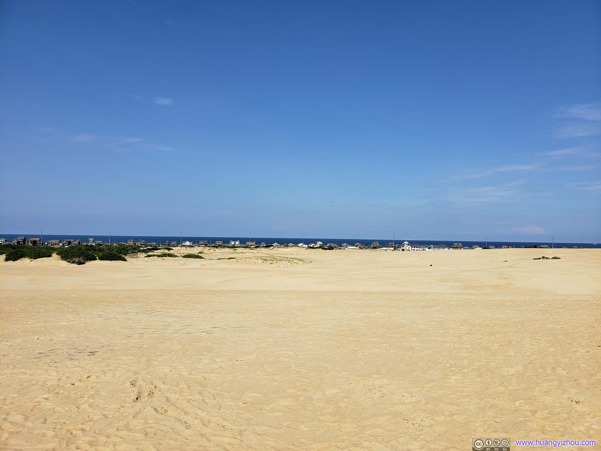
Villages by Ocean
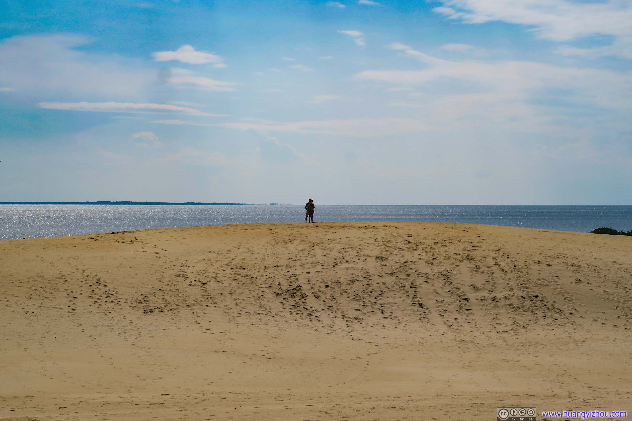
Lovers
Next, we took a detour onto Roanoke Island and visited Fort Raleigh.
Fort Raleigh
 Reconstructed Fort Raleigh
Click for detail
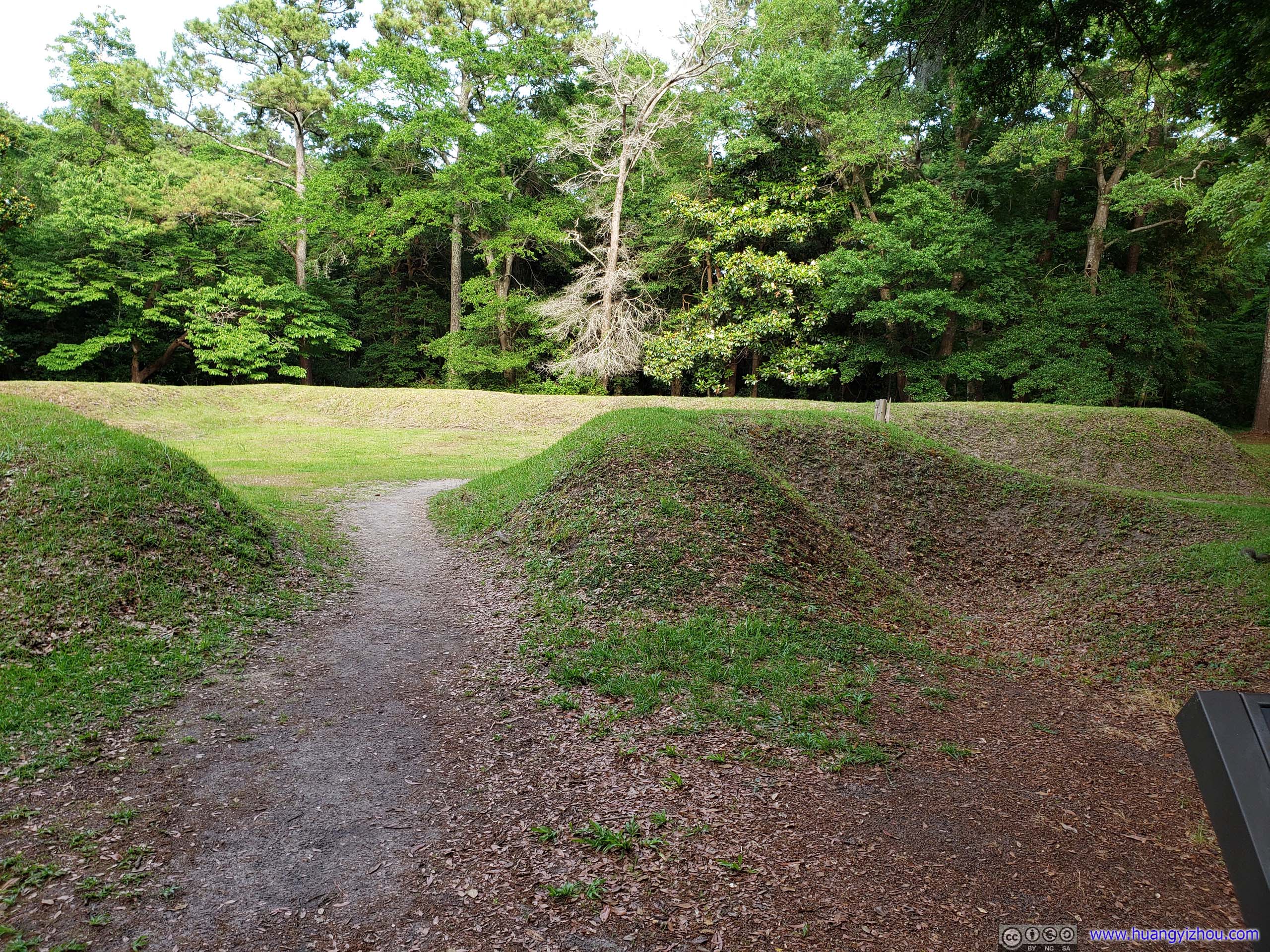
European expeditions in the late 1500s commonly constructed small defensive structures. Soldiers built these earthworks by digging ditches and then forming walls from the removed soil. Ralph Lane, A fortification expert, led the 1585 English expedition. At this spot, Lane busied his men with constructing such an earthwork.
The purpose of the earthwork is unknown. The small size would not have provided nearly enough space for the numbers of 1585 explorers, let alone the more than one hundred settlers that arrived two years later. Documentation shows the settlers lived in a palisaded fort, which has not yet been found.
From official information board.
Fort Raleigh was the site of the first English settlement in the United States. Three voyages were made from England to here between 1584 and 1587. However, when people visited the site again in 1590 and settlement was abandoned and no survivor was found. They were thus called “Lost Colony” which was also the name of an outdoor-play whose theater was nearby.
So right now, the only tangible thing about this colony was the earthwork in the previous photos that were reconstructed according to archeological findings.
We skipped the nearby Elizabethan Gardens because it’s past its closing time. Originally we planned to visit the town of Manteo, named after one of the Indians that the original English settlers “civilized” and brought back to Britain. Unfortunately there seemed to be some festive going on in Manteo and some roads were closed. So we headed farther south to our overnight campground in Cape Hatteras, passing Bodie Island Lighthouse first.
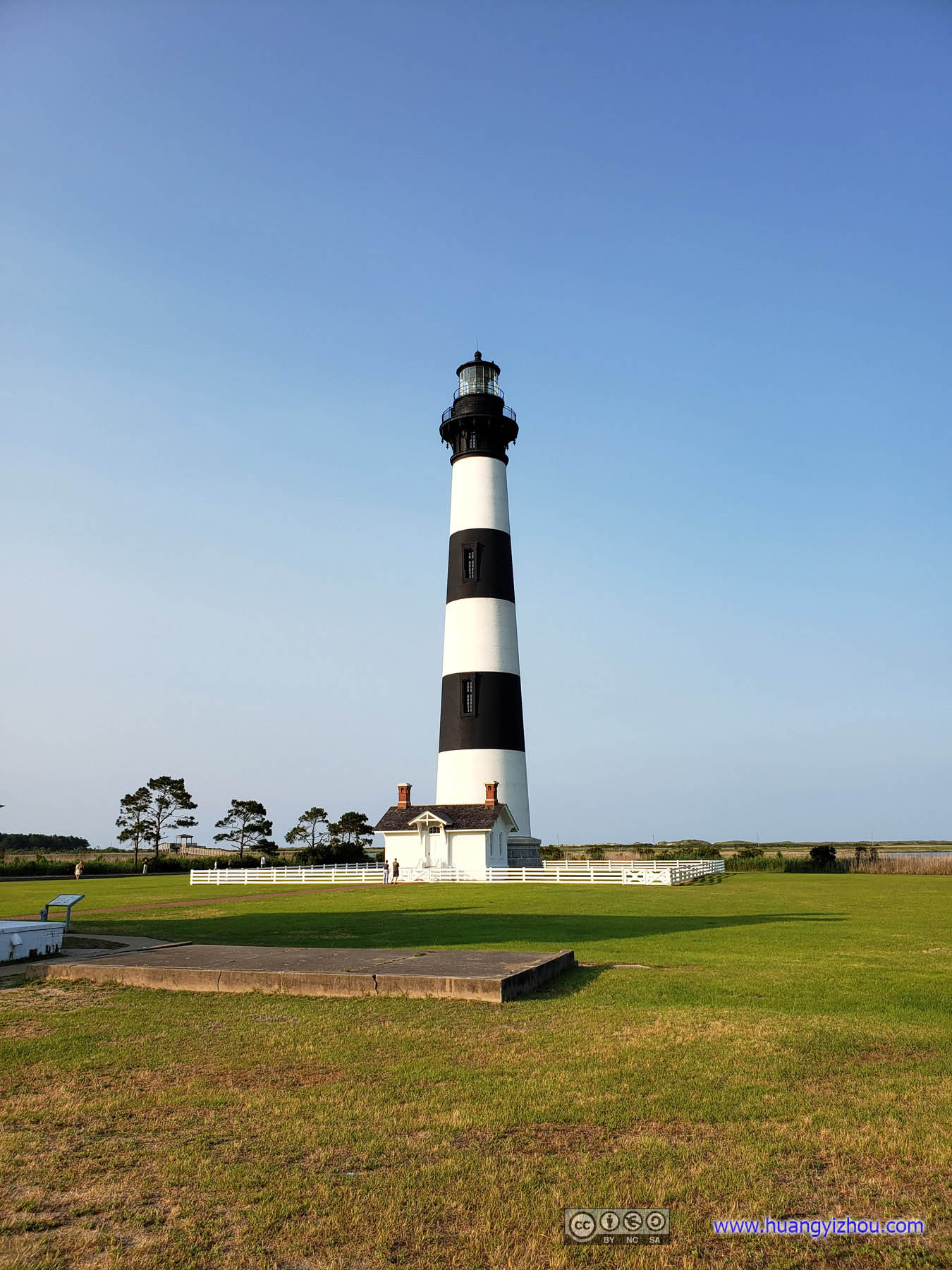
Bodie Island Lighthouse
Click for detail about Bodie Island Lighthouse
There is no part of the Coast of the U.S. which requires a Light House more than Body’s Island- ’tis in the direct route of all going North or South & of all foreign vessel bound into the Chesapeake… there were fifteen wrecks in sight at one place…
Thomas H. Blount, customs collector, in a 1843 letter to US Representative Ed Stanly
Nearby dangerous shifting nearshore sandbars caused hundreds of shipwrecks. Congress commissioned a lighthouse to be built to aid mariners in navigating this “Graveyard of the Atlantic”.
Current lighthouse is the third built in this area. The first lighthouse built in 1848 stood 57-feet tall on an unstable foundation, which became unsafe and was razed. In 1861, the 90-foot tall second lighthouse, built two years earlier, was blown up by Confederate troops during the Civil War. In 1871, work crews and supplies moved from the recently completed Cape Hatteras Lighthouse to begin construction of this lighthouse. On October 1, 1872, the third Bodie Island light was illuminated.
This brick lighthouse stands 164.4 feet tall. The lantern room near the top holds a first-order Fresnel lens. The light can be seen 19 miles away. With lighthouses spaced about 40 miles apart along the coast, past and present sea-farers have near-continuous views of these life-saving beacons as they navigate offshore waters.
From official information board.
Bodie Island Lighthouse
Not unexpectedly, by the time we reached the lighthouse it was already closed. But its grounds were still open so we took a few touristy photos with this beautiful glow of setting sun on the lighthouse body.
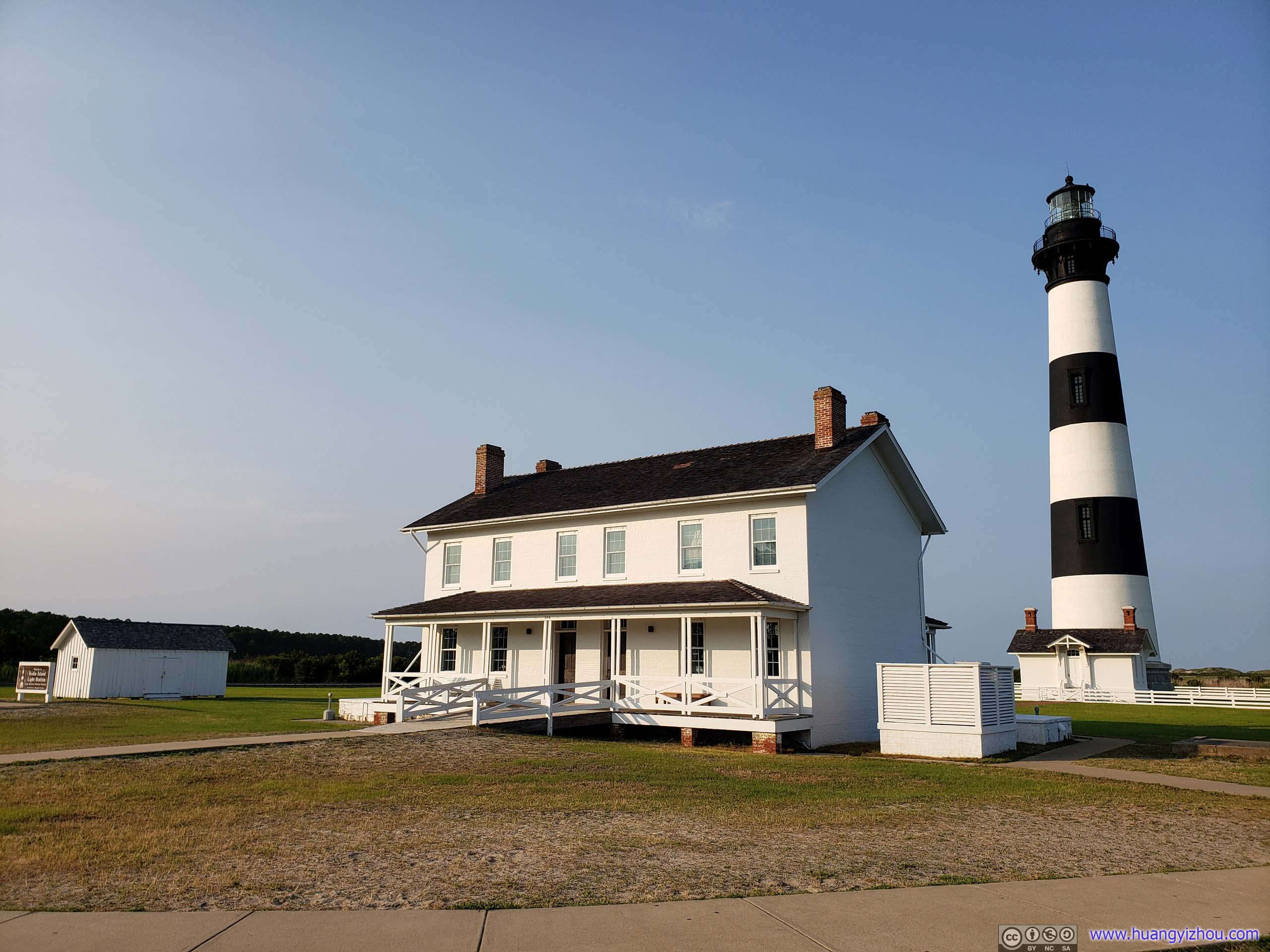
Lighthouse and Support Building
Next we reached Cape Point Campground for the night, set up tent and it was almost dark.
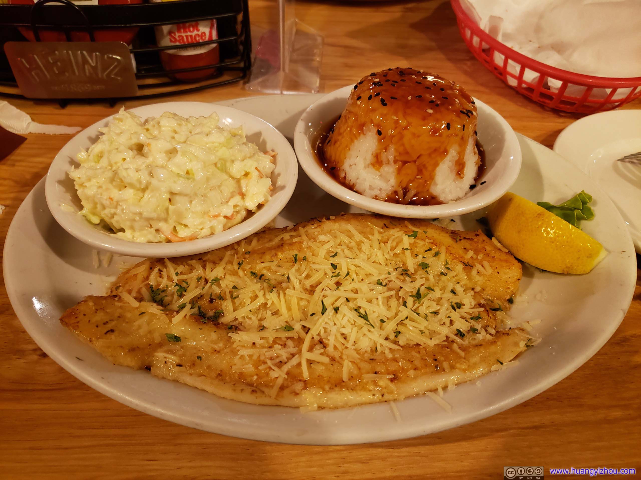
DinnerSince it’s by the ocean, this restaurant actually had a blackboard where customers can choose variants of freshly caught fish of that day, which sounded pretty amazing to someone that knew nothing about variants of fish.
END
![]() Day 2 of Carolinas Vacation, Outer Banks Day 1 by Huang's Site is licensed under a Creative Commons Attribution-NonCommercial-ShareAlike 4.0 International License.
Day 2 of Carolinas Vacation, Outer Banks Day 1 by Huang's Site is licensed under a Creative Commons Attribution-NonCommercial-ShareAlike 4.0 International License.