
Updated on September 11, 2023
Day 1 of 2023 Trip to Hawaii, Honolulu
First day of my January 2023 trip to Hawaii. My friend and I spent the day visiting the more touristy places in the southeastern part of Oahu island, before enjoying a cozy afternoon at Waikiki beach.
Waikīkī Beach
Our plan for the day was to drive down the coastal road (Kalaniana’ole Hwy) of southeastern Oahu, visiting some places of interest and taking a few short hikes along the way. For the afternoon, I had been thinking of some more adventurous hikes such as Mt. Olomana or Pali Puka, if the weather cooperated (spoiler, it didn’t).
With the jet lag, my friend and I had no difficulty waking up early this morning, as we were down at the breakfast terrace of our hotel (Hyatt Place) before the sun came out. It’s certainly one of the more bustling breakfast scenes among the Hyatt Places that I stayed at, an empty table wasn’t that easy to come by at 7am.
After breakfast, we grabbed our car from the valet and headed out at 8:30am. First, we planned to check out Diamond Head; unfortunately, it required timed reservations to enter, which we weren’t aware of. After being turned back at the gate, we made a reservation for the earliest spots, on the morning of Wednesday Jan 18, just before our flight to Maui.
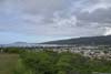
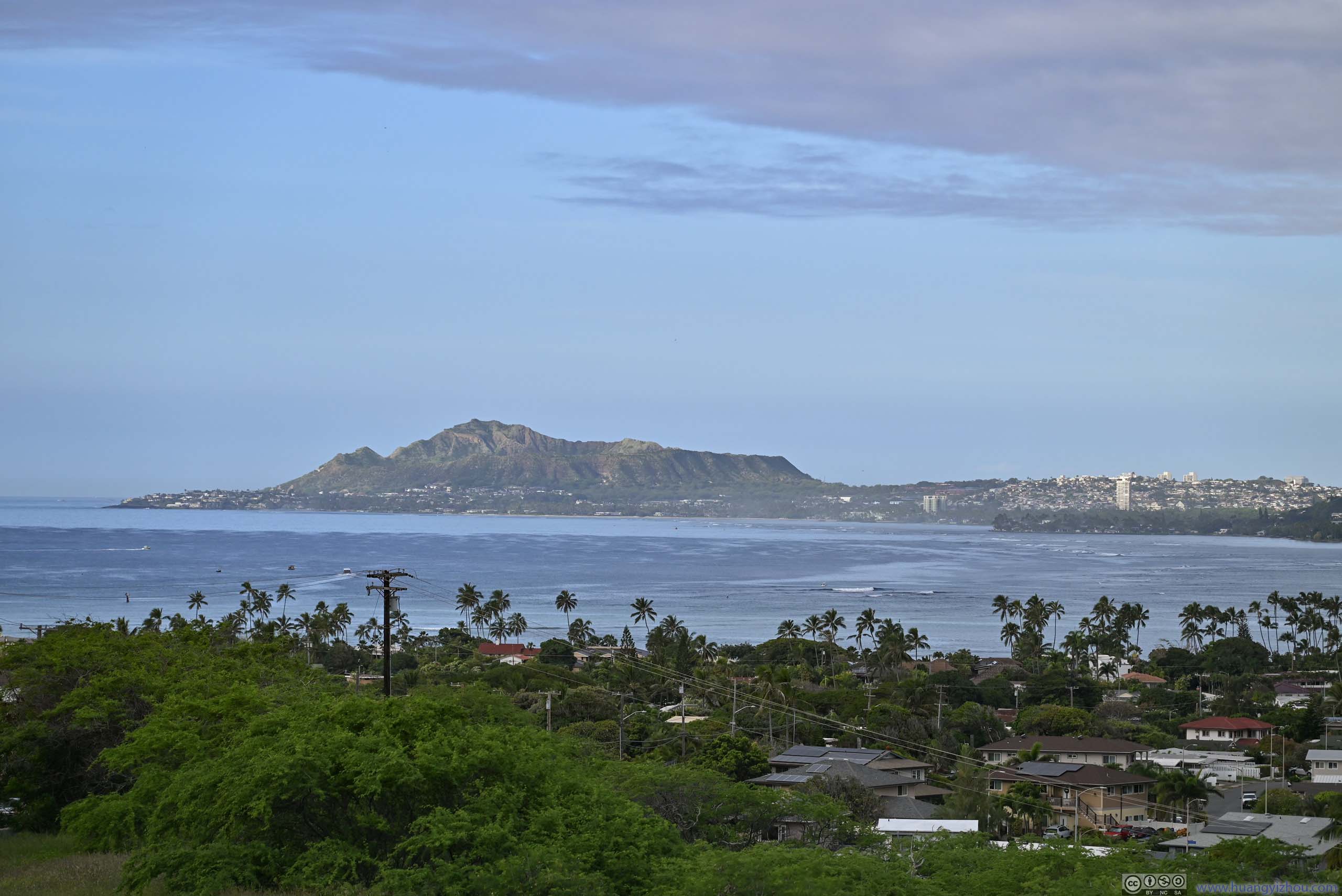
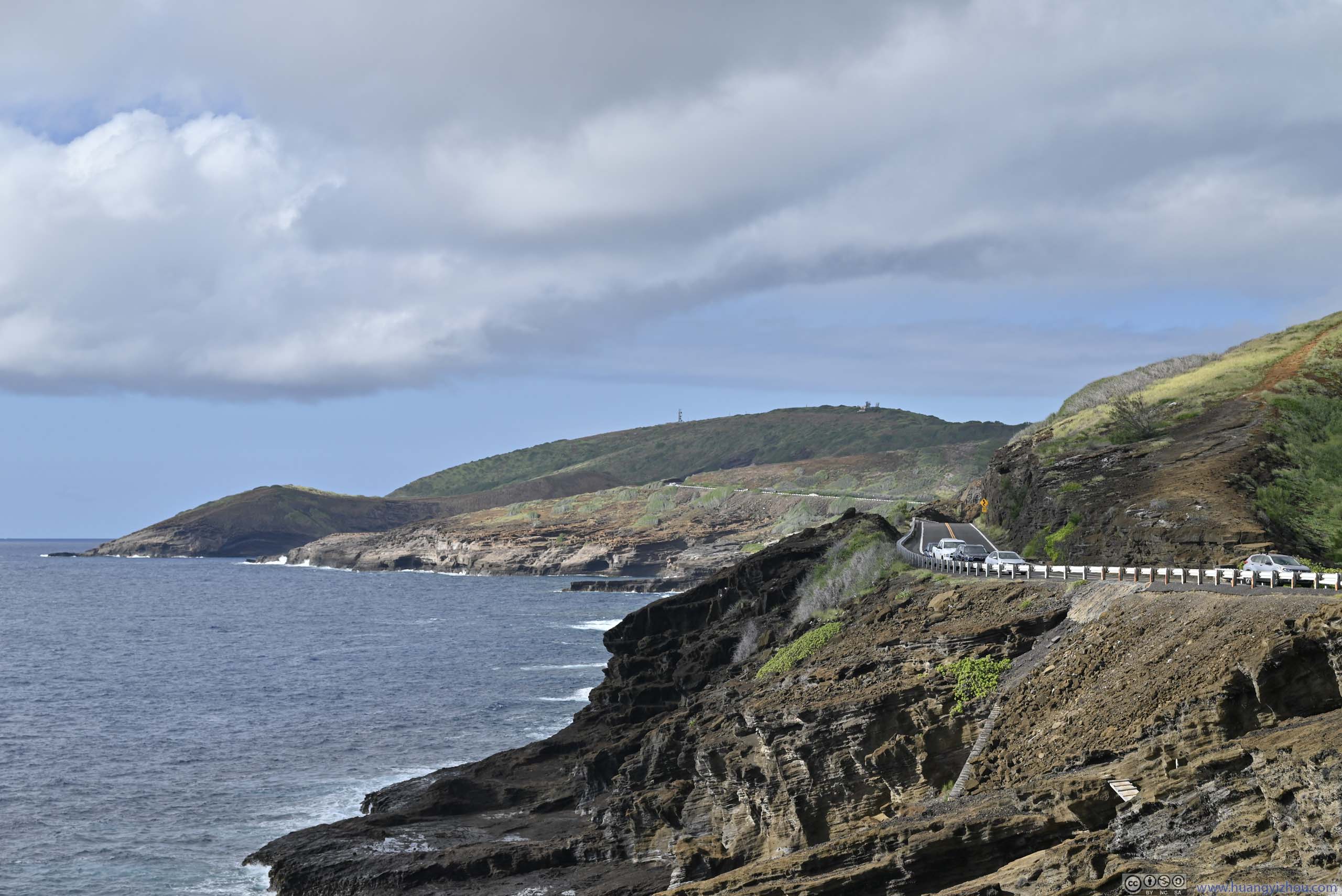
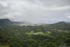
After that, we continued east, briefly stopping at Hawai’i Kai and Lāna’i Lookouts.
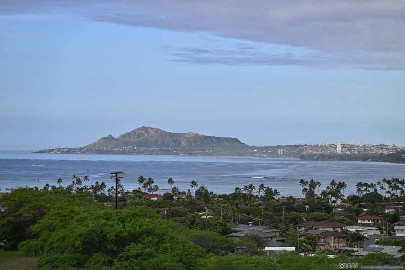 Distant Diamond Head Crater
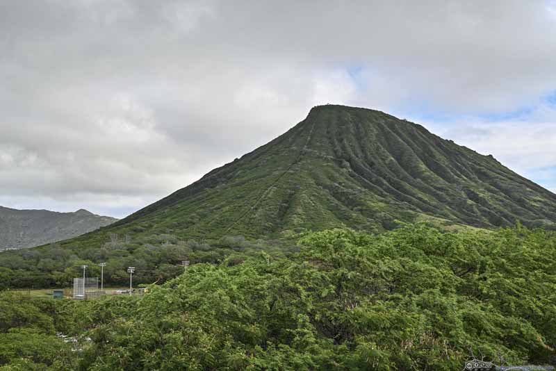 Koko Crater
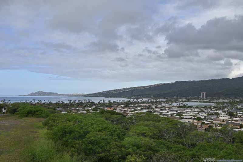 Maunalua Bay
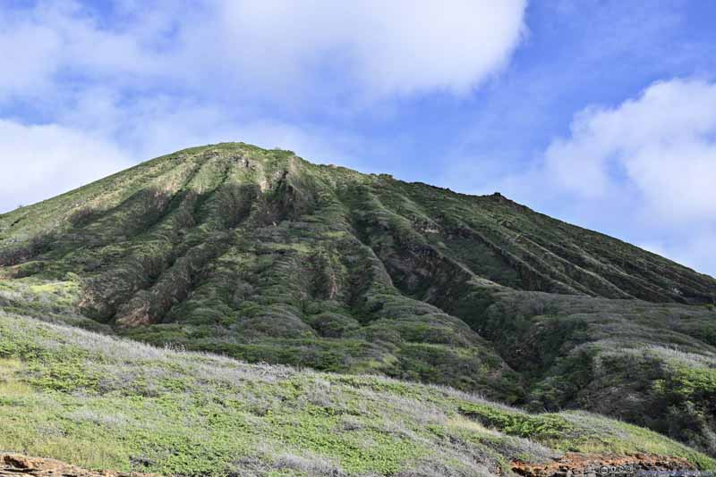 Side of Koko Crater
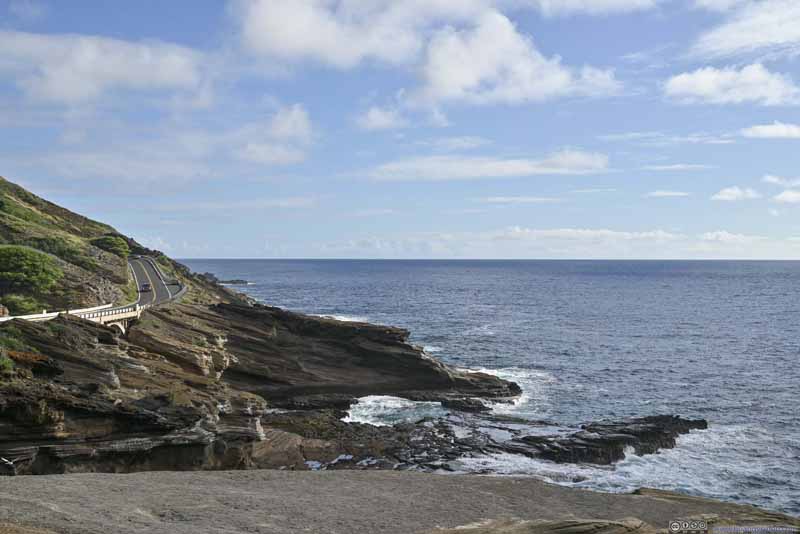 Coastal Road
 Shores
 Shores

Click here to display photos of the slideshow
Distant Diamond Head Crater
Koko Crater
Maunalua Bay

Side of Koko Crater
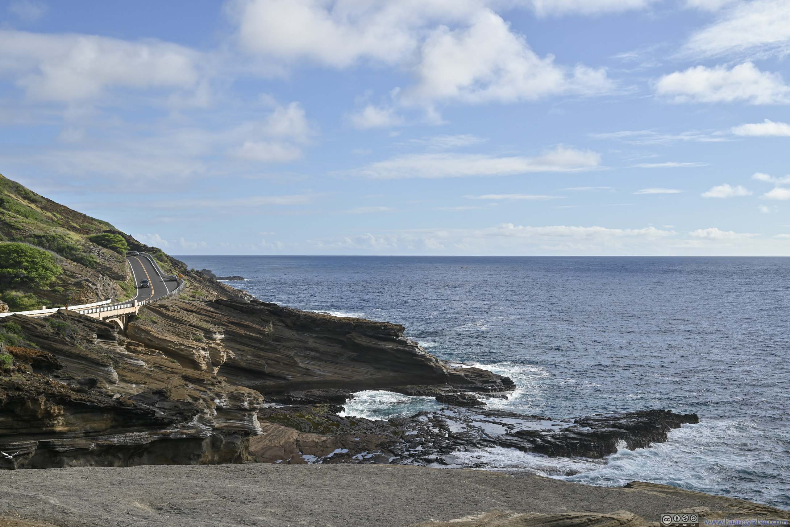
Coastal Road
Shores
Shores
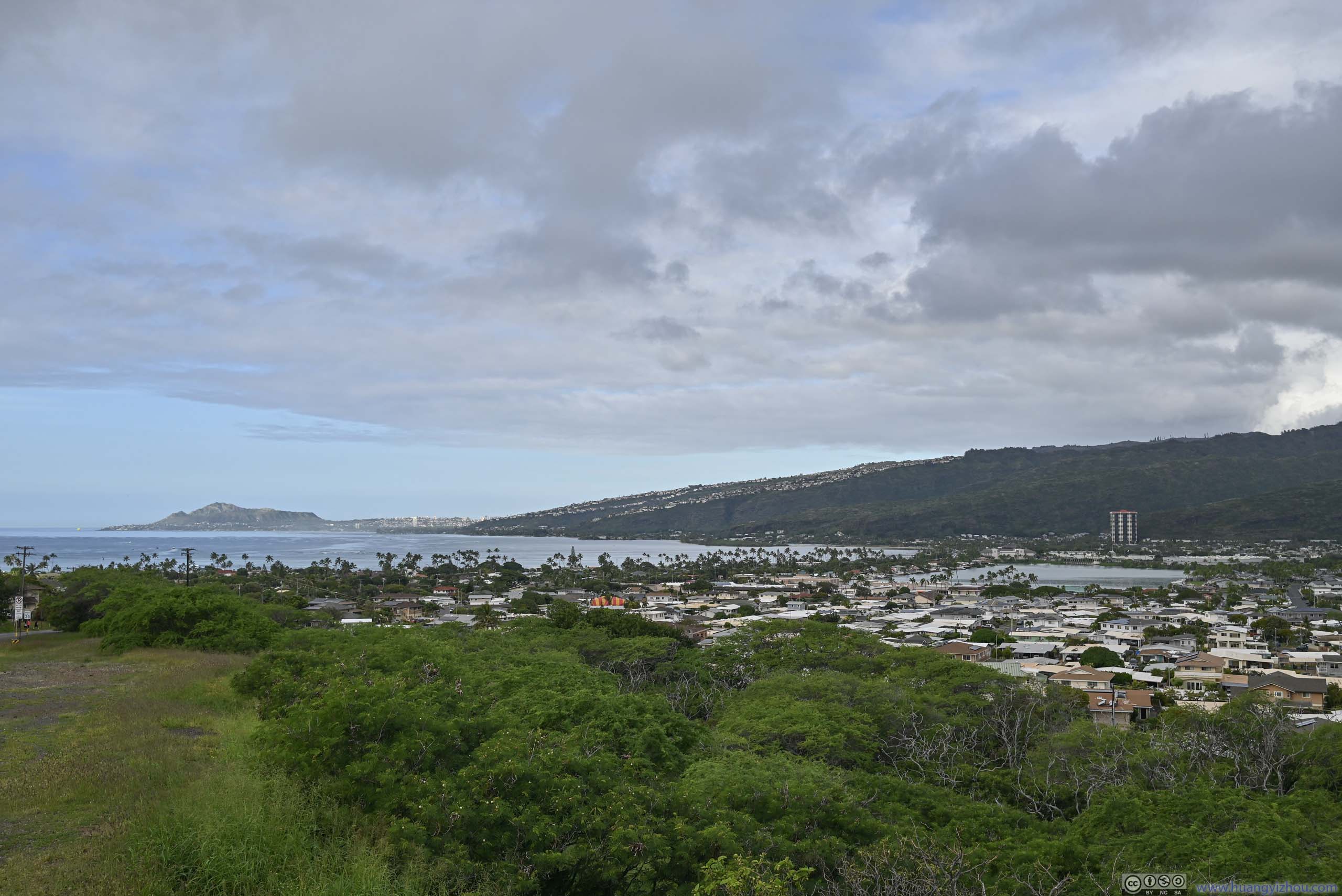
Koko Crater and Town from Hawaii Kai Lookout
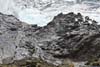
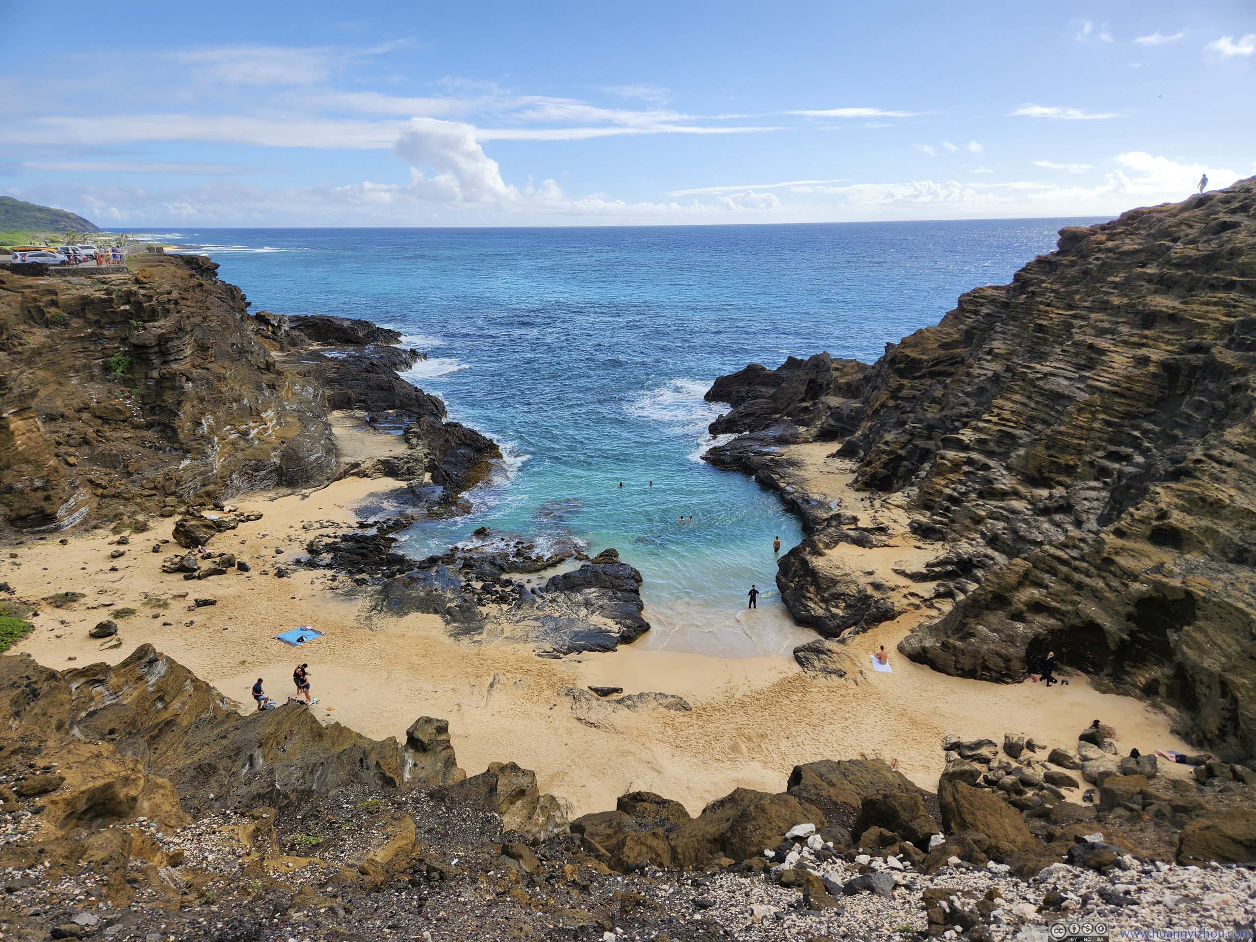
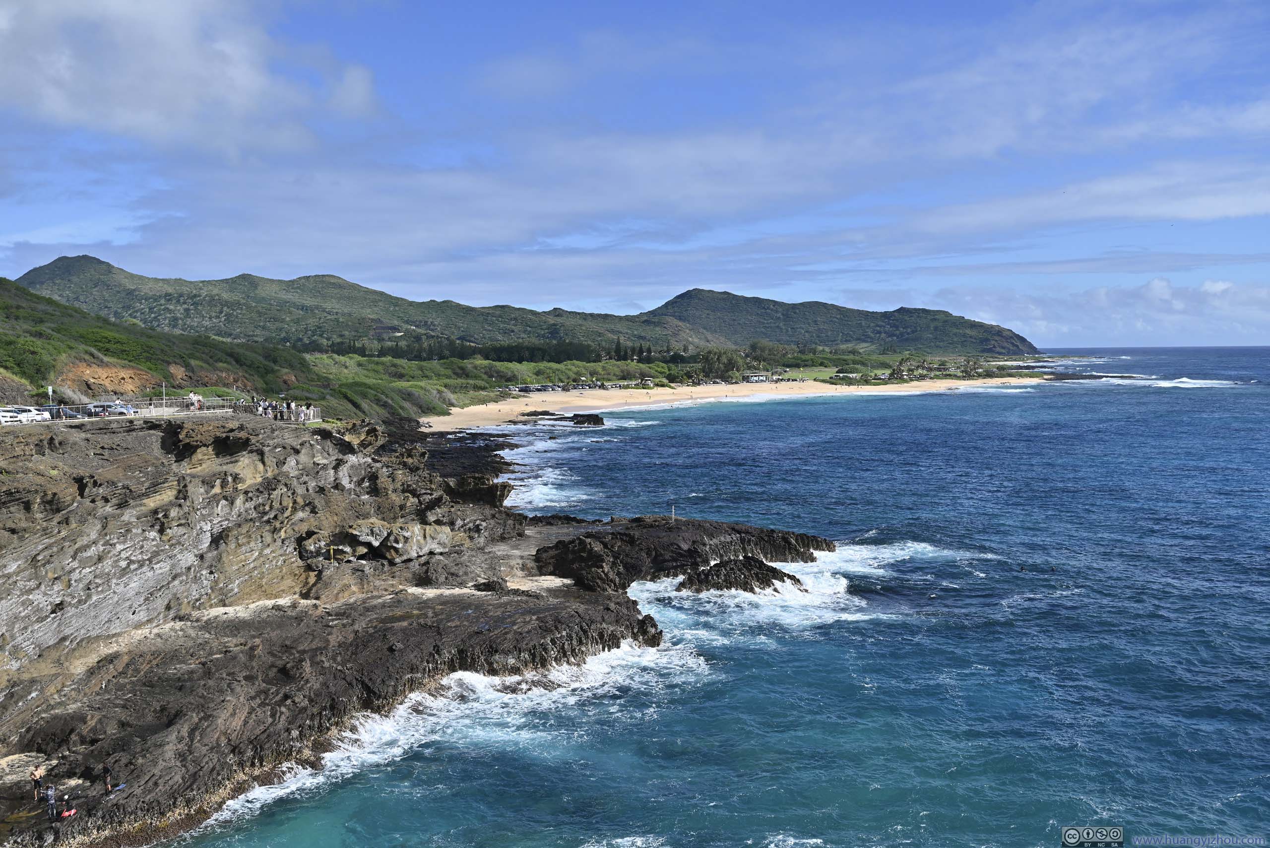
Both Hawai’i Kai and Lāna’i Lookouts were relatively small and easy to park. Things were different for the next stop on our list, Halona Blowhole Lookout, we spent quite some time waiting for a spot there (the parking lot also served the nearby Halona Beach).
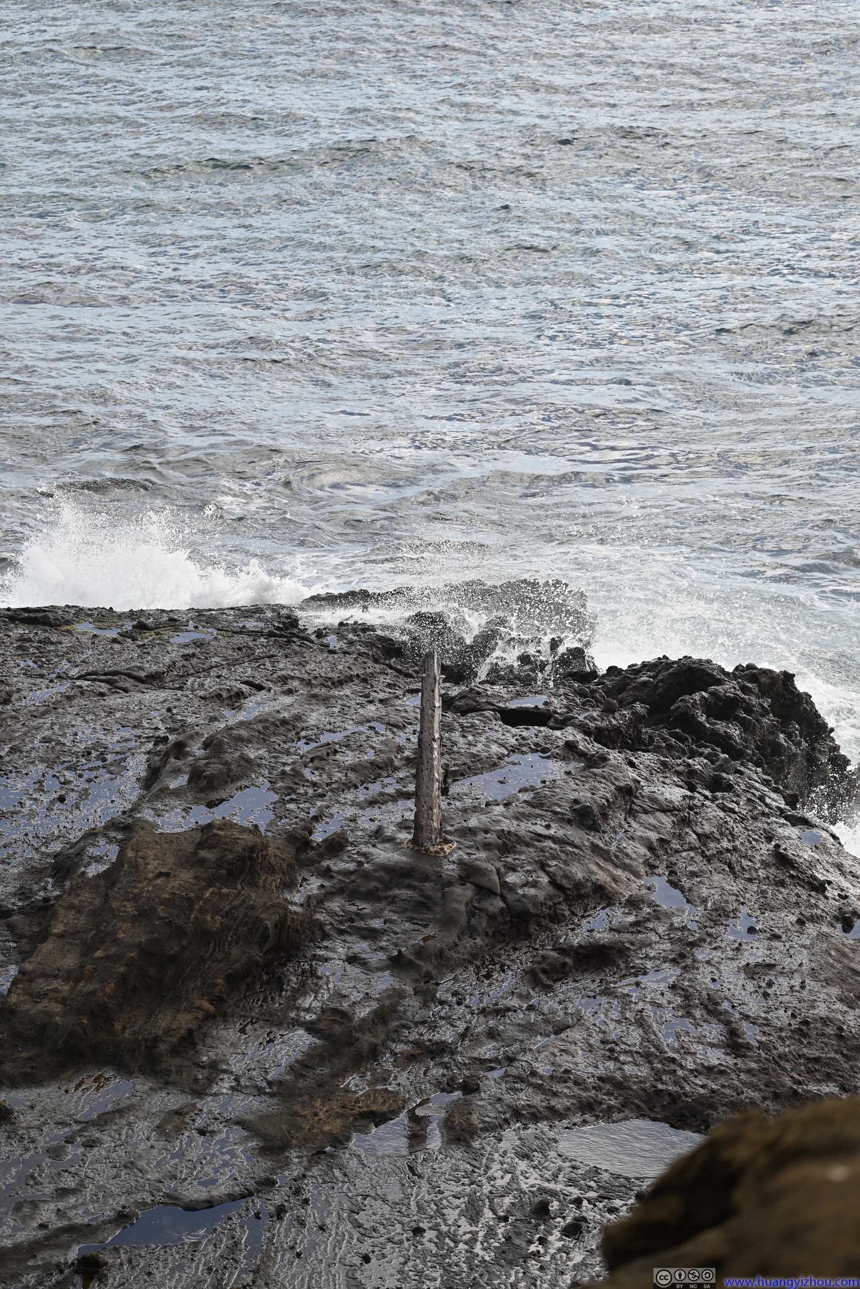
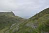
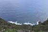
For the efforts spent on parking, the blowhole was a bit underwhelming (p1 below), with more spectacular photos an easy internet search away (it could also require more patience to observe a proper “blow”). In addition, a short walk away there’s a Japanese Fishing Shrine (Umi Mamori Jizo, p4 below), next to which were some boulders extending to the sea, offering scenic views of the coastline (p5-7 below).
 BlowholeSome water droplets from the blowhole in the center of this photo, hardly spectacular.
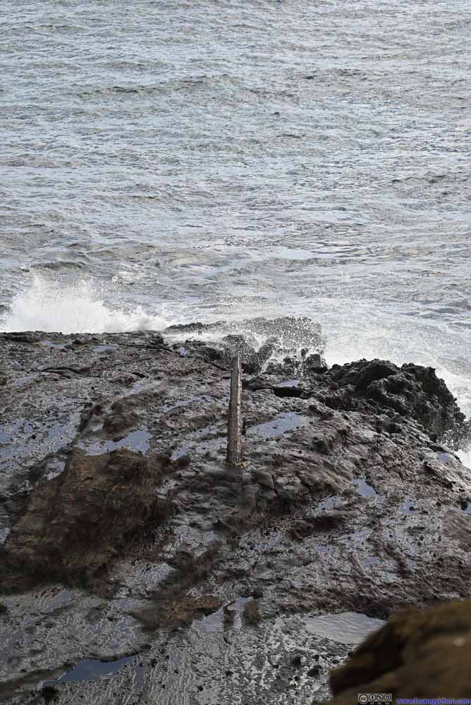 ConeAt first I thought this was the blowhole.
 Halona Beach Cove
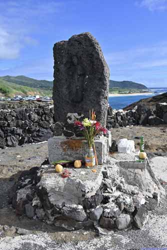
 Japanese Fishing Shrine
 Blowhole and Distant Wawamalu Beach Park
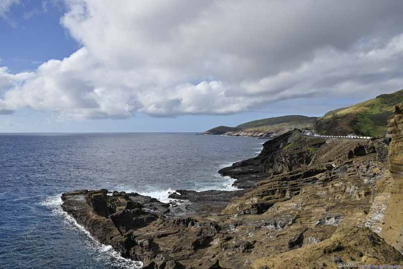 Coastline
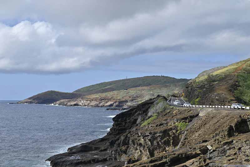 Coastline


Click here to display photos of the slideshow

BlowholeSome water droplets from the blowhole in the center of this photo, hardly spectacular.
ConeAt first I thought this was the blowhole.
Halona Beach Cove
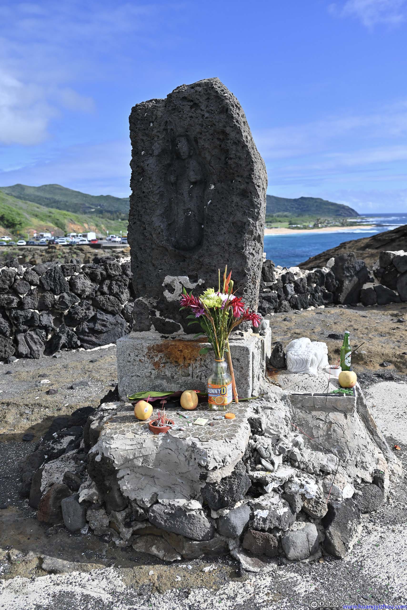
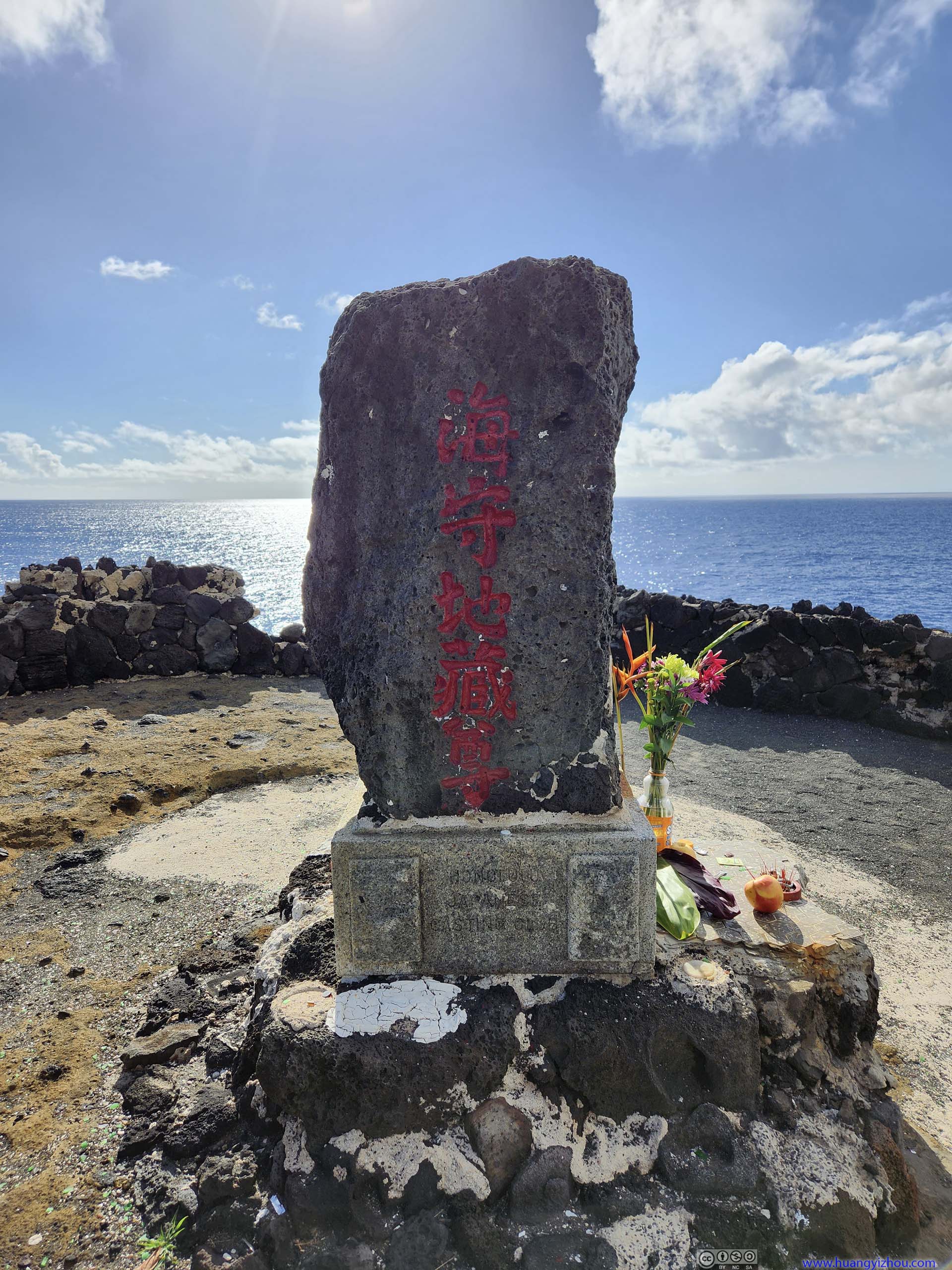 Japanese Fishing Shrine
Blowhole and Distant Wawamalu Beach Park

Coastline
Coastline
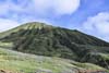
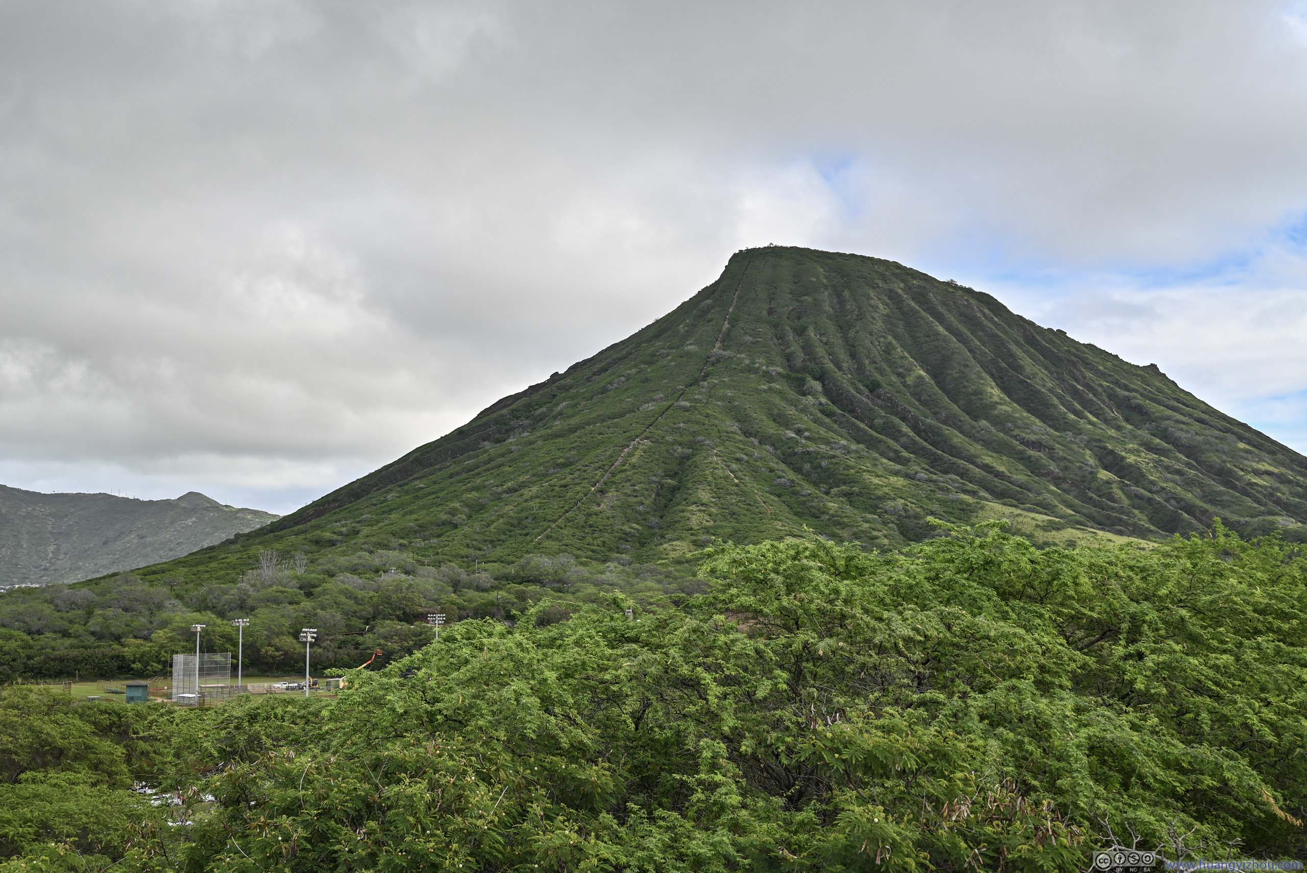
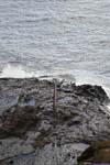
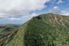
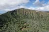
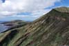
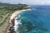
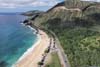
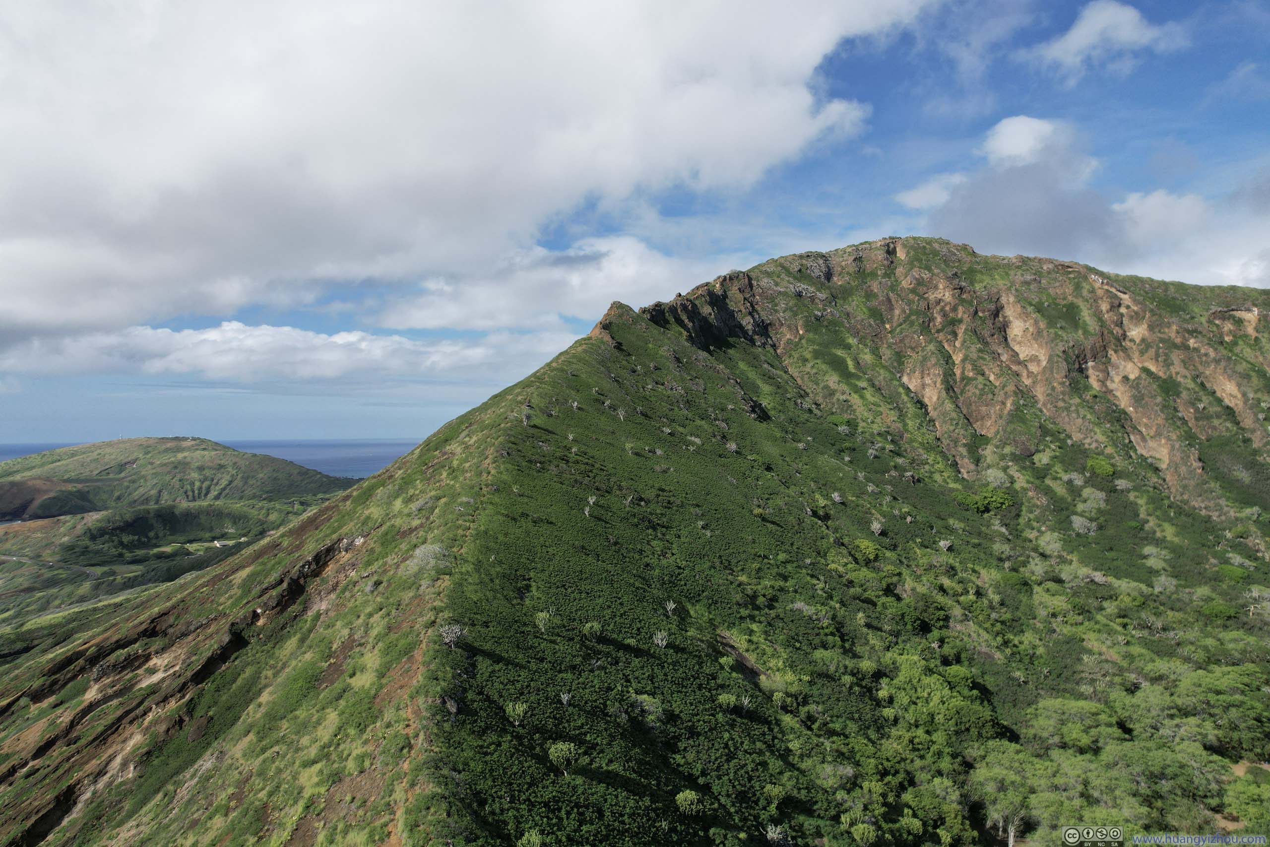
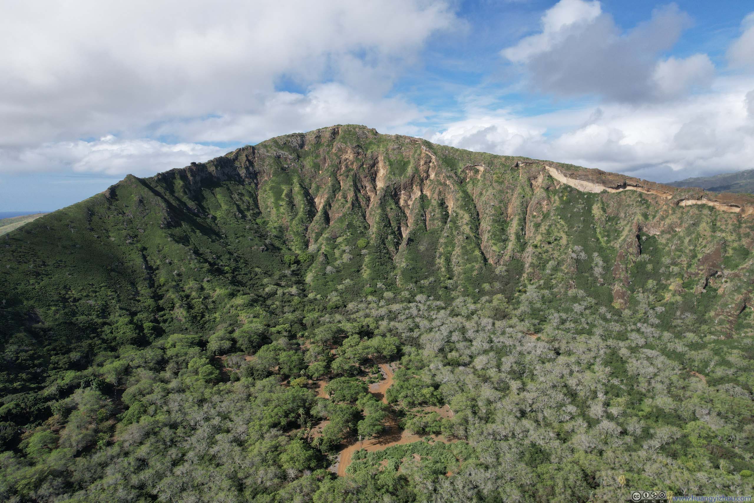
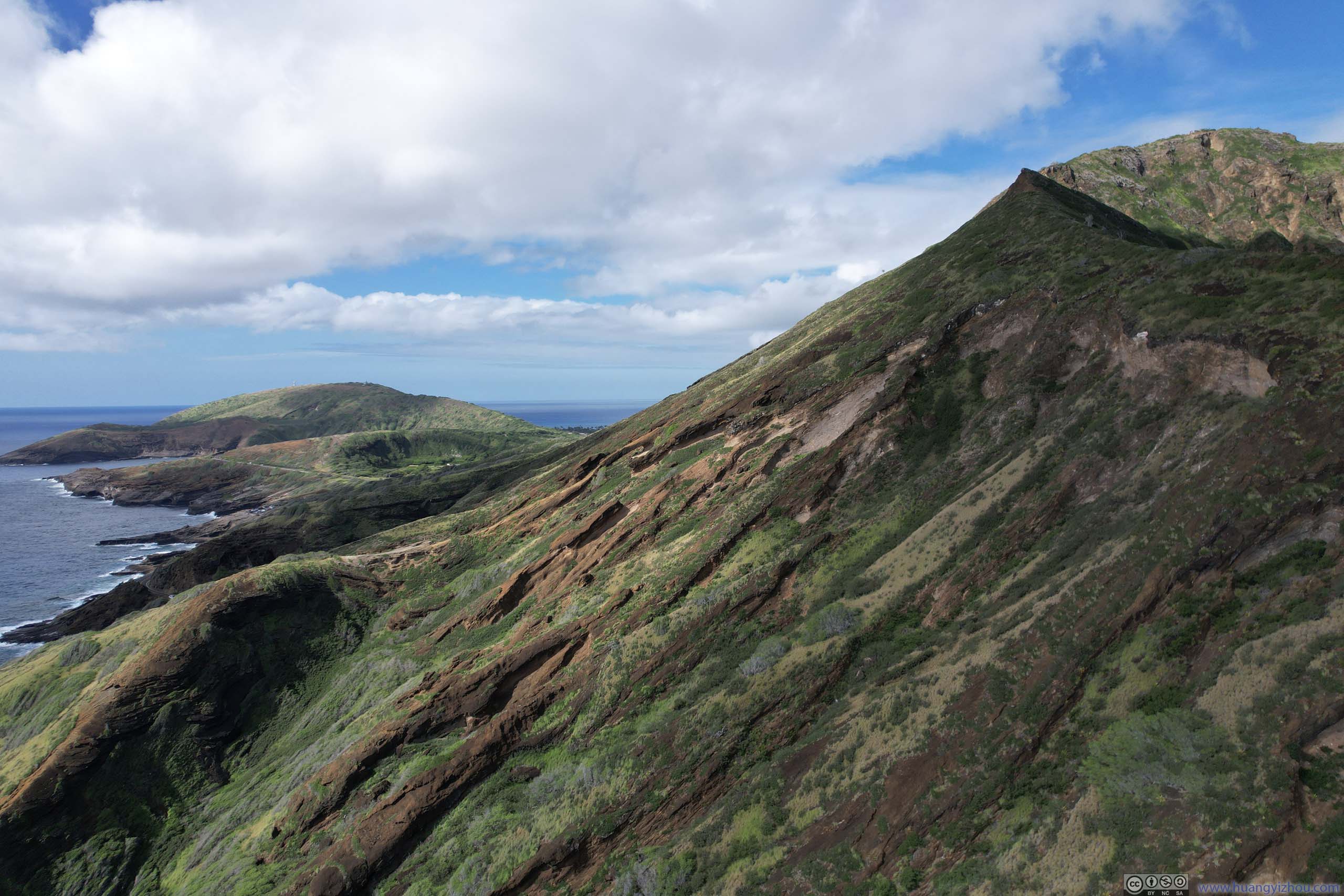
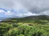
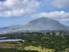
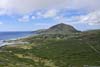
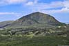
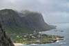
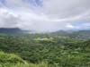
Our next stop was Wawamalu Beach Park, which featured a model aircraft field and was one of the few city parks in Honolulu where one could launch a drone. Nearby, there’s Koko Crater whose top should offer great views. But given the physical efforts to reach its top, my friend and I were more than happy to let the drone do the climb for us.
 Ridge of Koko CraterA faint trail (not on maps) following the ridgeline to the summit.
 Koko CraterOverlooking the trails of Koko Head Regional Park inside the crater.
 Southern Slope of Koko Crater
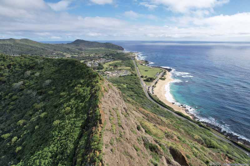 Ridge of Koko Crater
 Highway next to Ocean
 Overlooking Wawamalu Beach Park
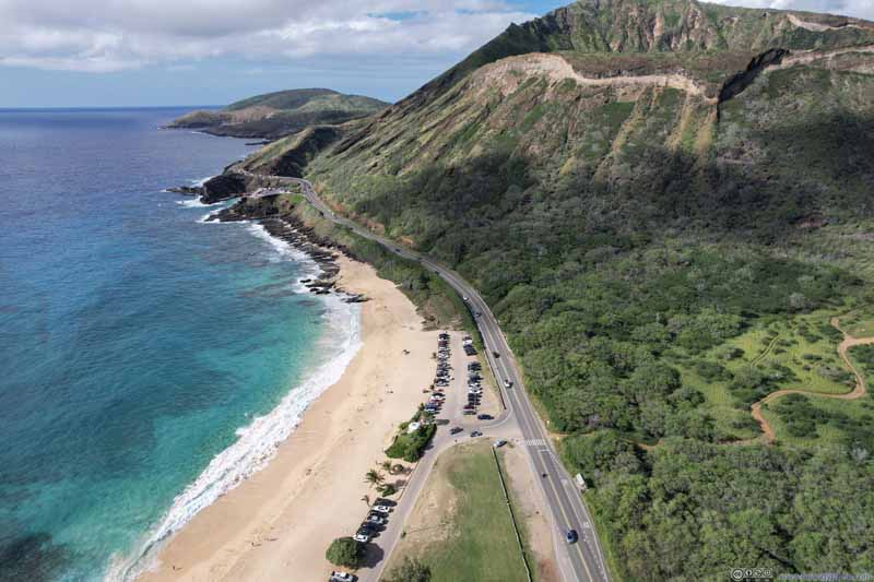 Overlooking Wawamalu Beach Park
Click here to display photos of the slideshow
Ridge of Koko CraterA faint trail (not on maps) following the ridgeline to the summit.
Koko CraterOverlooking the trails of Koko Head Regional Park inside the crater.
Southern Slope of Koko Crater
Ridge of Koko Crater

Highway next to Ocean
Overlooking Wawamalu Beach Park

Overlooking Wawamalu Beach Park
In addition, I also checked out the coastline towards Kailiili Bay, here’s a video:
Koko Crater and Wawamalu Beach Park
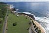
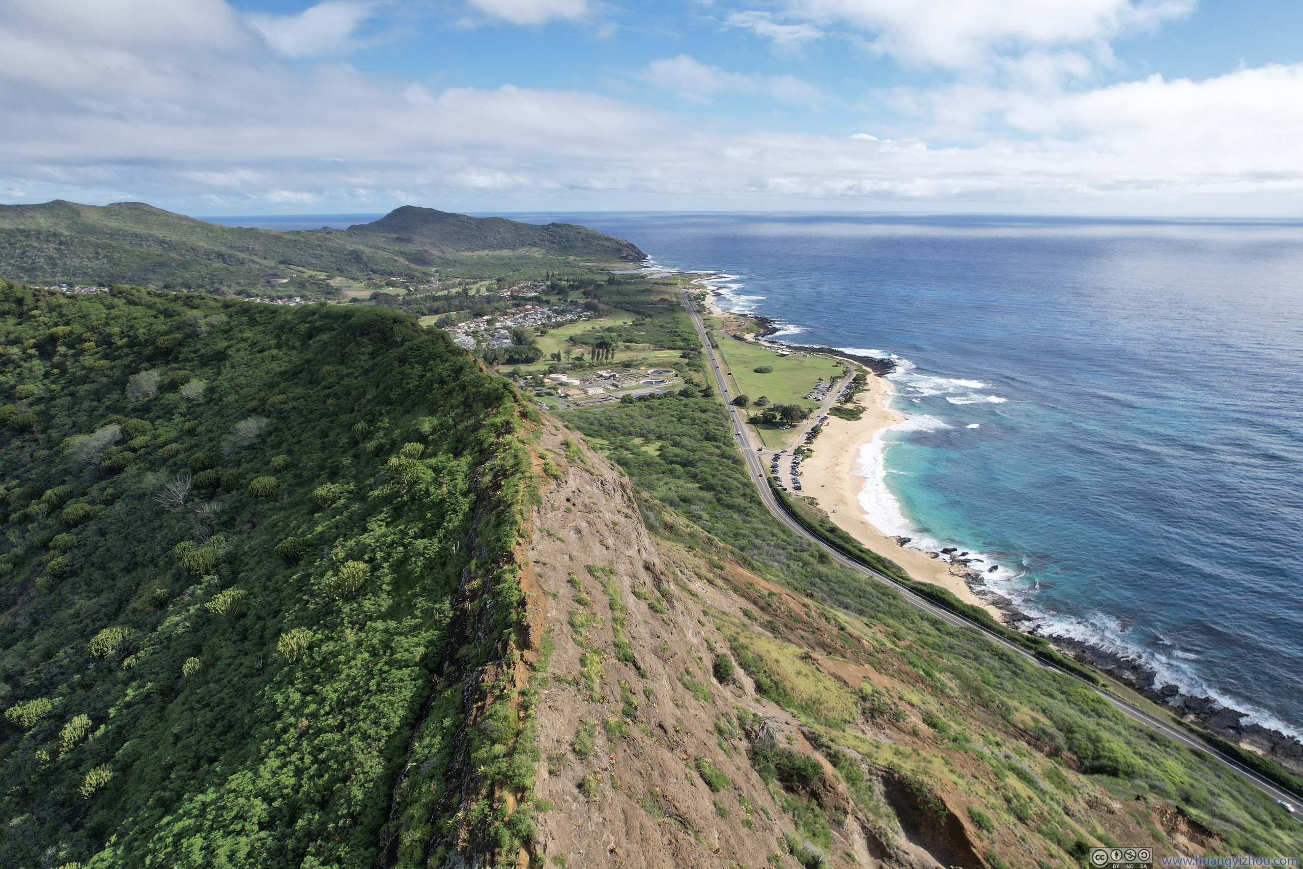
Makapu’u Point
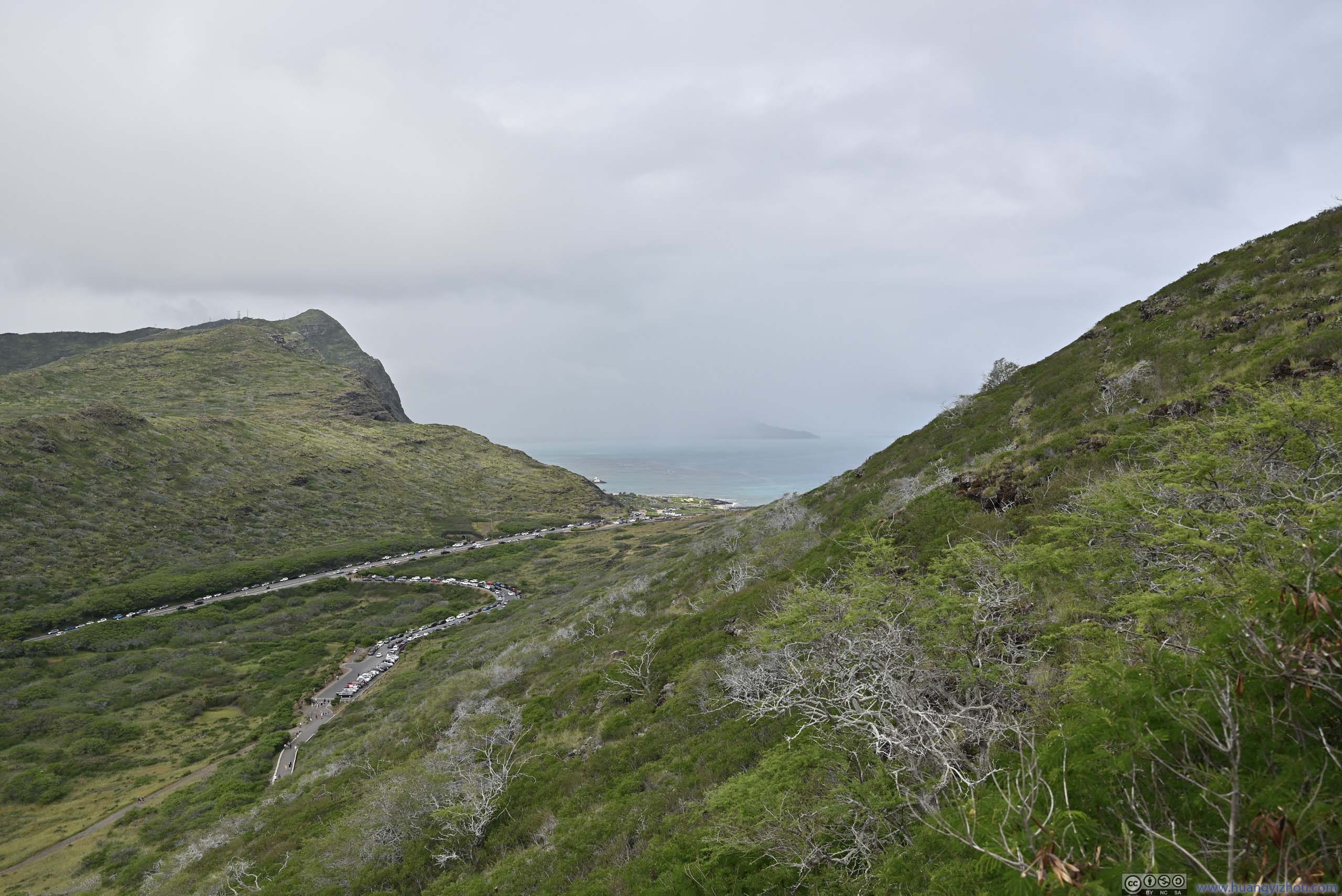
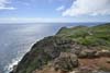
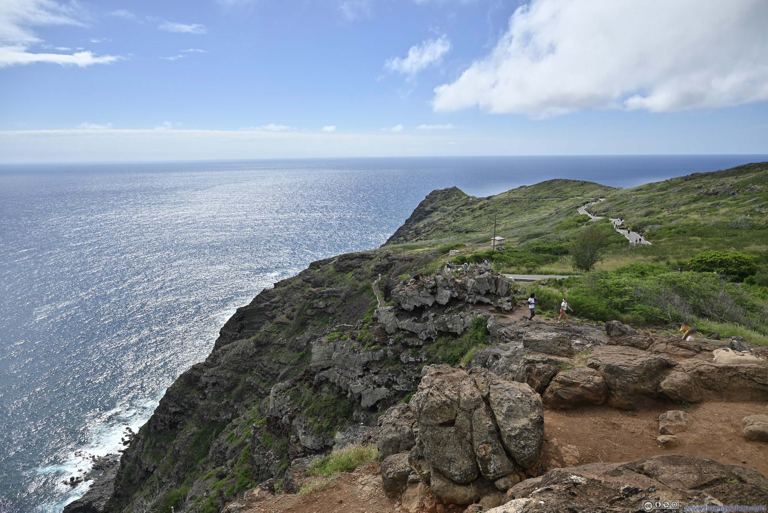
Next on our list was Makapu’u Point, the easternmost point of Oahu featuring a popular trail to an observation deck with fantastic views.
This was a very popular attraction, however, its parking lot only held about 30 cars. As a result, people resort to parallel parking along its access road (Makapuu Lighthouse Road), and when the access road was filled, onto the main road (Kalaniana’ole Highway).
It took us about 10 minutes to get parked, which wasn’t too bad for its popularity. After which we hit the trails.
Here’s GPS tracking:
The trail to Makapu’u Point was 4km out-and-back with 154m elevation gain spread constantly throughout its length. Its entirety was paved.
It started to drizzle just as we started our ascent. For a moment we thought of heading back to the car to fetch rain coats, luckily, we didn’t. The drizzle was so light that it didn’t wet our clothes, and completely stopped once we were about 1/3 of the way up. Otherwise, it’s hardly pleasant carrying extra clothes in such humid weather as we ended up panting and sweating along the way.
 Fields Below
 Distant Koko CraterTaken during our ascent, still some mist in the air.
 Distant Koko CraterThe weather got better during our descent.
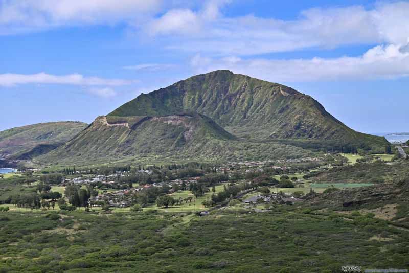 Distant Koko CraterThe weather got better during our descent.
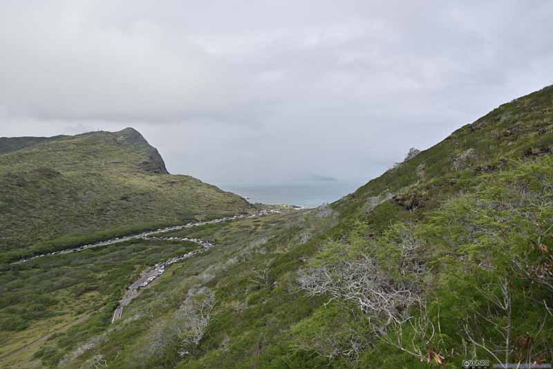 Makapu’u Gap
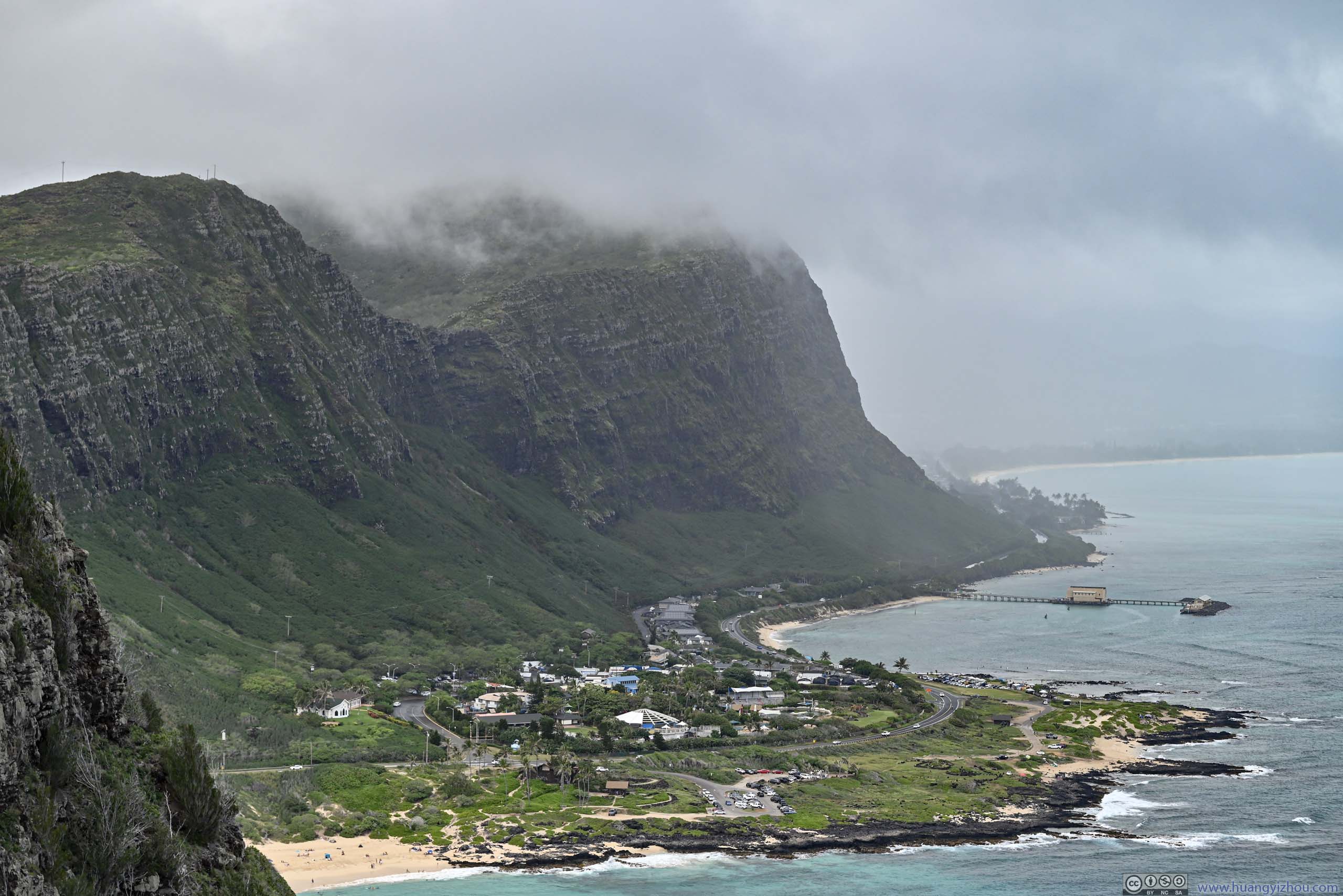
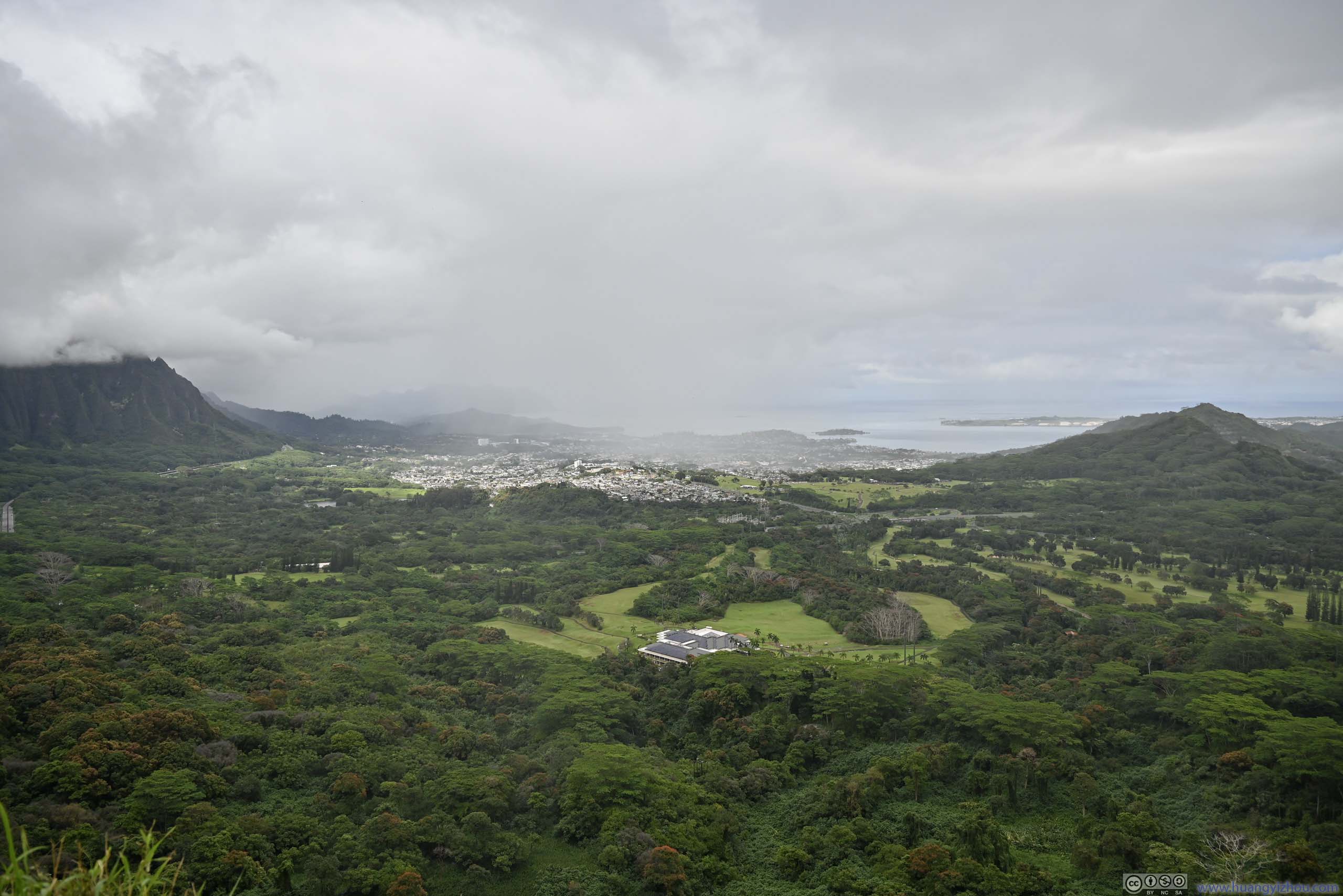
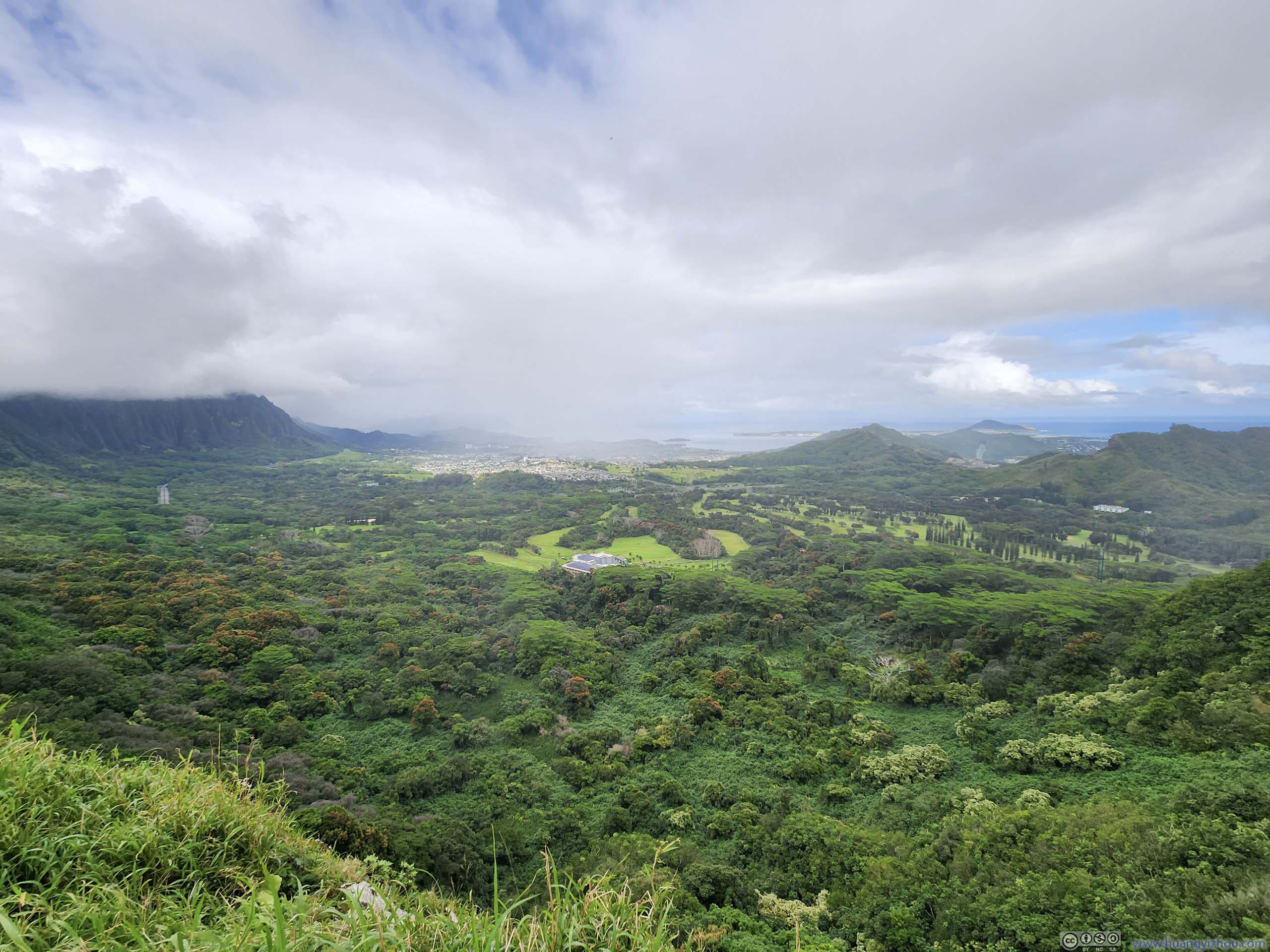
The only way to reach windward side of Oahu island from Honolulu before the tunnels. Also in this photo was the small parking lot in the lower-left and the huge amount of overflow parking.
Makapu’u Gap
The only way to reach windward side of Oahu island from Honolulu before the tunnels. Also in this photo was the small parking lot in the lower-left and the huge amount of overflow parking.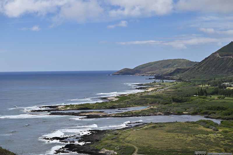 Shoreline
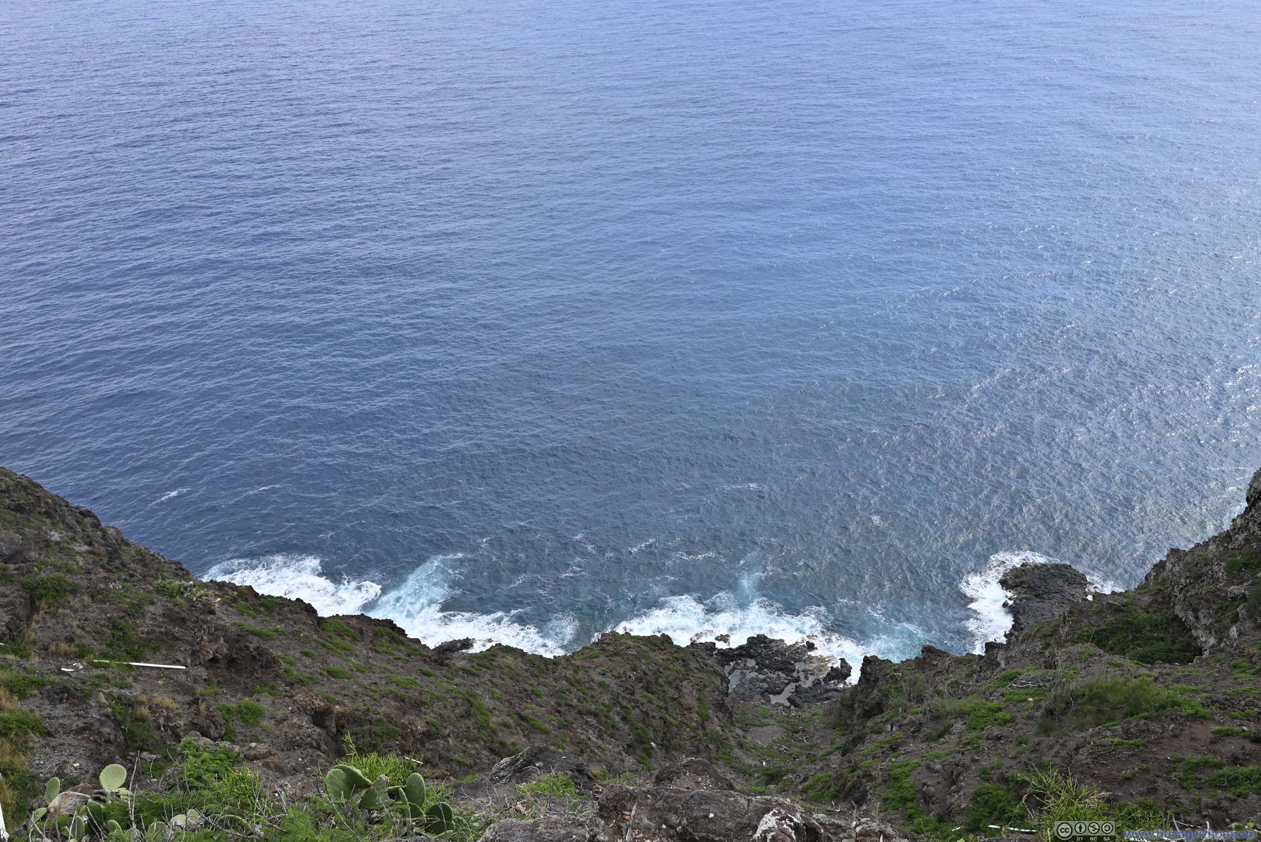
 Cliff along Trail

Click here to display photos of the slideshow

Fields Below

Distant Koko CraterTaken during our ascent, still some mist in the air.

 Distant Koko CraterThe weather got better during our descent.
Makapu’u Gap

Shoreline
Cliff along Trail
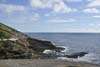
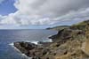
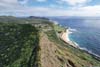
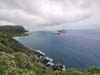
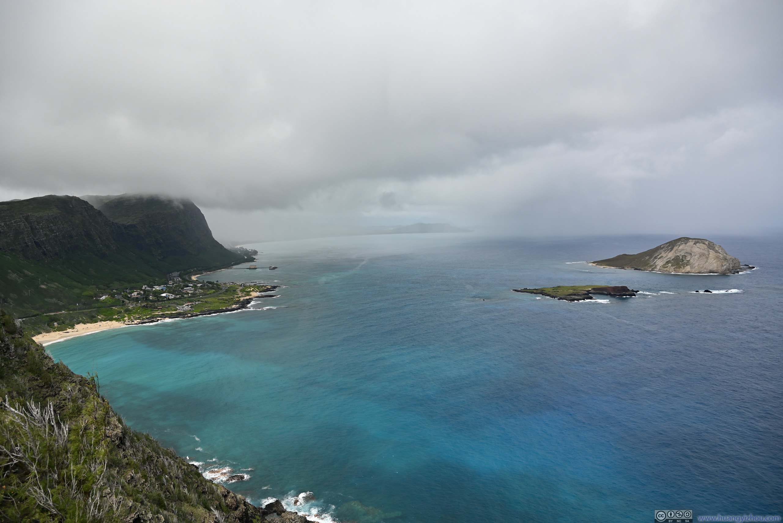
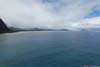
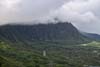
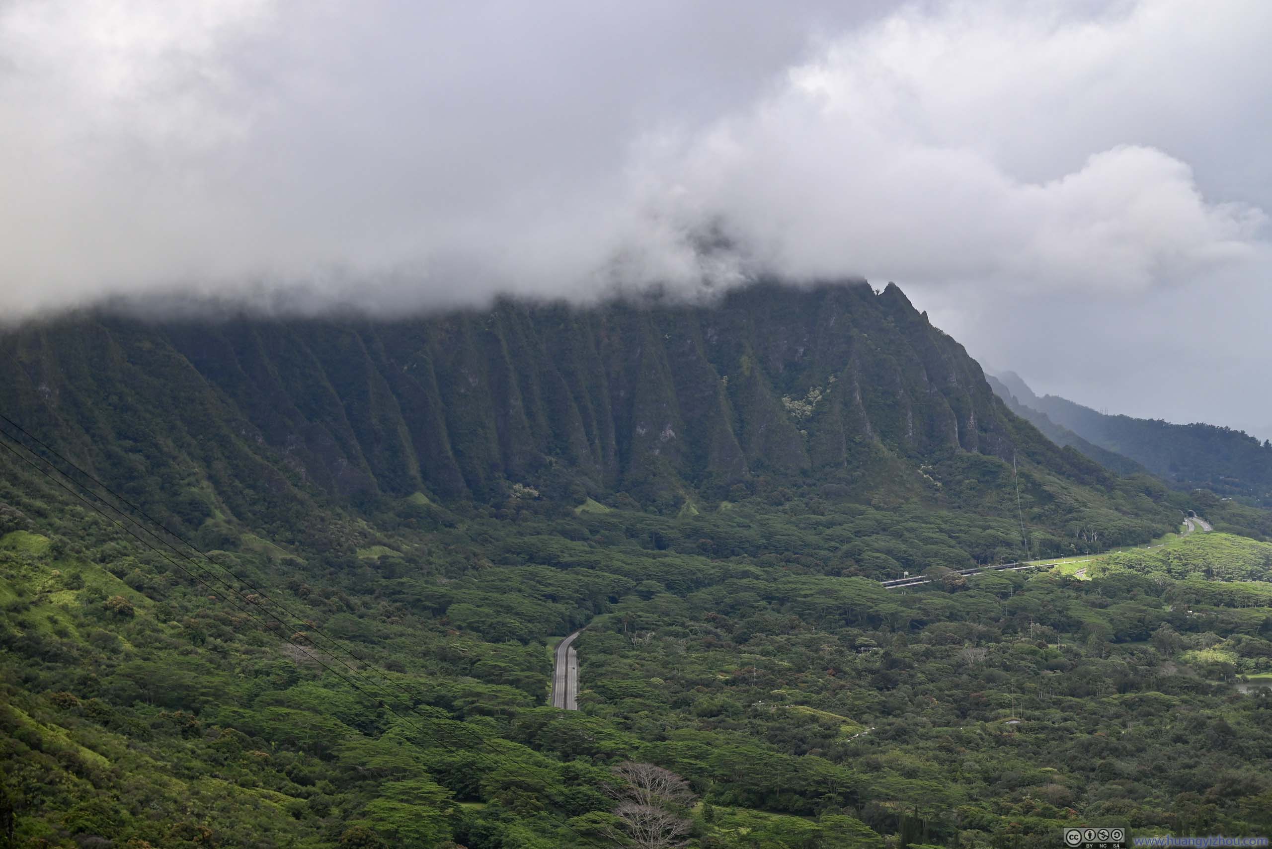
The ascent took us just over half an hour, the changing views from coastal wetland to expansive ocean made the physical efforts bearable. At the top, the views from the easternmost point of Oahu, of clouds crashing onto the fortress of Ko’olau Range along eastern Oahu, were greatly rewarding.
 Pukakukui Channel
 Pukakukui Channel
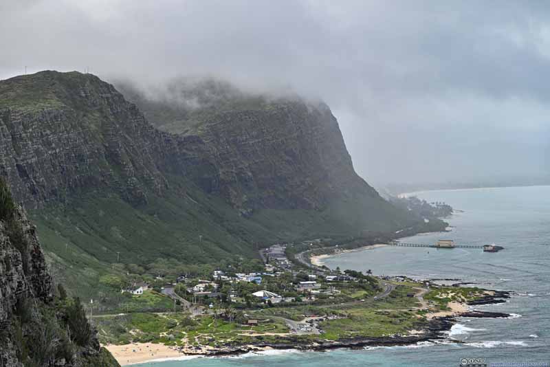 Cliffs along Oahu’s Windward SideAn imposing sight watching the clouds conquering the cliffs.
 Kāohikaipu and Mānana Islands
 Looking Back from Makapu’u PointTowards the south, the weather looked rather great.
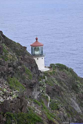
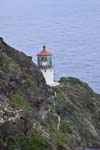
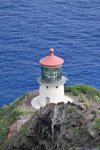 Makapu’u LighthouseTaken from along the trail (left) and from the overlook at the top (right).

Click here to display photos from Makapu’u Point.
Pukakukui Channel

Pukakukui Channel
Cliffs along Oahu’s Windward SideAn imposing sight watching the clouds conquering the cliffs.
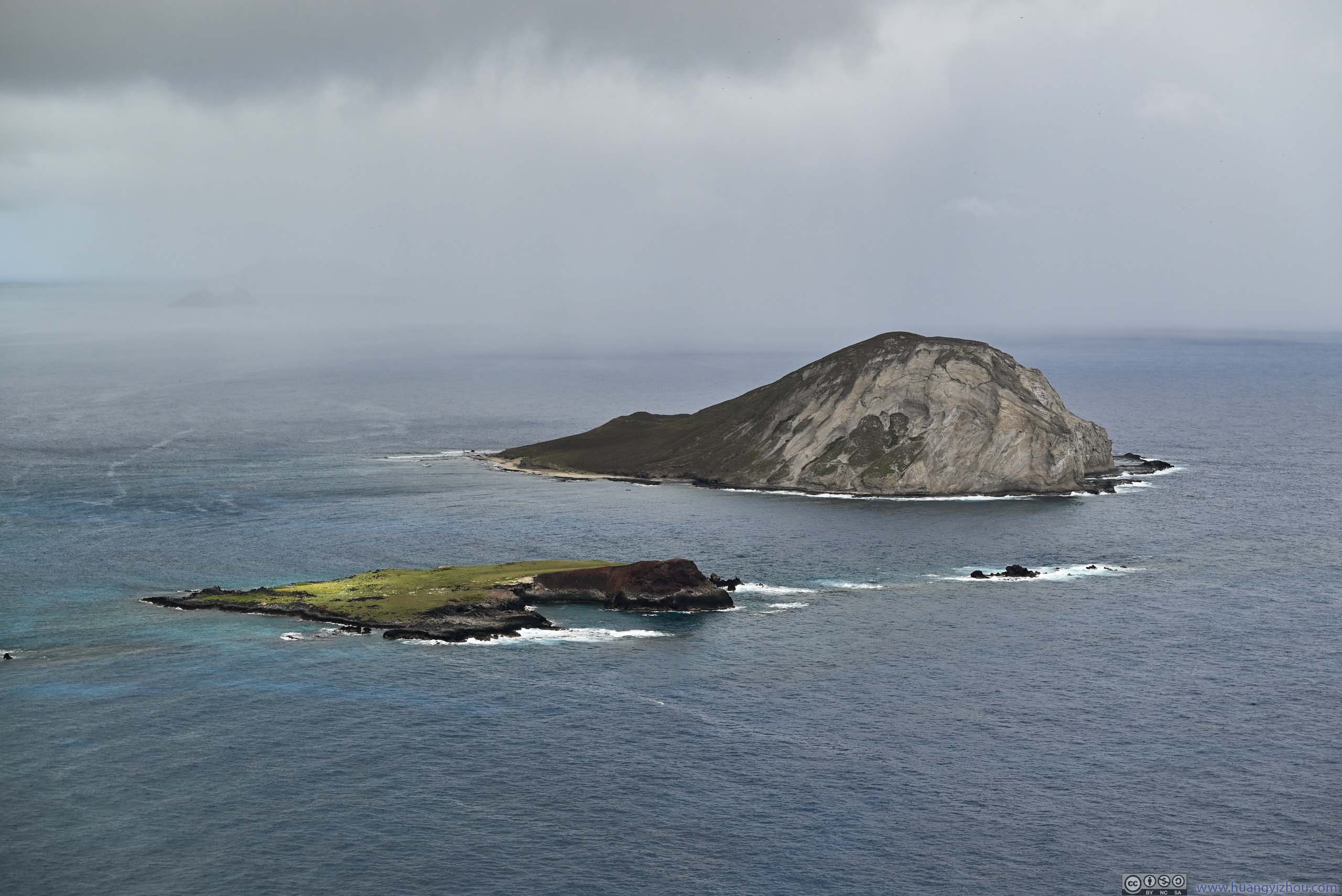
Kāohikaipu and Mānana Islands
Looking Back from Makapu’u PointTowards the south, the weather looked rather great.
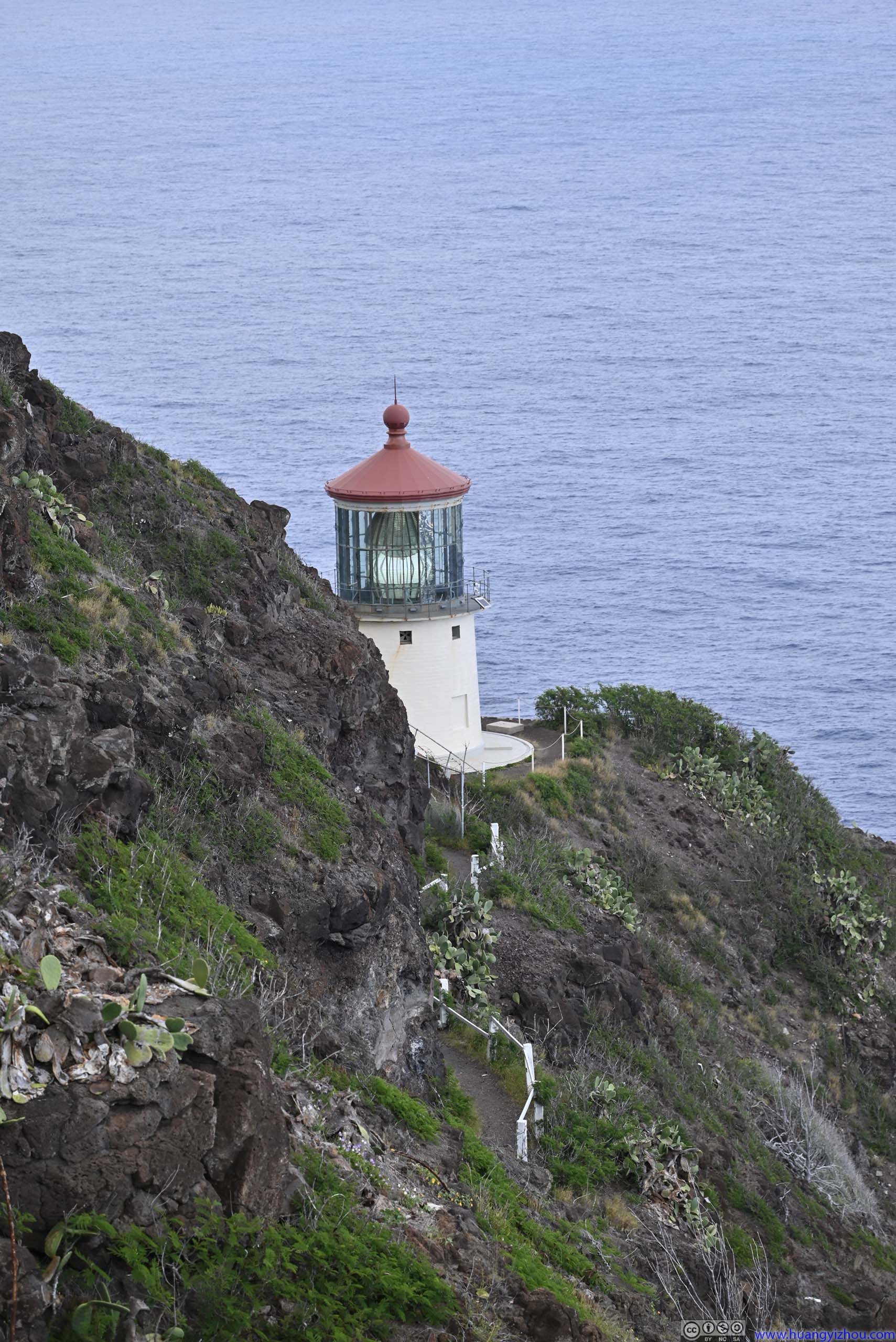
 Makapu’u LighthouseTaken from along the trail (left) and from the overlook at the top (right).
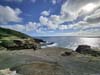
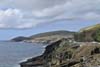
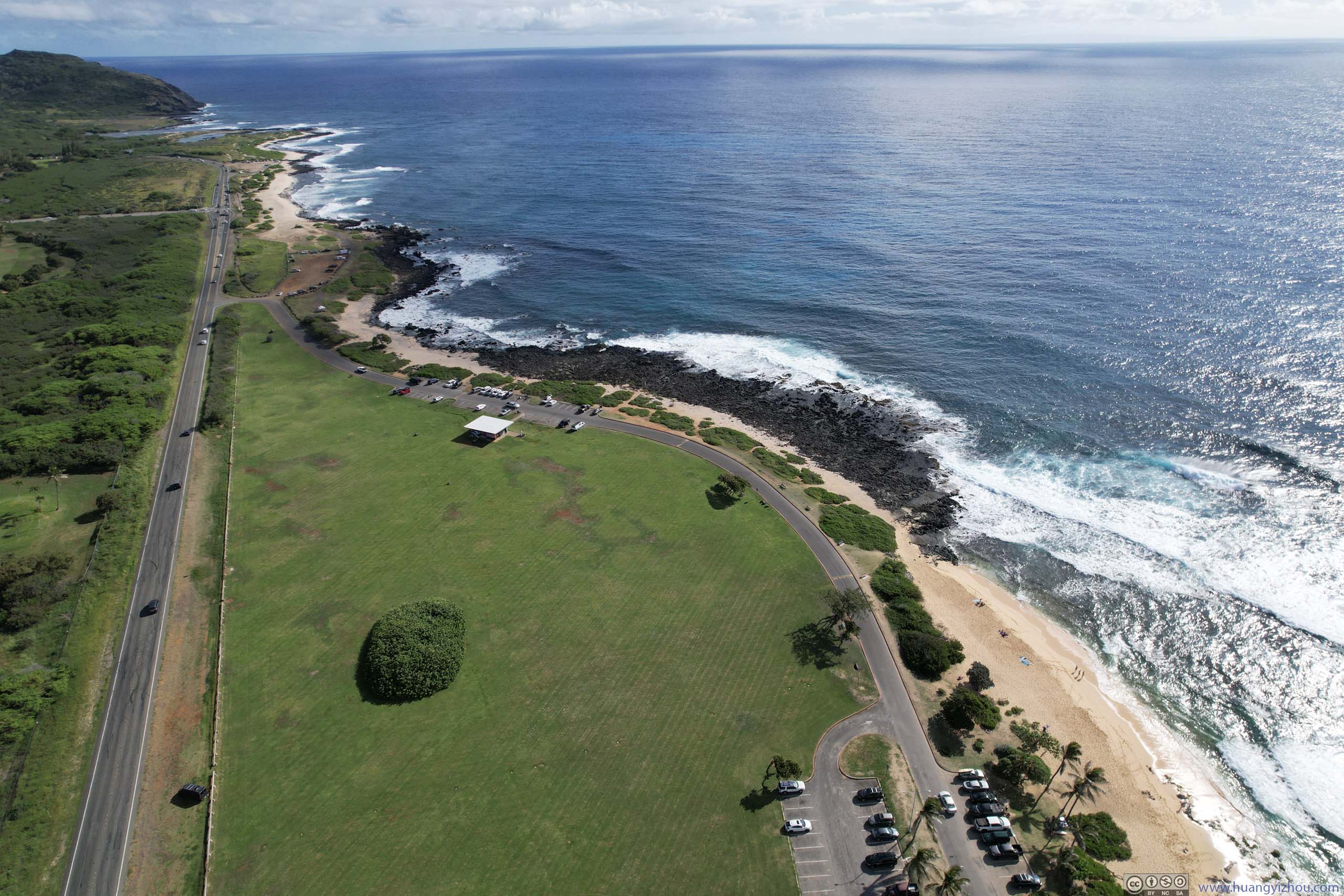
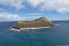
Since the area near Makapu’u Lighthouse wasn’t open to visitors, after leaving Makapu’u Point, I found a turnout along the highway and launched my drone, for an aerial tour of Pukakukui Channel.
 Makapu’u Lighthouse
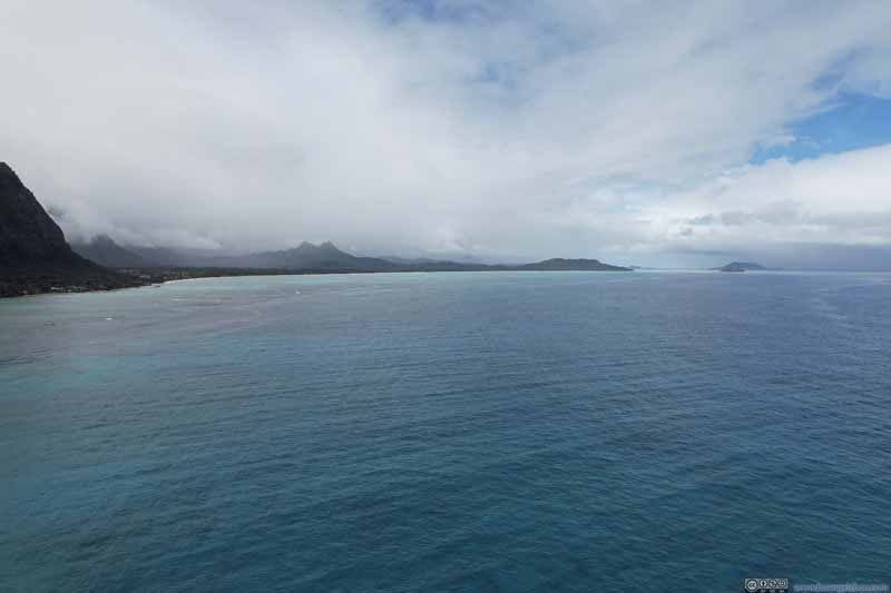 Coastline to the North
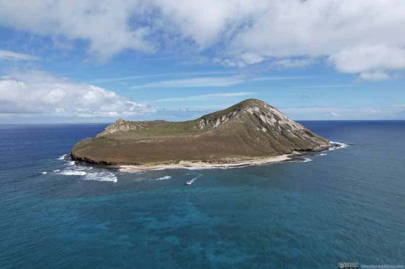 Mānana Island
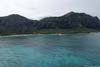
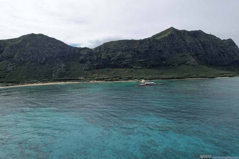 Makai Research PierVivid colors of the ocean.

Click here to display photos of the slideshow
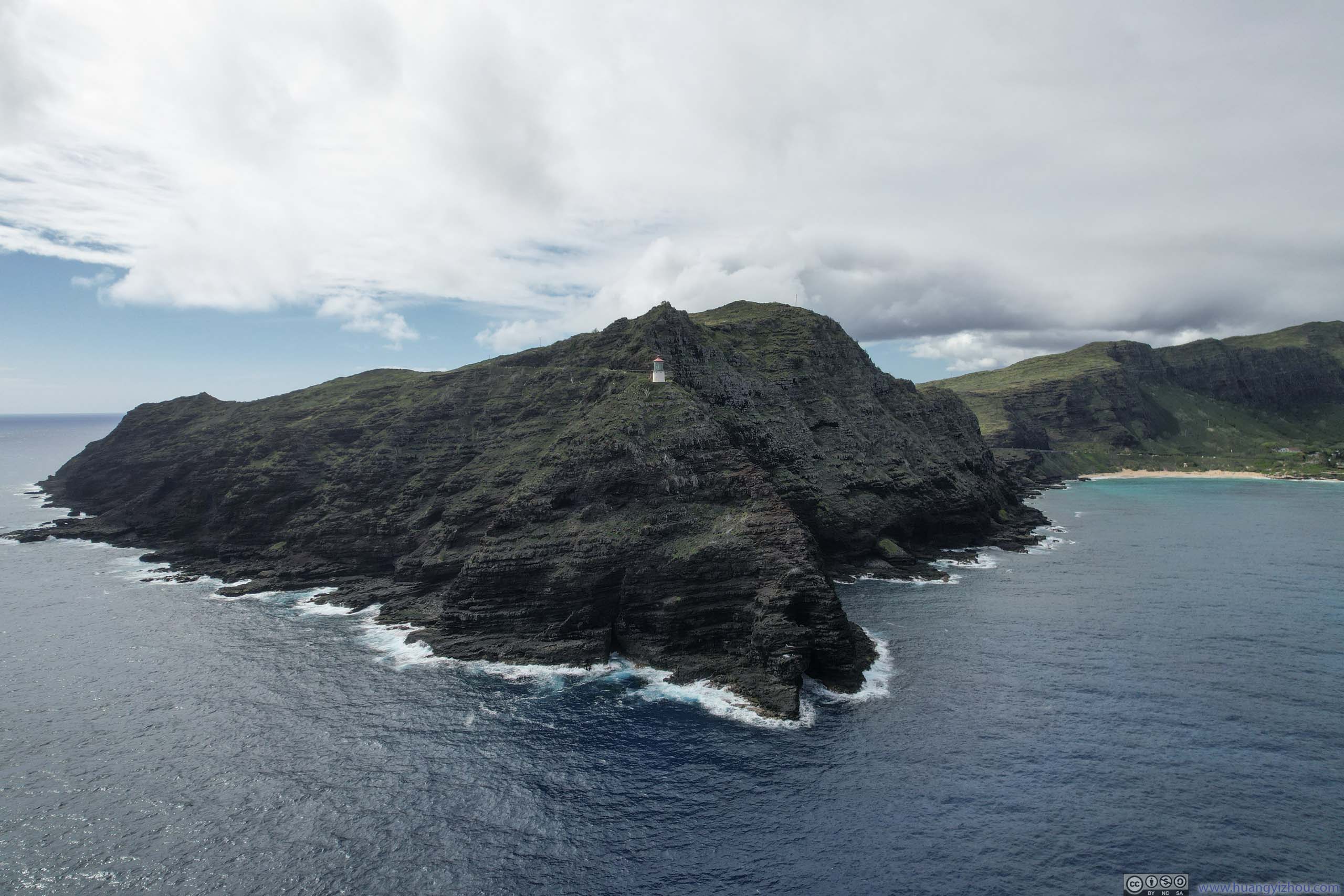
Makapu’u Lighthouse

Coastline to the North
Mānana Island
Makai Research PierVivid colors of the ocean.
Drone Overlooking Pukakukui Channel
Makapu’u Gap from the Sea
And here’s a video:
After that, we headed for the town of Kailua for a quick lunch. It’s also when an on-and-off rain hit the windward side of Oahu.
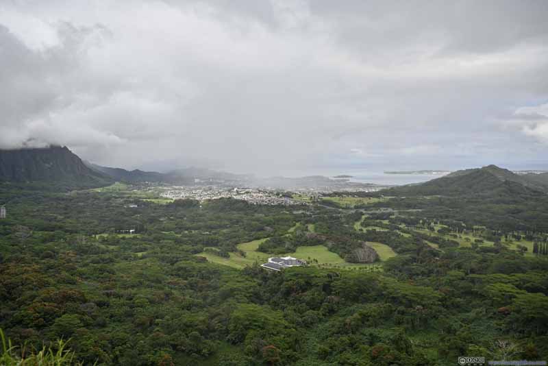
Nu’uanu Pali Lookout
After lunch, our plan was to hit some hiking trails that were more exciting. Of the two candidates, Mt. Olomana and Pali Puka, we decided on the latter, for it’s shorter and thus we could be more flexible when the weather wasn’t cooperative. On the other hand, Mt. Olomana involved walking on a paved road for some distance before the actual hike, so it would be a higher commitment.
The trailhead of Pali Puka was at Nu’uanu Pali Lookout. It’s located on a mountain gap, so the views were stellar. But for something hardly more than a roadside turnout, the 7-dollar parking fee (for non-residents) seemed exorbitant.
By the time we arrived, the rain was “off”, so we first checked out the scenic views. But when the wind (it’s a mountain gap) and rain hit, we retreated back to the car.
 View to the East
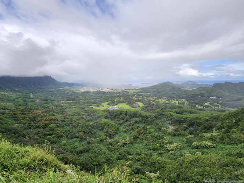 View to the East
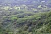
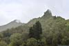
 Mountains in Mist
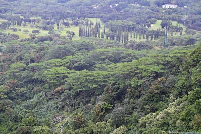 Trees
Trees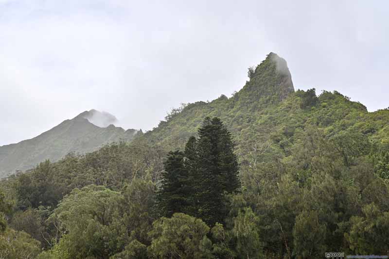 Pali Puka and Mountains Beyond
 Wild ChickenBased on the plastic cable tie on its right leg, maybe it’s not so wild…

Click here to display photos from Nu’uanu Pali Lookout.
View to the East
View to the East
Mountains in Mist
Trees
Pali Puka and Mountains Beyond
Wild ChickenBased on the plastic cable tie on its right leg, maybe it’s not so wild…
View from Nu’uanu Pali Lookout
After the rain passed a few minutes later, we decided to nonetheless check out Pali Puka Trail. Online comments mentioned it’s a steep trail with significant exposure, which could be dangerous when wet. After feeling how slippery the rocks were just a few steps in, we bailed out.
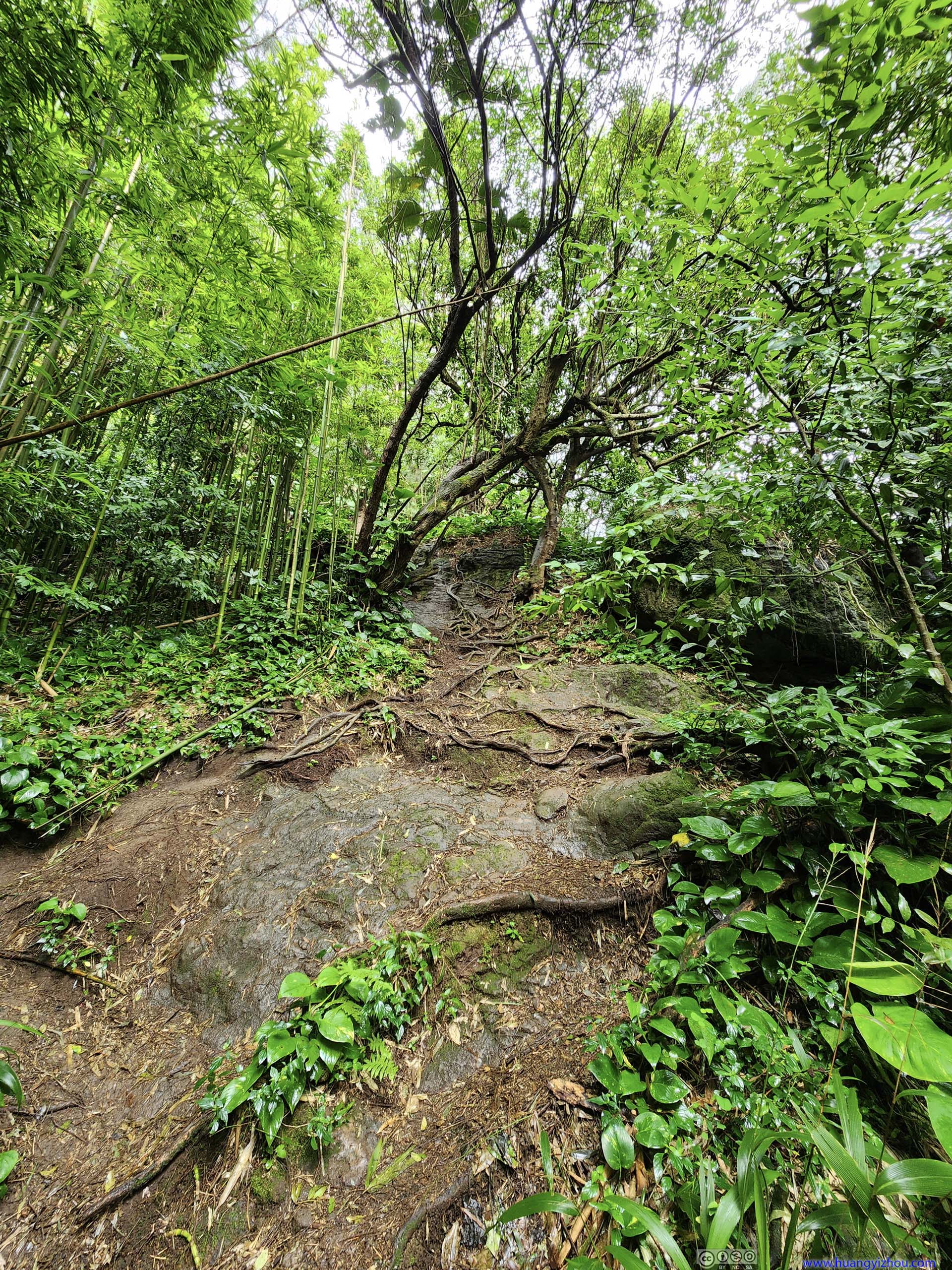
Initial Part of Pali Puka Trail
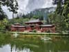
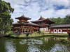
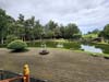
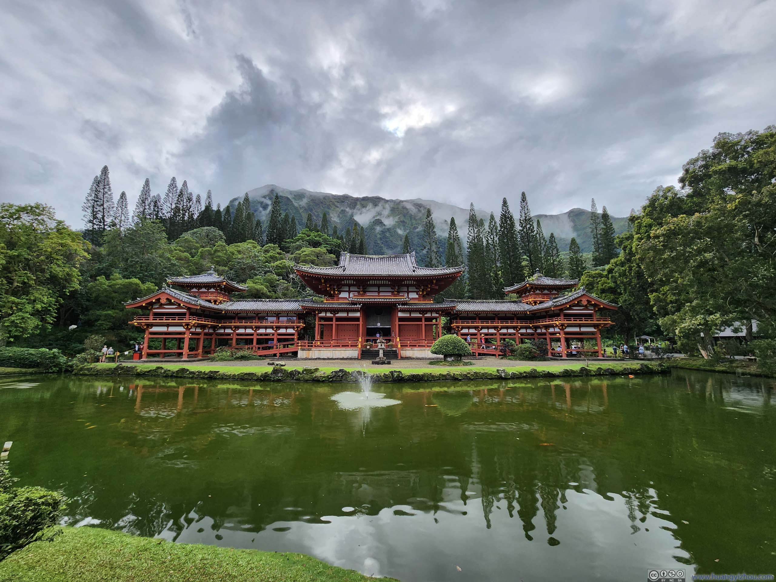
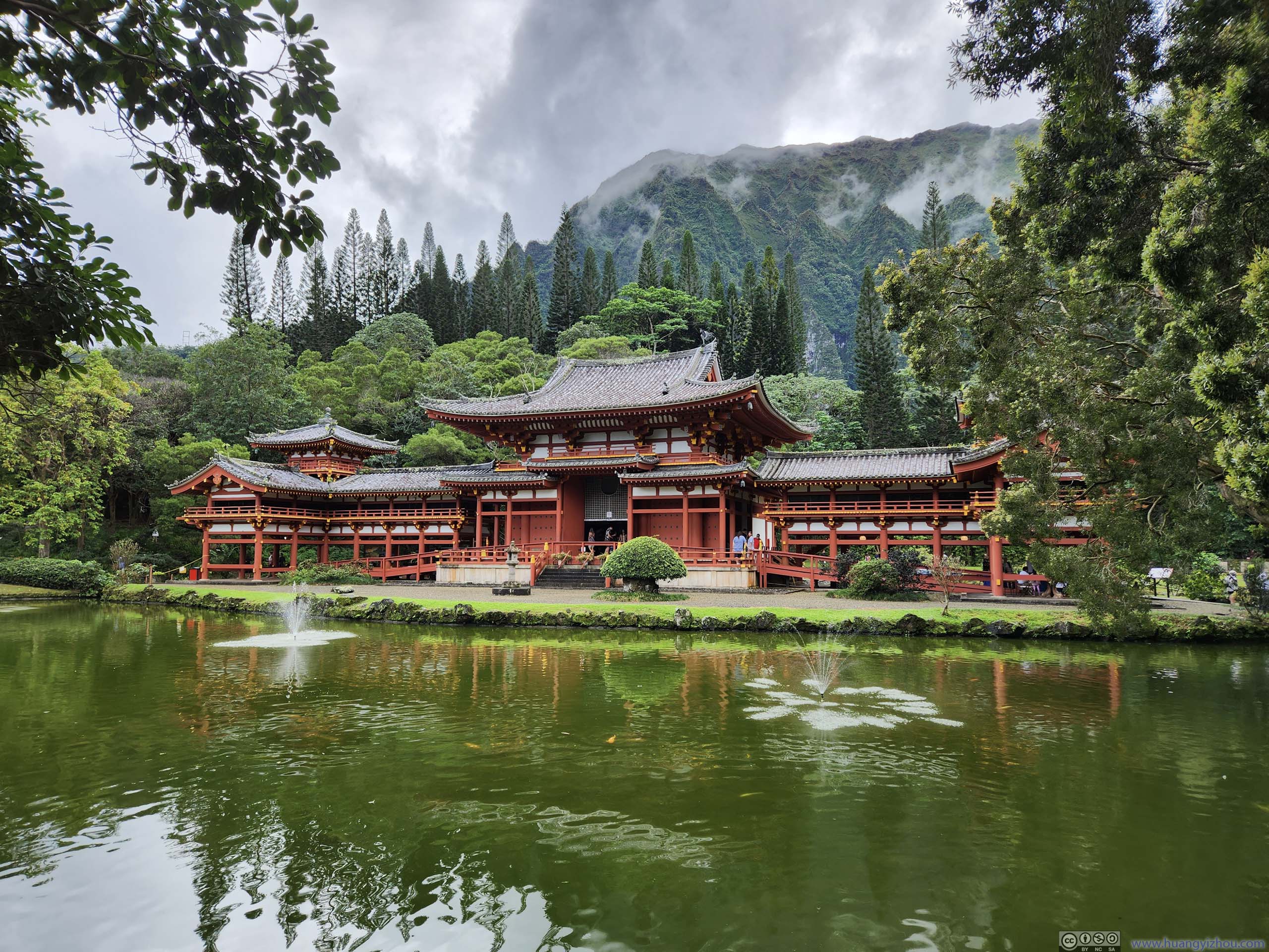
Byodo-In Temple
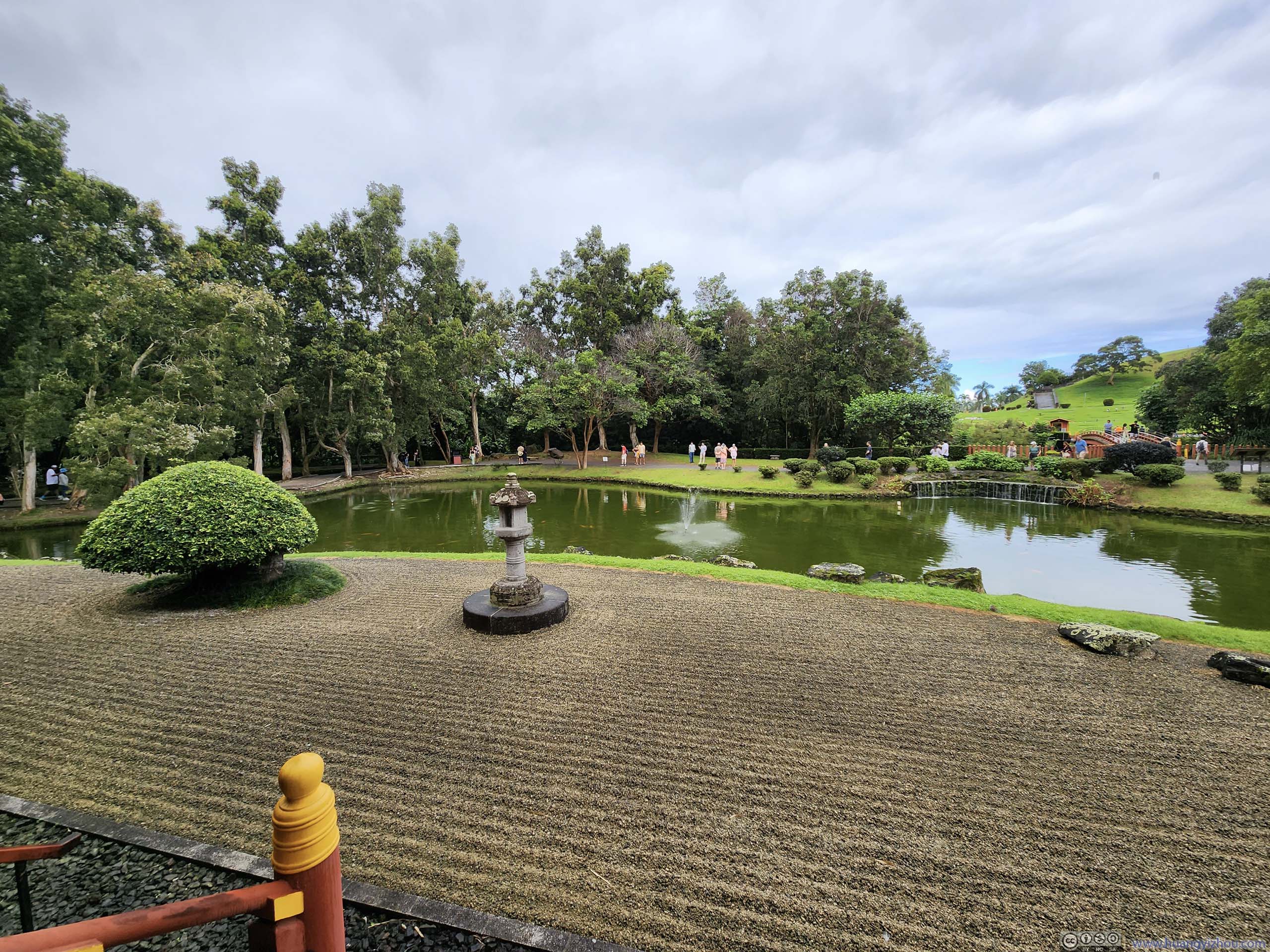
It’s only 2:20pm by the time we left Nu’uanu Pali Lookout, a bit early for us to head back to the hotel, so we decided to check out Byodo-In Temple not far away.
The Byodo-In Temple (平等院テンプル) was dedicated in August 1968 to commemorate the 100th anniversary of the first Japanese immigrants to Hawaii. It’s not a functional temple as it doesn’t have a resident monastic community, rather a cash cow for the nearby cemetery. Nonetheless, it’s a place where one can experience some ancient Japanese architecture in Hawaii (which feels very touristy).
Anyway, since it actually covered considerable land and sure had some exotic feeling, its 5-dollar (per person) admission felt less a robbery than the 7-dollar parking at Nu’uanu Pali Lookout, which most people stayed for less than 10 minutes.
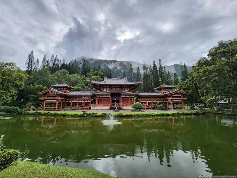 Byodo-In Temple
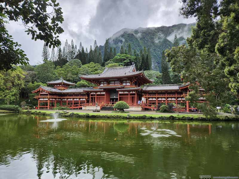 Byodo-In Temple
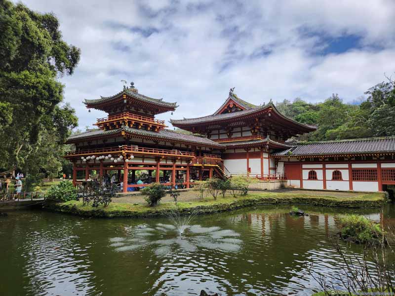 Side of Byodo-In Temple
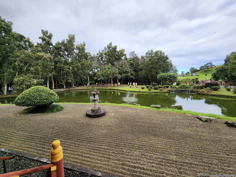 Front Yard of Temple
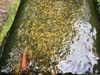
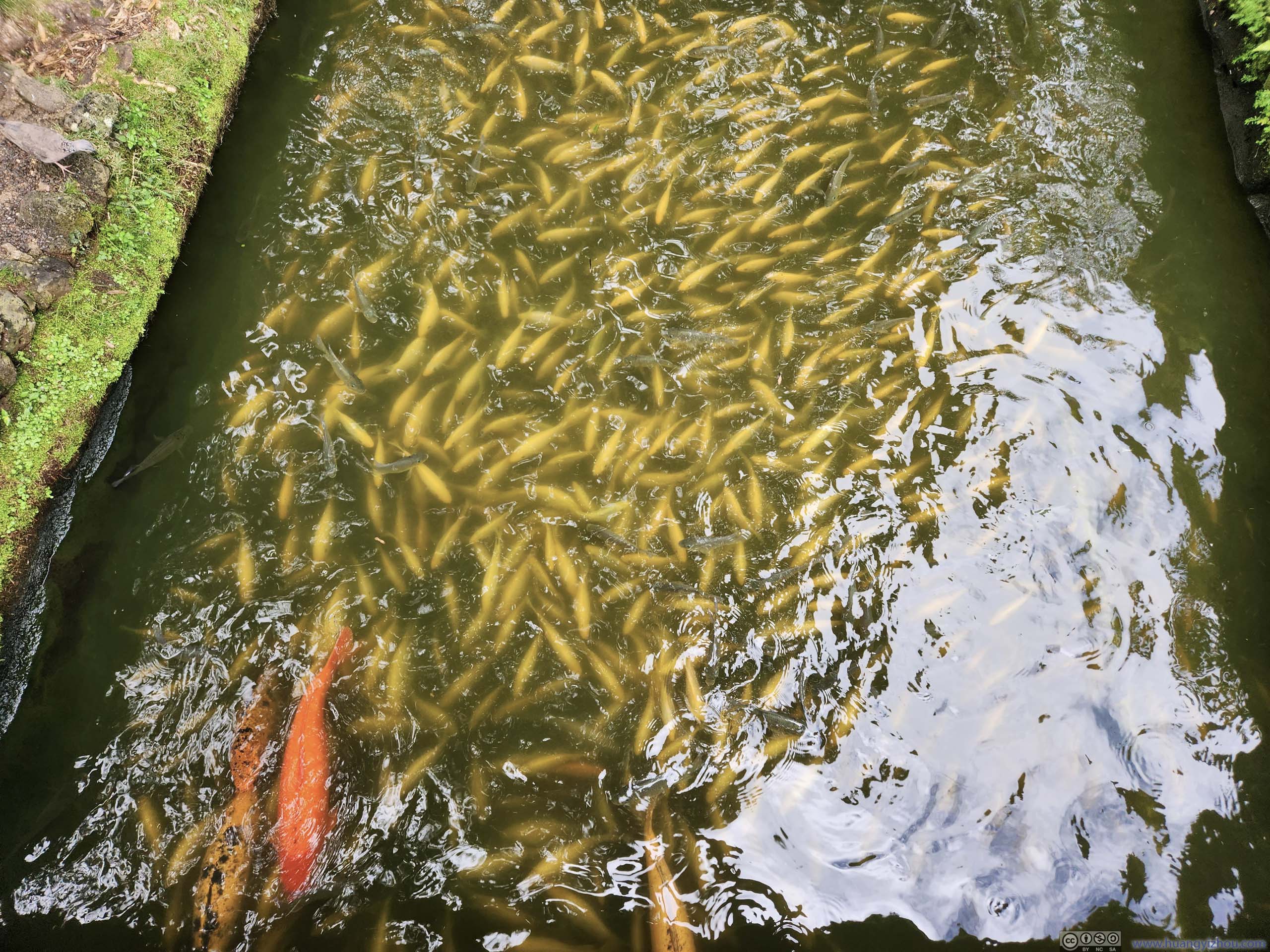
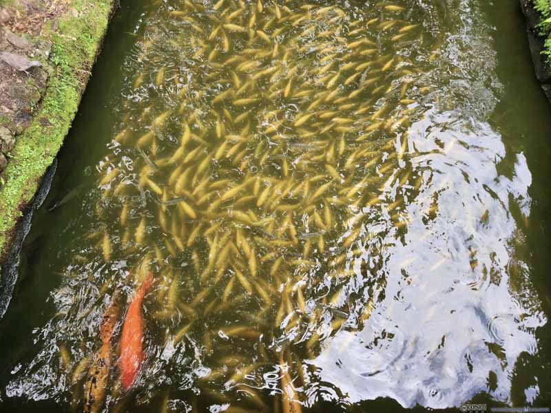 Fish in Byodo-In Temple
Usually koi fish in Asian temples were attracted to visitors as that’s how they were fed. Not these fish as they seemed scared away from me.
Fish in Byodo-In Temple
Usually koi fish in Asian temples were attracted to visitors as that’s how they were fed. Not these fish as they seemed scared away from me.

Click here to display photos from Byodo-In Temple.
Byodo-In Temple
Byodo-In Temple

Side of Byodo-In Temple
Front Yard of Temple
Fish in Byodo-In Temple
A side story, near the entrance of Byodo-In Temple was a giant bell, which visitors were “encouraged to ring” before their visit as “this brought good luck”. Unfortunately when we first entered the temple there’s a line of people ringing the bells, so we figured we would leave it until the end of our visit. Since we reversed the sequence, maybe that meant bad luck?
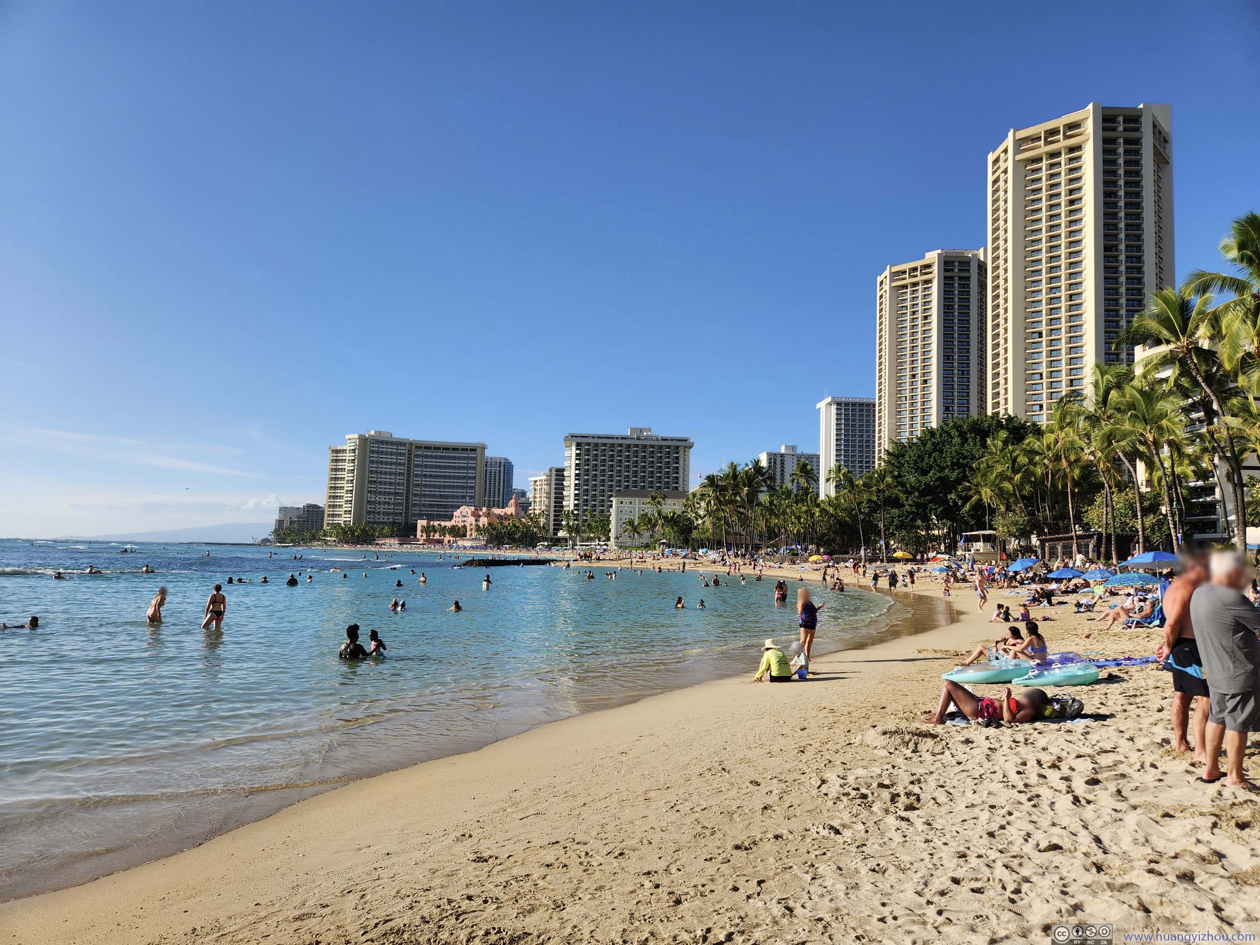
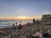
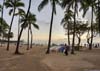
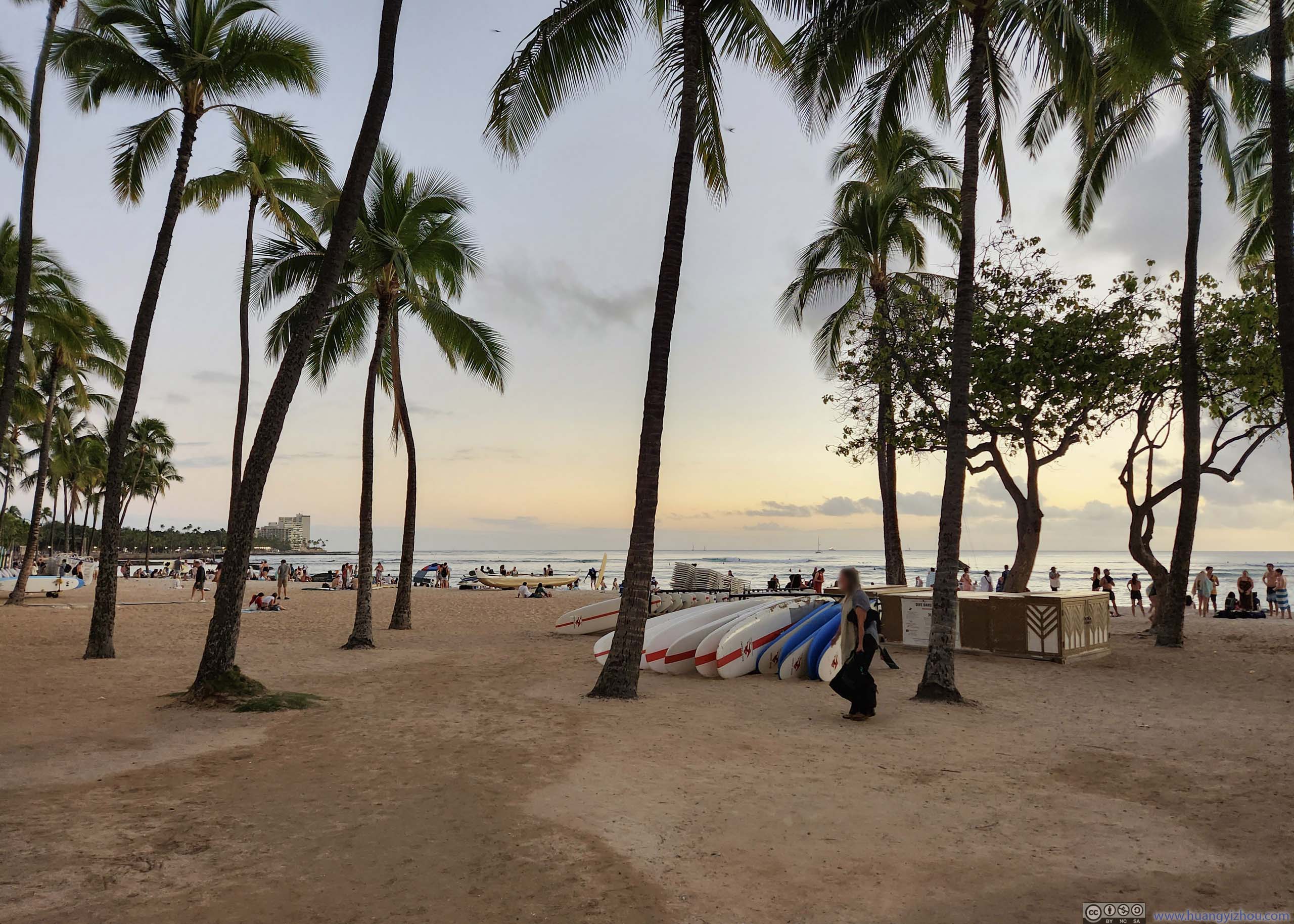
After that, we headed back to the hotel, which we reached just before 4pm. For the remaining 2 hours of daylight, we decided to relax at the nearby Waikīkī Beach.
A portion of the water of Waikīkī Beach was within a harbor and very shallow, which was great for wading or giving my friend a crash course on swimming. But its shallowness also meant it’s sort of hard to actually “swim”. Instead, lying on the sand was a more relaxing way to kill time.
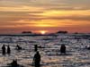
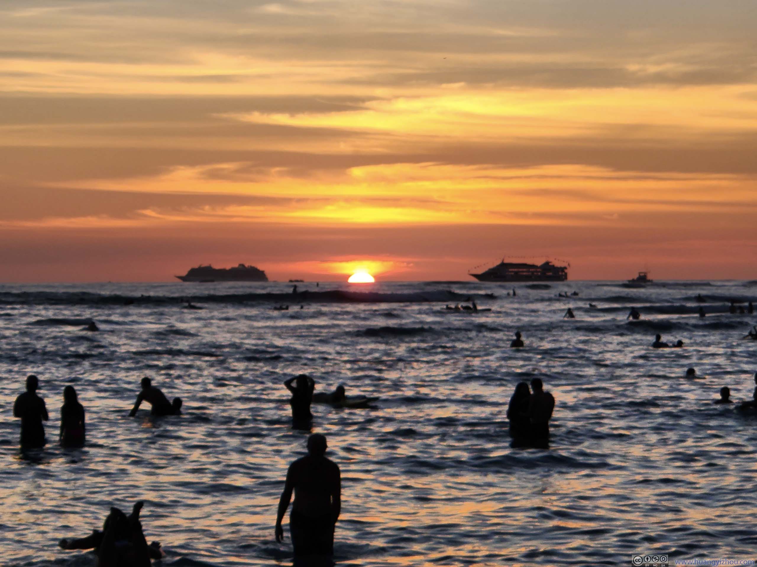
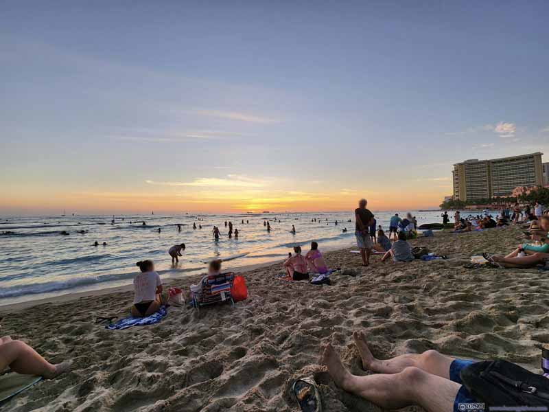 Sunset at Waikīkī Beach
 Sunset
 Waikīkī BeachIts most popular time of the day, at dusk. Taken the previous night after sunset.
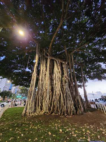
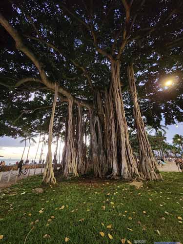 Banyan of Waikiki

Click here to display photos of the slideshow

Sunset at Waikīkī Beach
Sunset
Waikīkī BeachIts most popular time of the day, at dusk. Taken the previous night after sunset.
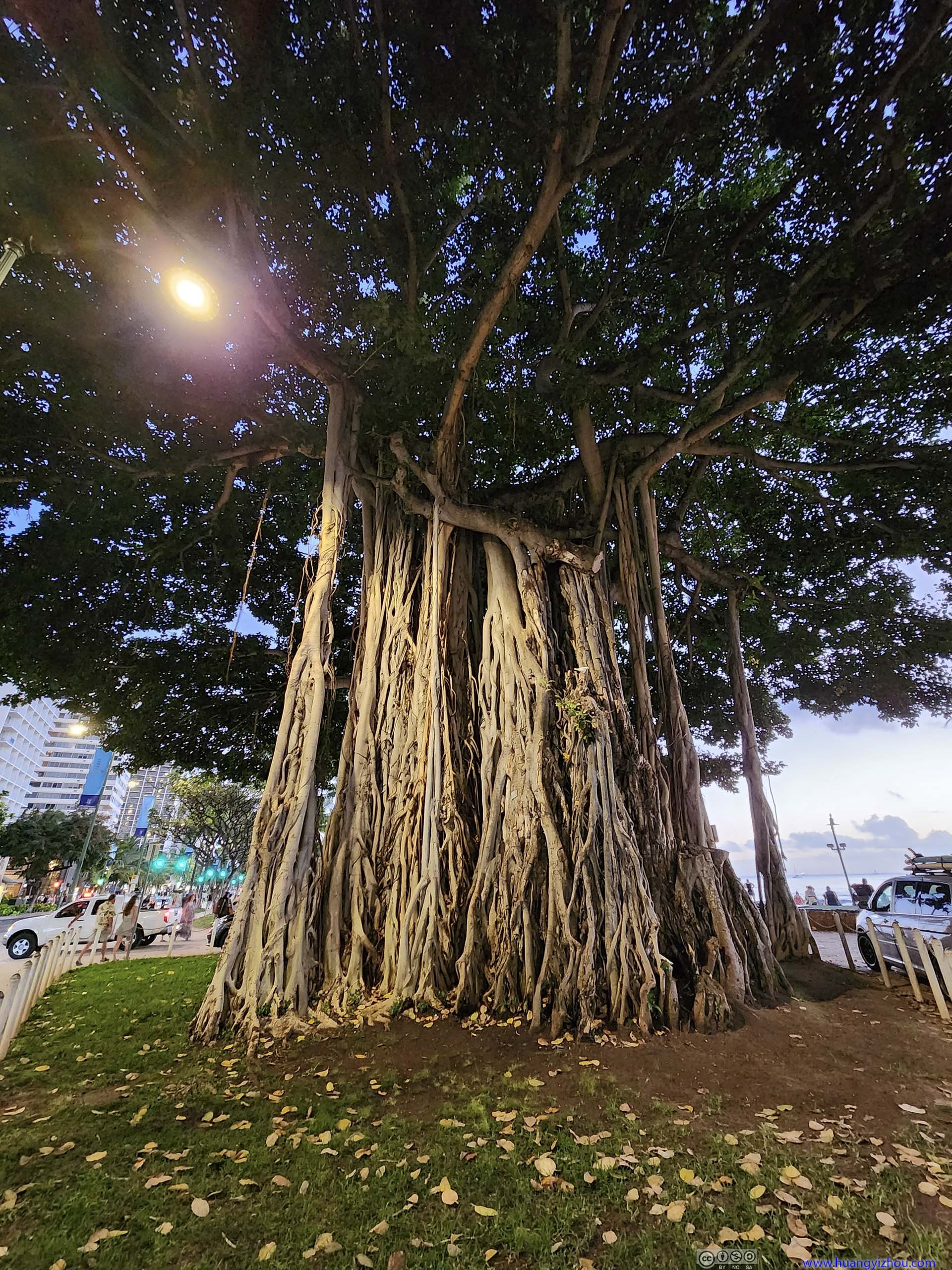
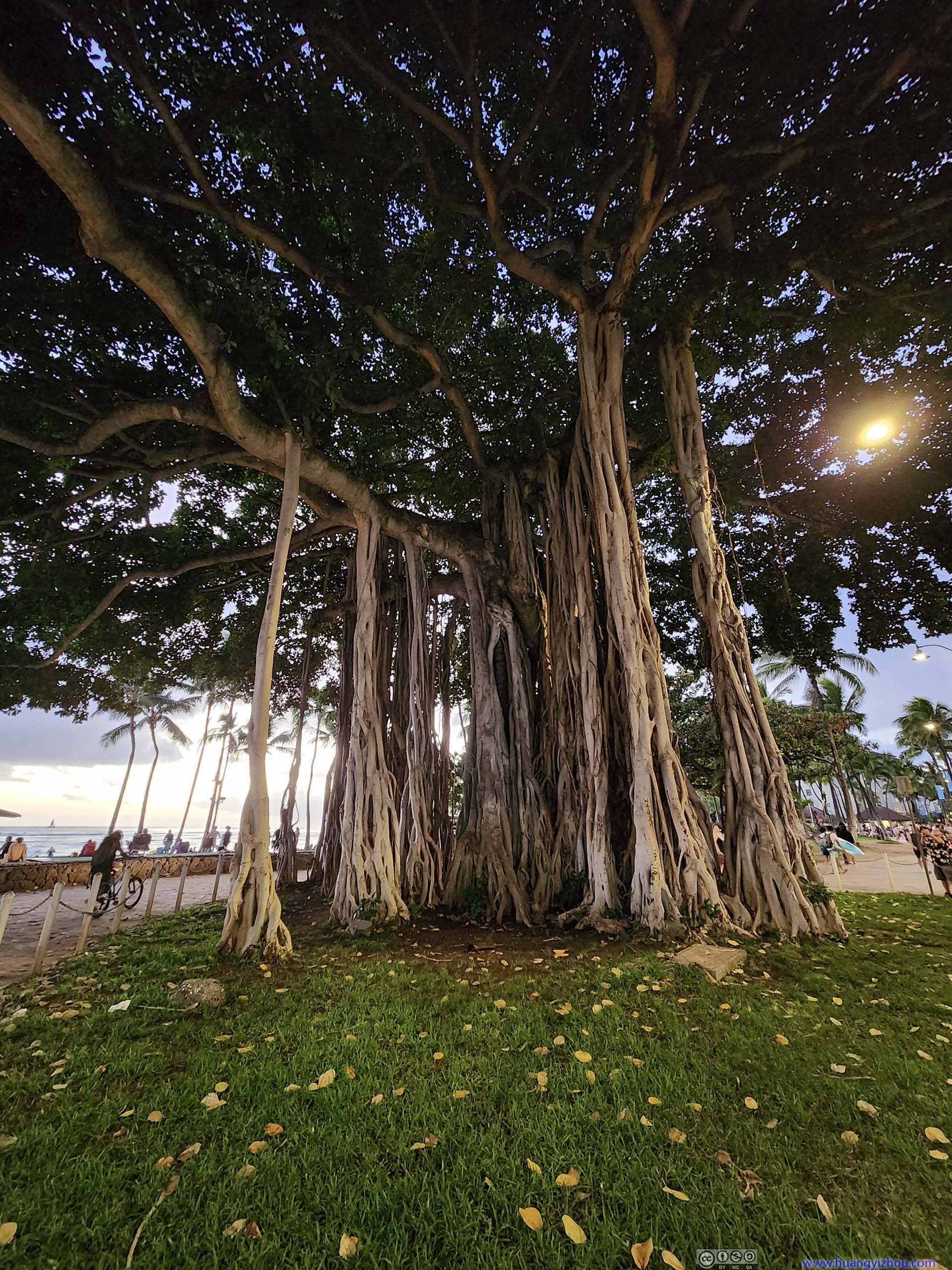 Banyan of Waikiki
We stayed at the beach until sunset, after which we returned to the hotel, got a decent shower, and was out for dinner.
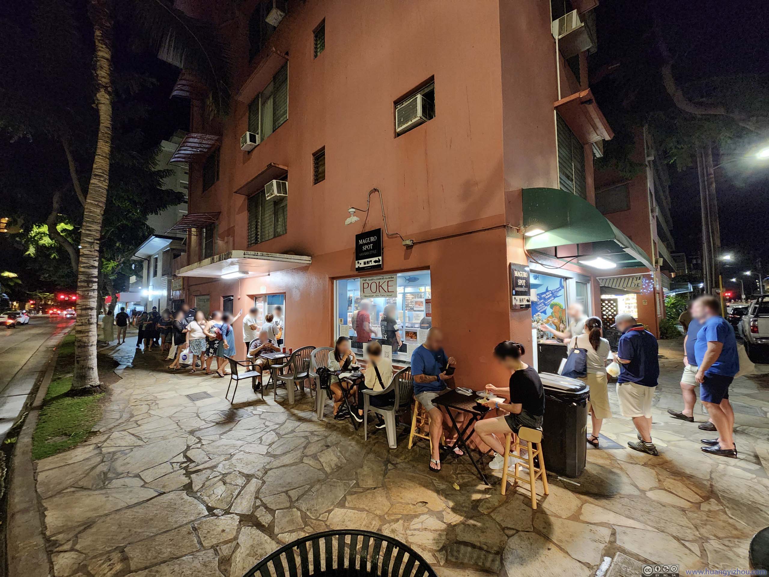
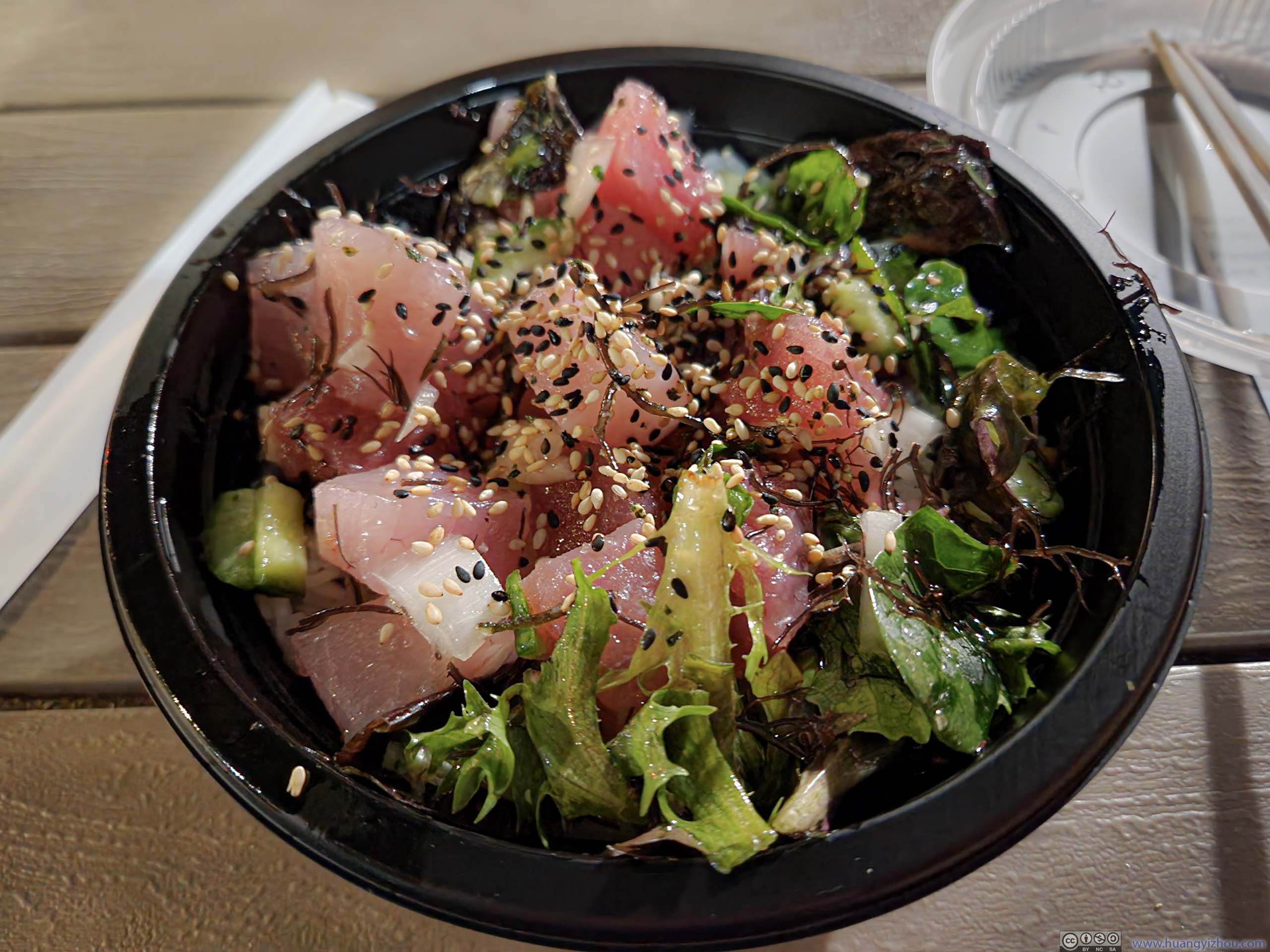 Dinner
END
![]() Day 1 of 2023 Trip to Hawaii, Honolulu by Huang's Site is licensed under a Creative Commons Attribution-NonCommercial-ShareAlike 4.0 International License.
Day 1 of 2023 Trip to Hawaii, Honolulu by Huang's Site is licensed under a Creative Commons Attribution-NonCommercial-ShareAlike 4.0 International License.