
Updated on April 26, 2024
Day 10 of Autumn 2023 Trip to Mountain States, Gunnison Route and Million Dollar Highway to Silverton
The tenth day of my autumn 2023 trip to the mountain states. I checked out Gunnison Route in the morning, a steep trail that descended down Gunnison Canyon. In the afternoon, I drove along Million Dollar Highway to Silverton.
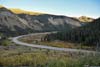
Red Mountains from Crystal Lake
Black Canyon of Gunnison
Gunnison Route
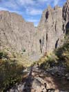
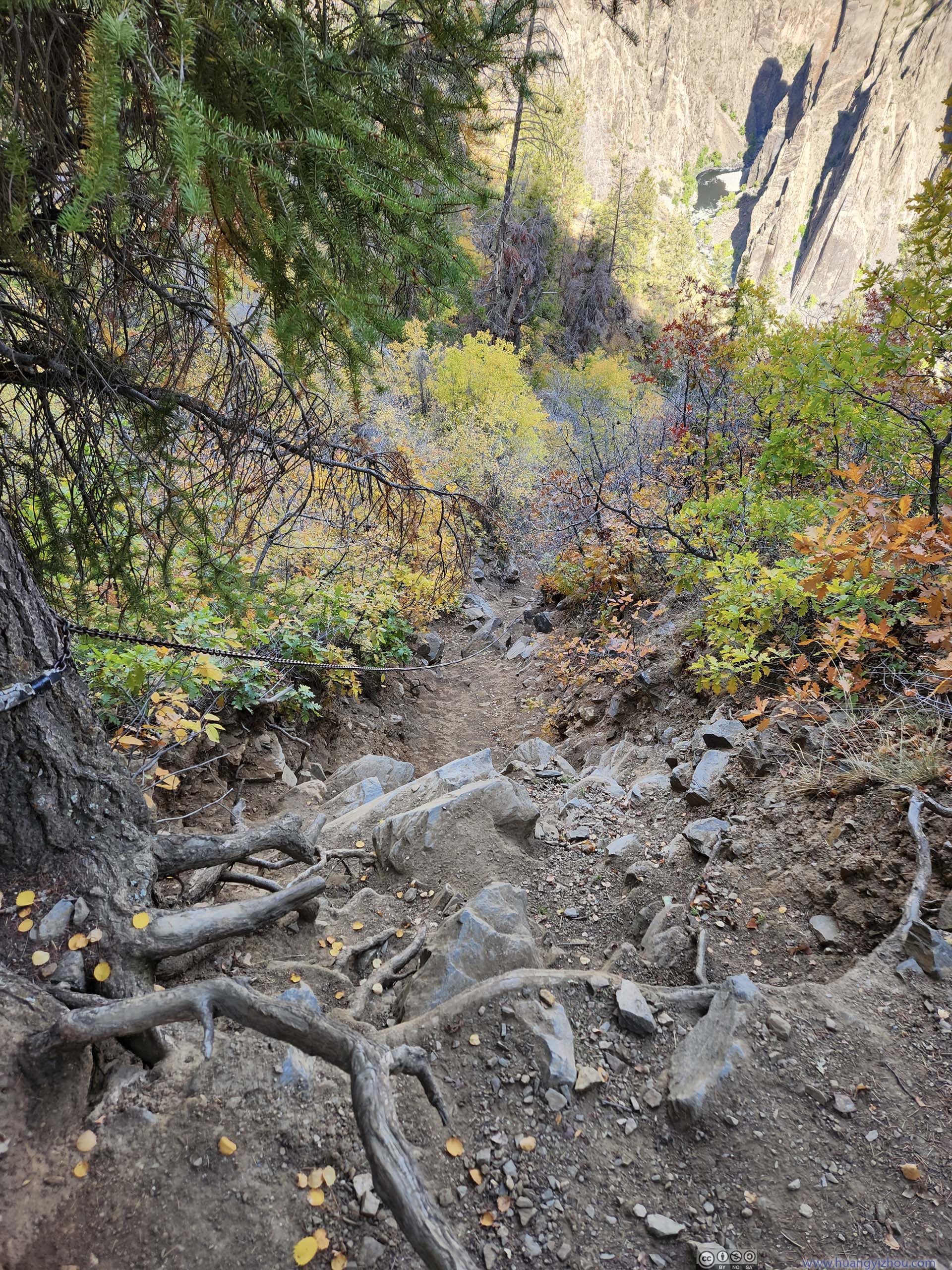
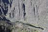
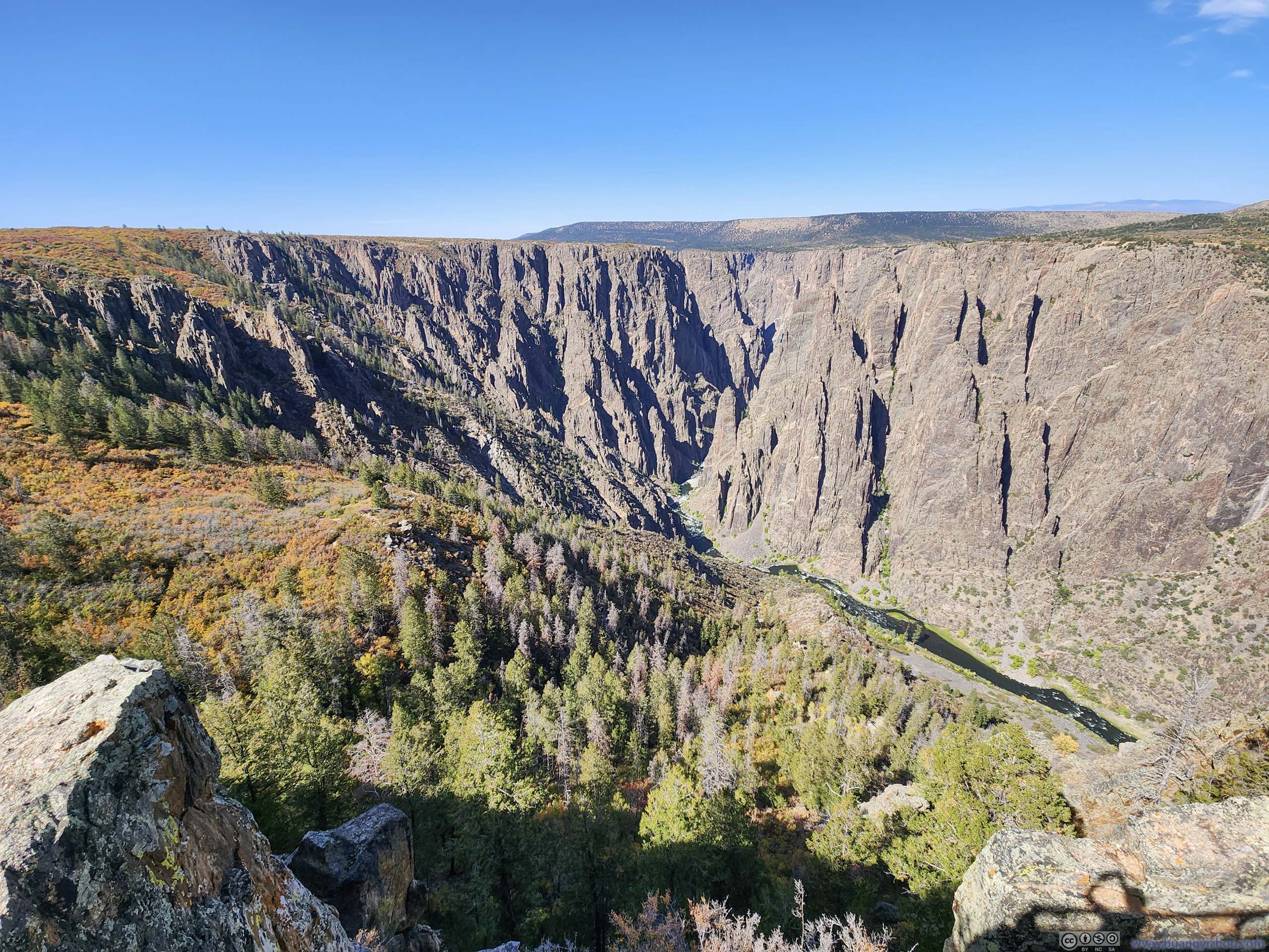
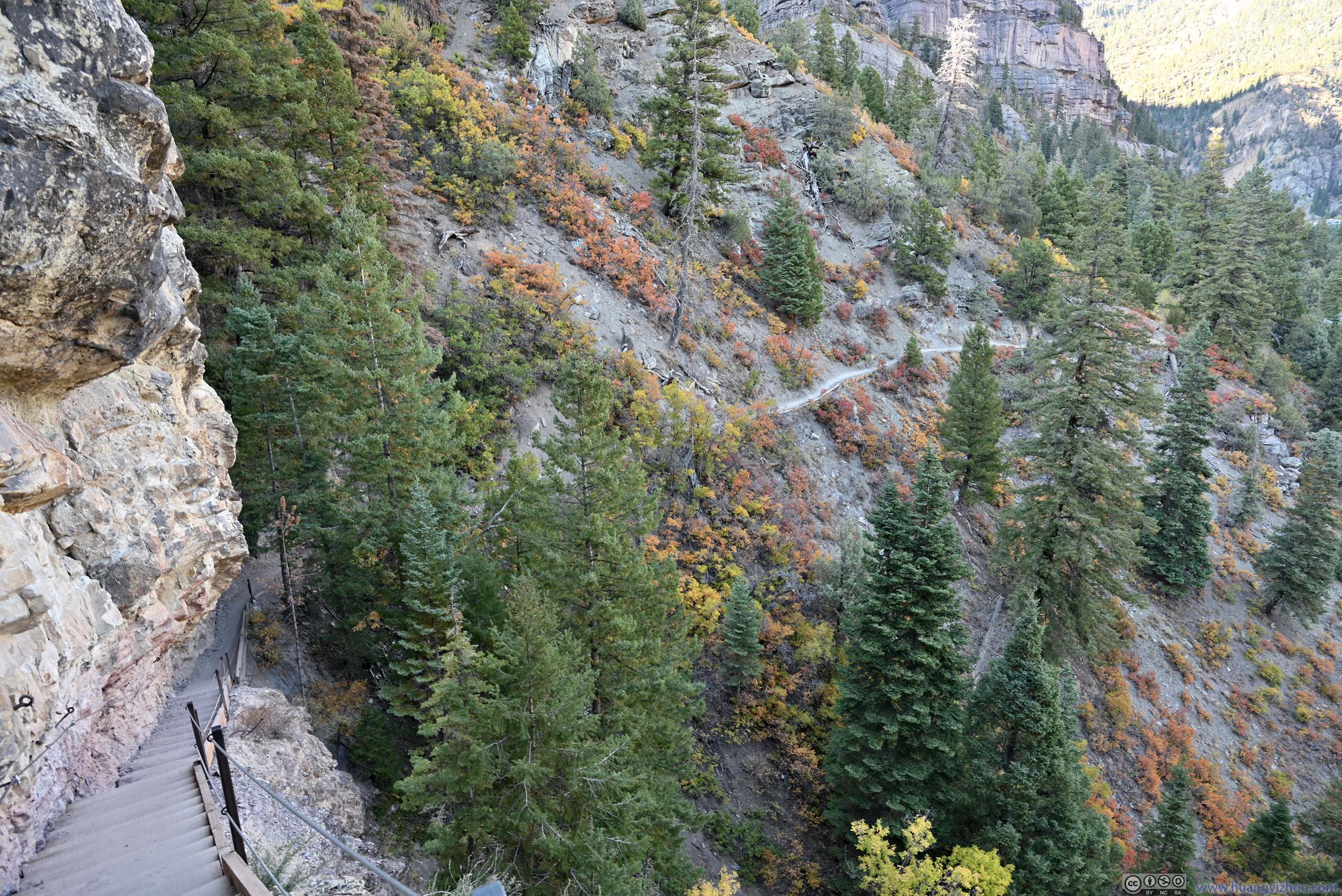
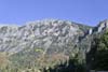
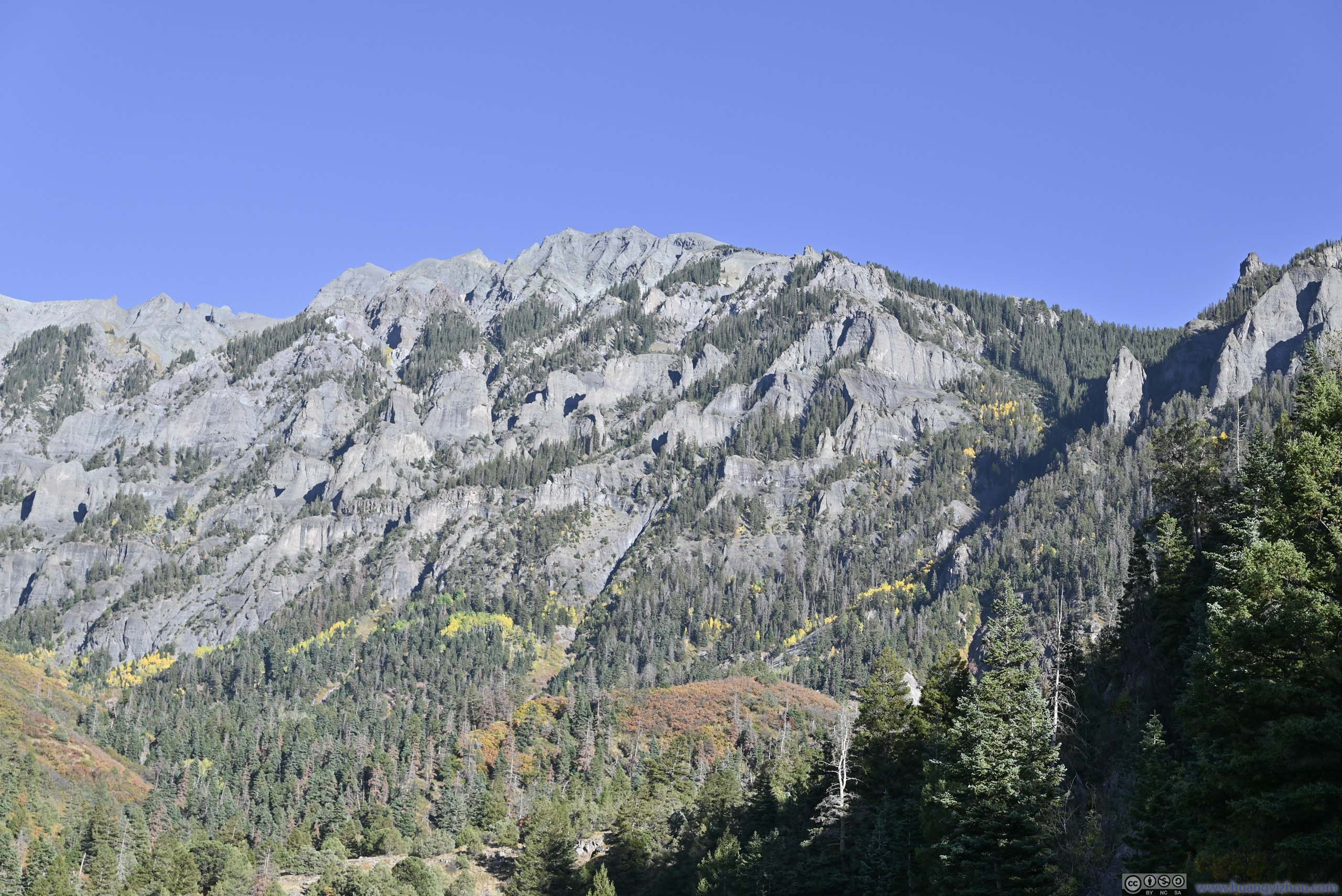
It’s hard not to admire the magnificent steepness of Gunnison Canyon, after I checked out most of the overlooks along its south rim the previous day. It’s even more astonishing that a few “routes” found their way to the river from both canyon rims. Among those, “Gunnison Route” was the most popular. It started out from the visitor center, shared its initial part with “Oak Flat Loop Trail”, before making a steep descent into the canyon. By Google Earth, the descent measured 750m in horizontal length, and 475m in vertical height, giving it an average gradient of 32 degrees.
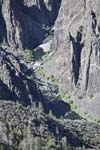
Here’s GPS tracking:
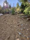
In my opinion, the average gradient of 32 degrees is not that bad, but I didn’t like the fact that a significant portion of the path was covered in dirt, that provided little traction (especially when going downhill). On this aspect I was more of a rock person, I would have a much better time should the path be made of solid rock.
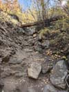
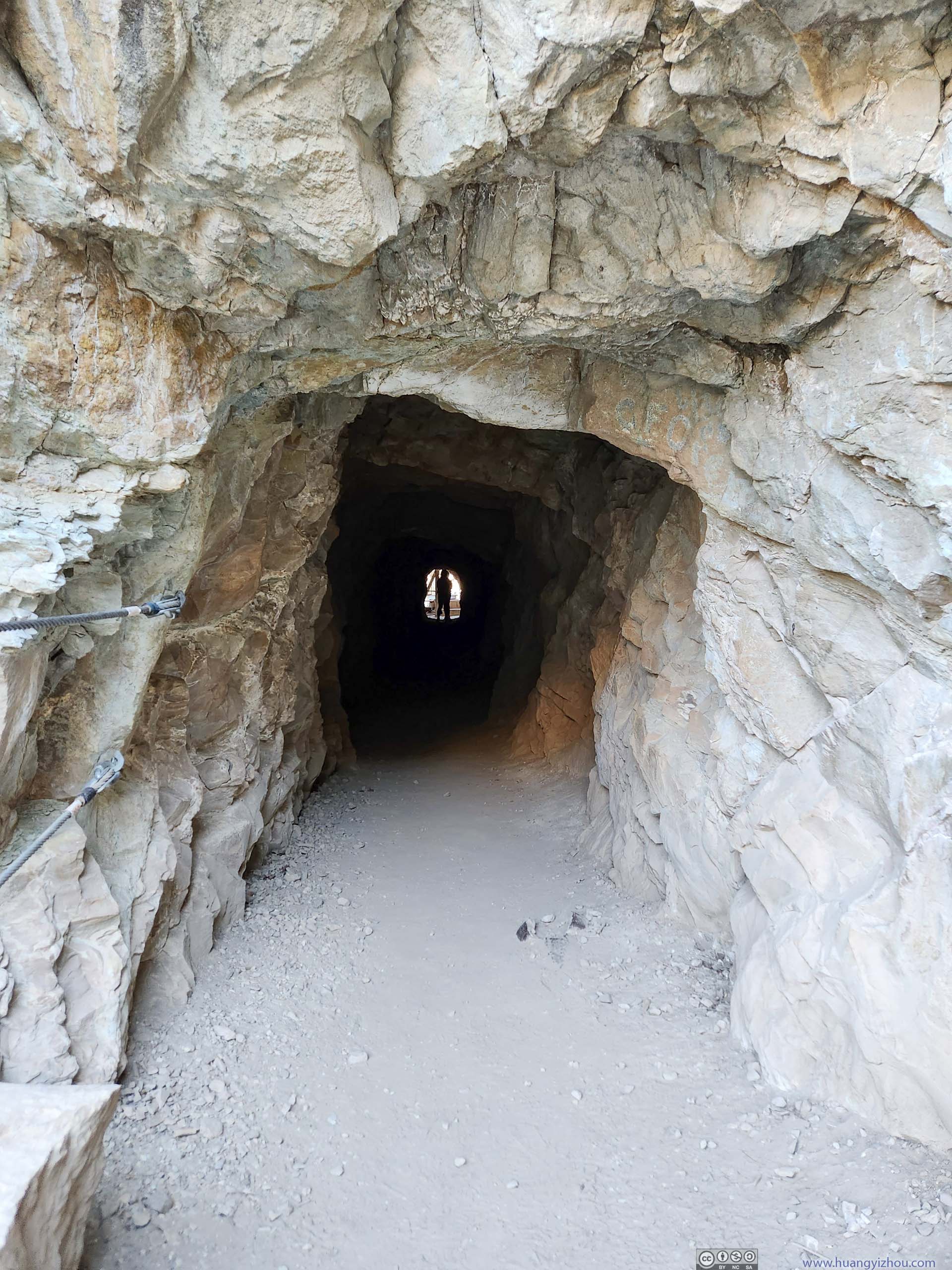
About one-third into the descent, there was a steep section with a chain installed (p4-6 below). In my opinion, I didn’t think the chain should be there. I managed the section without touching the chain, and I believe anyone that could make it to the river could do so without the chains. Sure it helped but in my opinion, the worst part of the trip was around two-thirds into the descent, where the route was made completely of dirt with minimal traction, and there were no plants around to provide additional handholds. I didn’t feel like aids should be placed before the crux of a route.
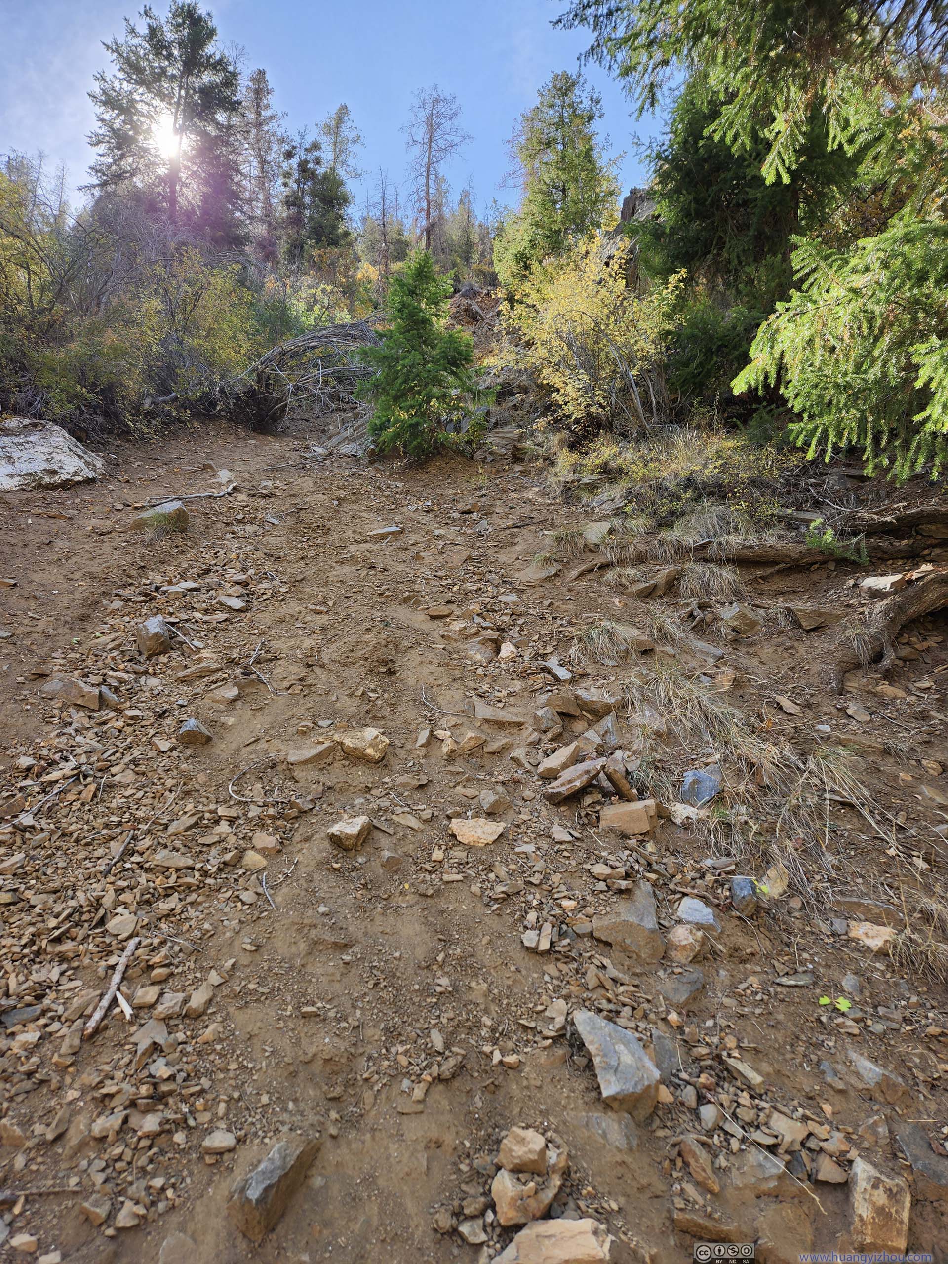
For reference, between “Oak Flat Loop Trail” and Gunnison River, the descent took me 90 minutes, and the ascent took me 72 minutes. I found that gloves were helpful (I bought them in Grand Junction more for tomorrow’s trip to Snowdon Peak but they came in handy today). During ascent, I encountered a few (very minor) route finding struggles and a few difficult moves that had me briefly stuck. But I would say the ascent was very enjoyable (unfortunately, the descent not so much). Another downside was that I ran into more spider nets along the trail than I liked.
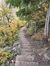
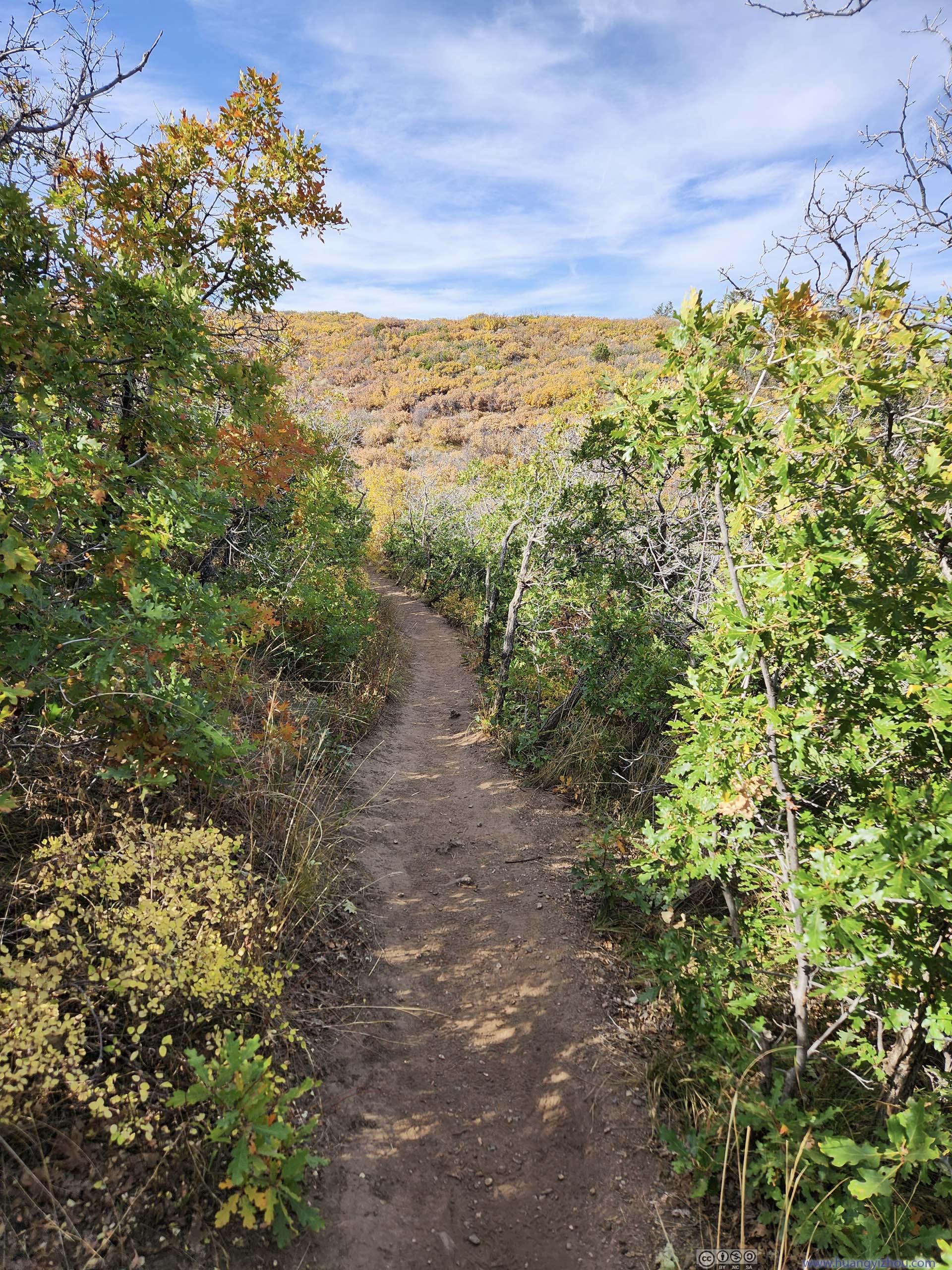
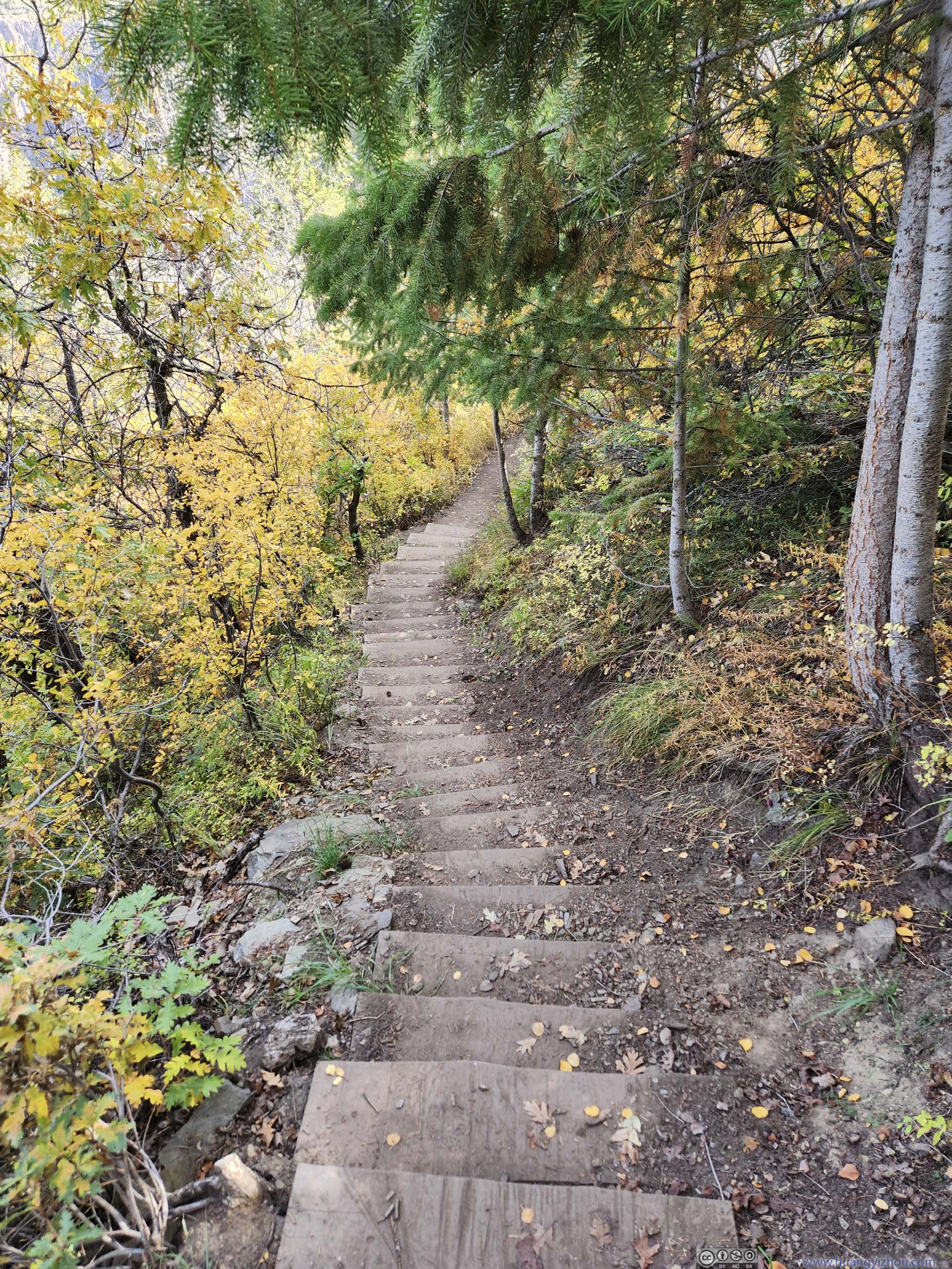
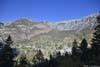
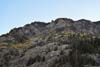
 Oak Flat Trail
 Oak Flat Trail
 Trail
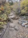
Trail Chain Section along Gunnison Route
 Chain Section along Gunnison Route
 Chain Section along Gunnison Route
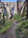
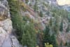
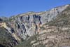
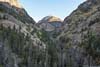
 Gunnison CanyonThe steep Gunnison Route in the lower part.
 Gunnison RouteTypical condition in the lower part, not unacceptably steep but very slippery.


Click here to display photos along Gunnison Route.
Oak Flat Trail
Oak Flat Trail

Trail
Chain Section along Gunnison Route

Chain Section along Gunnison Route

Chain Section along Gunnison Route
Gunnison CanyonThe steep Gunnison Route in the lower part.
Gunnison RouteTypical condition in the lower part, not unacceptably steep but very slippery.
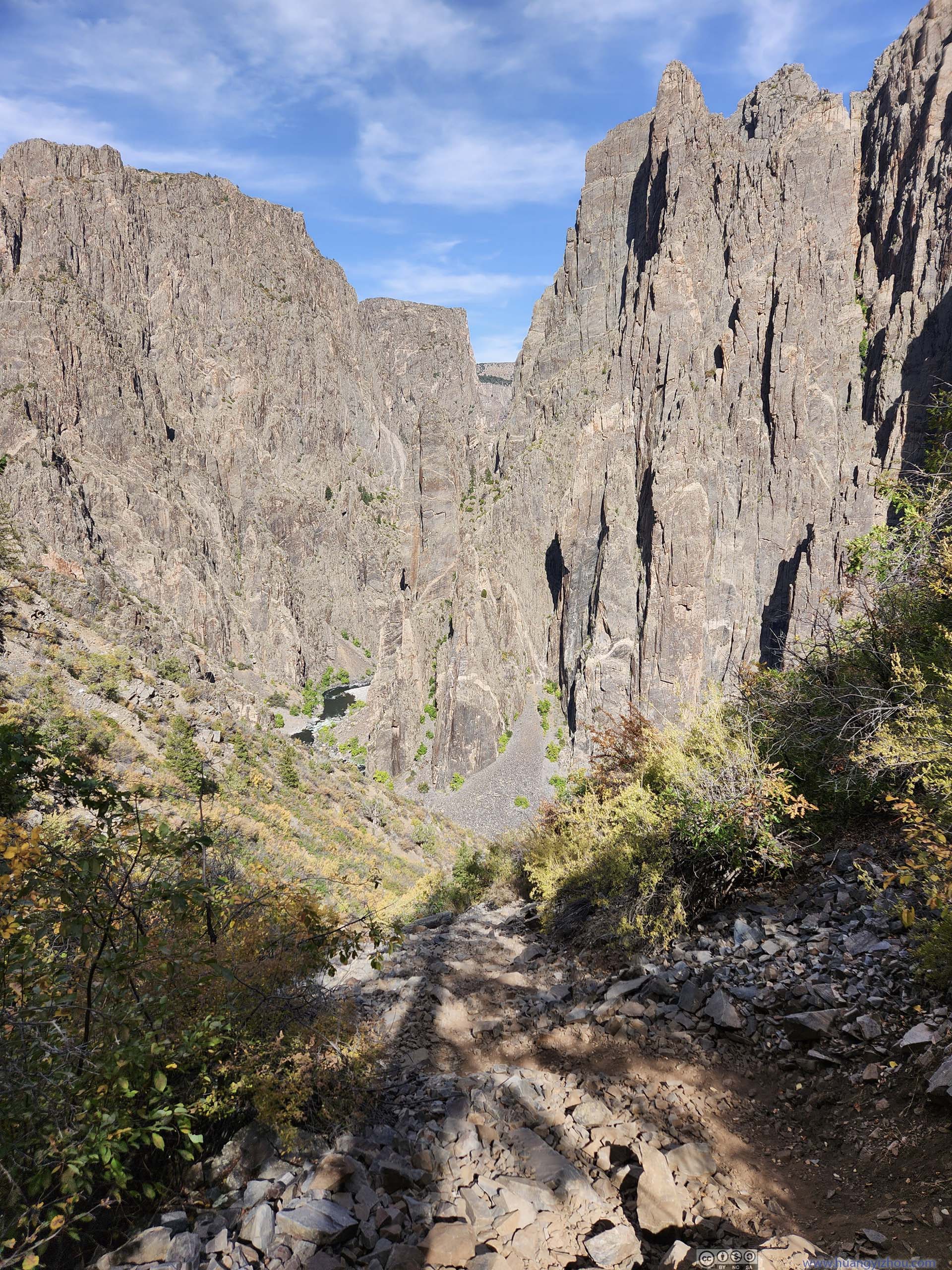
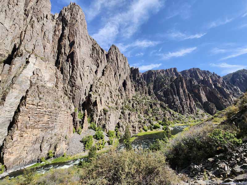
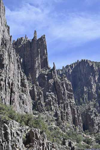
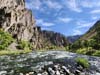
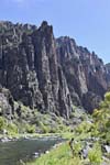
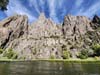
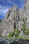
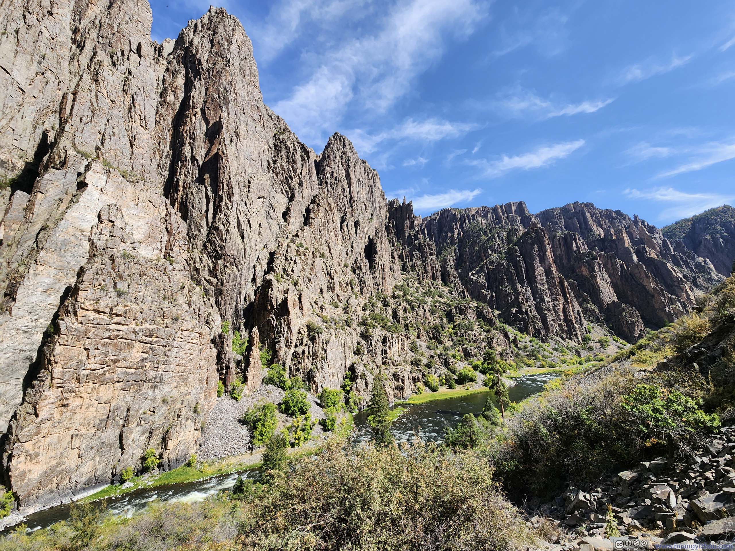
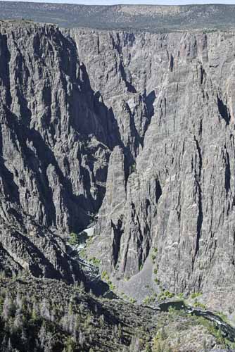
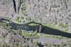
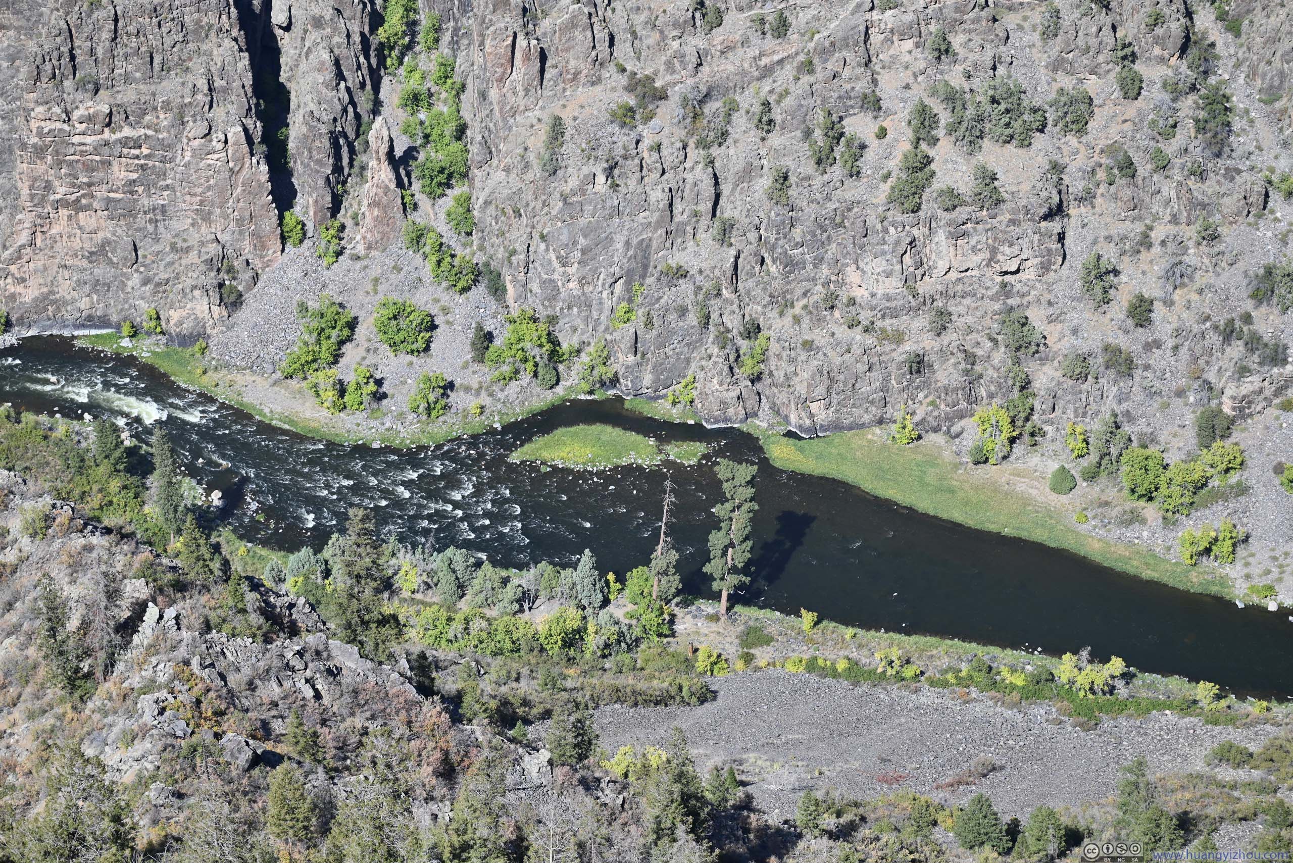
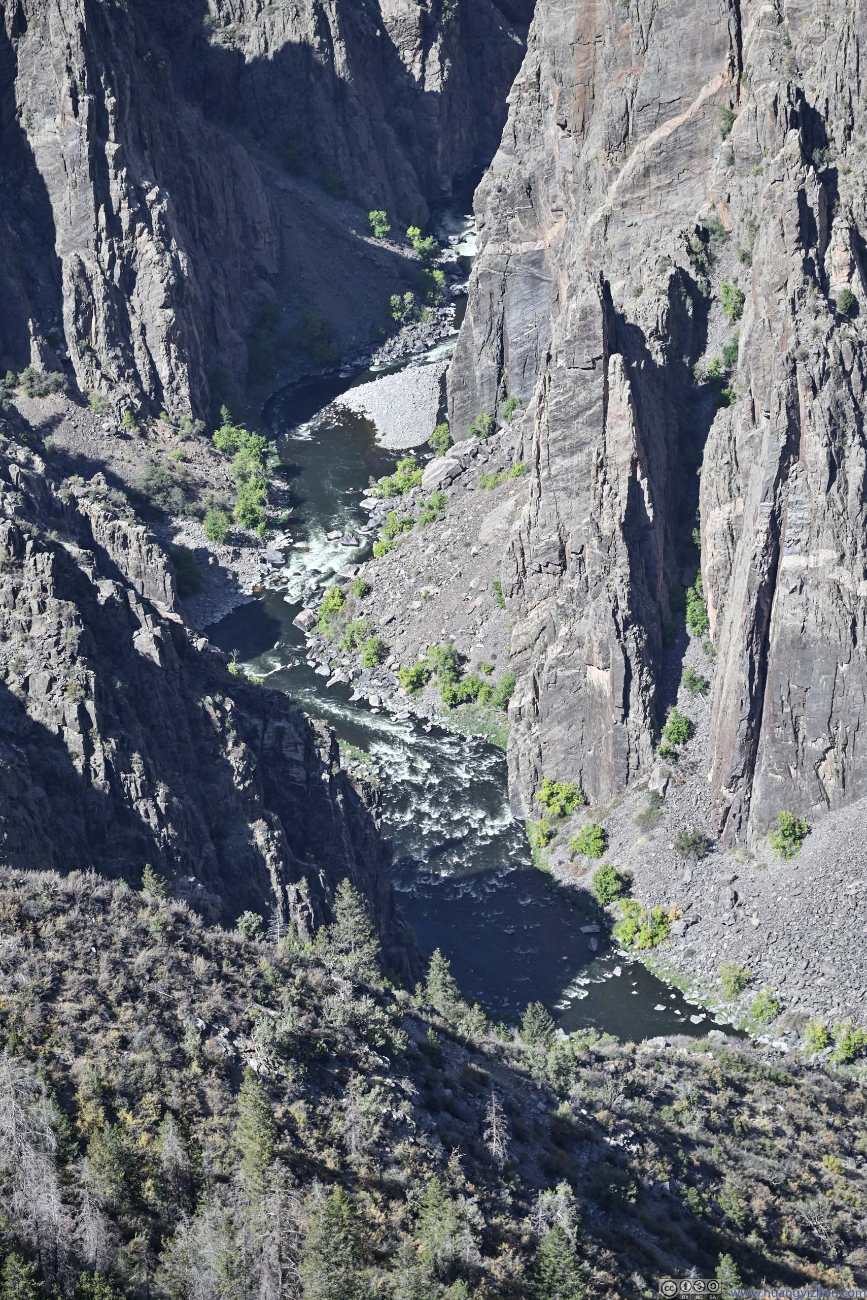
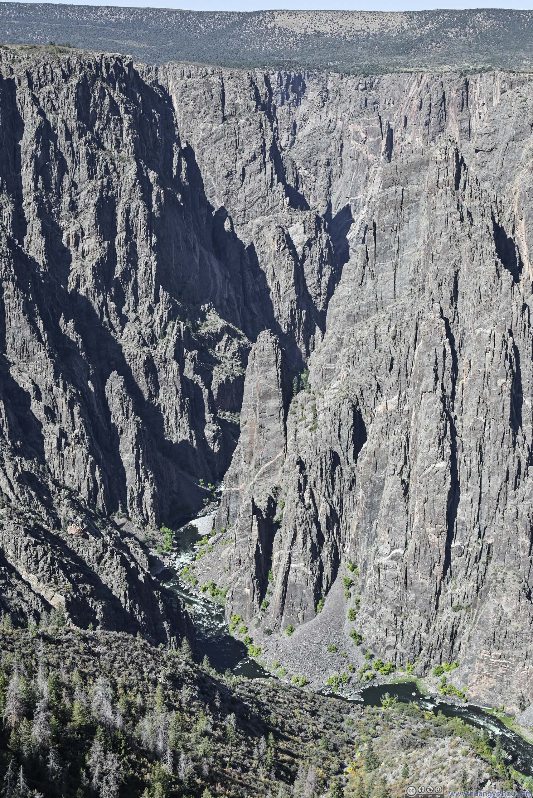
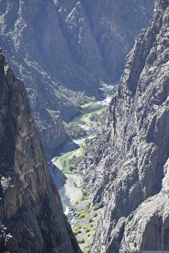
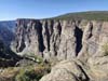
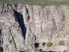
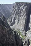
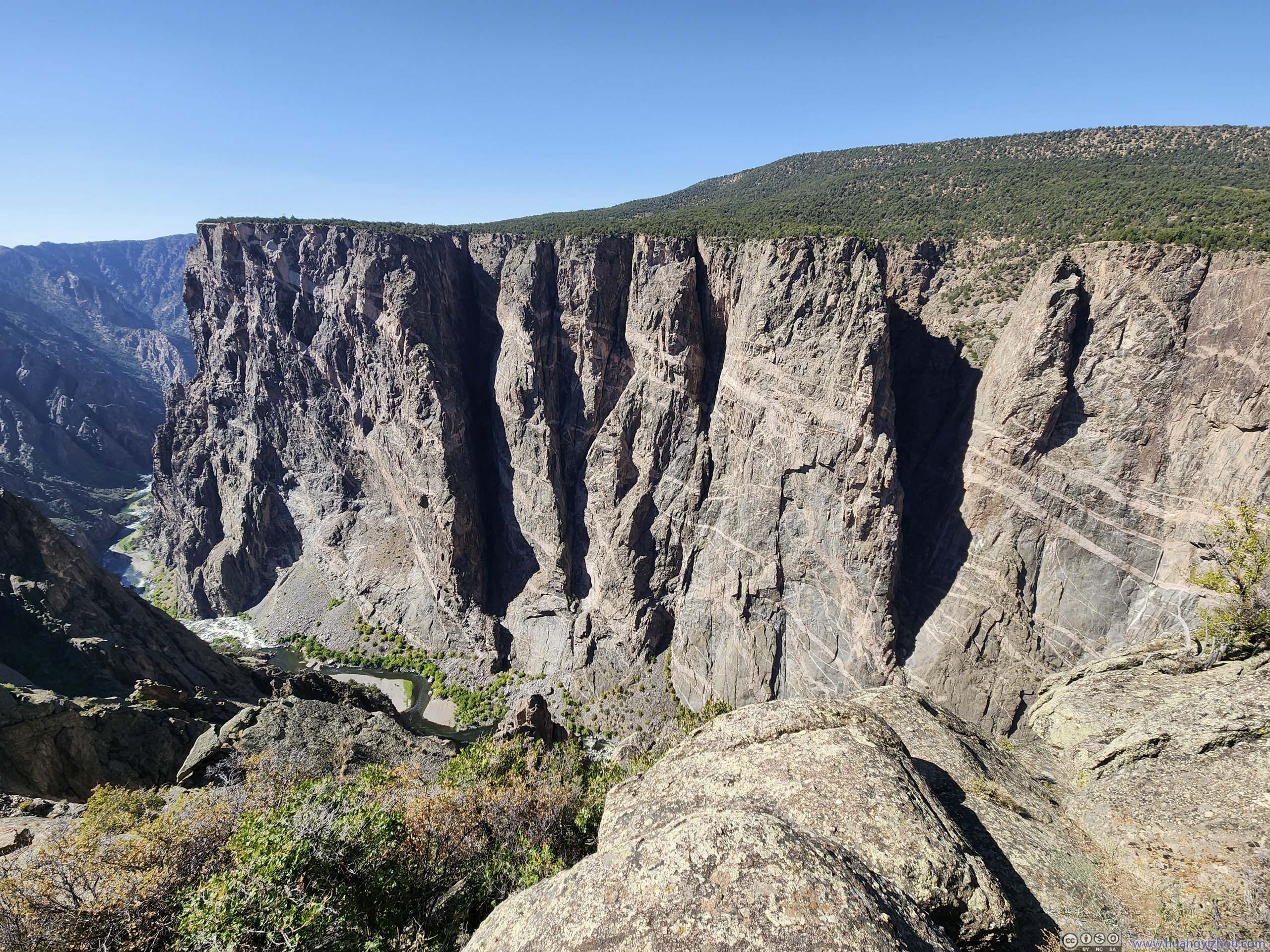
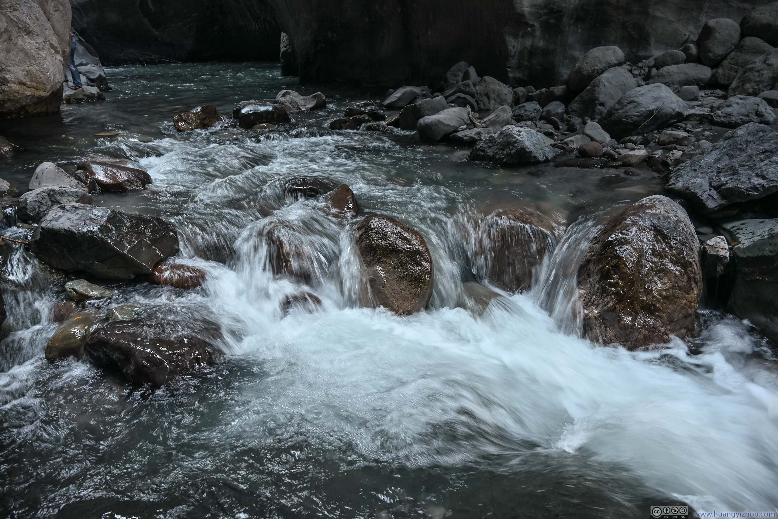
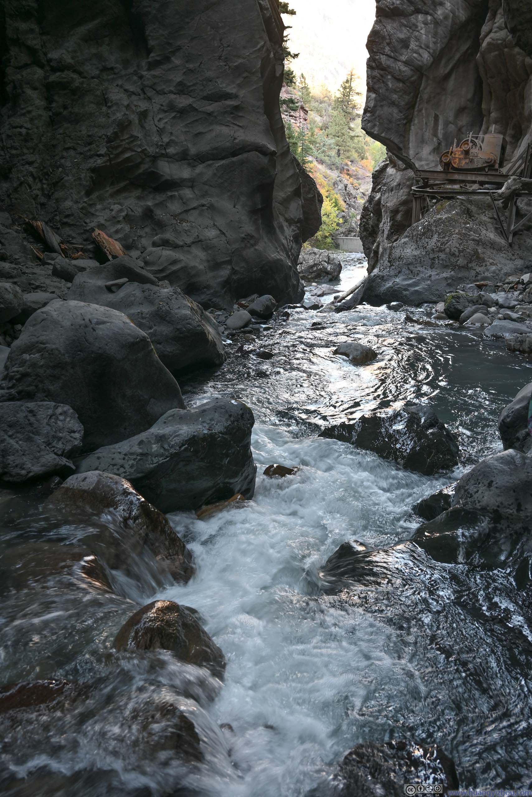
Down at Gunnison River, the never-ending sound of roaring torrents seemed to be a lasting ovation to those that overcame the challenging journey and made it to the river. Unfortunately, around this area (as seen from “Pulpit Rock” or “Gunnison Point”) the southern rim of the canyon had relatively shallow slopes, so it lacked the characteristic deep canyon view that made Gunnison Canyon famous (such as, “Exclamation Point” along the north rim).
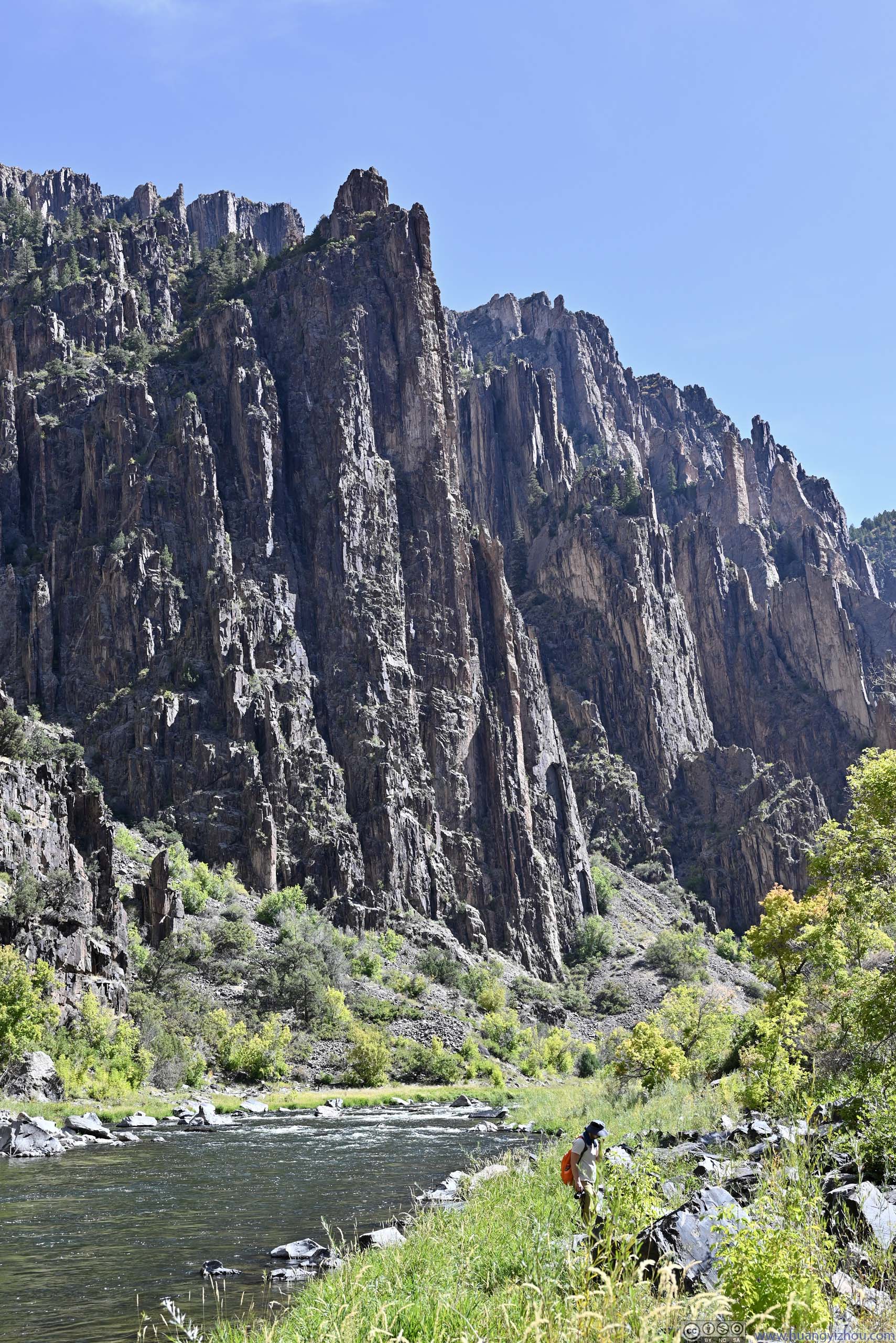
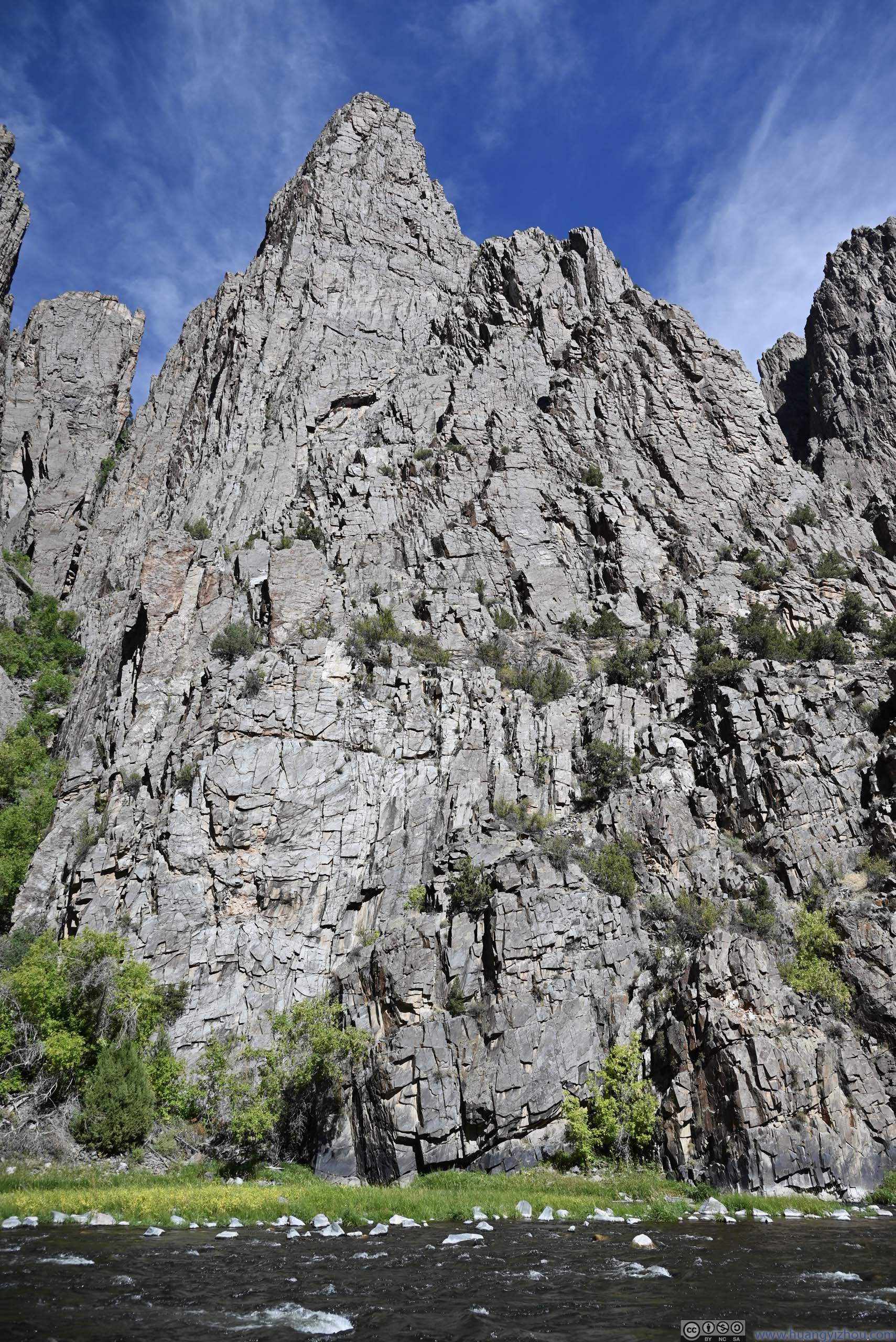
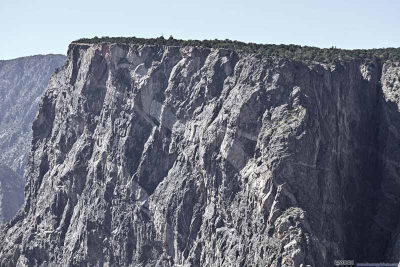
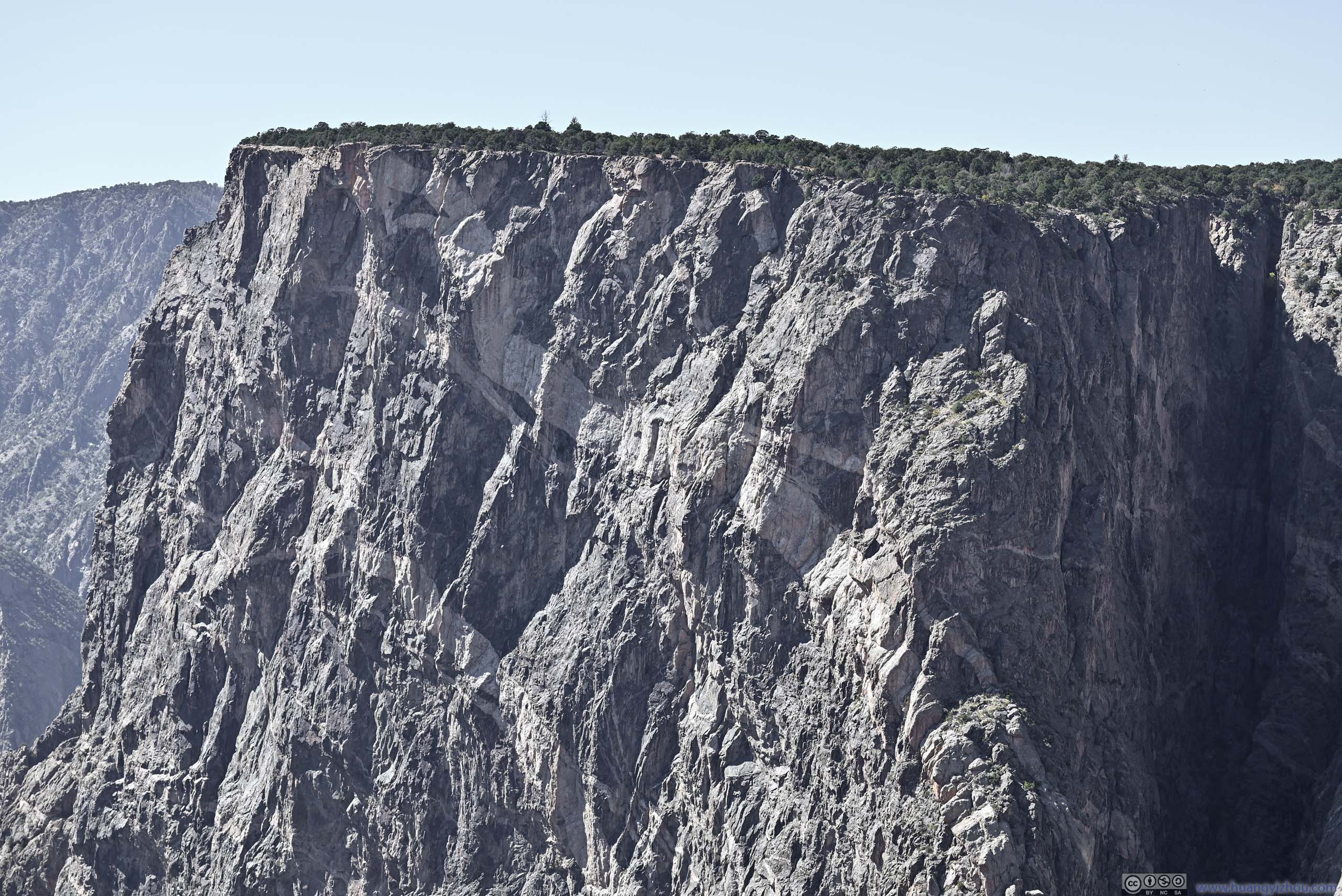
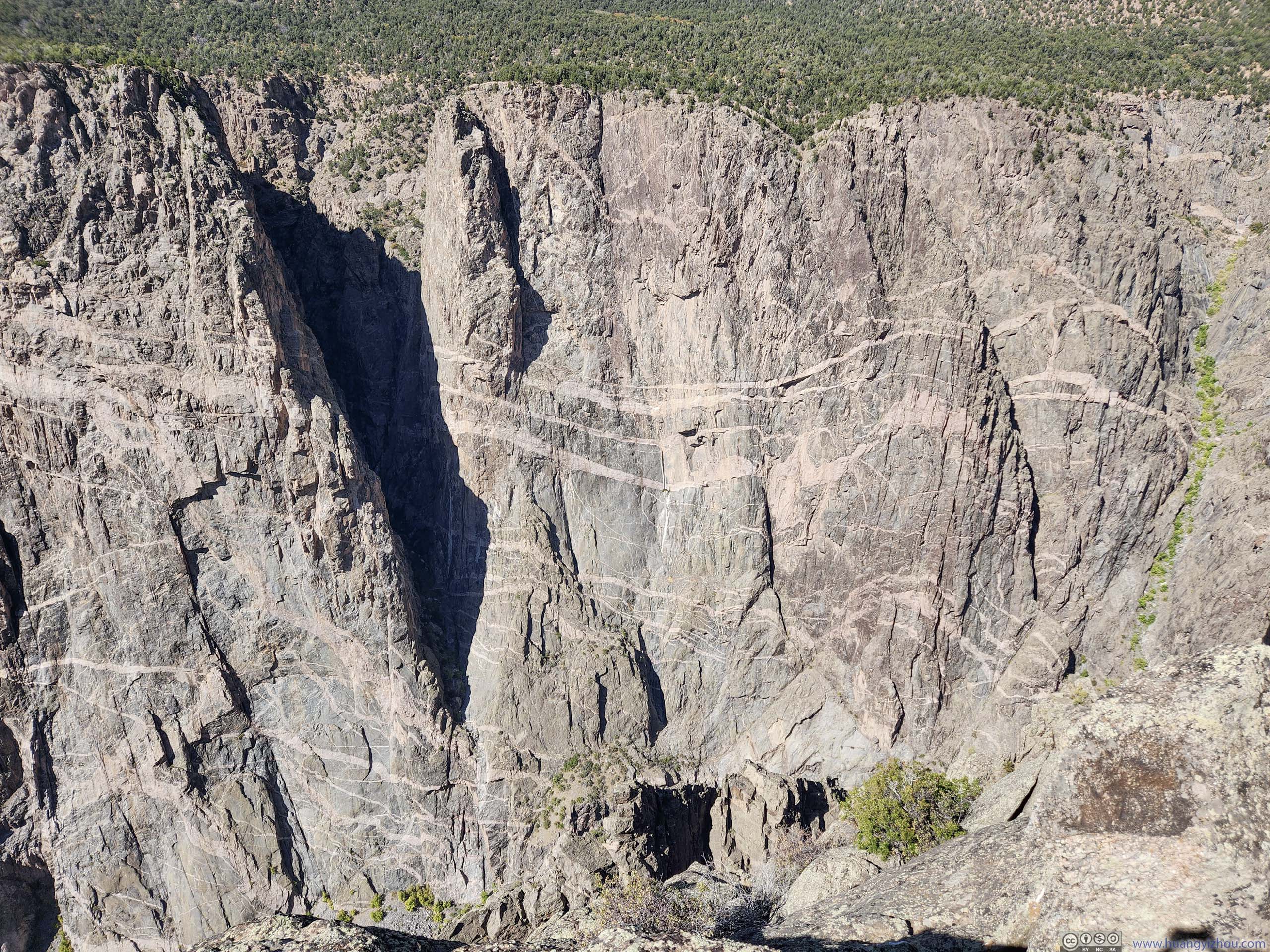
Here I took a closer look at the rocks that formed the north rim of the canyon. Unlike the smooth canyon walls near “Painted Wall”, here the walls had seen more erosion, more like different rock slabs that were glued together.
 Overlooking Gunnison River
 Gunnison River
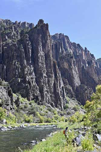
 Walls of Gunnison Canyon
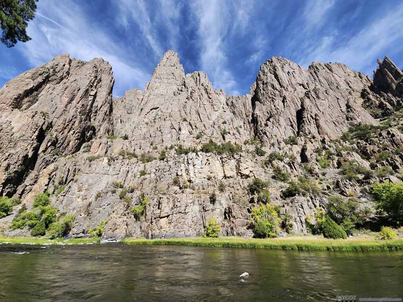 Gunnison Canyon
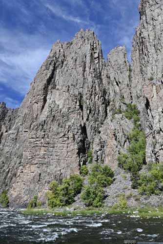
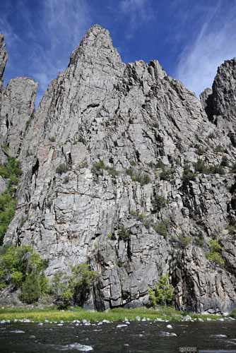 Walls of Gunnison Canyon
 Gunnison CanyonThe gentle south rim, following which Gunnison Route descended down the canyon.
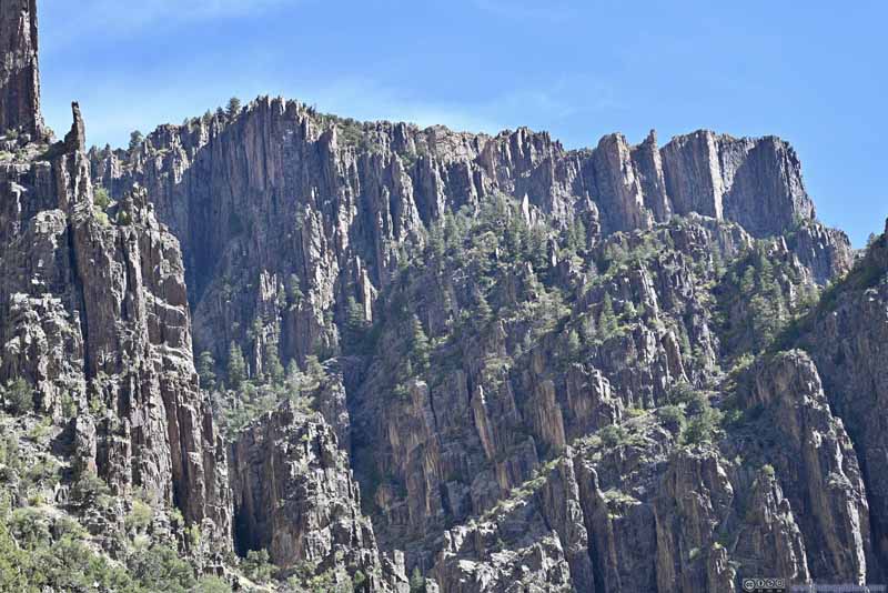 Walls of Gunnison CanyonAll the rock slabs uniformly pointed towards one direction: the sky.
 Gunnison Canyon
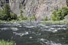
 Torrents along Gunnison River


Click here to display photos from the bottom of Gunnison Canyon.
Overlooking Gunnison River

Gunnison River
 Walls of Gunnison Canyon

Gunnison Canyon

 Walls of Gunnison Canyon
Gunnison CanyonThe gentle south rim, following which Gunnison Route descended down the canyon.

Walls of Gunnison CanyonAll the rock slabs uniformly pointed towards one direction: the sky.
Gunnison Canyon
Torrents along Gunnison River
Gunnison Canyon
Here’s a video I took in the bottom of Gunnison Canyon by the water.
14 seconds, 9Mbps for both H264 and H265 for a total file size of 15.4MB.
After spending 30 minutes by the river (including some snack time), I started to head back. Before going back to my car, I checked out another overlook near “Gunnison Point”. Interestingly, I found the end of Gunnison Route and the beach where I rested earlier.
 Gunnison CanyonGunnison Route followed the gentle south rim in this photo down to the river.
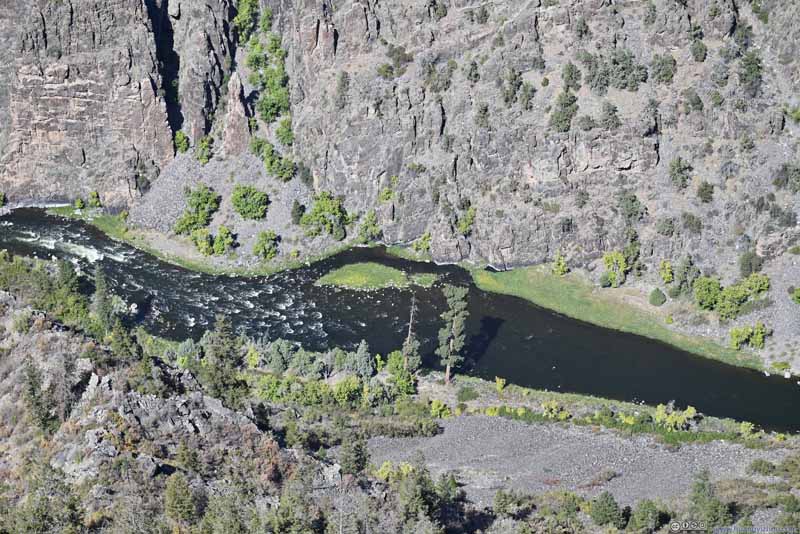 Bottom of Gunnison CanyonWhere I was earlier today.
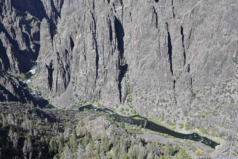 Gunnison Canyon
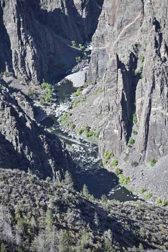
 Gunnison Canyon

Click here to display photos of the slideshow
Gunnison CanyonGunnison Route followed the gentle south rim in this photo down to the river.
Bottom of Gunnison CanyonWhere I was earlier today.

Gunnison Canyon
 Gunnison Canyon
Before I left the park, I checked out “Painted Wall View” (I skipped it yesterday as I couldn’t find parking). It offered an unobstructed view of the painted wall. Unfortunately, shadows were hard in the photos.
 Painted Wall of Gunnison CanyonThe most striking white stripe in this photo, like a dragon or serpent.
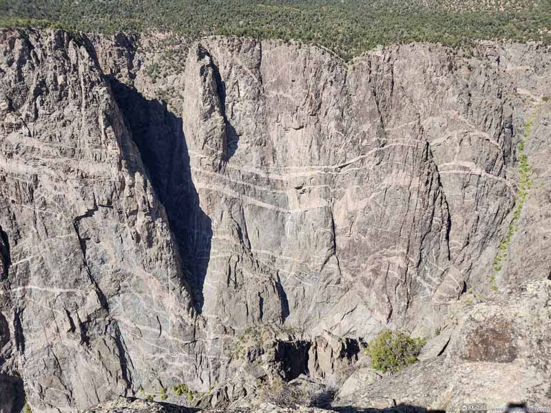 Painted Wall of Gunnison Canyon
 Painted Wall of Gunnison Canyon
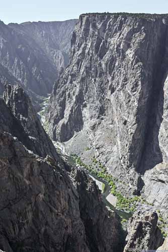
 Gunnison River Winding in Canyon
Click here to display photos from Painted Wall View.
Painted Wall of Gunnison CanyonThe most striking white stripe in this photo, like a dragon or serpent.
Painted Wall of Gunnison Canyon
Painted Wall of Gunnison Canyon

 Gunnison River Winding in Canyon
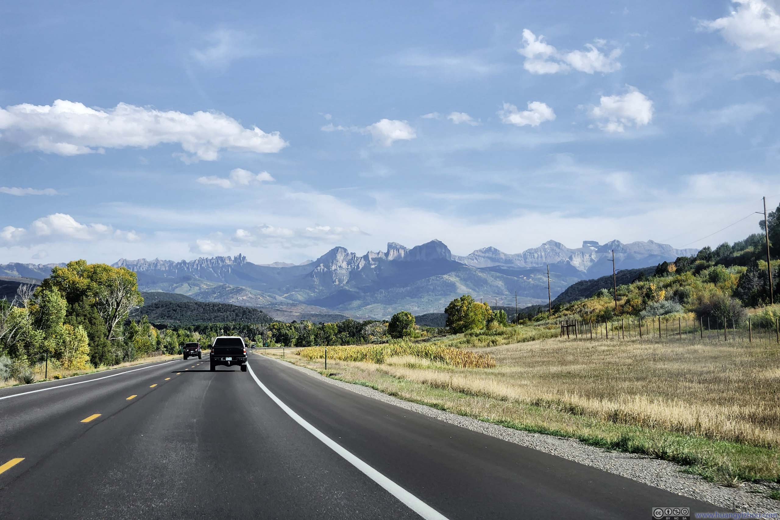
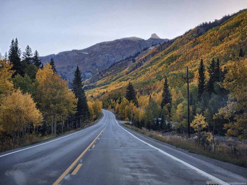
After leaving Black Canyon of the Gunnison National Park, I drove south and into the realm of San Juan Mountains. For this trip, I picked the central part of San Juan Mountains (along US 550), over the eastern part (along CO-149) over accessibility, and over the western part (along CO-145) as I wanted to leave the few peaks in Lizard Head Wilderness for a future trip.
It also meant I would be driving through Million Dollar Highway from Ouray to Silverton, where the name either corresponded to the road’s construction cost back in the 19th century, or the spectacular views along the way. Since I visited during (what I thought was) peak foliage season along Million Dollar Highway, I could certainly attest the foliage was the best among my 2+ week trip.
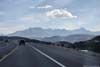
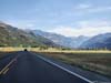
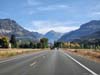
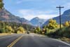
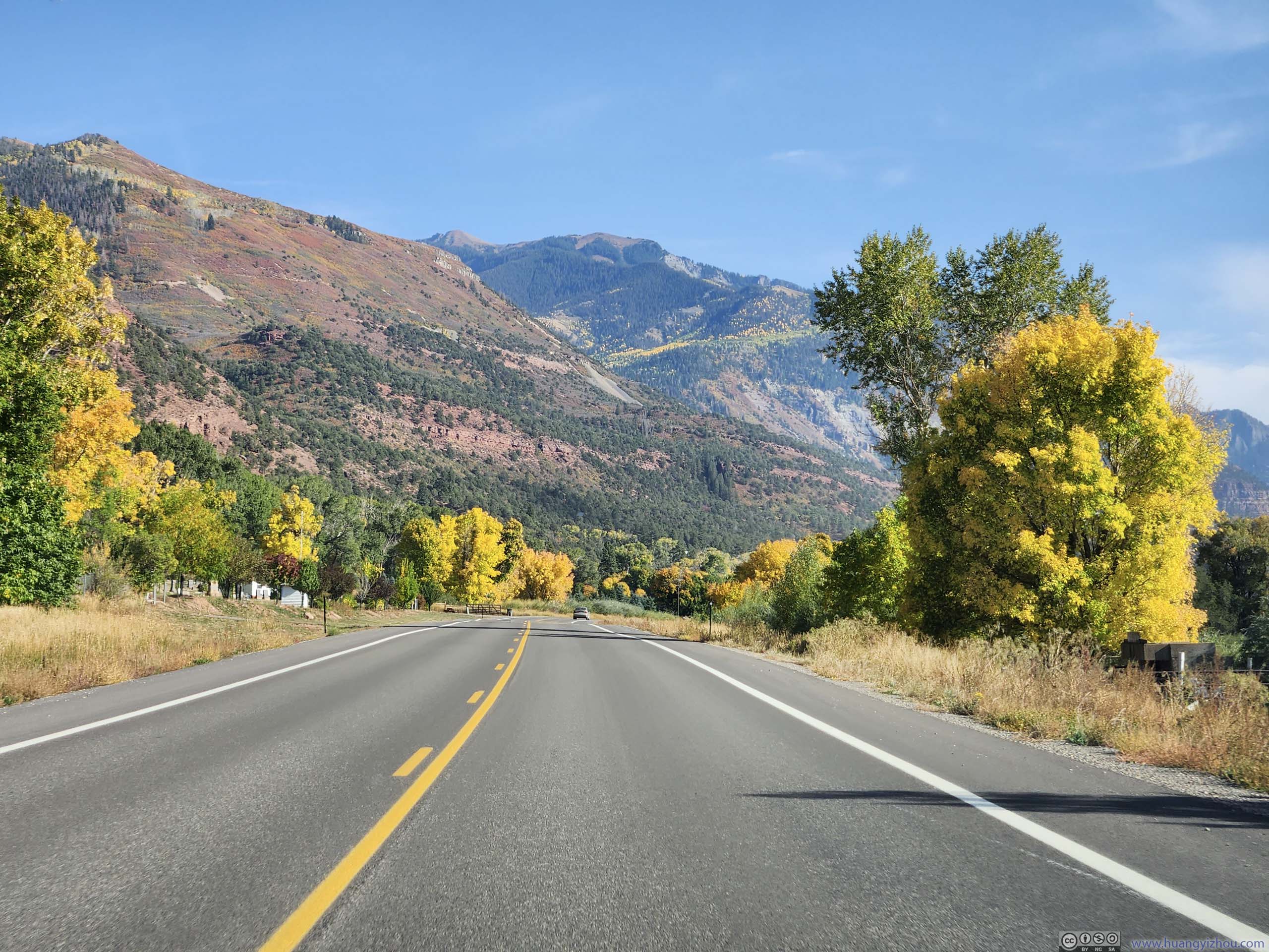
The exciting sights began before I reached Ridgway, with the magnificent contours of Uncompahgre and Sneffels Peaks lining the distant horizon. After Ridgeway, it’s an ever-narrowing valley as one closed in on Ouray.
 Uncompahgre Mountains beyond Road
 Sneffels Range of San Juan Mountains
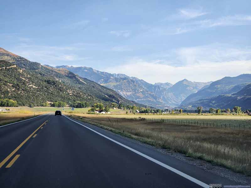 Valley into Ouray
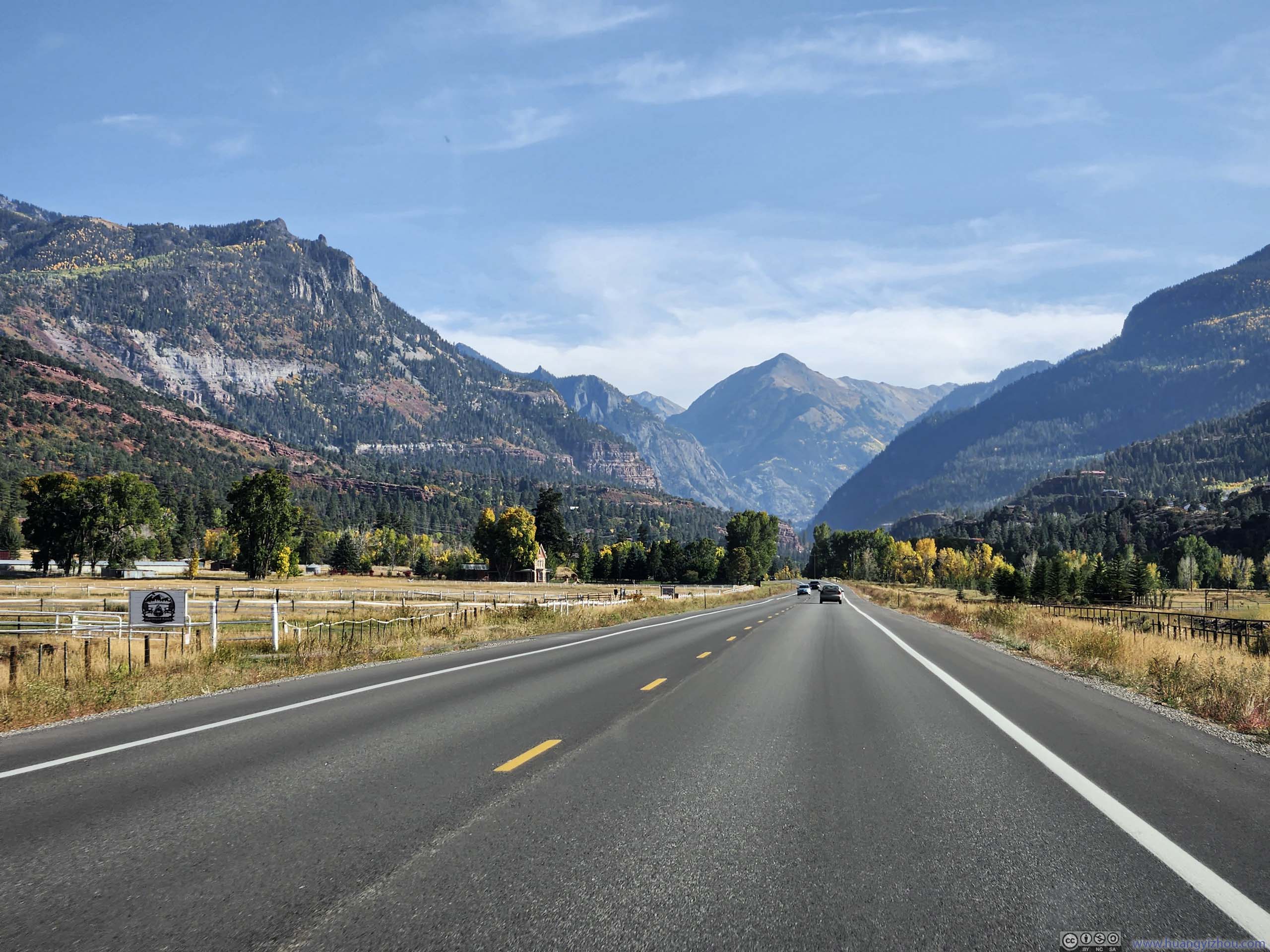
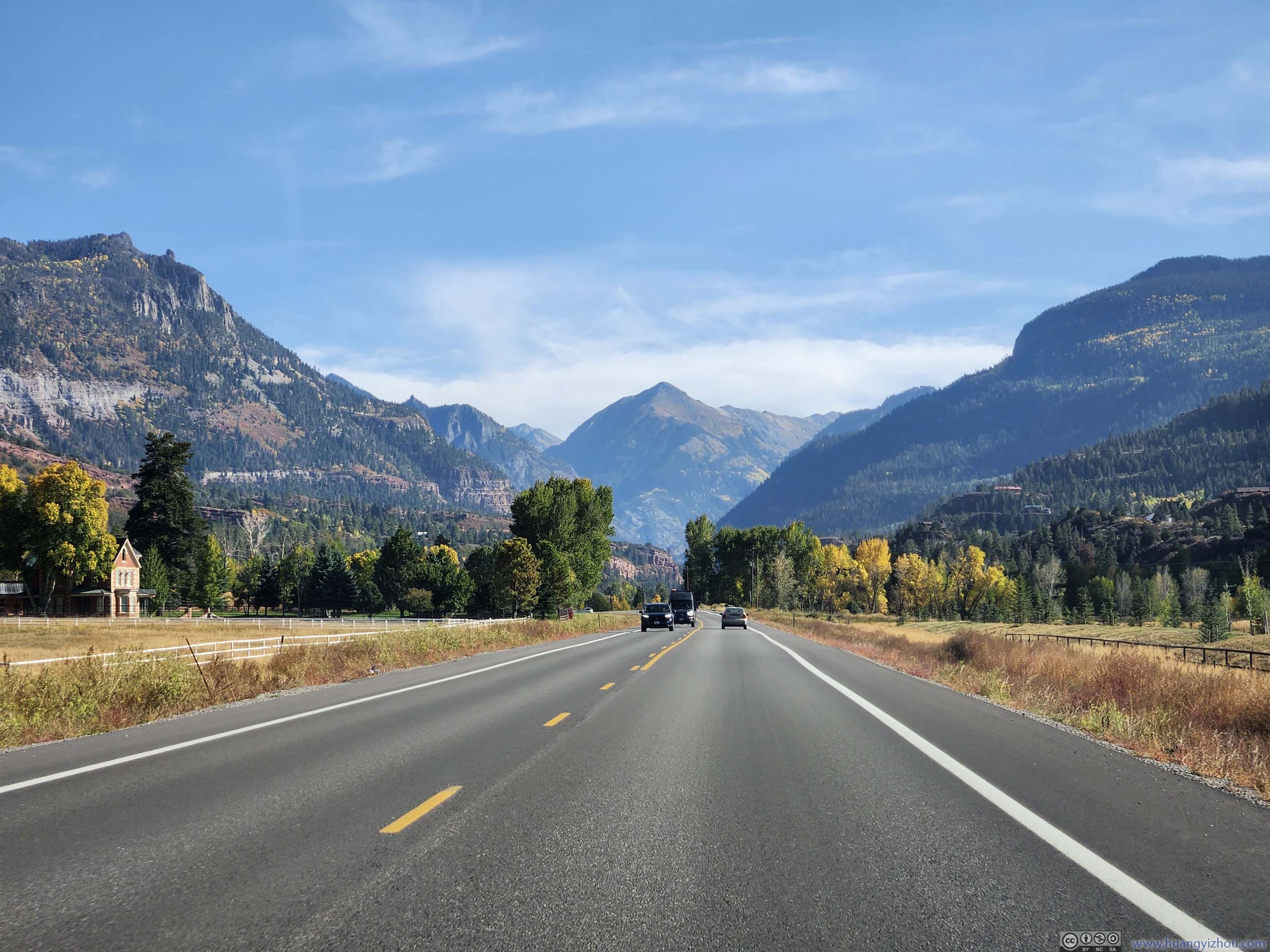
 Mountains out of Ouray
 Road into Ouray
 Road into Ouray
 Road into Ouray
Click here to display photos along the road.
Uncompahgre Mountains beyond Road
Sneffels Range of San Juan Mountains

Valley into Ouray
Mountains out of Ouray
Road into Ouray
Road into Ouray

Road into Ouray
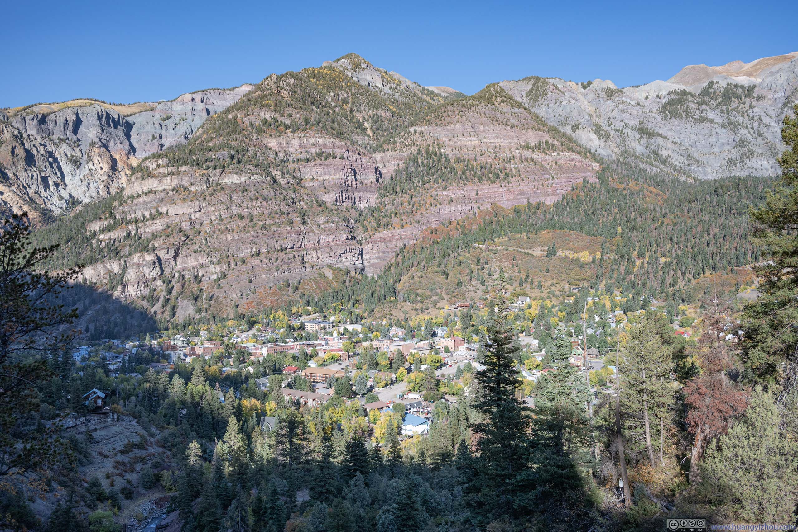
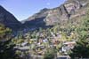
Town of Ouray
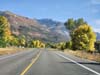
Nicknamed “Switzerland of America”, Ouray CO was a town surrounded by mountains on all sides. Unfortunately, the mountains weren’t (by my standards) accessible so I didn’t plan to stay in this town for long. I nonetheless decided to check out its top two (summer) attractions: Lower Cascade Falls and Box Canyon Falls.
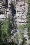
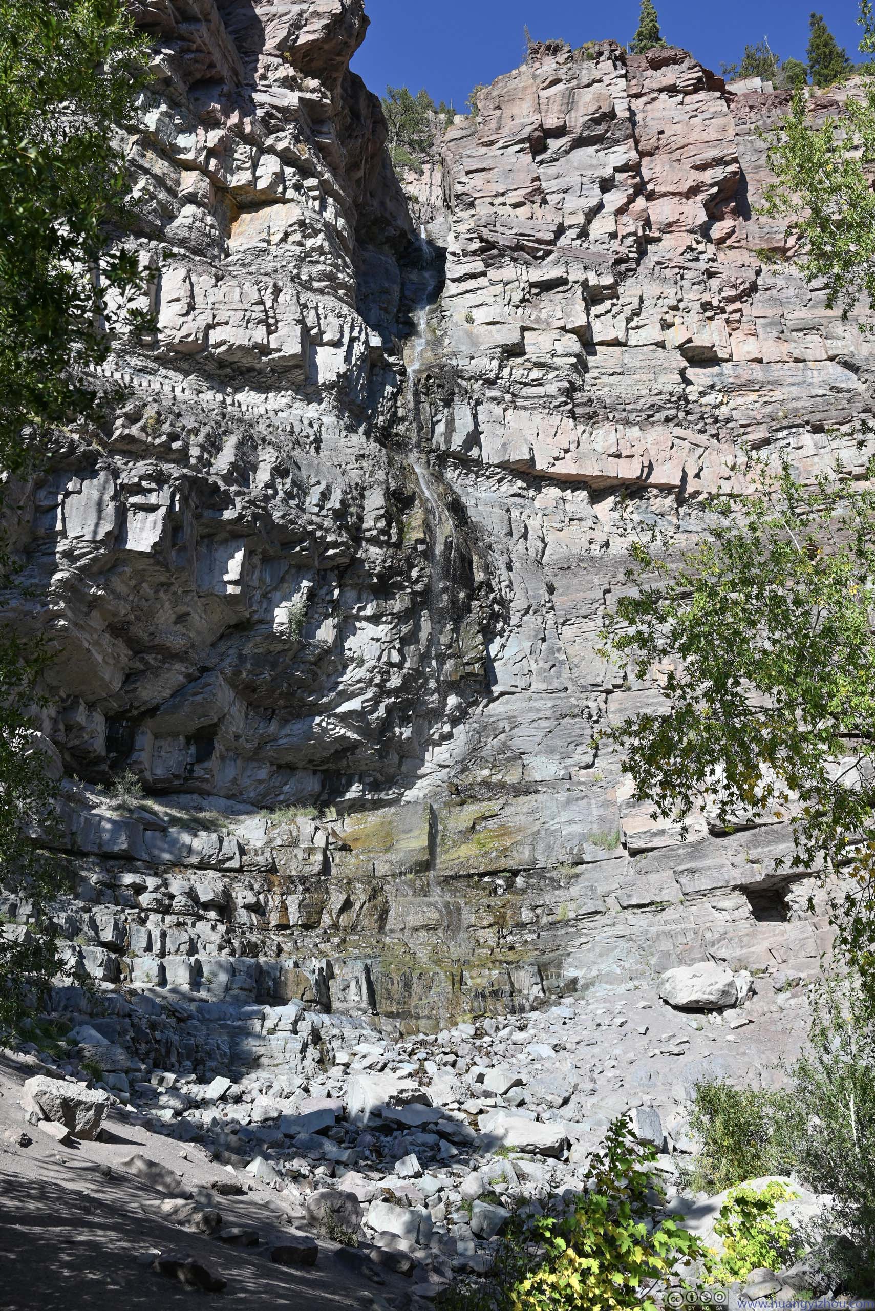
Lower Cascade Falls
This one was located just a short walk from the parking lot. Unfortunately, the water flow was very meager during my visit. One could head onto “Ouray Perimeter Trail” for a closer look of the waterfall (p3) below, but I wasn’t thrilled by the sight.
 Lower Cascade FallsTaken near the parking lot / trailhead.
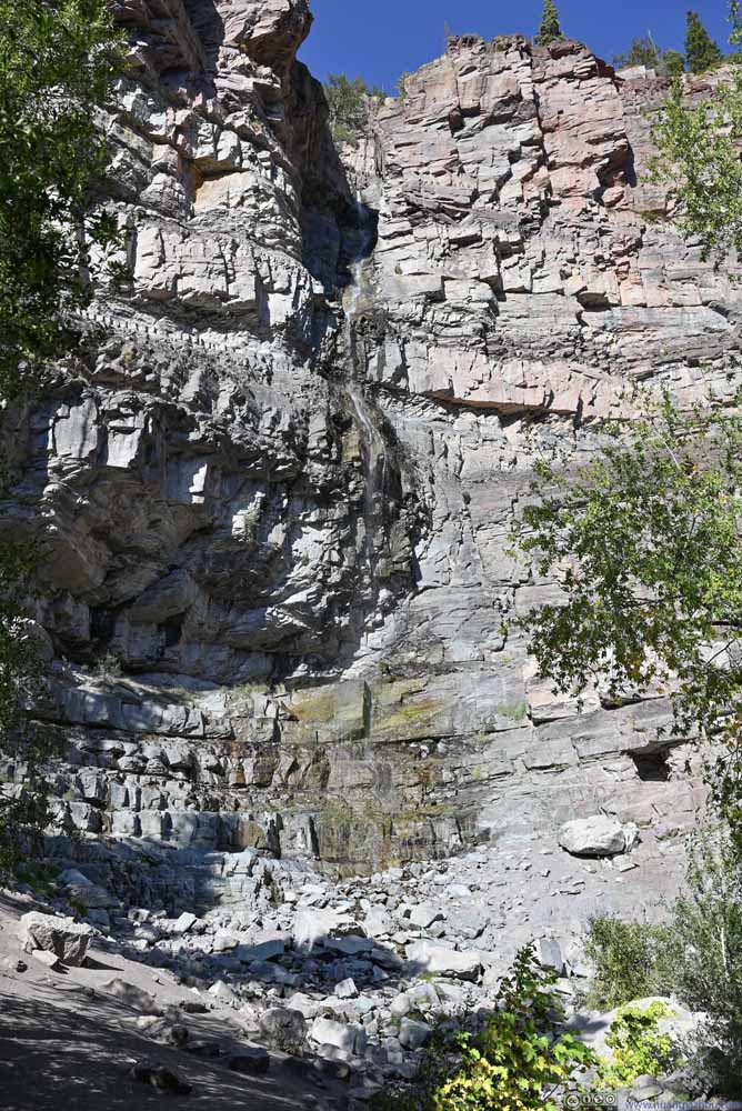 Lower Cascade FallsTaken at the foot of the waterfall.
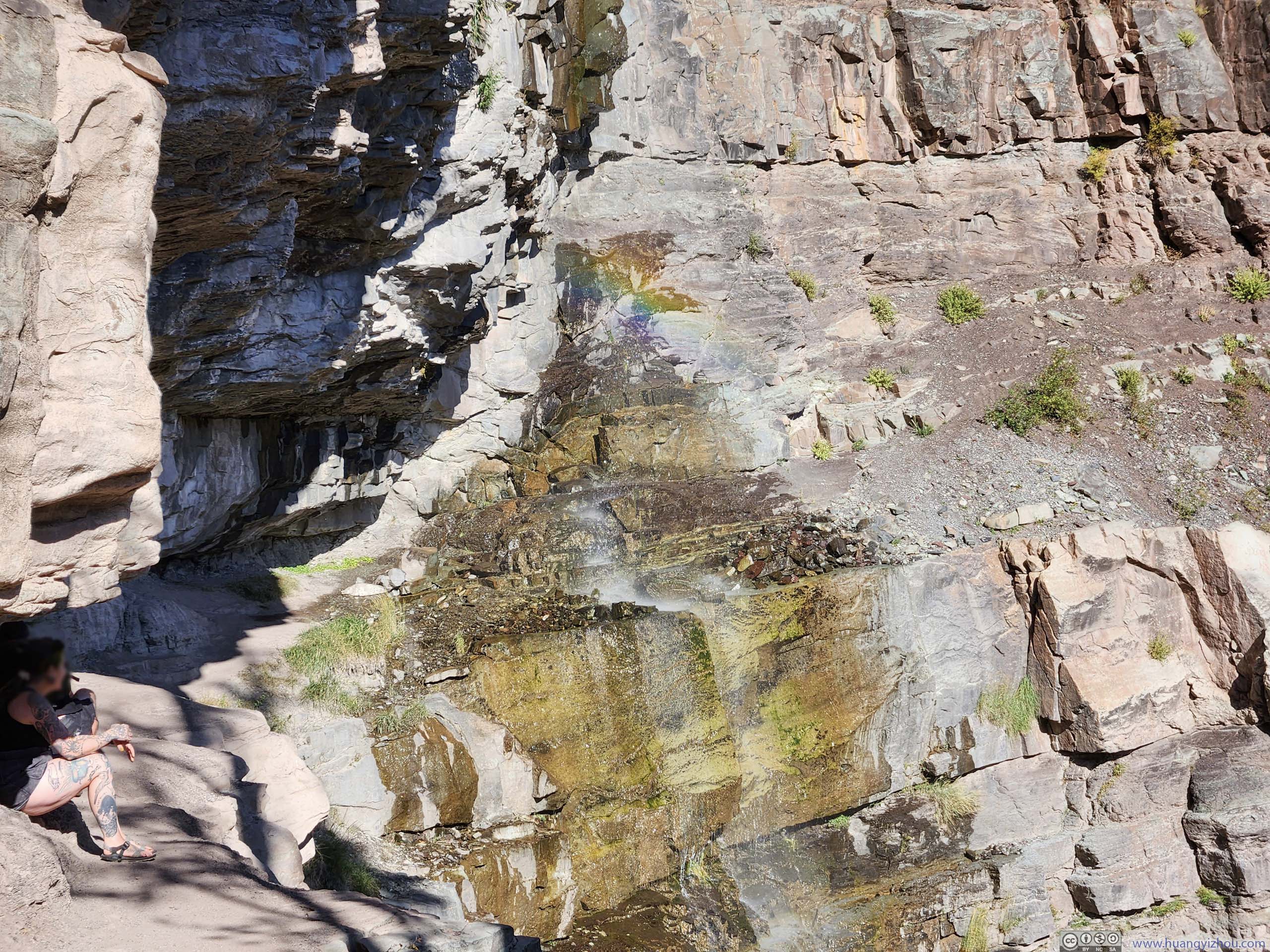
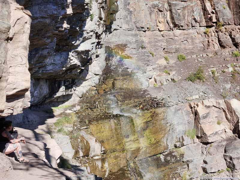 Rainbow by Lower Cascade Falls
Along Ouray Perimeter Trail, I found the water splashed by the waterfall created a mini rainbow, which somehow made up for its meager water flow. In this photo, I used Photoshop to enhance its color. In the lower-left of this photo, a path extended underneath the rocks, beyond where the two people sat, to the waterfall, where one could choose to get drenched (saw someone did that).
Rainbow by Lower Cascade Falls
Along Ouray Perimeter Trail, I found the water splashed by the waterfall created a mini rainbow, which somehow made up for its meager water flow. In this photo, I used Photoshop to enhance its color. In the lower-left of this photo, a path extended underneath the rocks, beyond where the two people sat, to the waterfall, where one could choose to get drenched (saw someone did that).


Click here to display photos of the slideshow

Lower Cascade FallsTaken near the parking lot / trailhead.
Lower Cascade FallsTaken at the foot of the waterfall.
Rainbow by Lower Cascade Falls
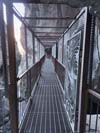
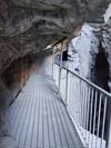
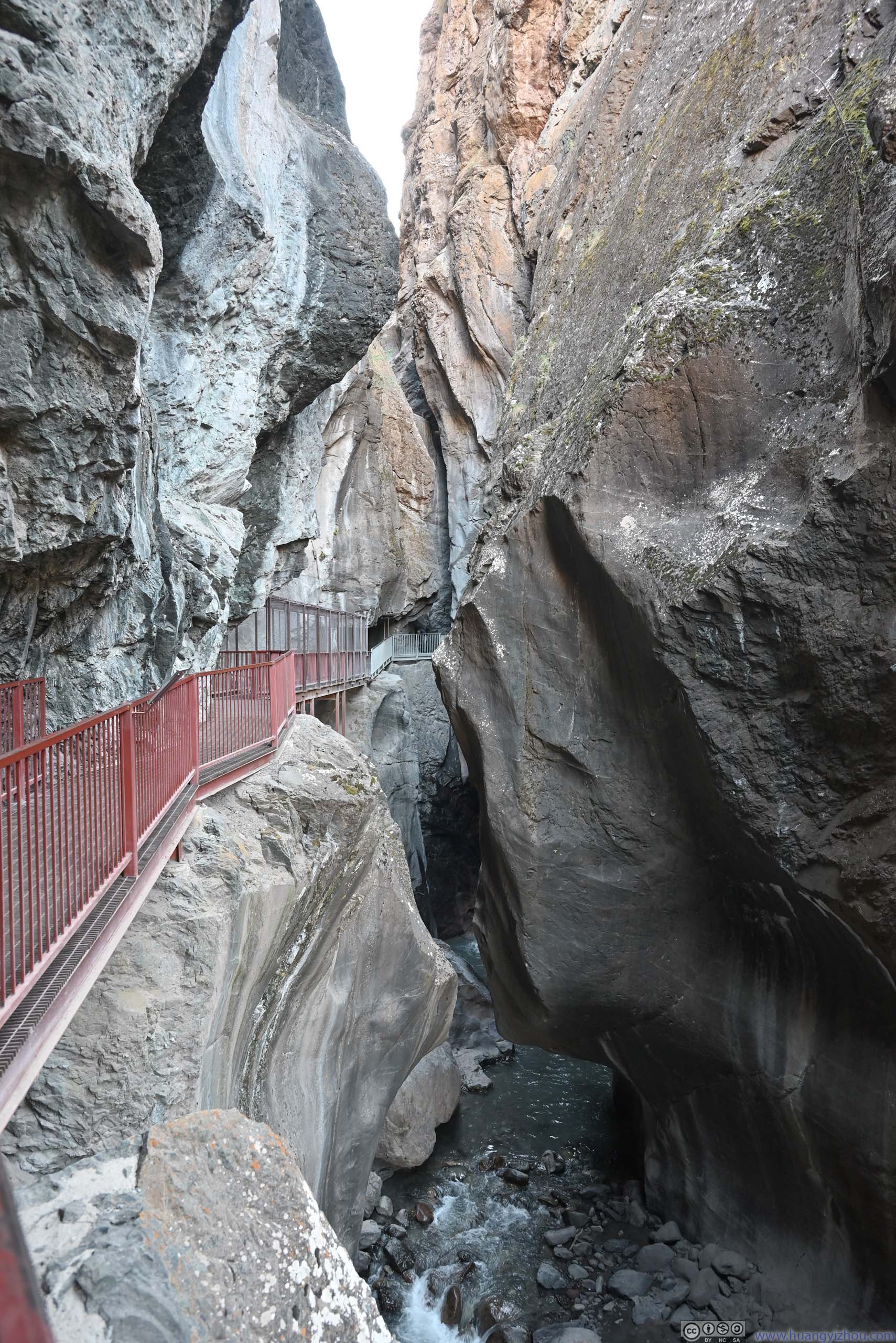
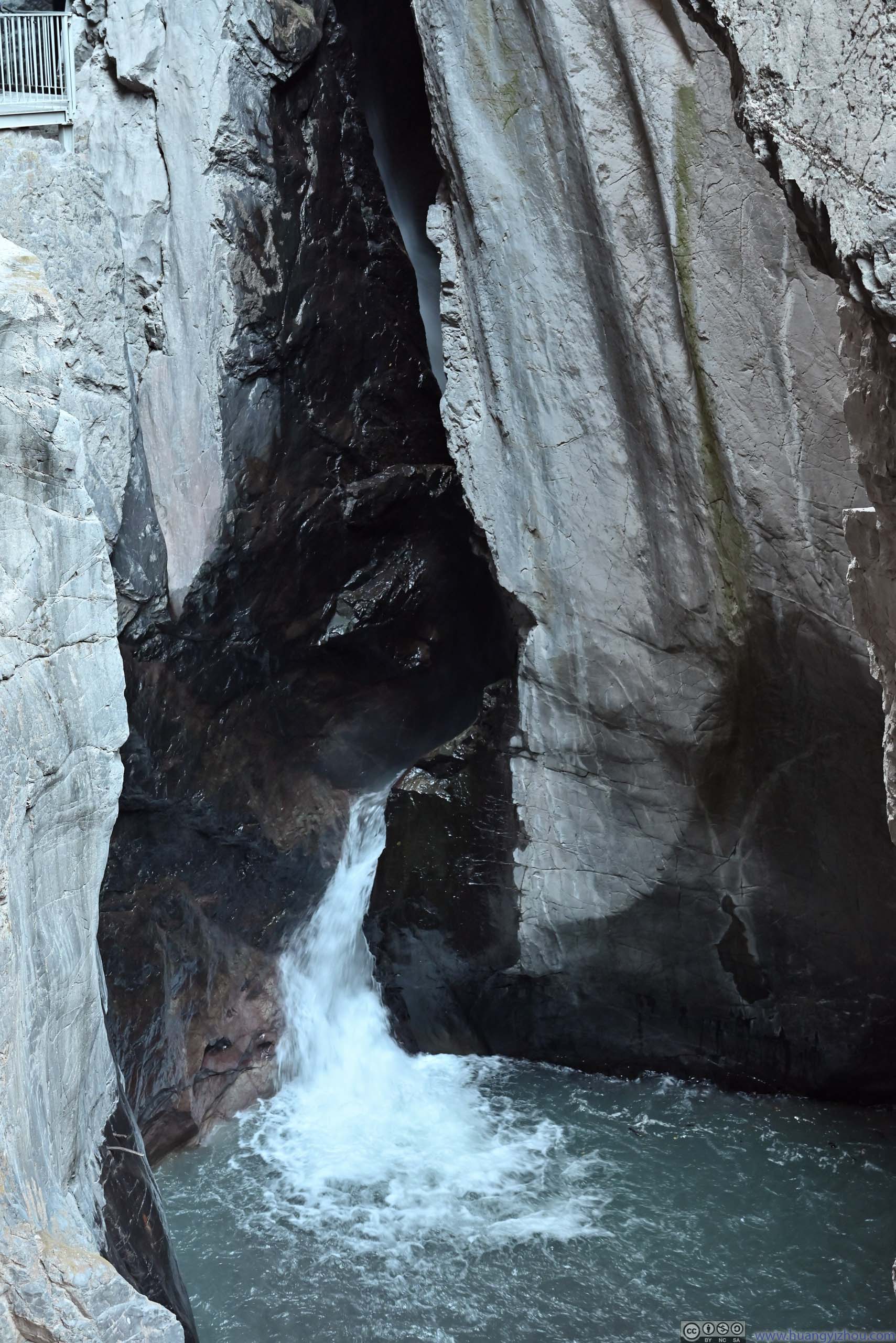
Box Canyon Falls
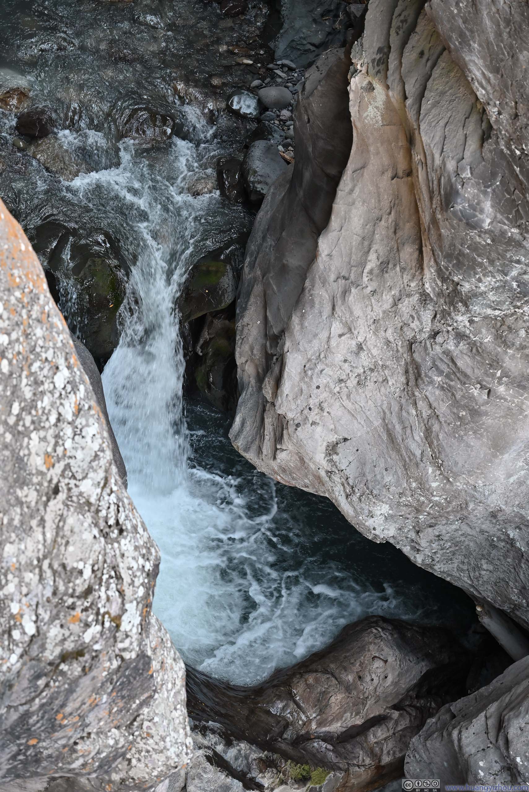
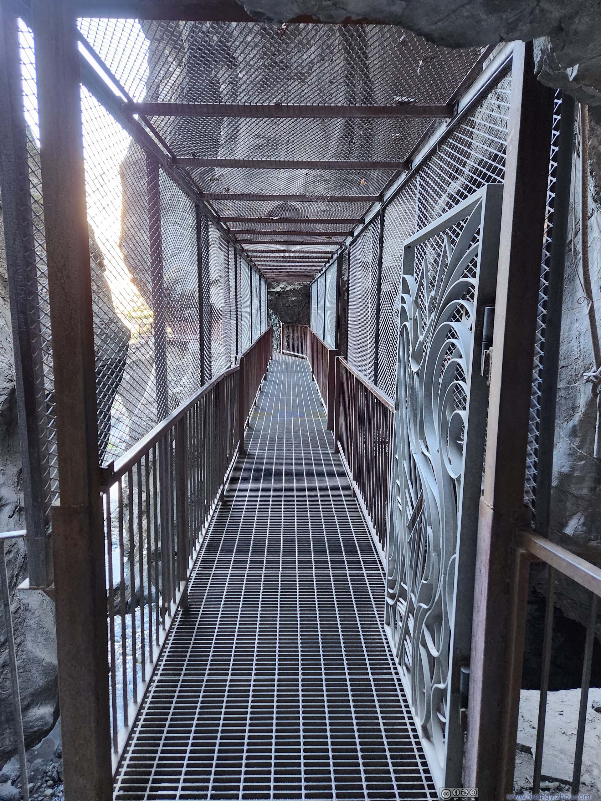
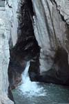
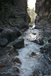
This one charged a small entrance fee ($7 per person if remembered correctly), but it’s well worth the time and money (I didn’t think so for Lower Cascade Falls). It’s a proper, high-aspect-ratio canyon that began with a deafening outburst of water (like a burst fire hydrant), followed by a series of (small) cascades, convoluted twist and turns, all in a narrow canyon where canyon wall on the other side was almost tangible. Its narrowness meant enclosed metal passages had to be installed so visitors could tour it (hence the entrance fee I guess).
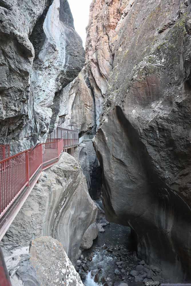 Box Canyon
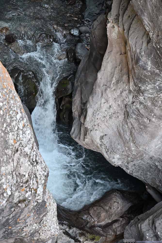 Box Canyon
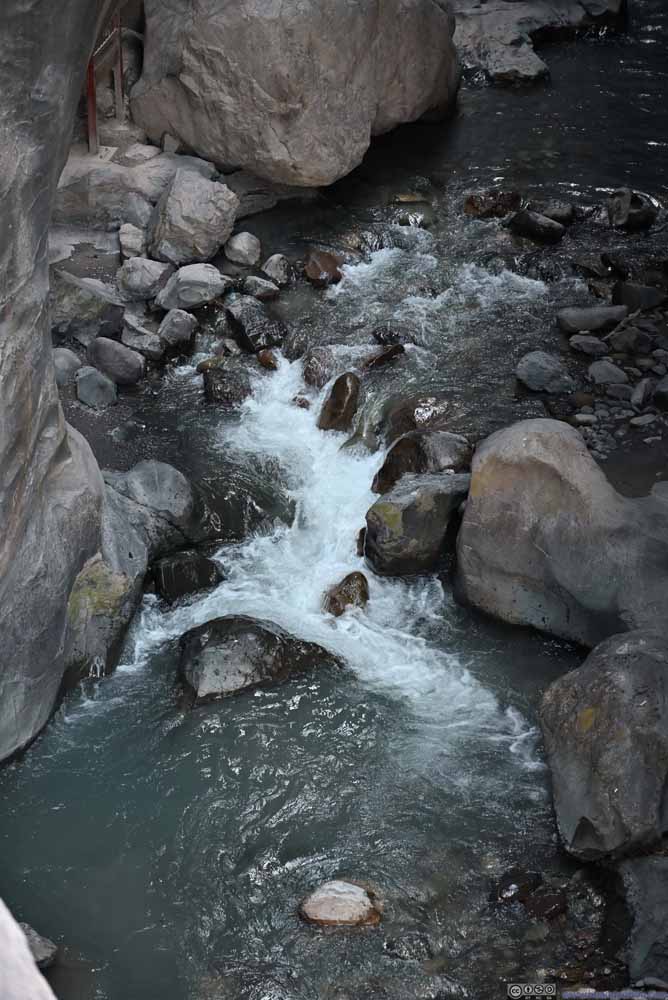 Box Canyon
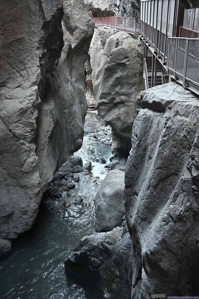 Box Canyon
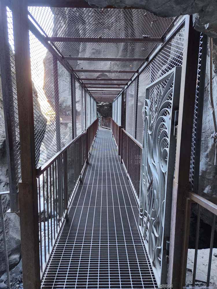 Passage
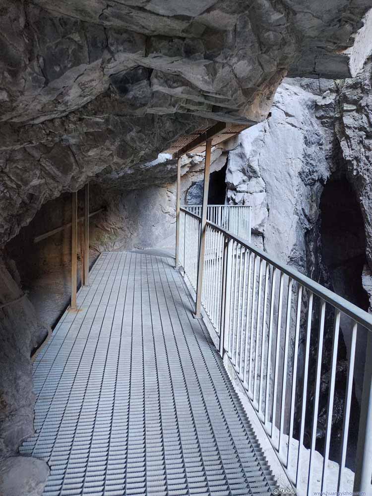 Passage
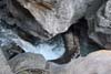
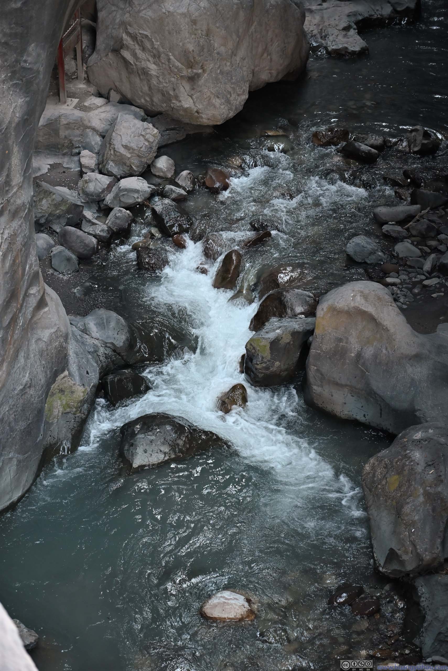
 Torrents in Box Canyon


Click here to display photos of the Box Canyon.
Box Canyon
Box Canyon
Box Canyon

Box Canyon
Passage

Passage

 Torrents in Box Canyon
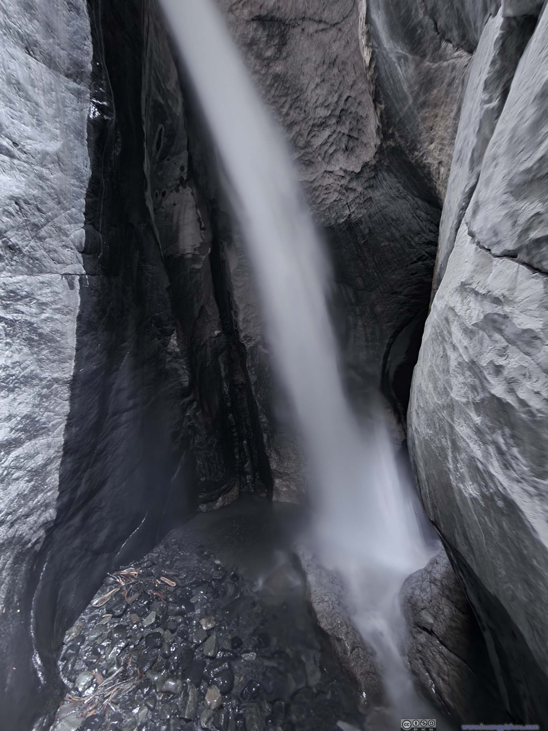
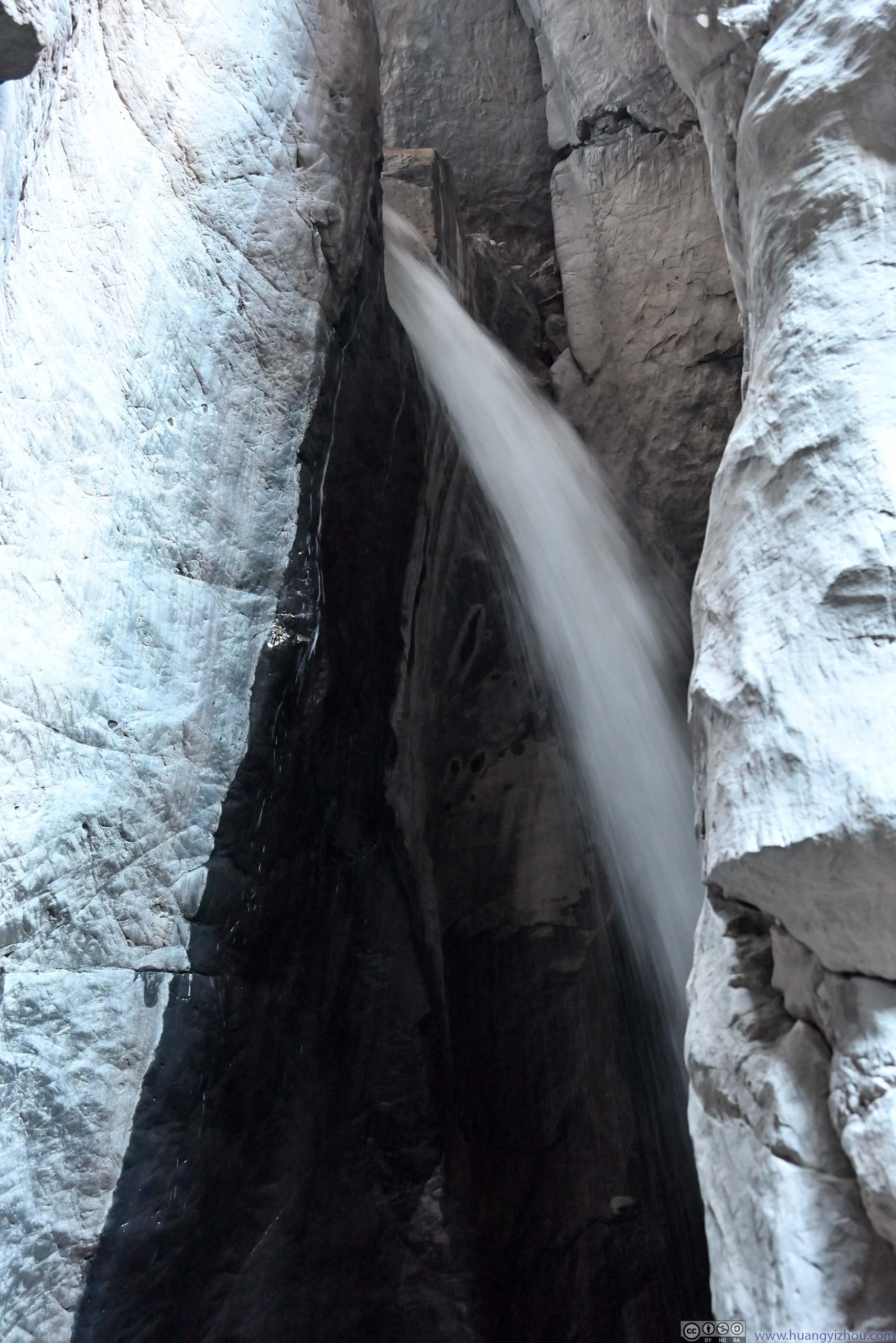
Here’s a video of the waterfall at the end of the passage:
12 seconds, 7Mbps for both H264 and H265 for a total file size of 10.4MB.
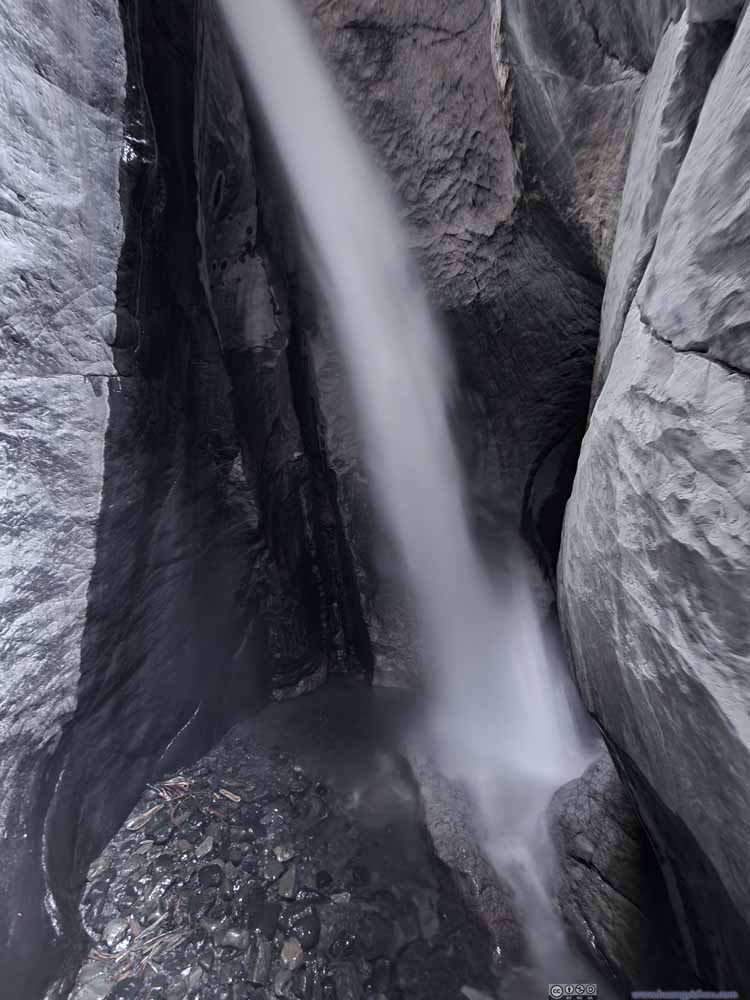 Waterfall in Box Canyon
 Waterfall in Box Canyon
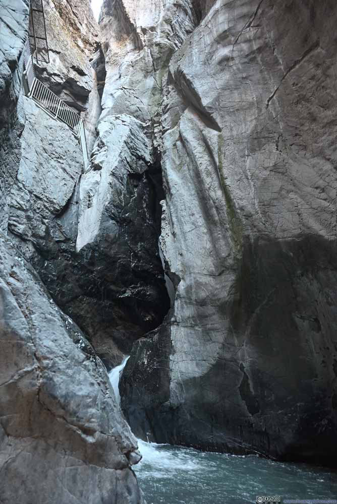 Box Canyon
 TorrentsA bit hard to photograph the lower part of the waterfall from the canyon floor.
 Creek
Creek

Click here to display photos of the slideshow
Waterfall in Box Canyon
Waterfall in Box Canyon

Box Canyon
TorrentsA bit hard to photograph the lower part of the waterfall from the canyon floor.
Creek
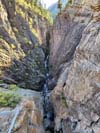
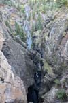
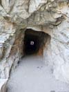
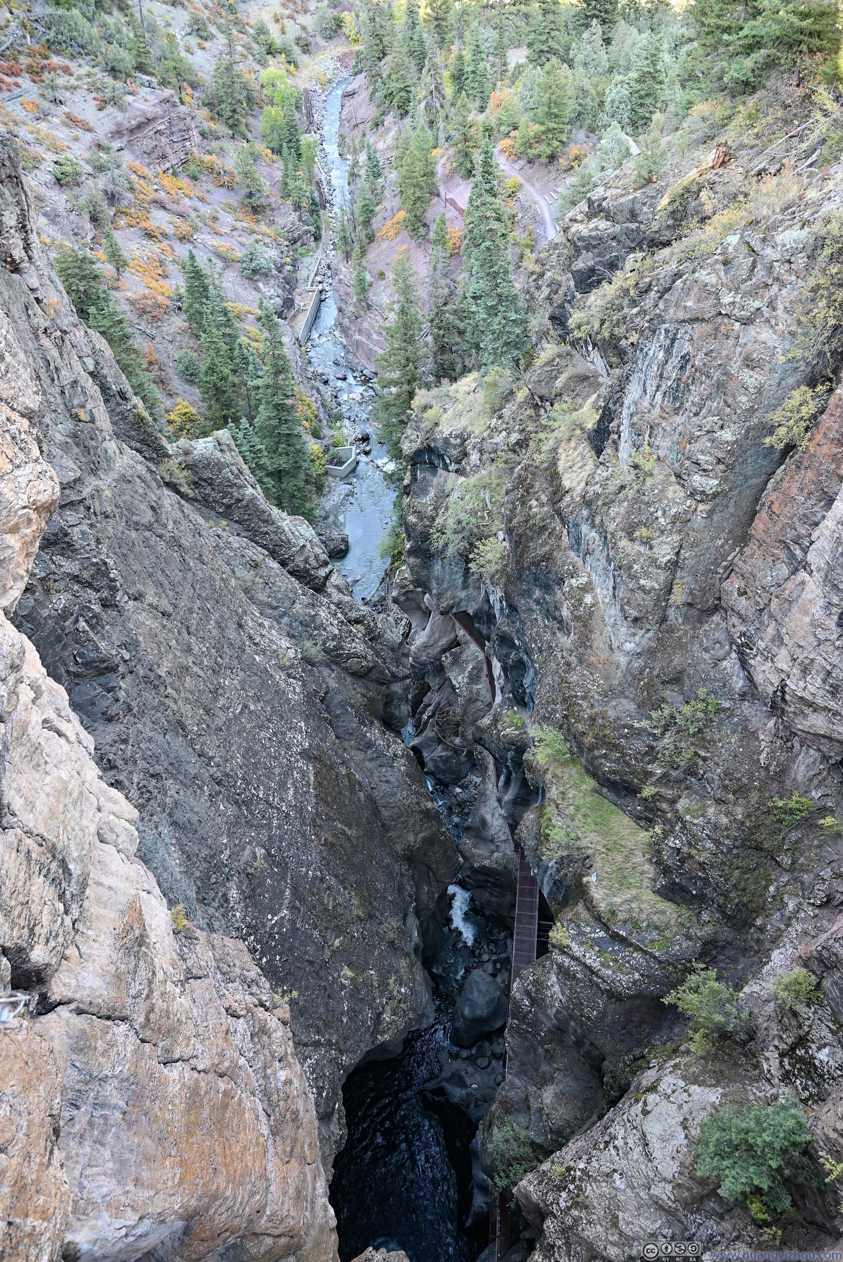
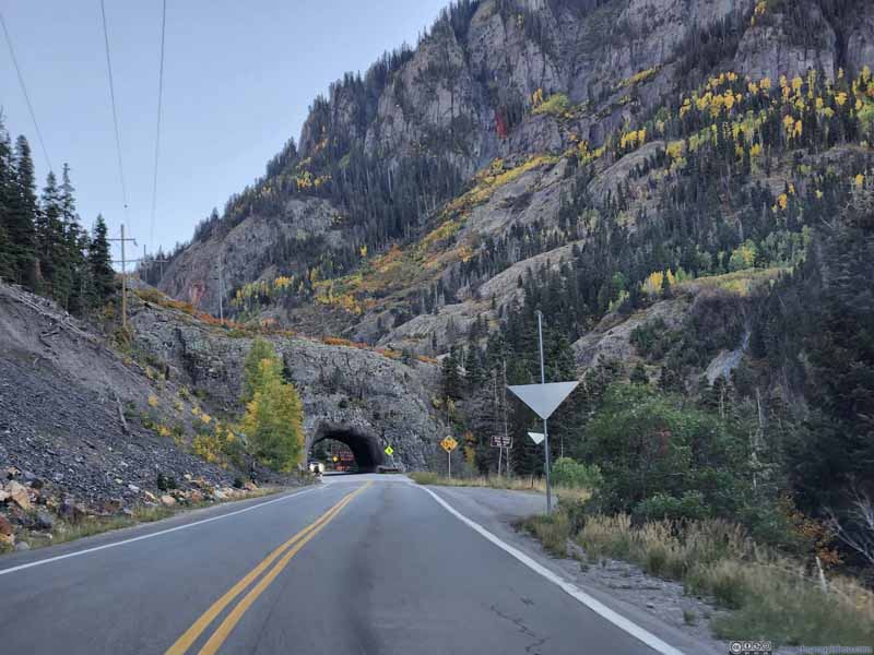
Apart from the narrow canyon with enclosed metal passage, one could head onto Ouray Perimeter Trail to a bridge spanning across the canyon. On one side, it’s the source of the water that extended deep from another series of narrow canyons (p1 below), on another side, the water flew out of the canyon into the town of Ouray (p2 below). After the bridge, Ouray Perimeter Trail immediately entered a tunnel (p3 below) as it continued its way north (p4 below).
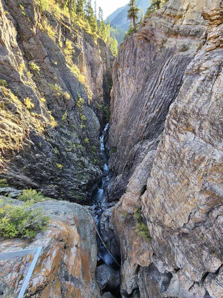 Box CanyonA tiny bit of waterfall visible in the lower center.
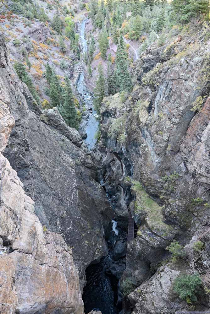 Box CanyonThe passage into Box Canyon visible in the lower center.
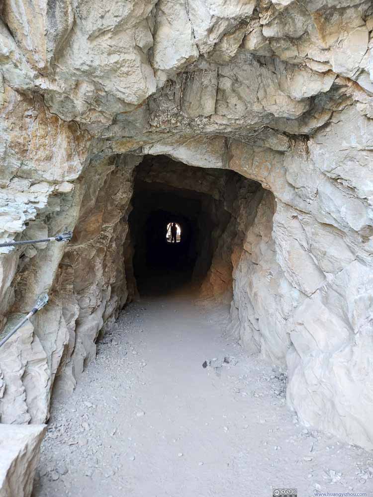 TunnelPart of Ouray Perimeter Trail.
 Perimeter Trail beyond TunnelThe bushes in peak foliage.
Click here to display photos of the slideshow

Box CanyonA tiny bit of waterfall visible in the lower center.
Box CanyonThe passage into Box Canyon visible in the lower center.
TunnelPart of Ouray Perimeter Trail.
Perimeter Trail beyond TunnelThe bushes in peak foliage.
This part of Ouray Perimeter Trail also offered great views overlooking the town of Ouray, where foliage in the town blended perfectly into the background mountains that displayed various mineral colors.
 Cascade Mountain beyond Town of Ouray
 MountainsTo the north, soaring above the town of Ouray.
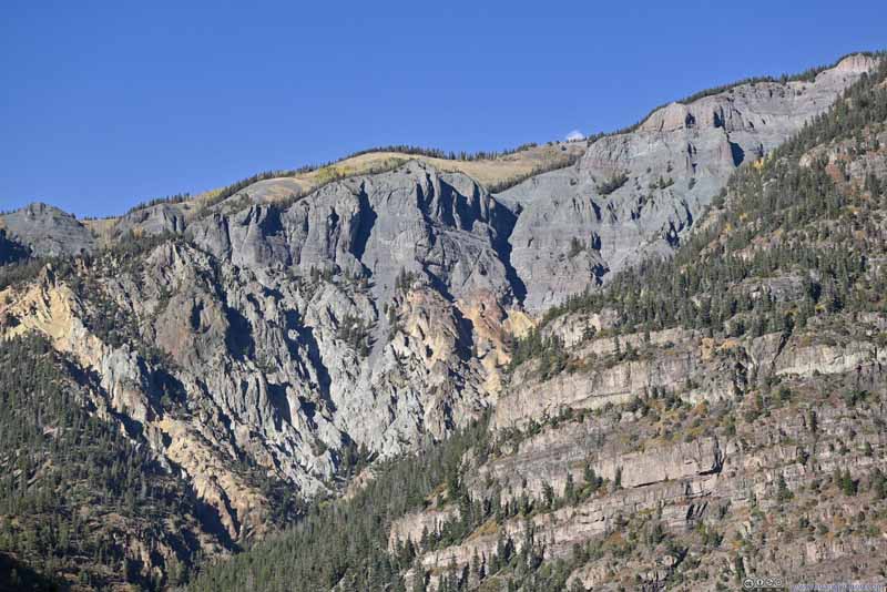 MountainsGood mixture of colors and shapes of rocks.
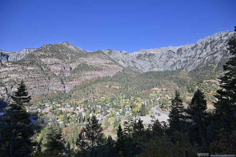 Ouray Surrounded by Mountains
Click here to display photos of the slideshow
Cascade Mountain beyond Town of Ouray

MountainsTo the north, soaring above the town of Ouray.

MountainsGood mixture of colors and shapes of rocks.

Ouray Surrounded by Mountains
A minor complaint, I felt the town of Ouray wasn’t remotely keen on paving roads. Most of the roads in town (apart from US550) were gravel.
After that, I left the town of Ouray heading further south. At an (unofficial) overlook shortly after leaving Ouray, I grabbed a few final photos of this lovely town, before it’s engulfed by shadows.
 Overlooking Town of Ouray
 Mountain Road out of Ouray
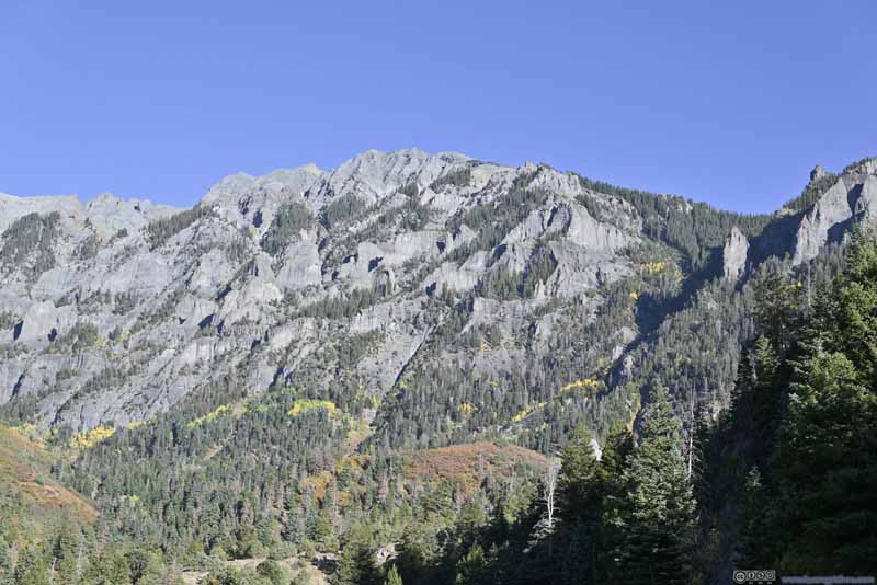 MountainsMany miniature peaks.
Click here to display photos of the slideshow
Overlooking Town of Ouray

Mountain Road out of Ouray
MountainsMany miniature peaks.
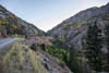
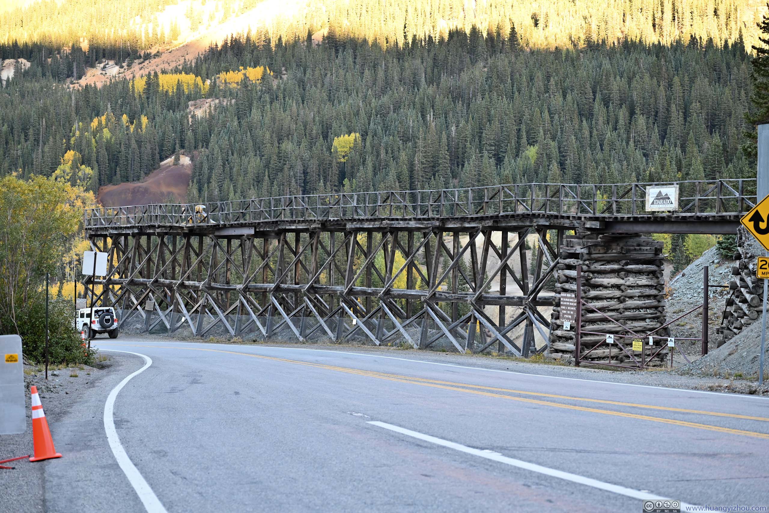
Million Dollar Highway
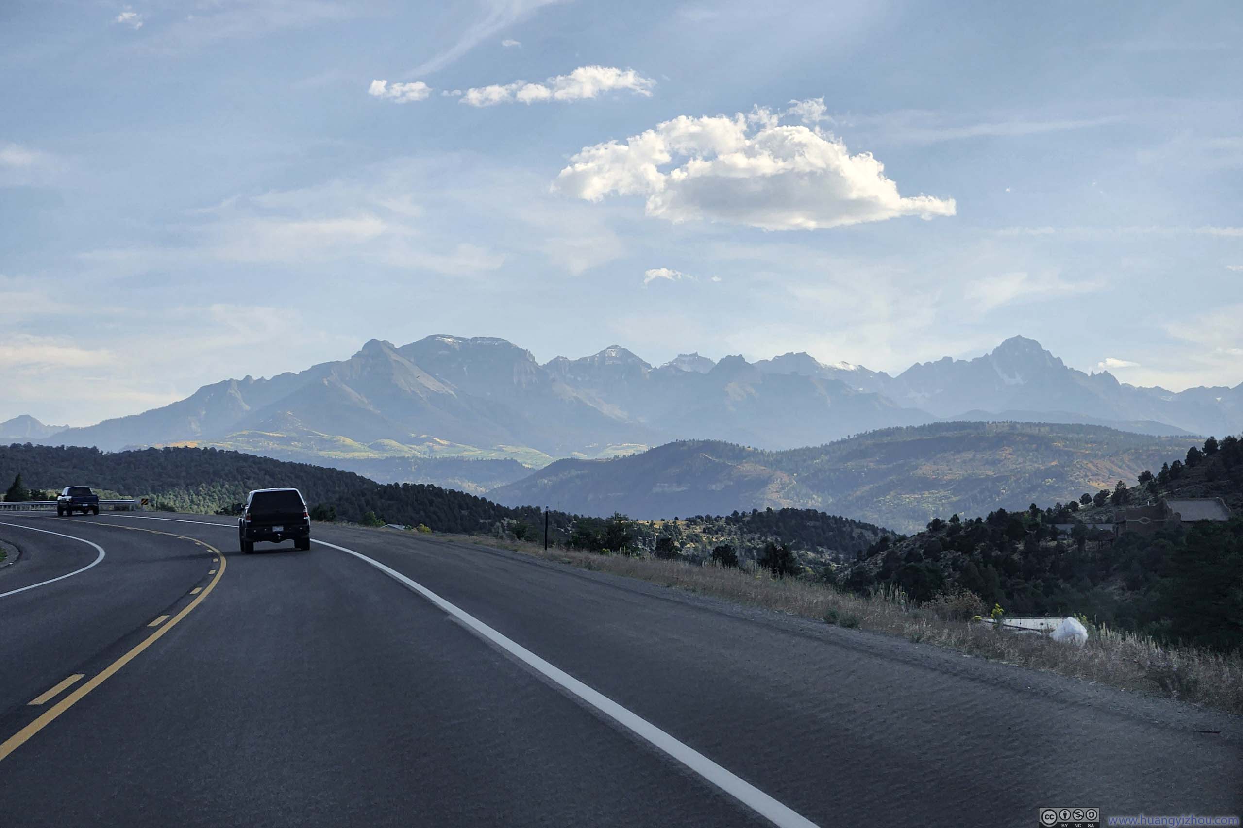
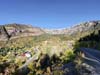
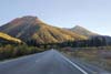
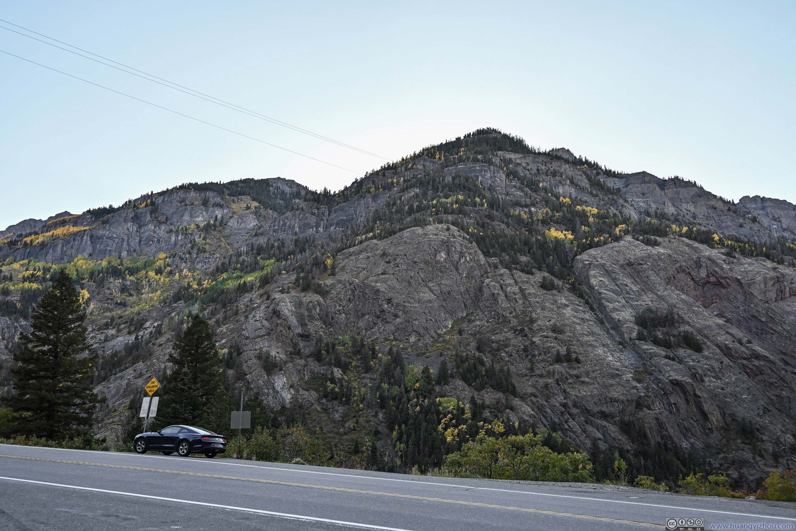
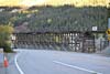
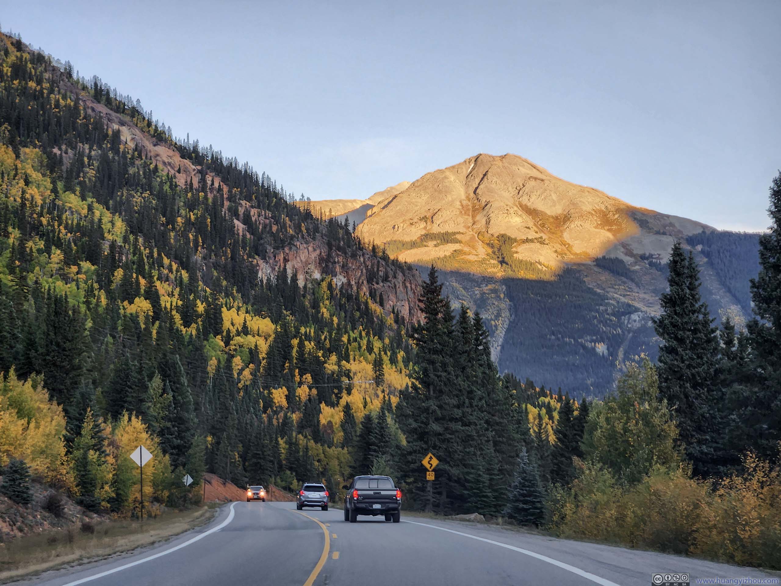
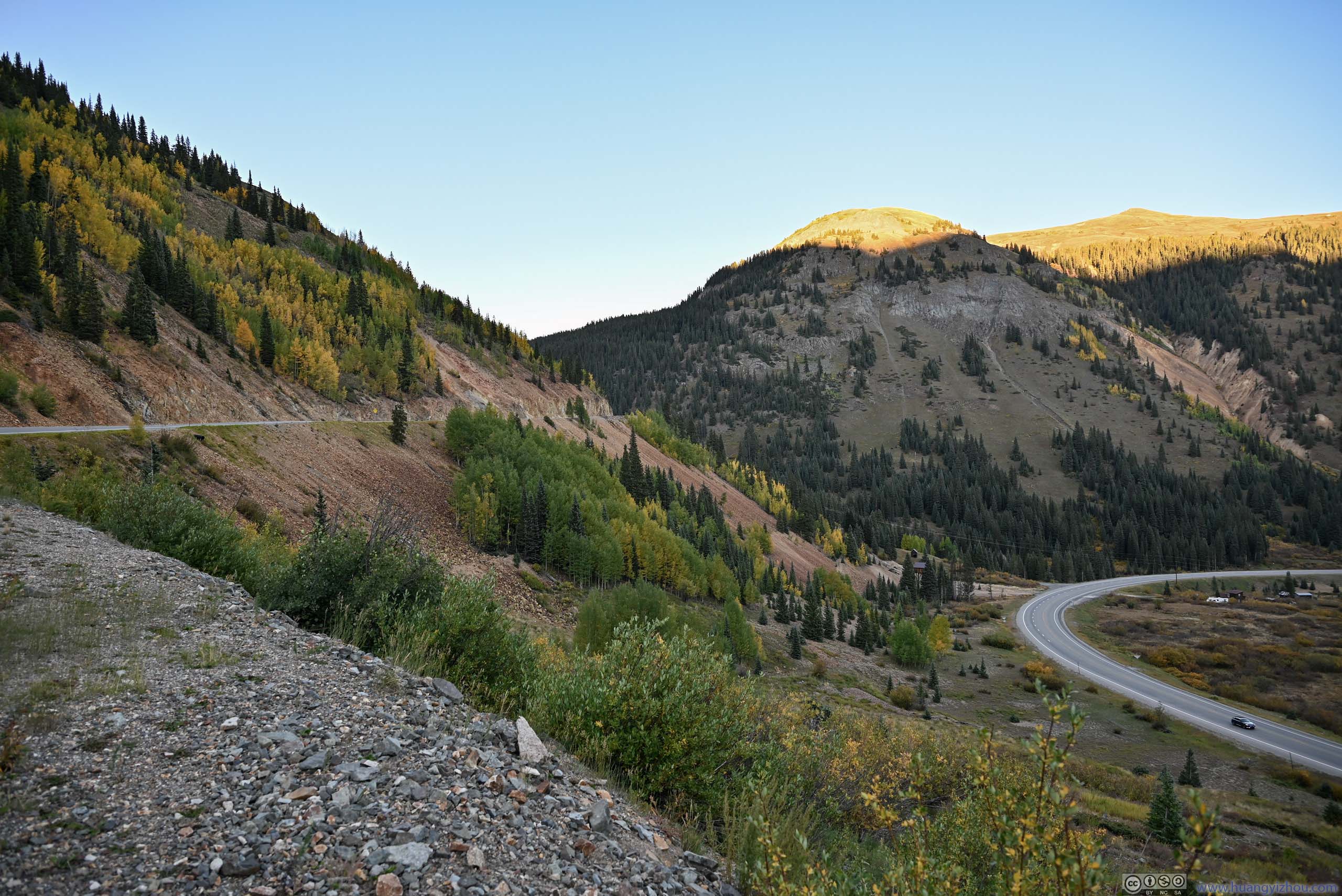
It’s Million Dollar Highway once I left Ouray. Between Ouray and Red Mountains / Crystal Lake, the road was constructed along a deep valley (Uncompahgre Gorge), with no guardrails (to aid snow removal). It could be a very long tumble if one drove off the road at certain places. I was heading southbound, the side of road closer to the cliff, but I didn’t feel the road was in any way dangerous. (It could help that I was travelling at the safest/driest time of the year for this road).
Below is a timelapse video from my windshield-mounted GoPro, recording my entire drive through Million Dollar Highway (starting outside Ridgeway CO).
- 0:00 Starting near Dallas, Colorado, heading south along US 550
- 0:25 Ridgeway, intersection with State Route 62. This was when the distant Uncompahgre mountains near Ouray came into view.
- 1:44 Downtown Ouray. I checked out Cascade Falls Park and Box Canyon Falls. The video resumes after leaving Box Canyon Falls.
- 2:47 Overlook for Bear Creek Falls. Right before and after this point is the diciest sections of the Million Dollar Highway, with steep cliffs on one side of the road. (In summer I think the road presents no danger.)
- 3:19 Crossing over Uncompahgre River. Grabbed a few photos here.
- 4:18 Crystal Lake / Full Moon Dam. A completely different scene after ascending out of the previous valley. I joined the crowds to appreciate the early autumn foliage, against the backdrop of magnificent Red Mountains ahead.
- 5:39 Red Mountain Overlook, near some mining relics. Not the best views from here.
- 6:15 Red Mountain Pass. First of the three mountain passes from Ridgeway to Durango.
- The video ends after I entered Silverton.
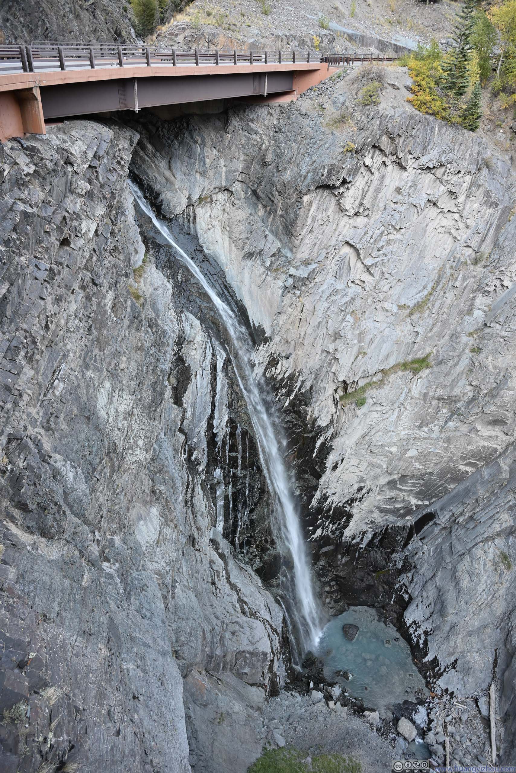
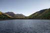
Bear Creek Falls Overlook
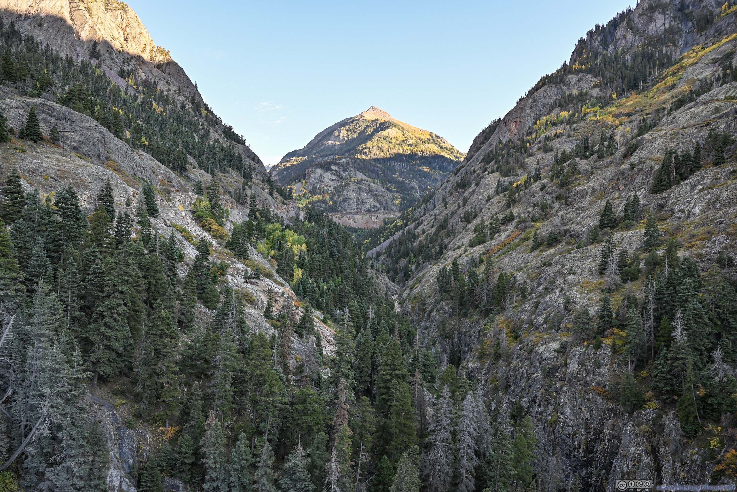
This was a major overlook along the way, with views of a waterfall and the lovely cyan color of pond at its foot. In comparison, Lower Cascade Falls was such a disappointment earlier today. It also offered views of a deep valley to the south, with Abrams Mountain at its end. It’s like a gate keeper, maintaining order of these sovereign mountains.
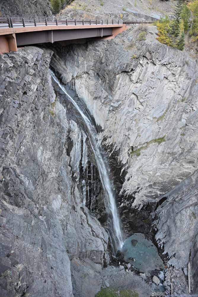 Bear Creek Falls
 Abrams Mountain
 Valley and Abrams Mountain
 Hills
Hills
Click here to display photos from Bear Creek Falls overlook.
Bear Creek Falls
Abrams Mountain
Valley and Abrams Mountain
Hills
And below is a collection of photos along the road.
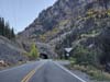
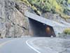
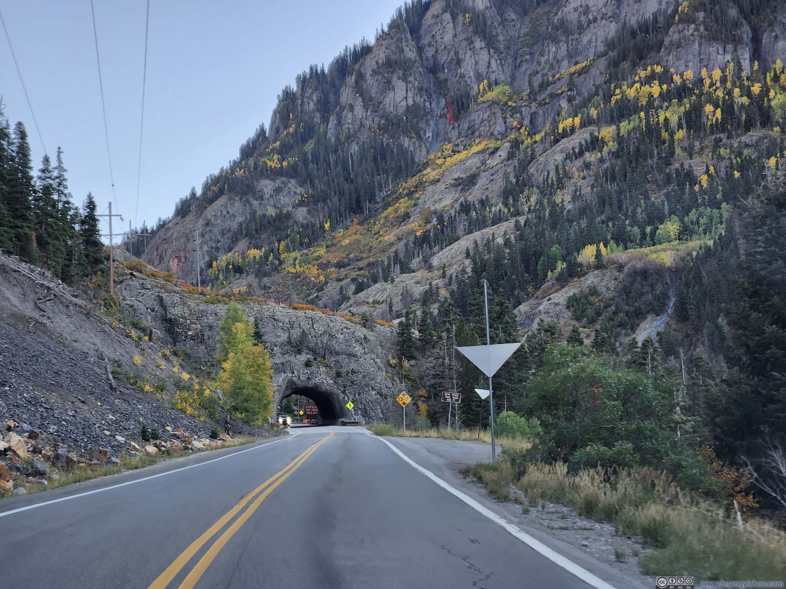
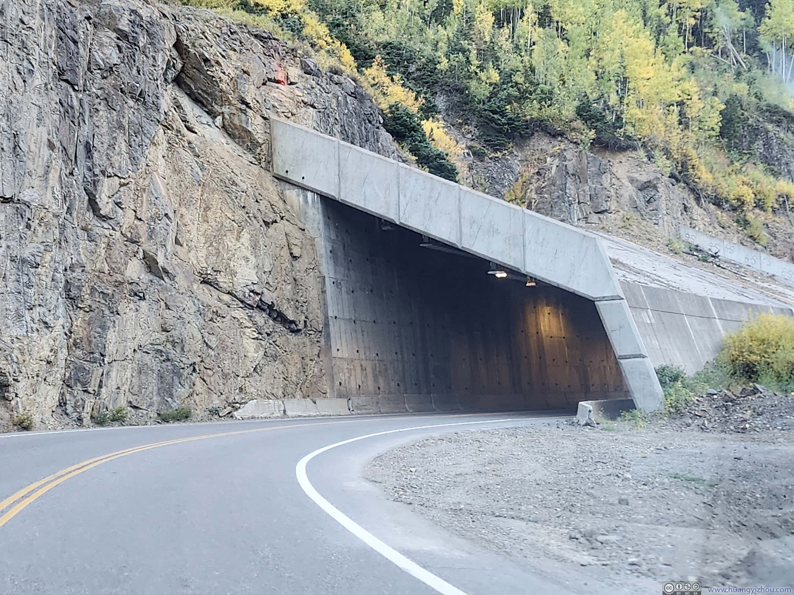
 Tunnel
 Million Dollar Highway beneath Abrams Mountain
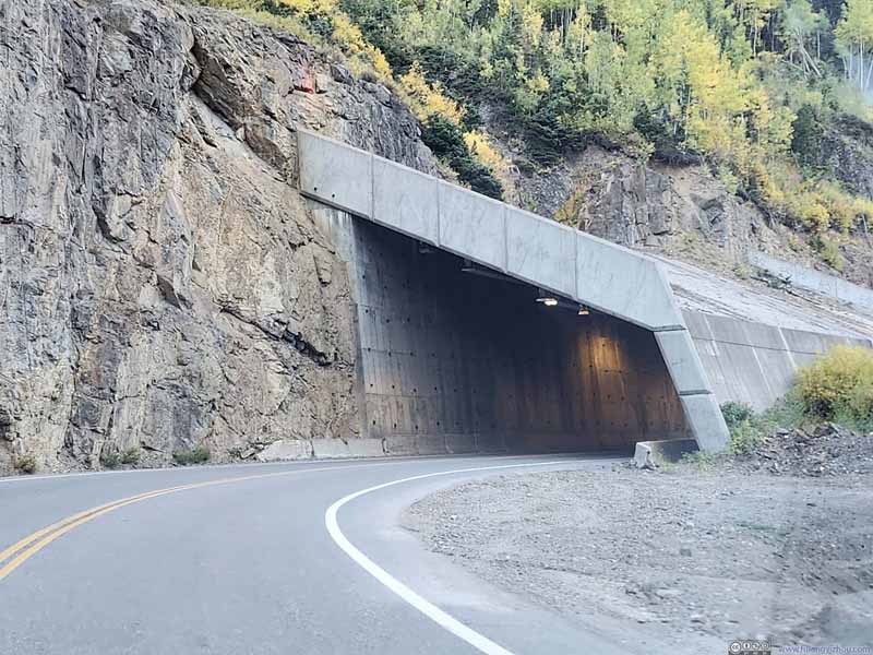 Snow Shed
 Red Mountains
 Red Mountains from Road

Click here to display photos along Million Dollar Highway.
Tunnel
Million Dollar Highway beneath Abrams Mountain
Snow Shed

Red Mountains

Red Mountains from Road
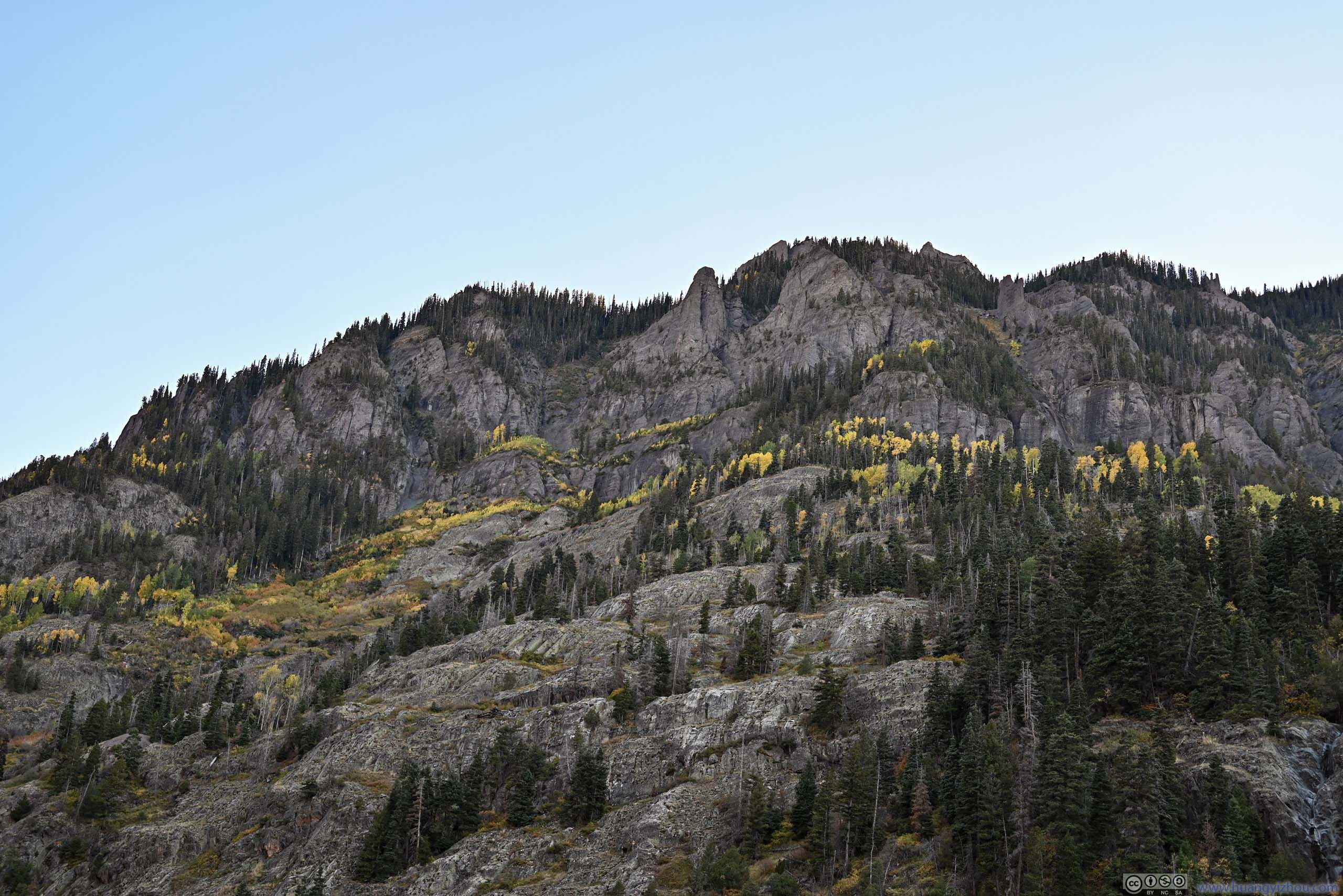
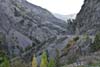
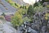
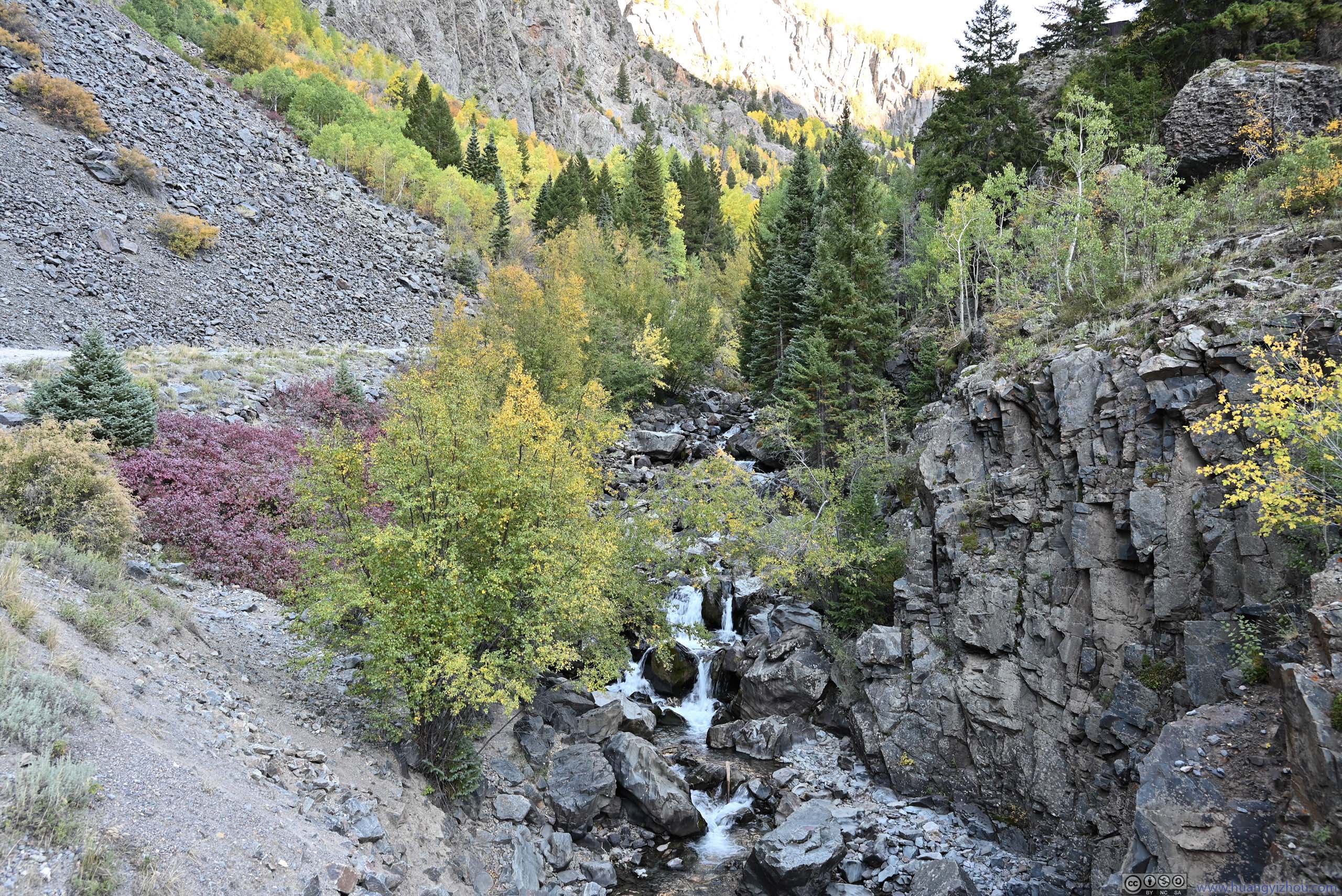
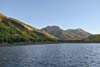
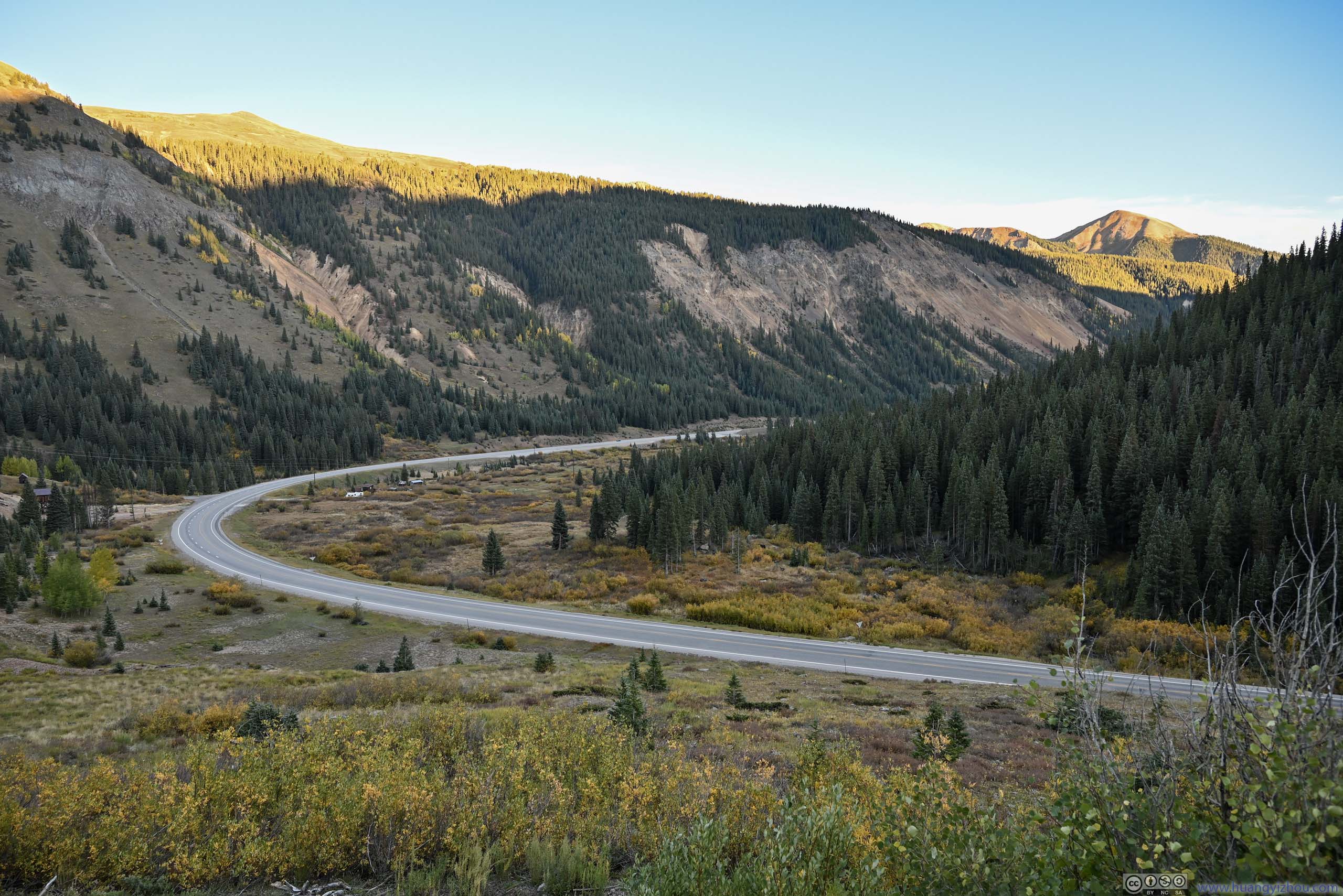
Further south, I found another (unofficial) overlook, where the road crossed Uncompahgre Creek. This was at the foot of Abrams Mountain, with a spectacular blend of colors in the surrounding valley (p1-2 below).
 Valley with Foliage
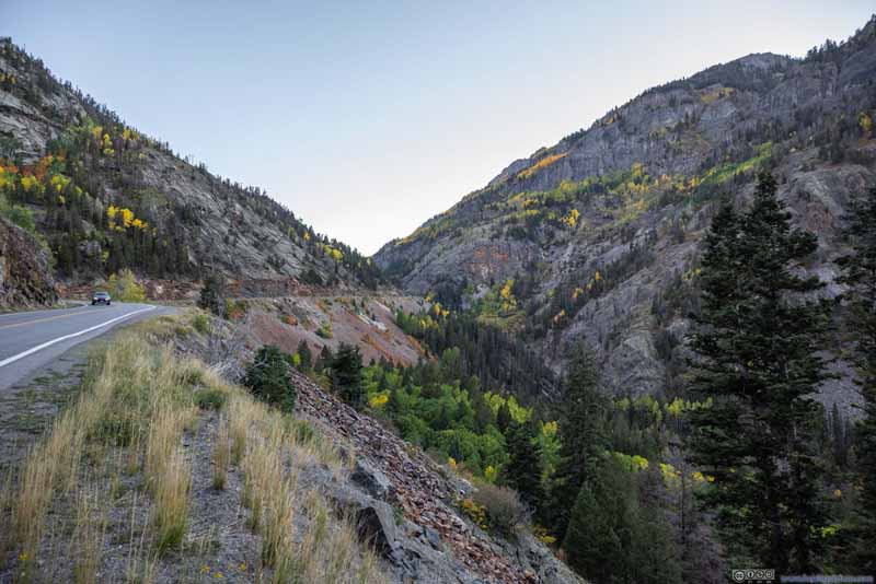 Valley
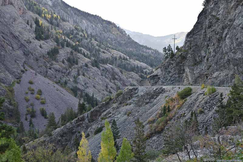 Million Dollar HighwayLooking back towards the northwest.
 Mountains
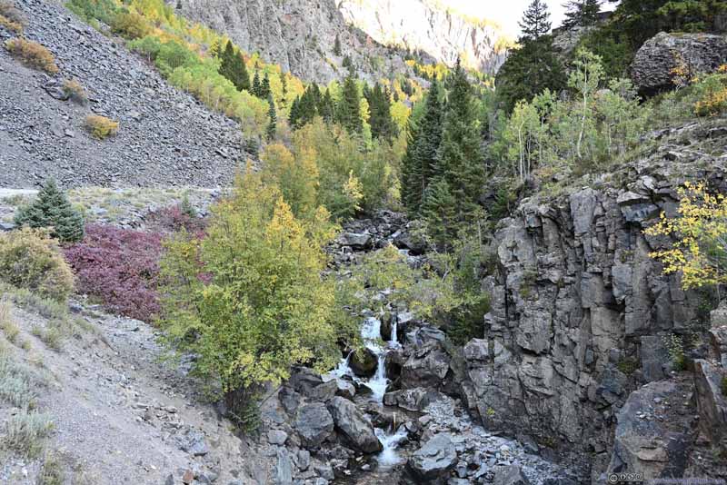 Uncompahgre RiverFelt more like a creek when it crossed Million Dollar Highway here.
Click here to display photos of the slideshow

Valley with Foliage

Valley

Million Dollar HighwayLooking back towards the northwest.
Mountains
Uncompahgre RiverFelt more like a creek when it crossed Million Dollar Highway here.
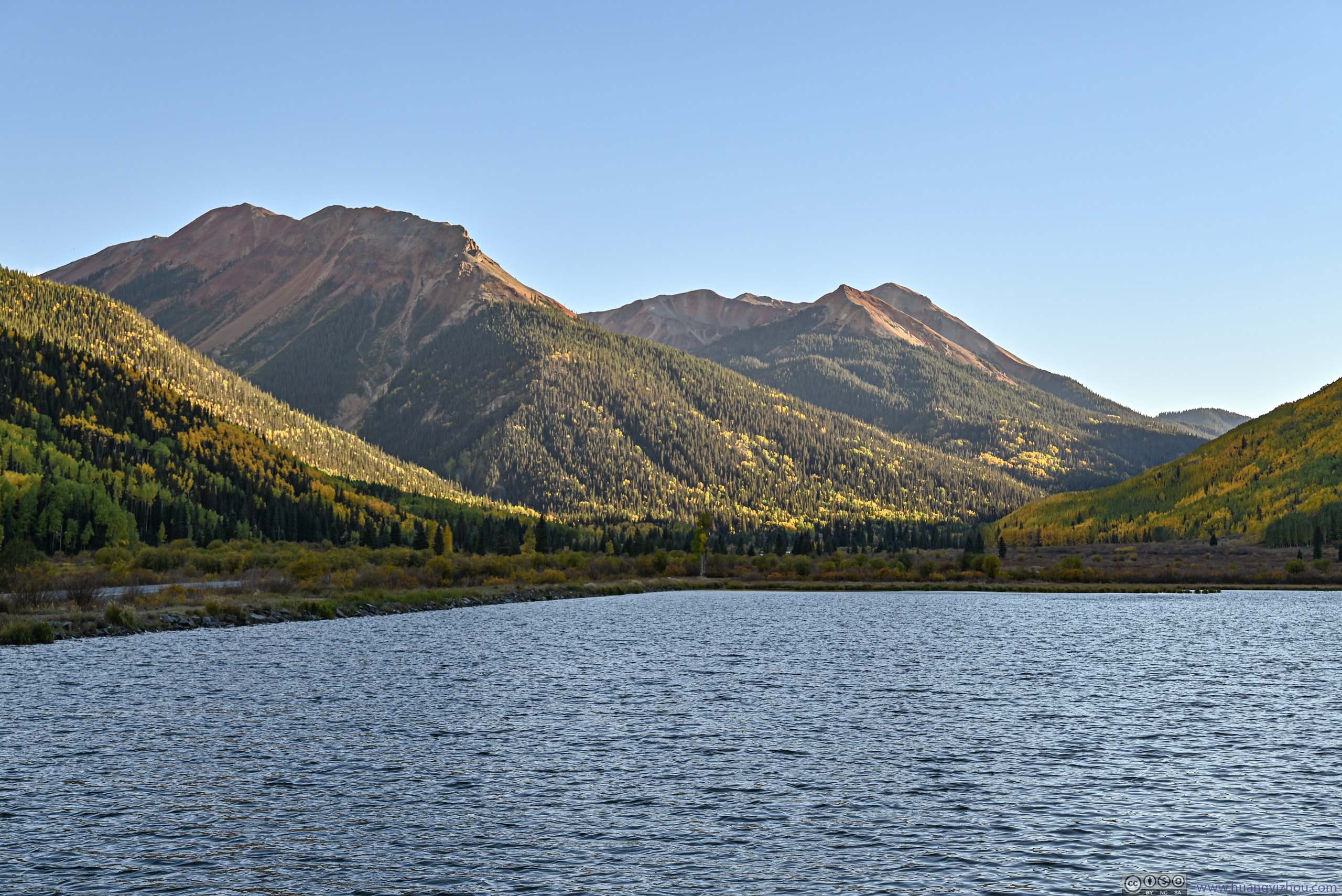
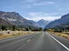
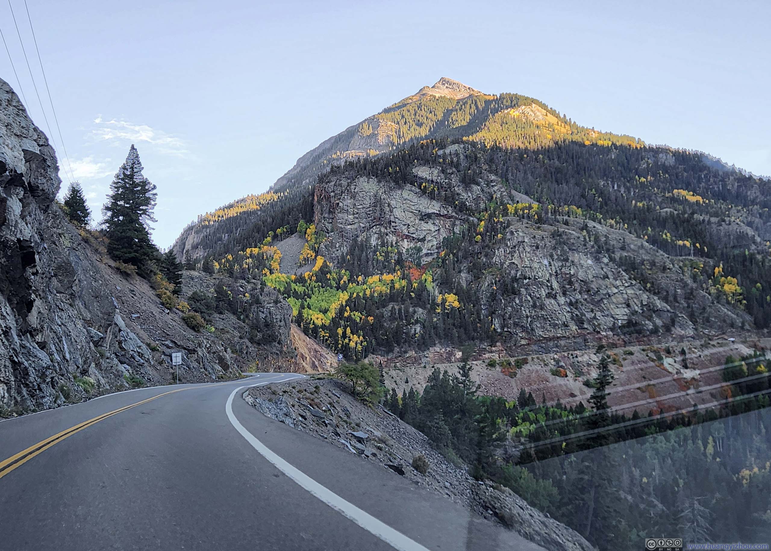
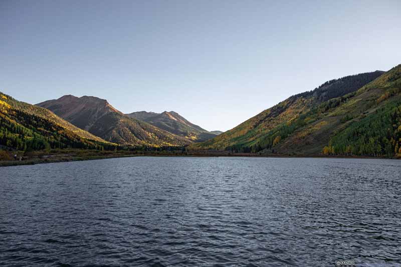
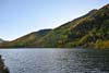
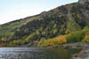
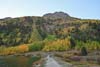
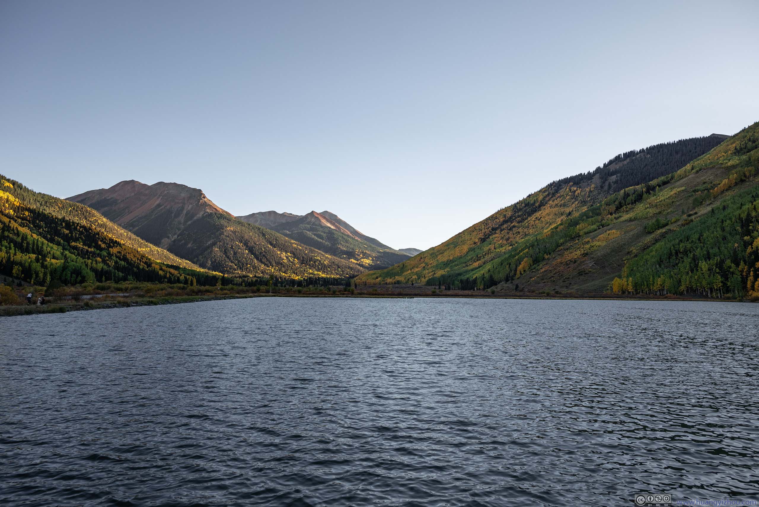
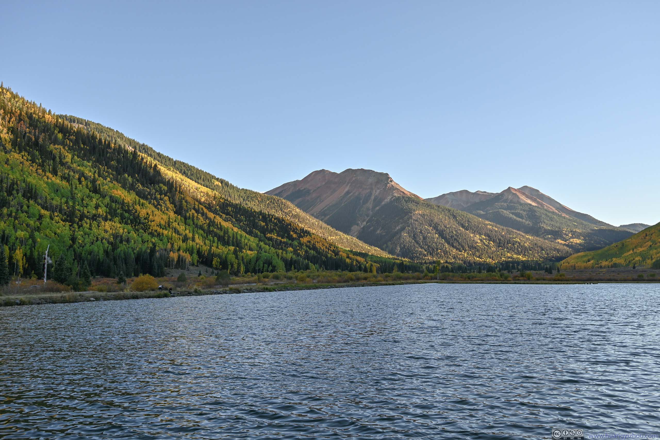
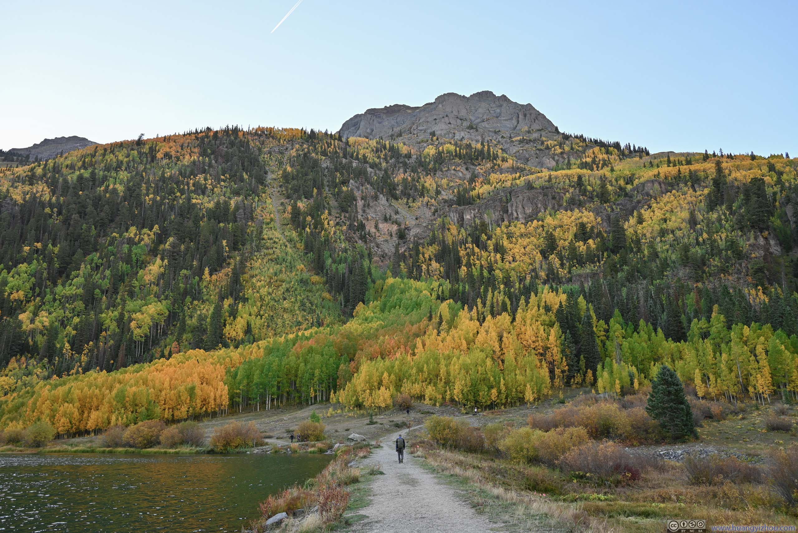
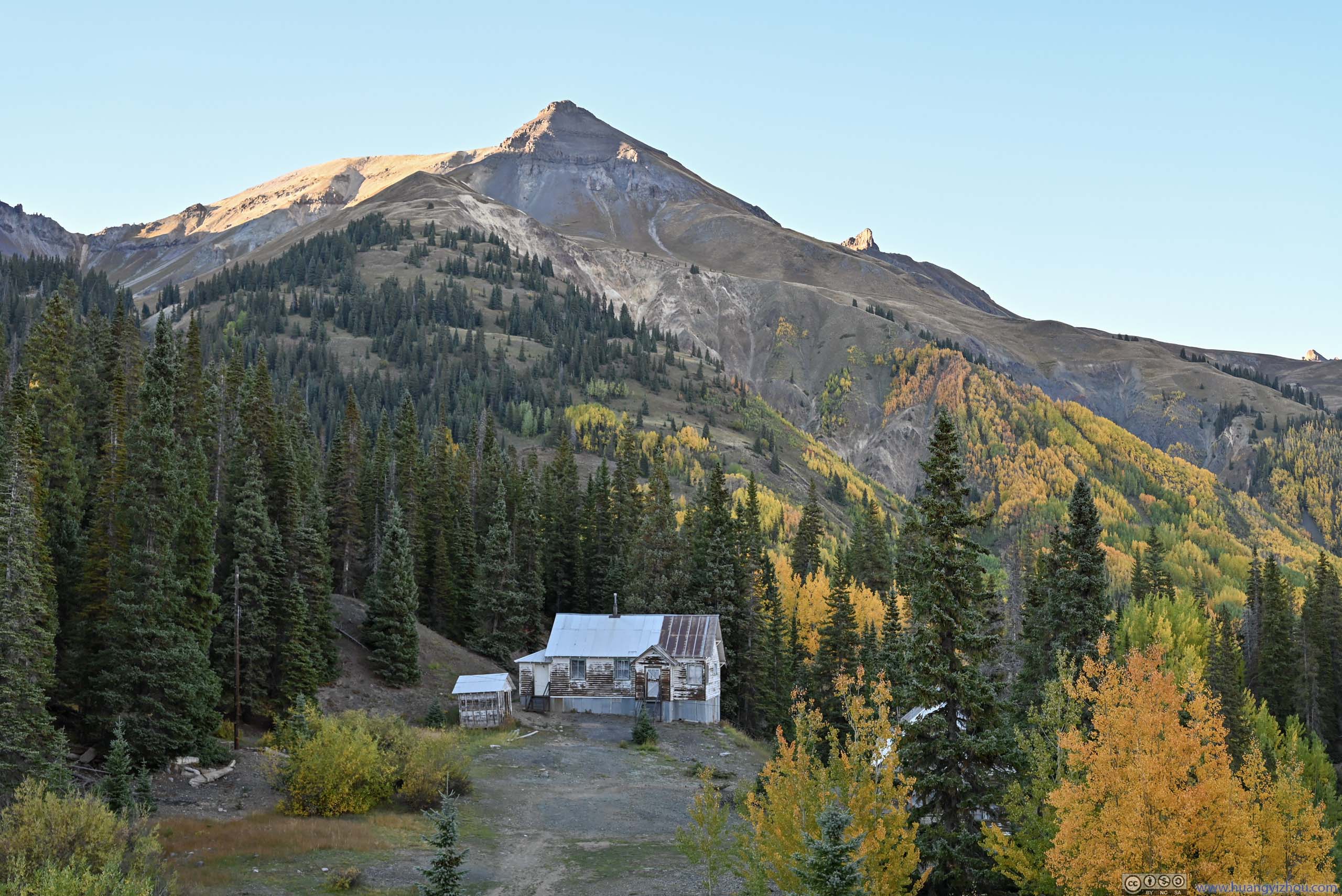
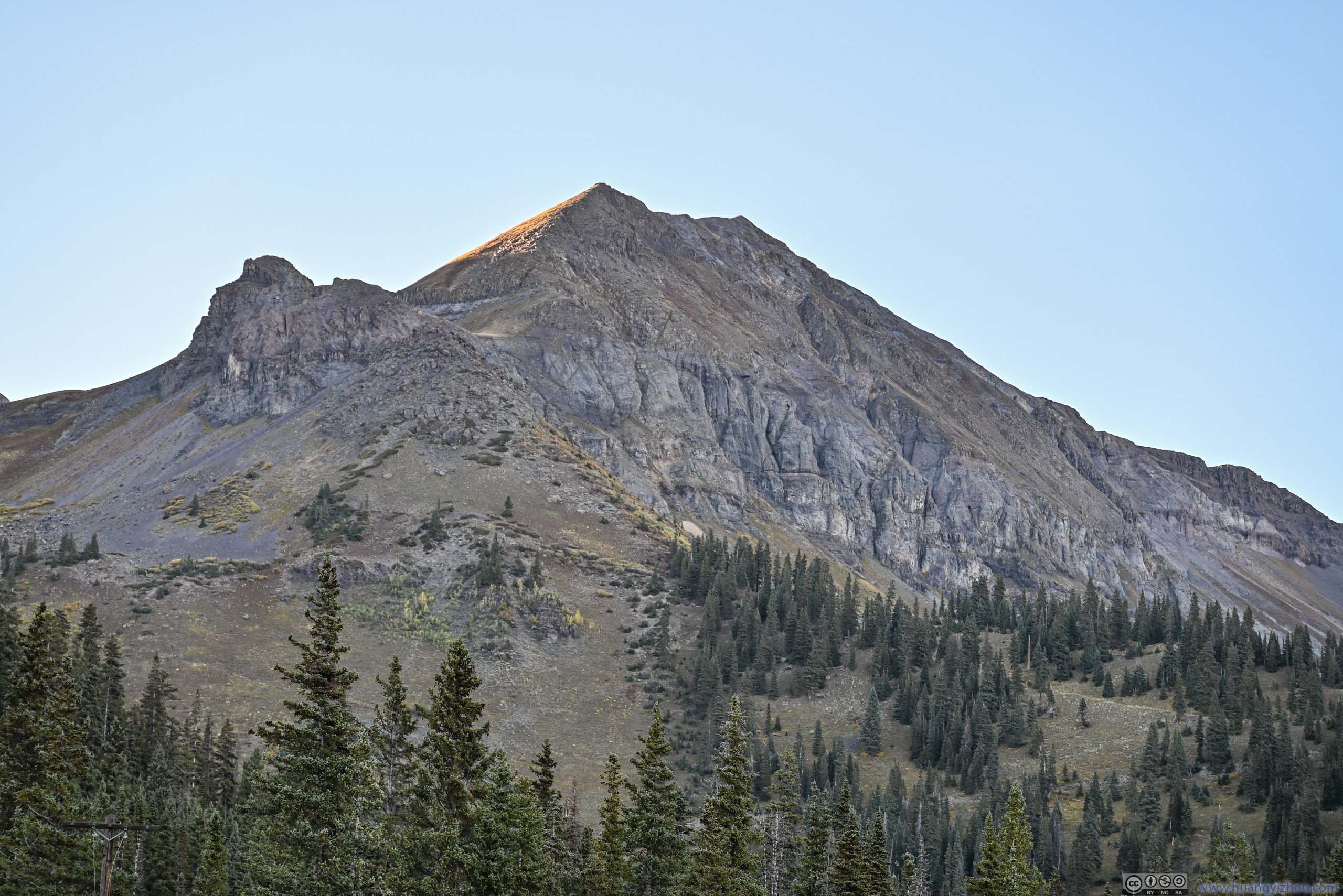
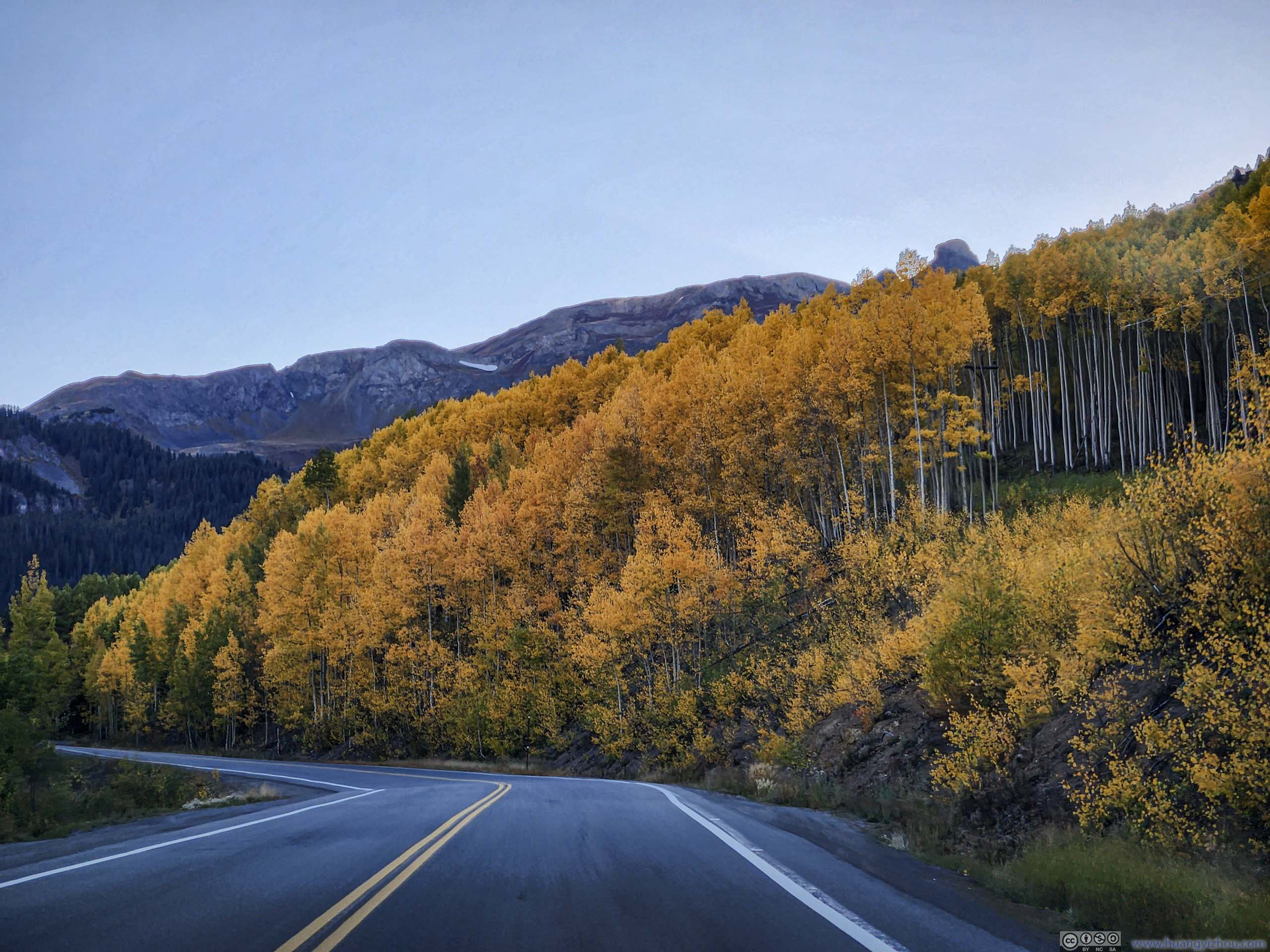
Crystal Lake
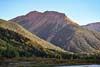
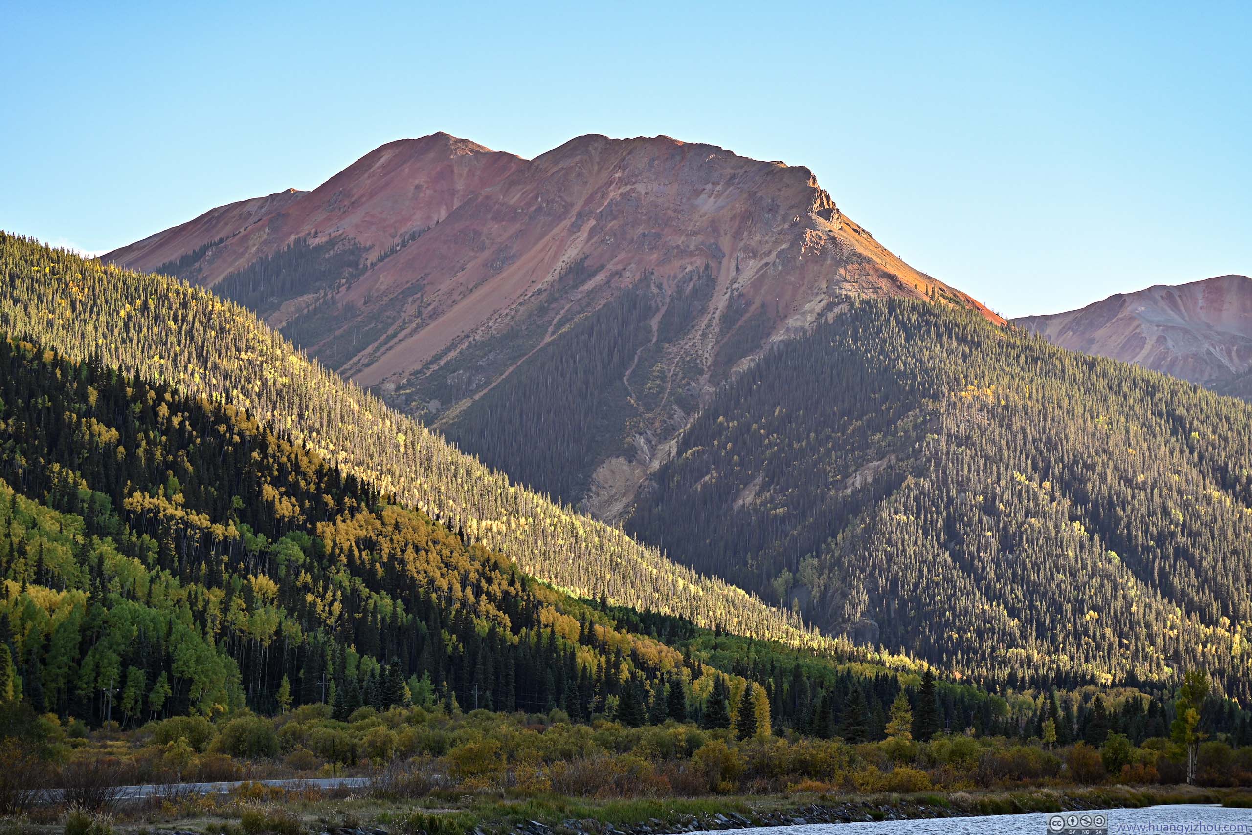
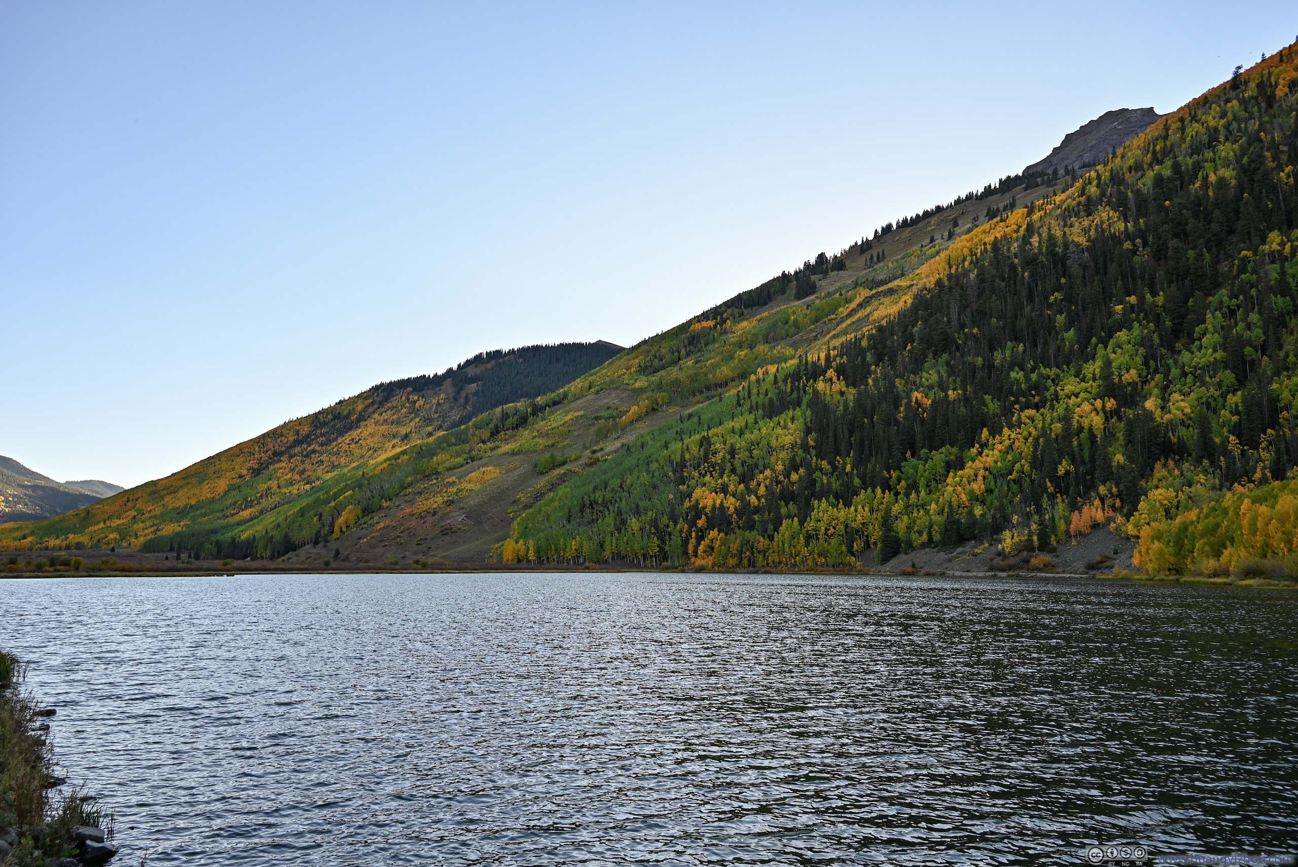
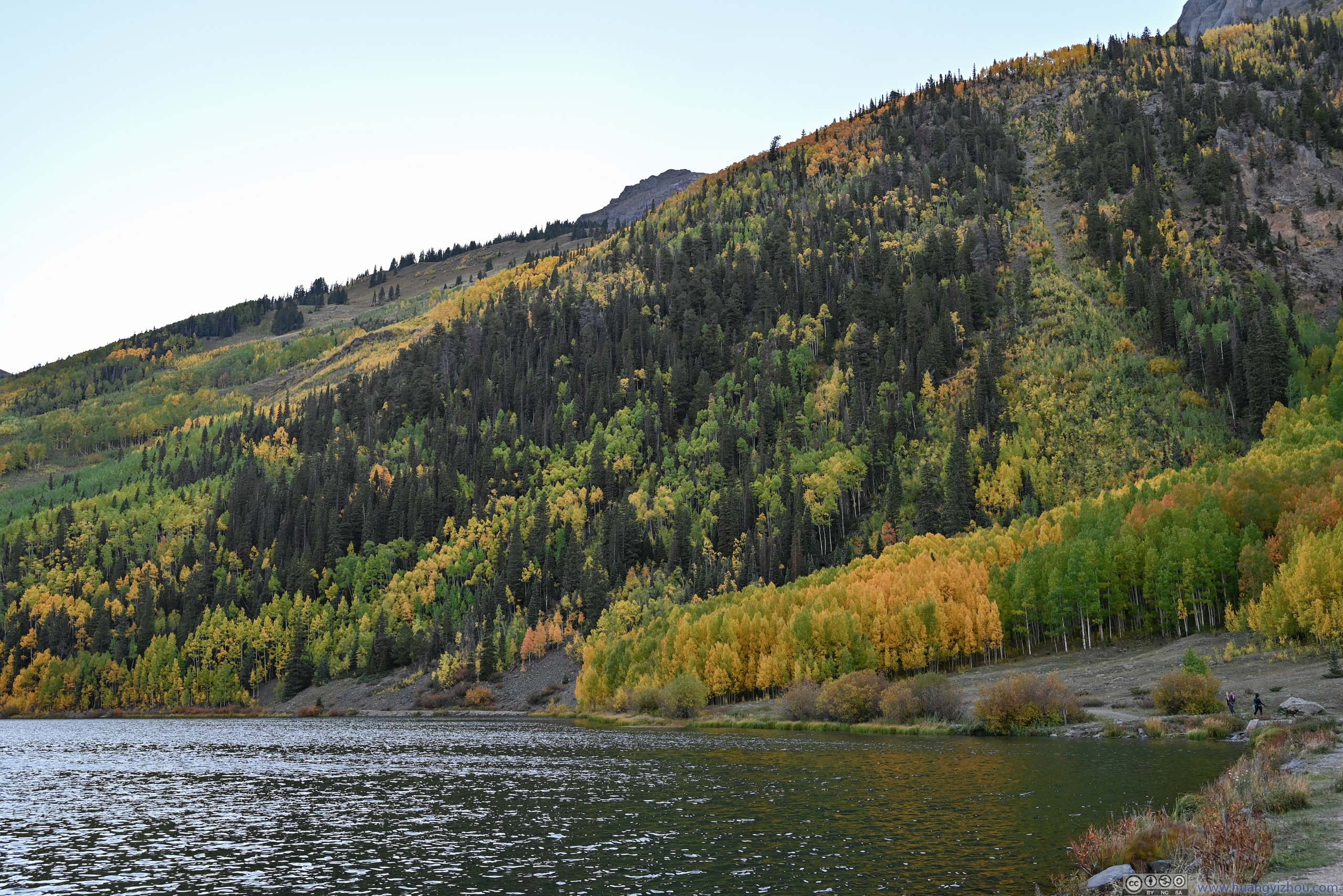
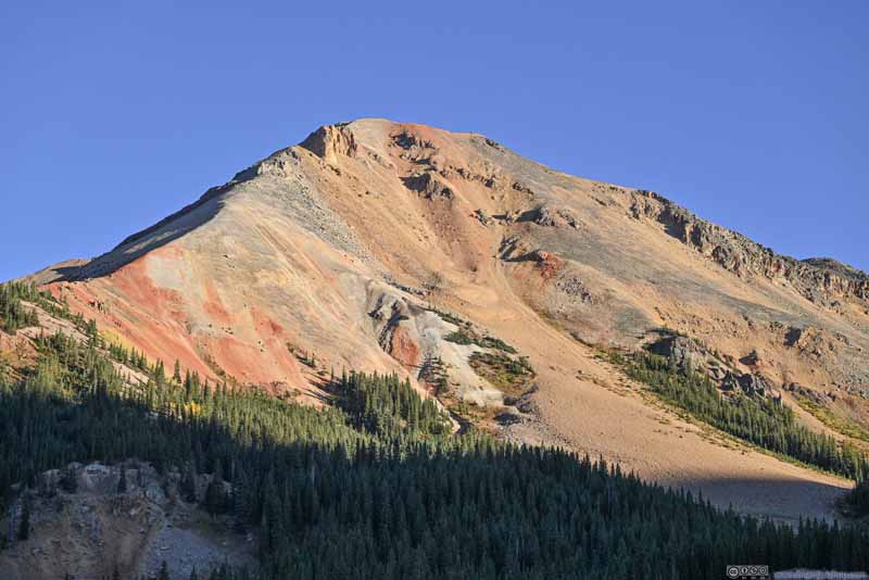
After a series of switchbacks, the valley opened up, and a few distinctively colored mountains popped into view. It turned out that they were plainly named “Red Mountains”, the color red resulting from oxidation of iron. Along the road was an open body of water called “Crystal Lake”, with great foliage on the mountains that flanked the lake. Combined with the red mountains in the distance, this was arguably the best view of foliage throughout this trip.
 Red Mountains from Crystal Lake
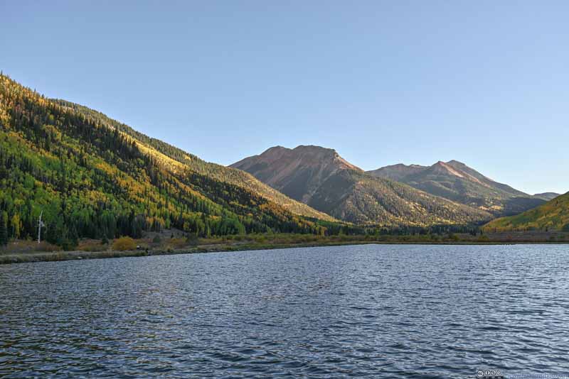 Red Mountains from Crystal Lake
 Red Mountain 1
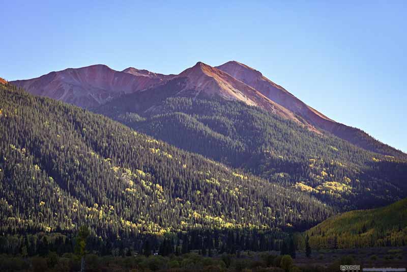 Red Mountains 2 and 3
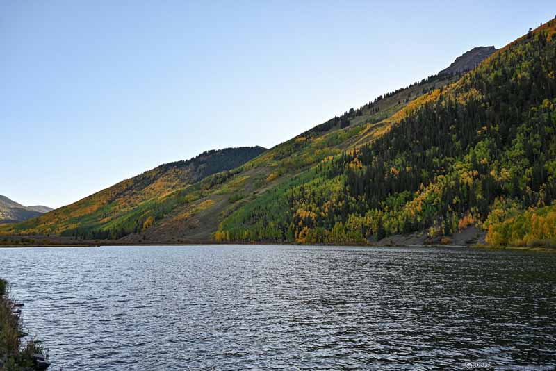 Foliage along Crystal Lake
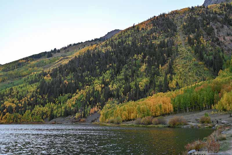 Foliage along Crystal Lake
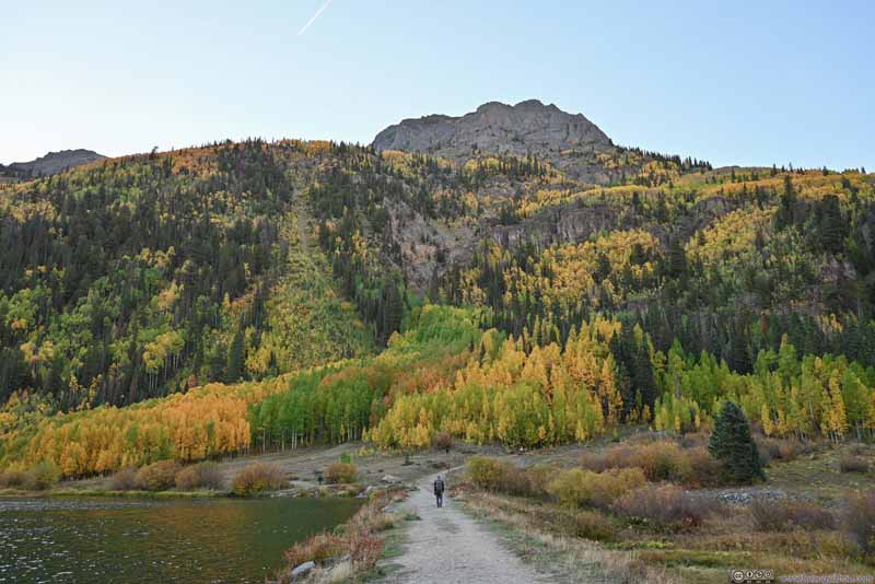 Foliage along Crystal Lake
Click here to display photos from Crystal Lake.
Red Mountains from Crystal Lake
Red Mountains from Crystal Lake
Red Mountain 1

Red Mountains 2 and 3
Foliage along Crystal Lake
Foliage along Crystal Lake
Foliage along Crystal Lake
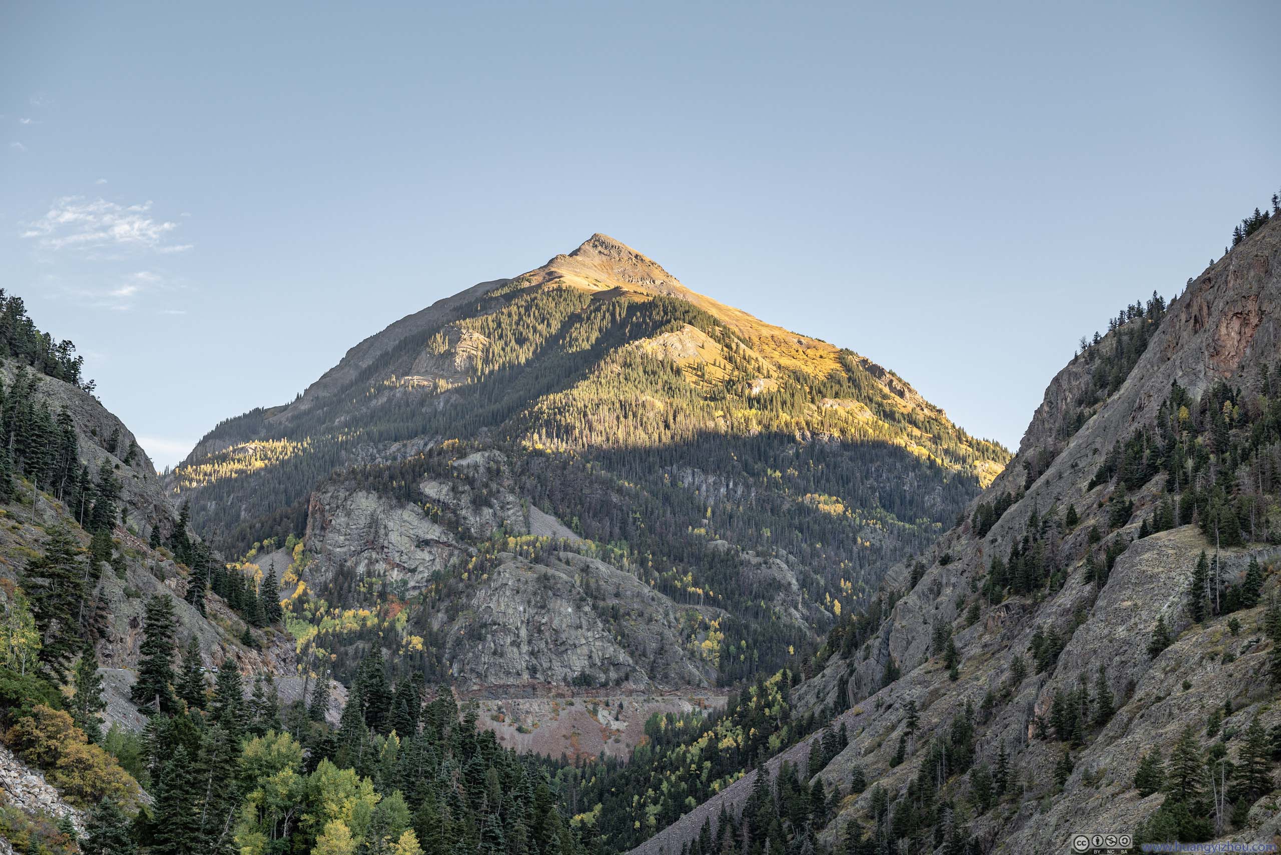
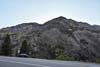
Red Mountain Overlook
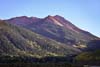
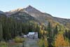
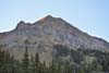
Continuing on, the road entered another series of switchbacks before Red Mountain Pass. Next to one of the switchbacks was “Red Mountain Overlook”. This was the closest established overlook of the Red Mountains, unfortunately, the views were somewhat obstructed by trees. The valley nearby was the home of many mining sites for various metals, some mining relics were visible not far from the road.
 Red Mountain 3
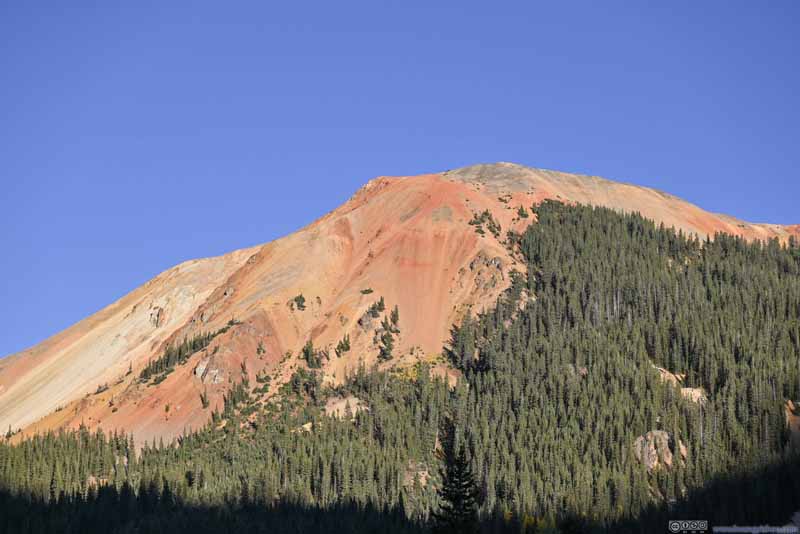 Red Mountain 2
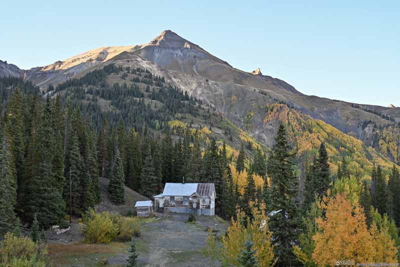 Mountain
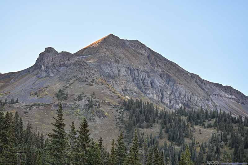 Mountain
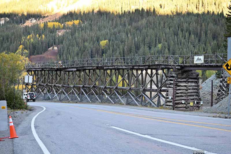 Mining Relics
Click here to display photos of the slideshow

Red Mountain 3

Red Mountain 2
Mountain
Mountain
Mining Relics
Then I continued towards Silverton.
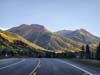
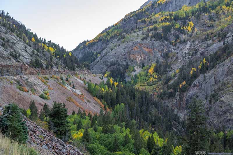
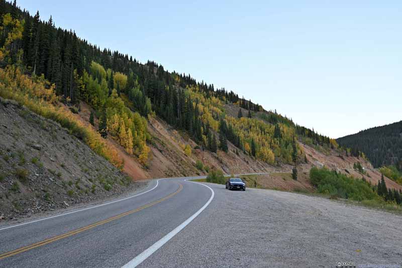
As a brief conclusion, I felt the most scenic part of Million Dollar Highway was between Ouray (Bear Creek Falls) and Red Mountain Pass. It started out as a winding road in a deep valley, showcasing the masculine heart of mountainous Colorado. After it overcame the series of switchbacks and with Red Mountains popping into view, it’s a sight that would astonish the most sophisticated critics. The road continued to be lined with intense foliage. It’s just that after Red Mountain Pass, more of the landscape was occupied by pine trees, that were best paired with snow.
 Foliage along Million Dollar Highway
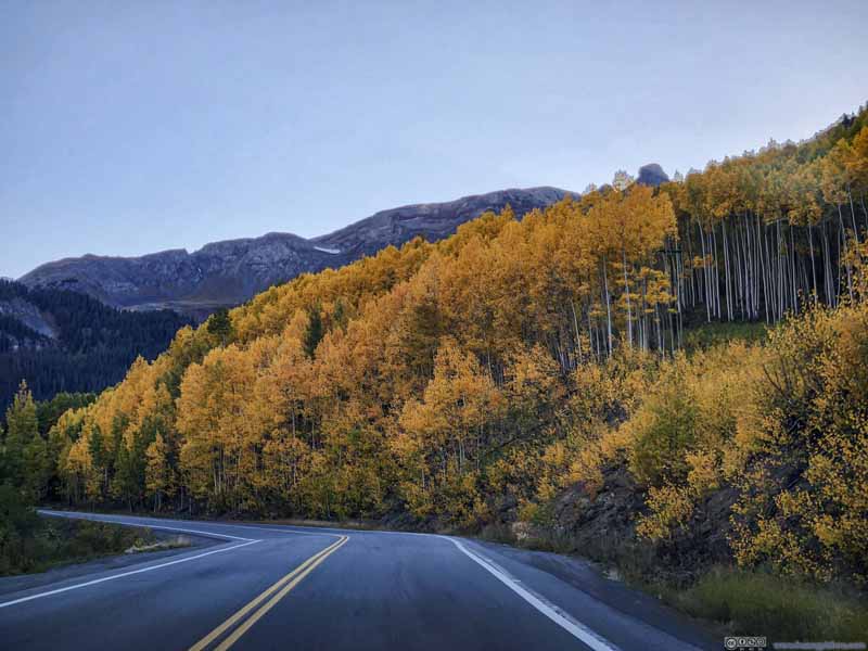 Foliage along Million Dollar Highway
 Kendell Mountain from Million Dollar Highway
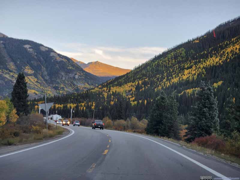 Road into Silverton


Click here to display photos along Million Dollar Highway.

Foliage along Million Dollar Highway
Foliage along Million Dollar Highway
Kendell Mountain from Million Dollar Highway

Road into Silverton
 Million Dollar Highway
 Million Dollar Highway
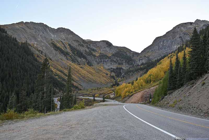 Valley
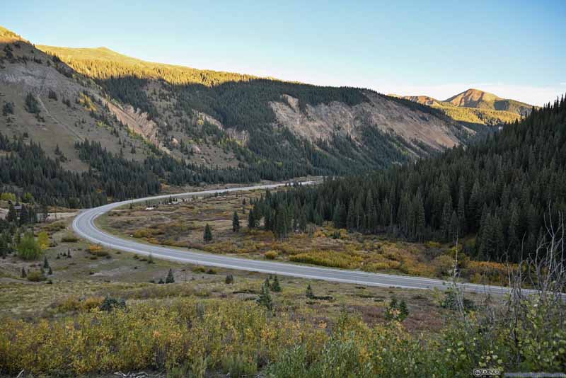 Million Dollar Highway


Click here to display photos of the slideshow

Million Dollar Highway
Million Dollar Highway

Valley
Million Dollar Highway
In the end, I made it to Silverton just before sunset, and called it a day.
END
![]() Day 10 of Autumn 2023 Trip to Mountain States, Gunnison Route and Million Dollar Highway to Silverton by Huang's Site is licensed under a Creative Commons Attribution-NonCommercial-ShareAlike 4.0 International License.
Day 10 of Autumn 2023 Trip to Mountain States, Gunnison Route and Million Dollar Highway to Silverton by Huang's Site is licensed under a Creative Commons Attribution-NonCommercial-ShareAlike 4.0 International License.