
Updated on April 23, 2022
Hiking Loudoun Heights Trail from Harpers Ferry
A nice winter day when a thin sheet of snow blanketed the earth. I headed off to the historic town of Harpers Ferry for some hiking and exploration.
Split Rock Overlooking Harpers Ferry
Usually, I consider hiking in winter, among lifeless tree branches, dull. In comparison, summer leaves were a much better sight to behold. Snow was the only thing that could rival all signs of summer lives, aesthetically.
So after some snow fell over the mid-Atlantic region, I decided to head outside and explore nature. Harpers Ferry wasn’t too far from Washington DC that I lived, it’s a small town rich in history and natural scenery, and I made it my destination today.
Harpers Ferry
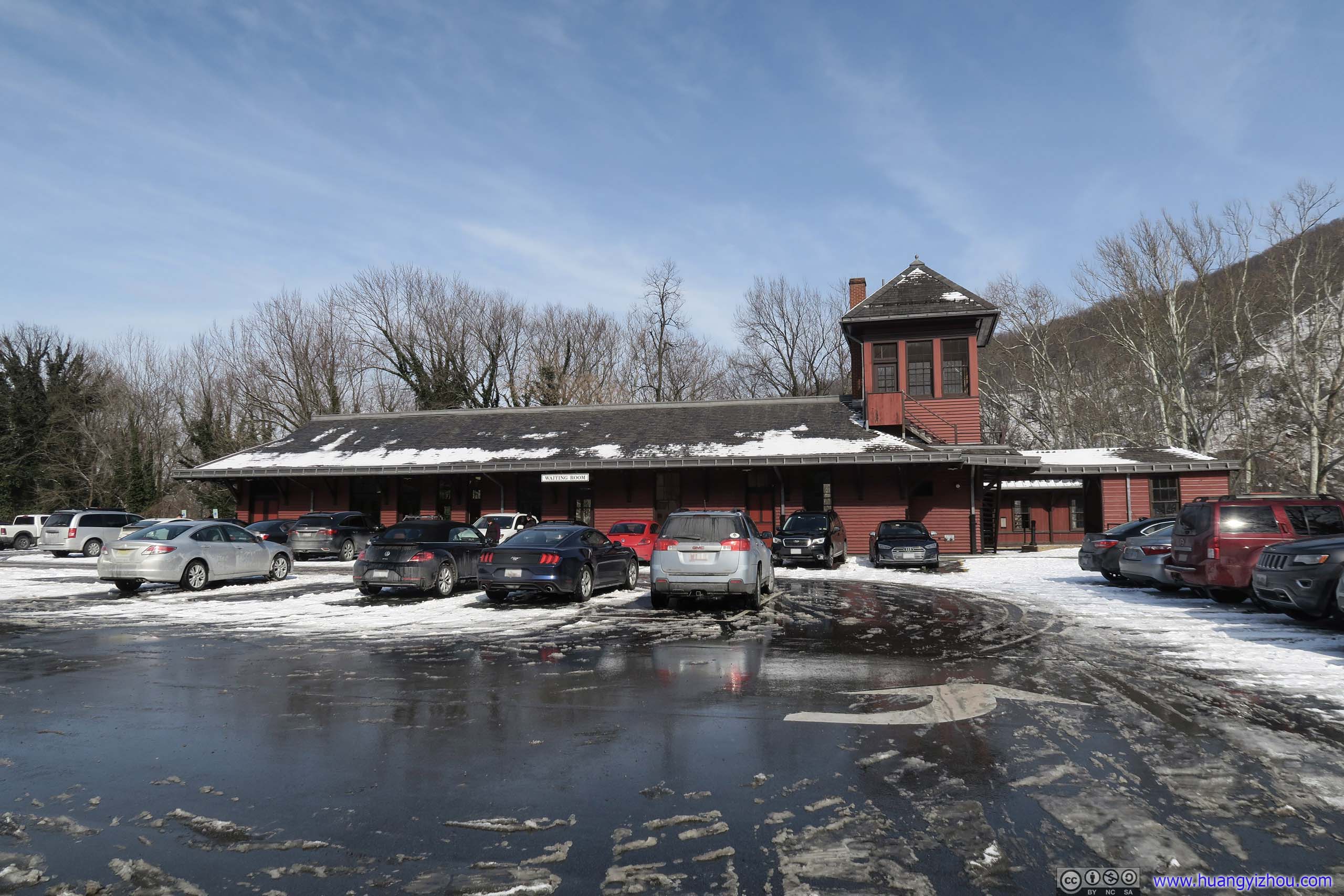
I parked my car at Harpers Ferry Train Station, where one of the few parking lots in town was located. It seemed to me that one technically needs to pay NPS (or have a pass) to park at the train station.
Situated in a gap of the Blue Ridge Mountain and at the confluence of the Shenandoah and Potomac Rivers, Harpers Ferry was a town of important geological location.
A primitive ferry was established in 1733 by peter Stephens, who later sold the business to Robert Harper in 1747, and thus the town got its name.
Train Station
The town witnessed the great transportation race connecting Ohio valley to the East coast, between Baltimore and Ohio (B&O) Railroad and Chesapeake and Ohio (C&O) Canal in particular. Coincidentally, construction of both the railroad and the canal started on the same day of July 4, 1828. The canal ran parallel to Potomac River in its entirety from Washington DC to Cumberland, and its construction managed to reach Harpers Ferry first, and thus somehow secured the right of way along the river farther West. The railroad failed in the race to reach Harpers Ferry, and to avoid mountainous terrain in Western Maryland, crossed Potomac River into (West) Virginia. Ultimately, technology prevailed and the railroad reached Cumberland 8 years before the canal. The railroad also brought prosperity to Harpers Ferry as a gateway to Ohio Valley.
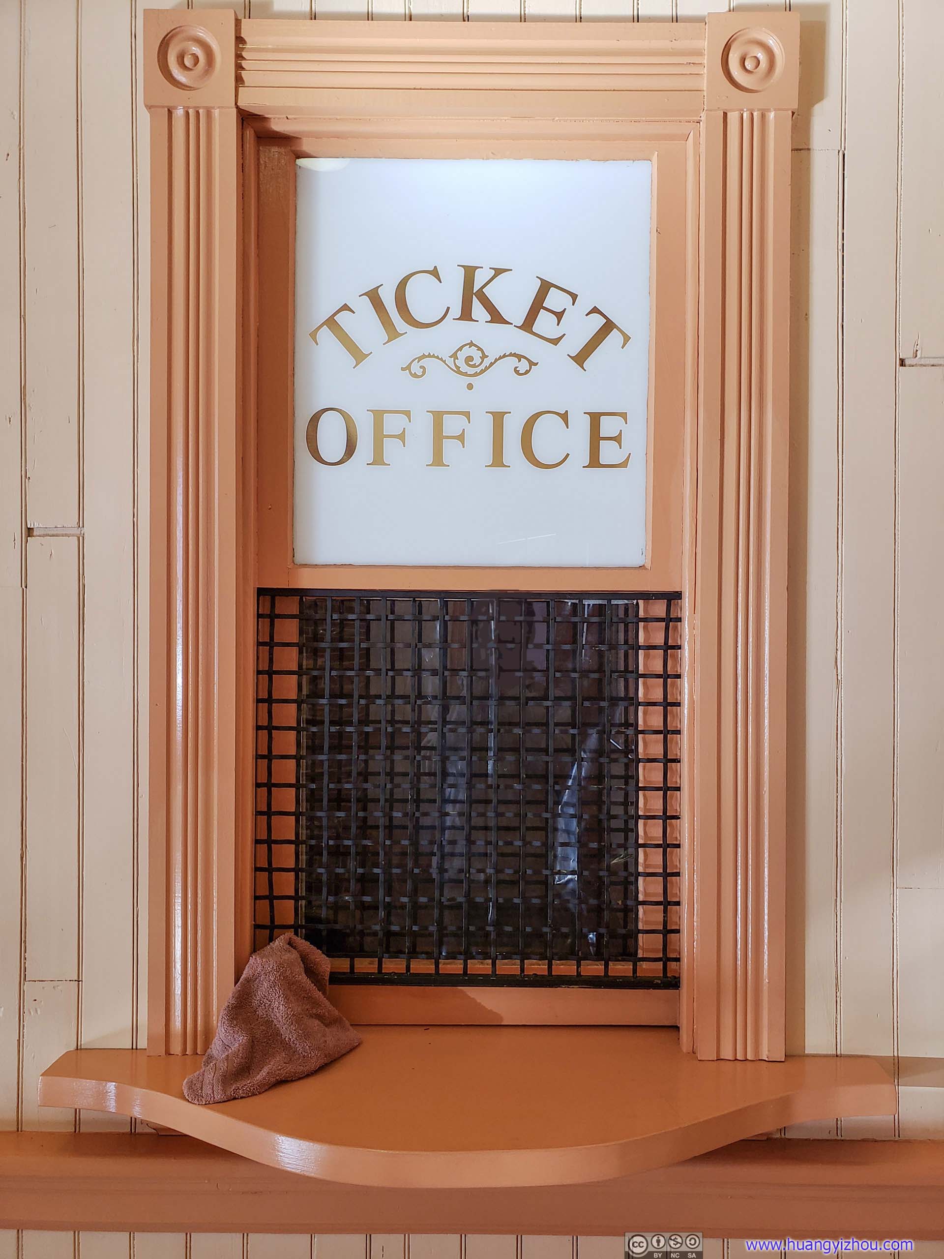
Antique Ticket Office WindowAttesting the railroad’s rich history as the nation’s first railroad carrier open for public service.
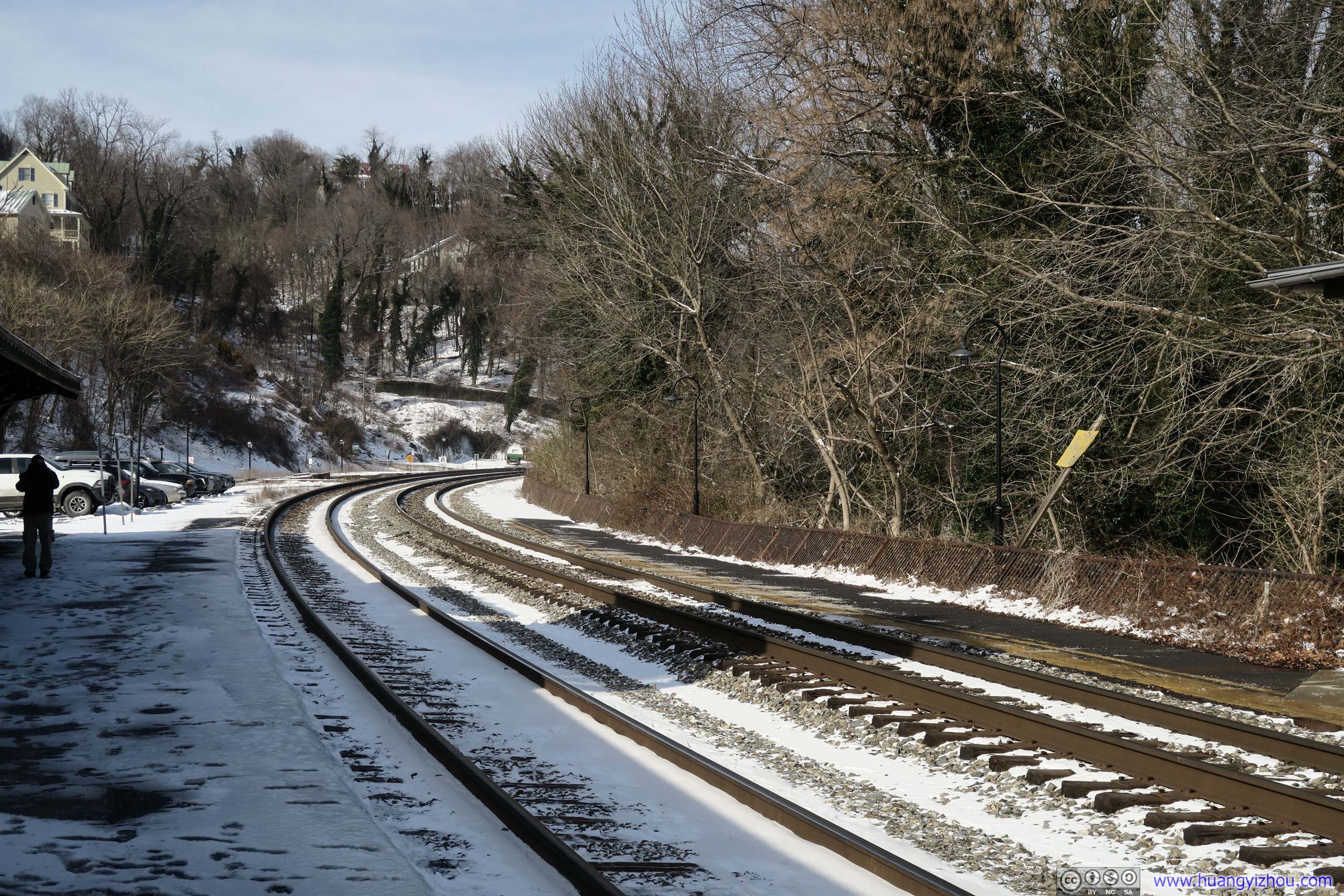 Railway
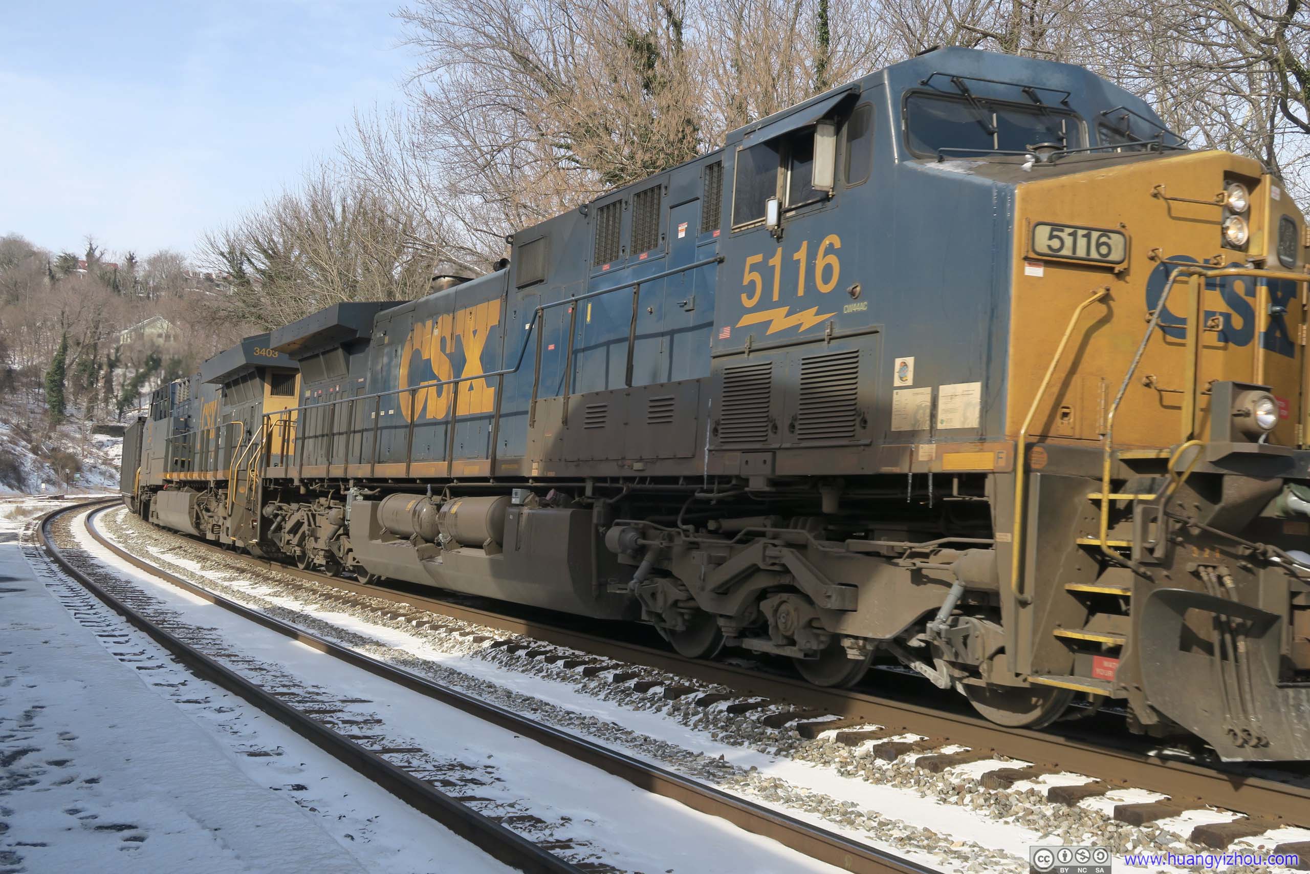
 Freight Train Passing ByAfter many merges, B&O Railroad was part of CSX today. In addition, Harpers Ferry Station was also served by Maryland’s commuter train, MARC, to Washington DC on weekdays.
Train Station Building
Right next to the train station, Federal Armory buildings used to line the banks of Potomac River. The site of the Armory was chosen by George Washington in 1794 to produce military arms.
In October 1859, abolitionist John Brown, in an unsuccessful attempt to gather arms for black rebel, raided the Federal Armory. The event has been called the dress rehearsal for the Civil War.
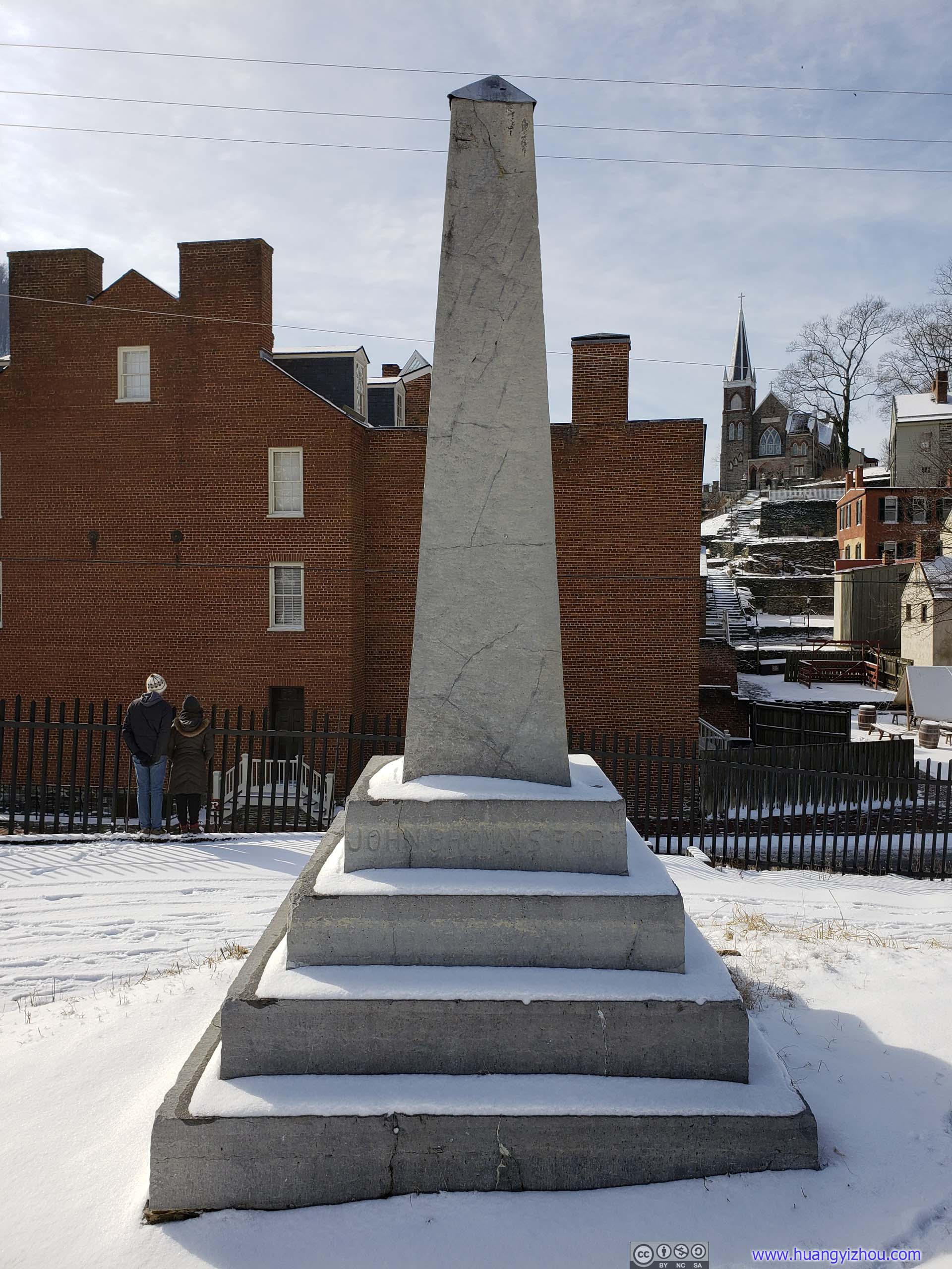
John Brown MonumentThe original location of “John Brown Fort”, the Federal Armory’s fire-engine house, where abolitionist John Brown and his raiders were captured by US Marines on October 17, 1859. The Fort was moved in 1891 and original foundation covered by railroad in 1892.
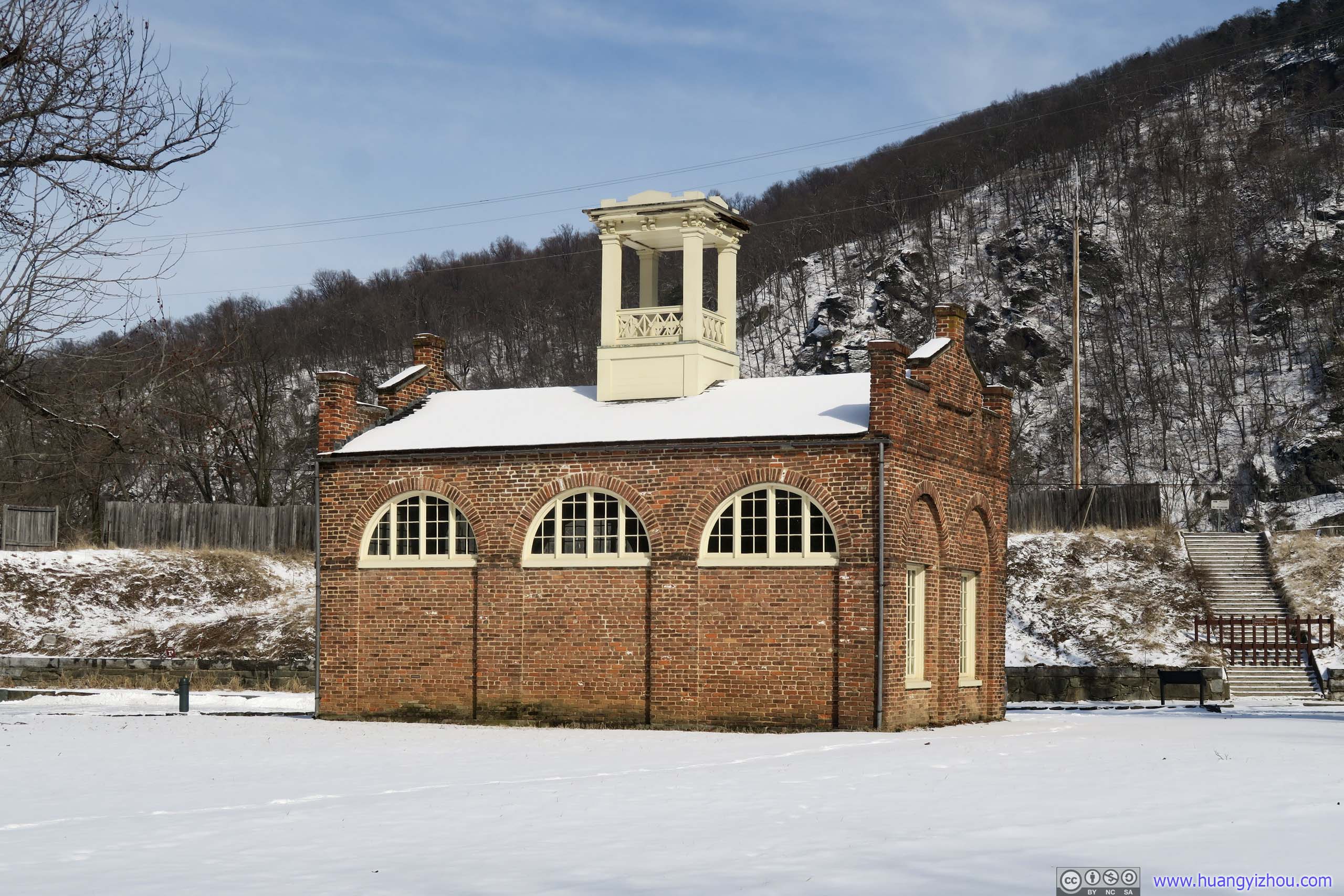
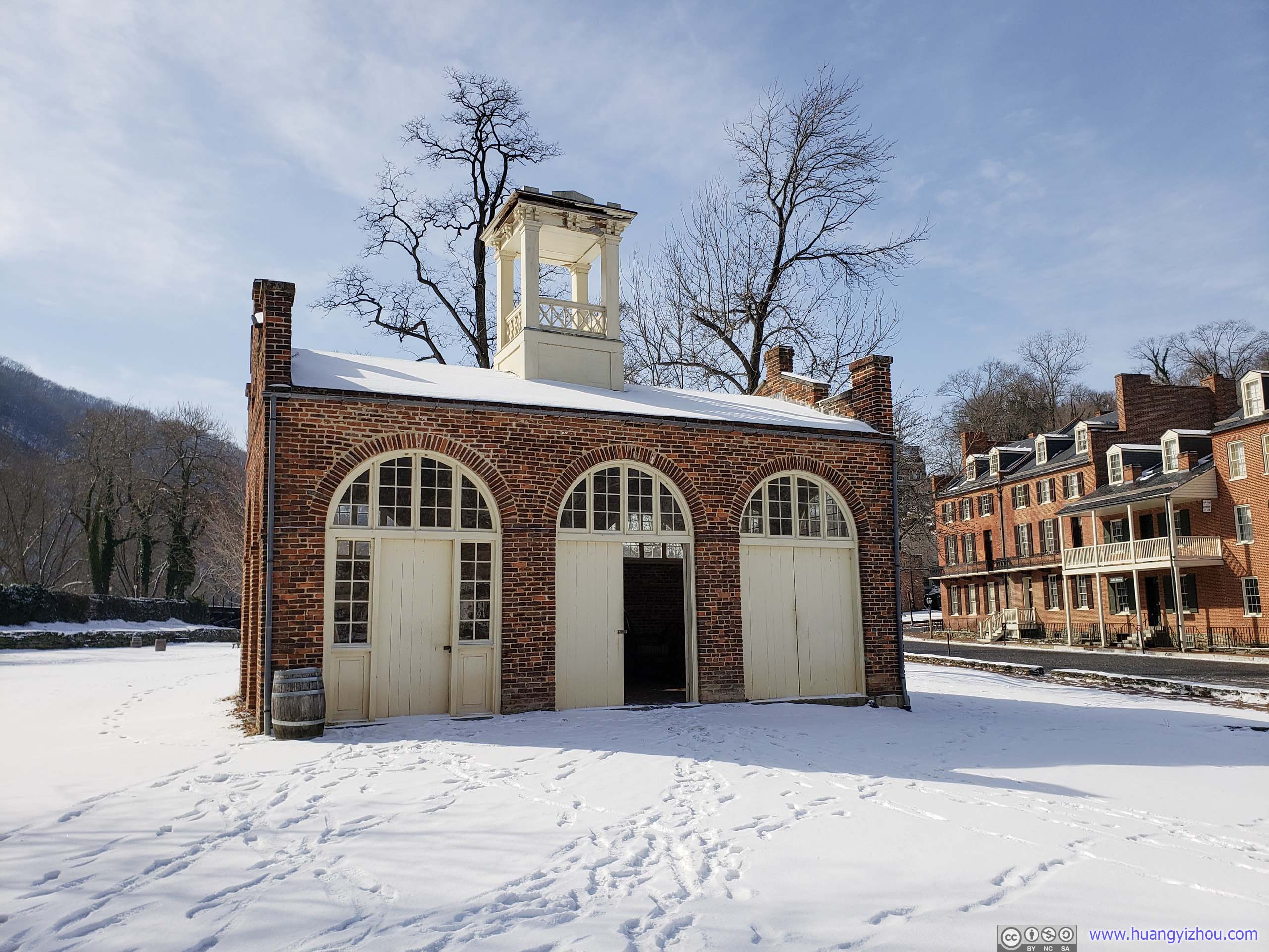 John Brown’s FortModern reproduction 150 meters south of the original location.
Next to the reconstructed John Brown’s Fort was Arsenal Square. After Virginia seceded from the Union and its militia tried to seize the armory and arsenal, retreating federal forces burned the arsenal to the ground.
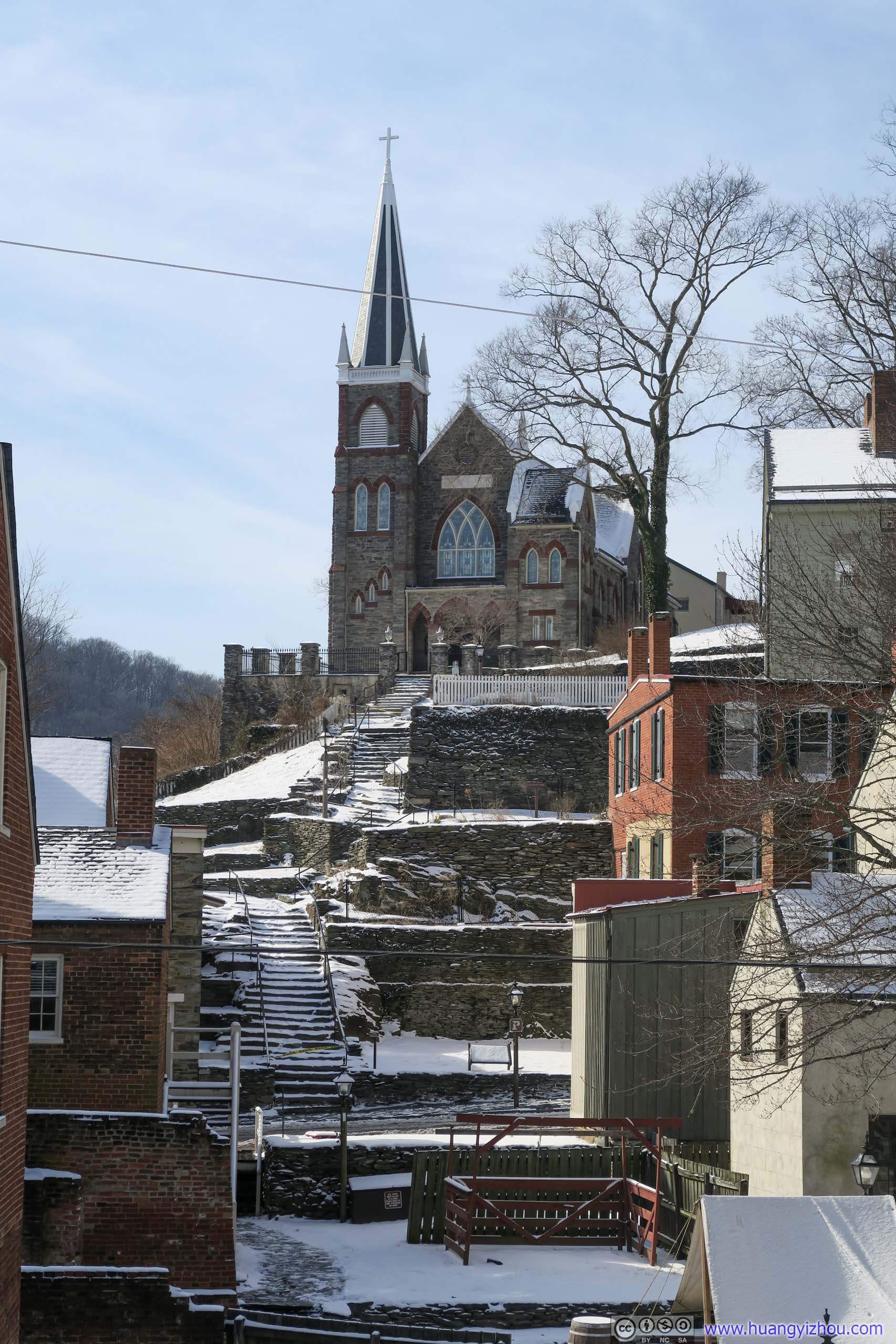
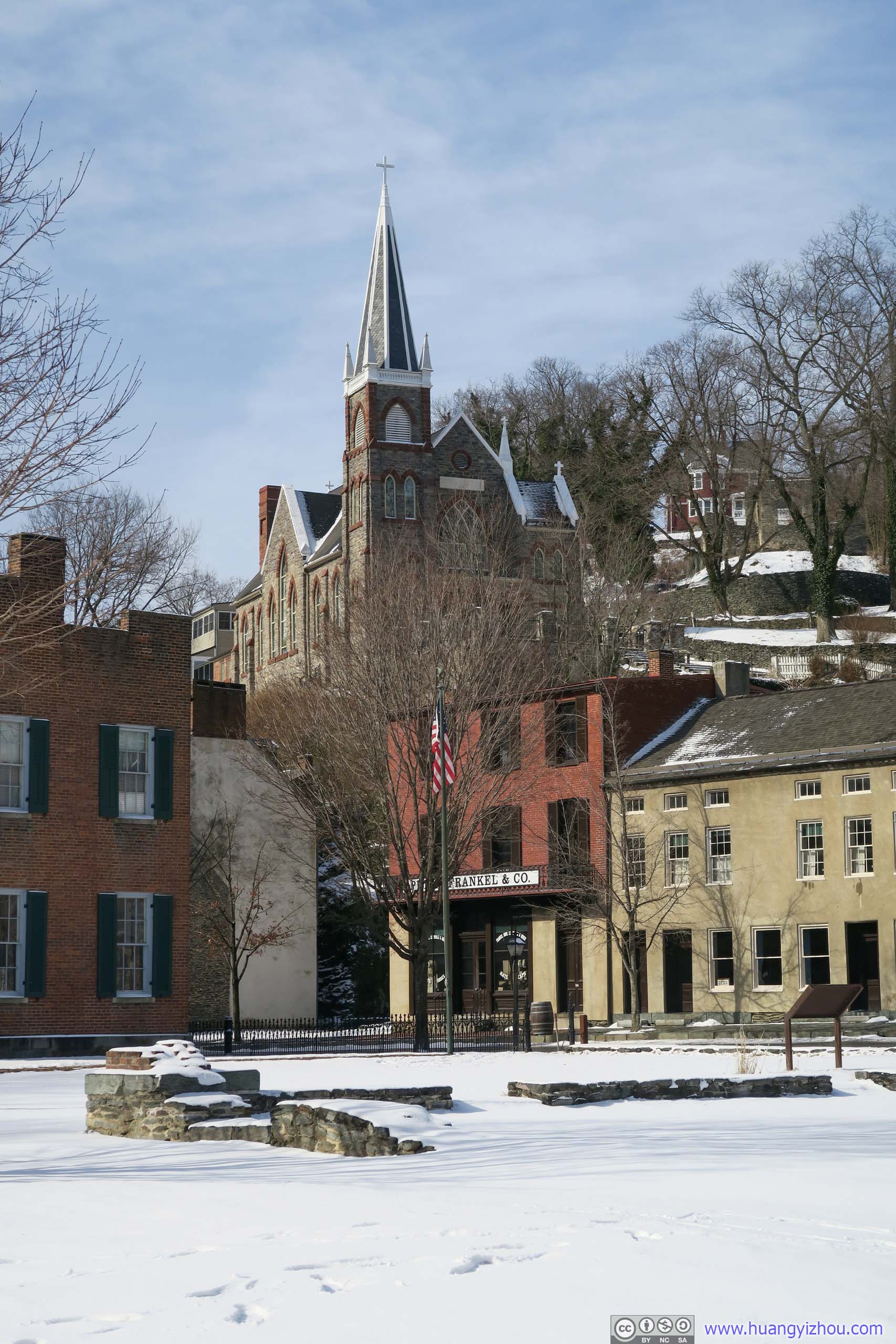 St. Peter’s Roman Catholic Church on Hill

 Harpers FerryI guessed the front-row buildings here dated back to the civil war era and beyond.
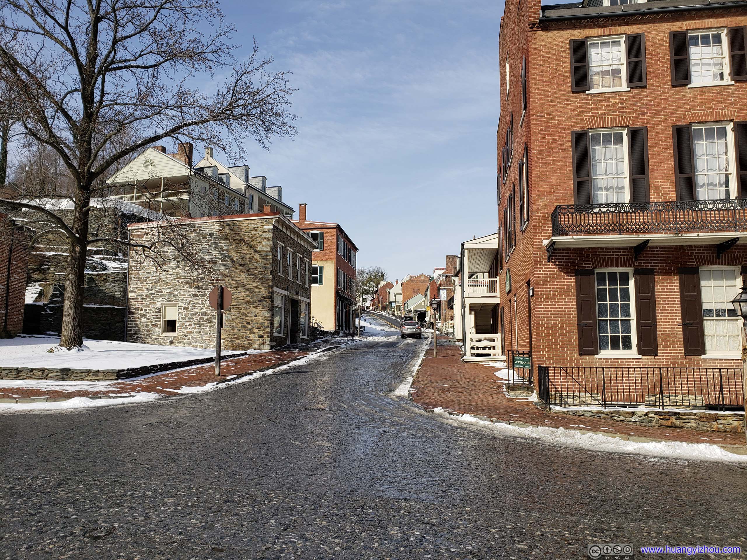
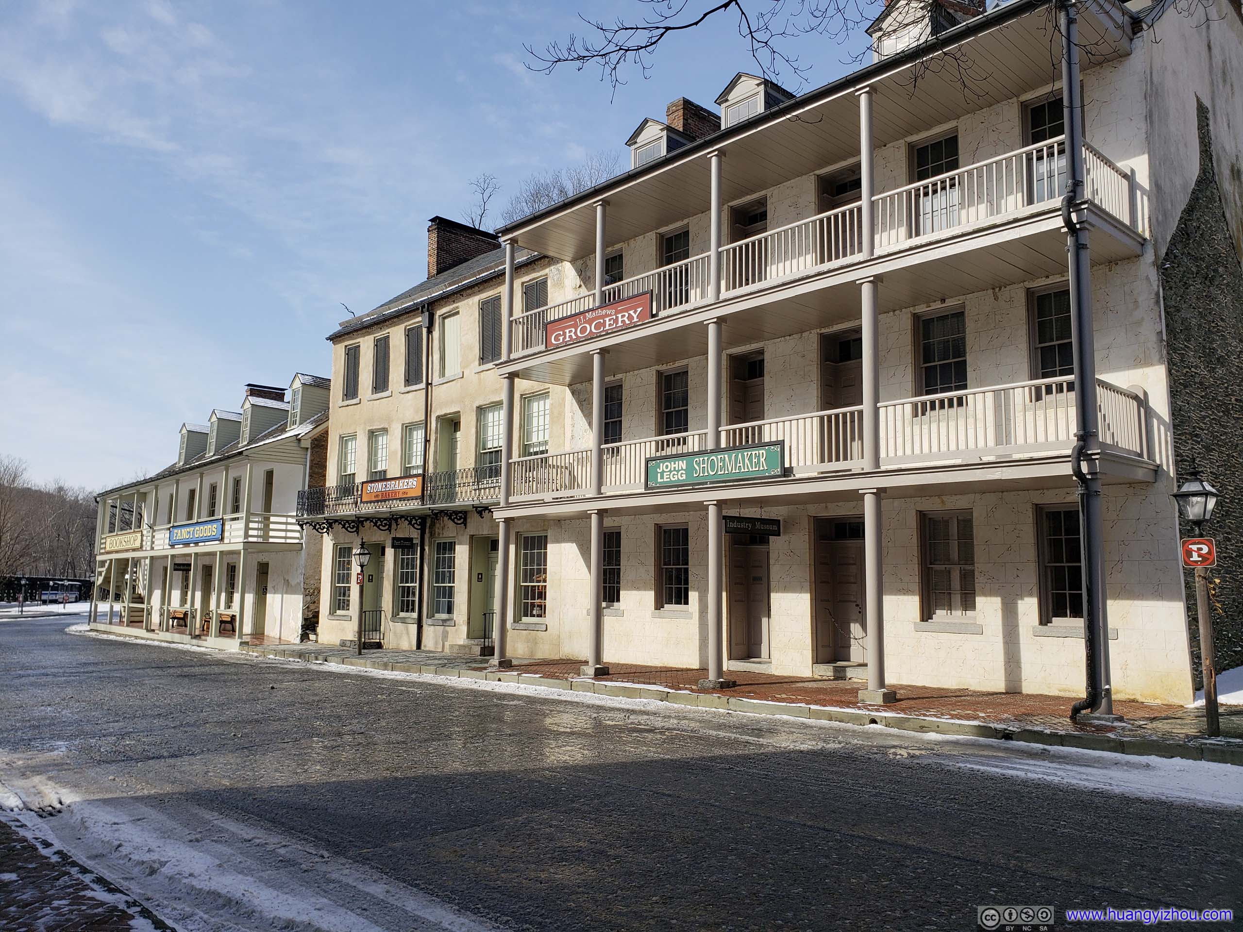
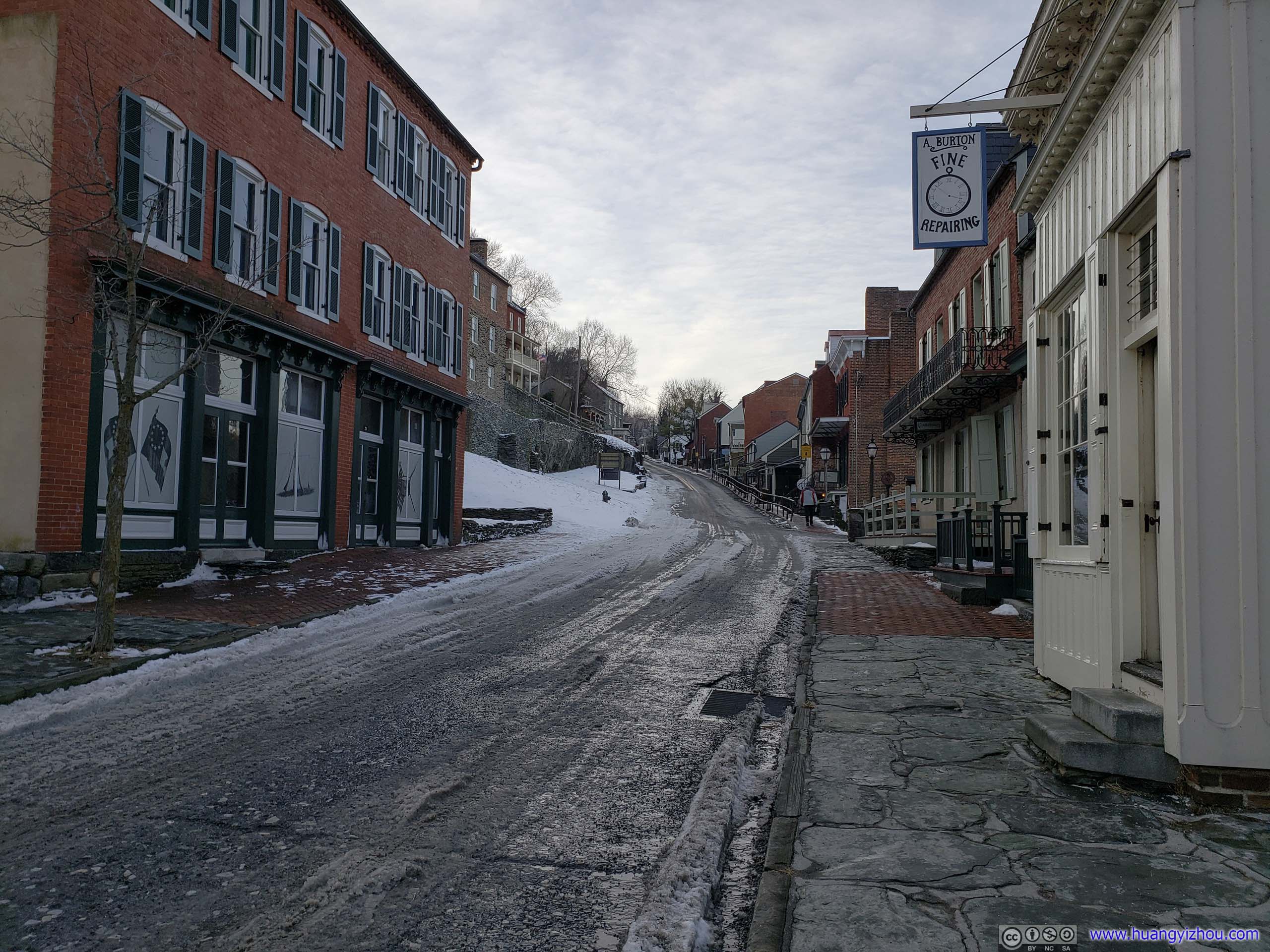 Street
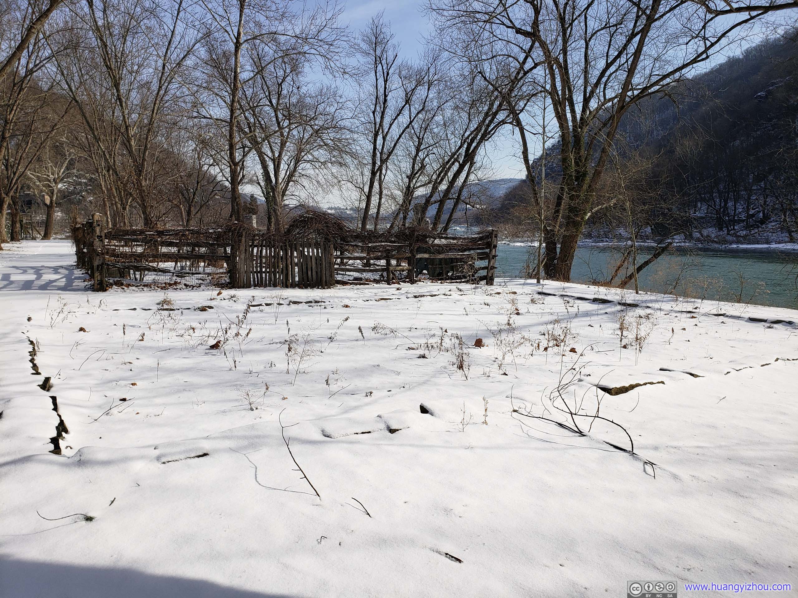
After that, I took a stroll heading West along Shenandoah River.
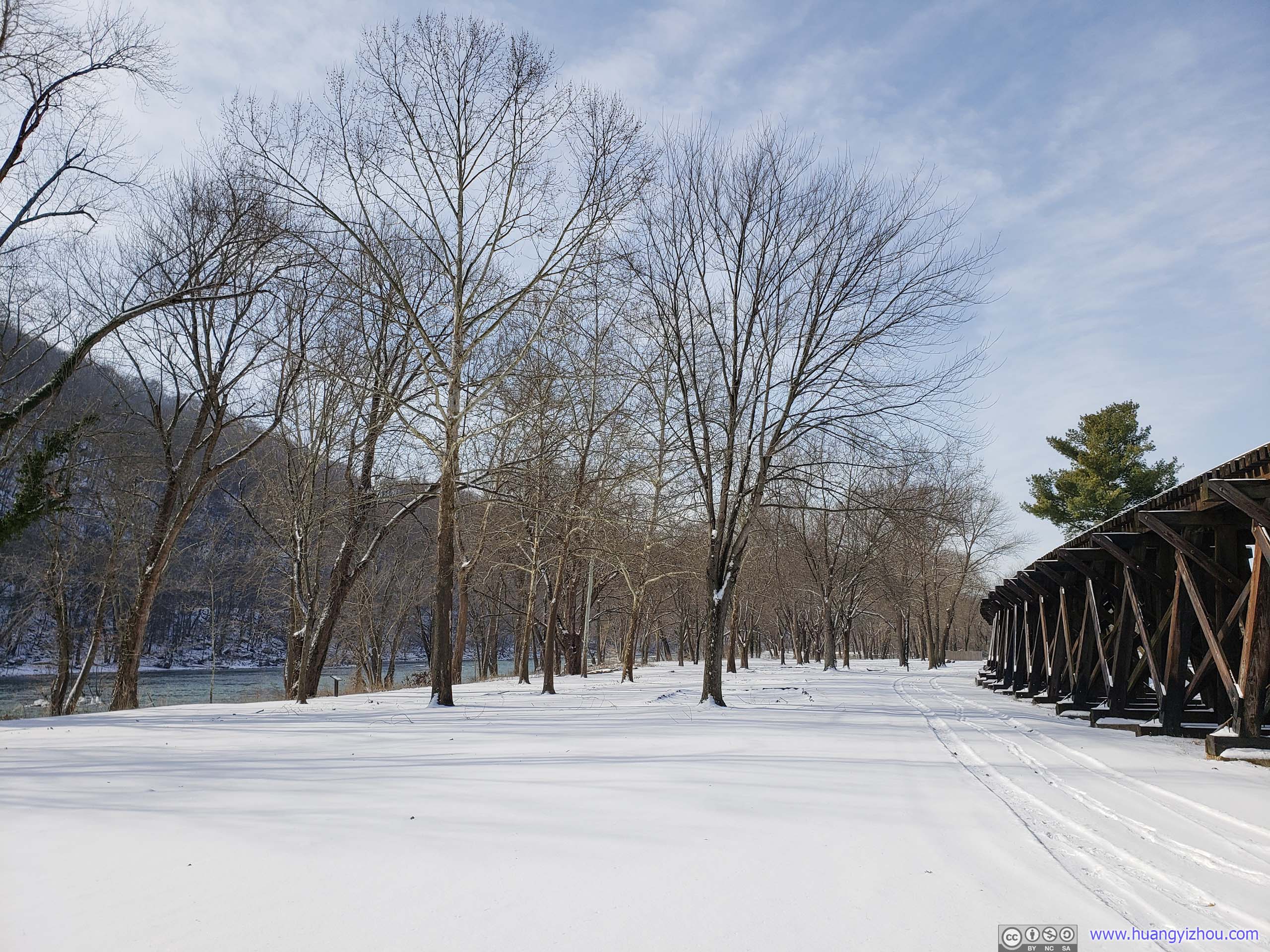
Field Covered in Snow
Despite being in a strategic location, the mountains surrounding Harpers Ferry made it a hard to defend, military wise. The town changed hands 14 times during the Civil War, the most notable being the Battle of Harpers Ferry in September 1862. The battle could have a thrilling plot to rival Gettysburg not too far from here. But unfortunately, it’s a battle that the Union lost, and in short to a not-so-glamorous reason because the Union Commander Col. Miles chose to keep most troops near the town, instead of occupying commanding positions on the surrounding heights. As a result, its battlefields received much fewer visitors than the famous Gettysburg, and few would associate Civil War with such a little town.
Foundation of Market HouseArmory workers purchased fresh vegetables, meat and fish every Wednesday and Saturday here at the Market House. Constructed by the government near mid-century, the building that once stood here architecturally resembled the refurbished armory buildings along Potomac River. The Sons of Temperance, a 19 century organization campaigning for the prohibition of liquor, financed construction of the second floor for their meeting hall. The building was badly destroyed after the 1936 flood.
The destruction of the federal armory and the subsequent Civil War, during which the town changed hands multiple times, had a devastating blow to the town’s economy. A brewery was erected on the shores of Shenandoah River in 1895, in an attempt to revitalize the town, which didn’t fare too well with West Virginia’s prohibition in 1914.
Interestingly, the prohibition organization “The Sons of Temperance” had their meeting hall right next to the town’s brewery. I guess the two neighbors weren’t too nice to each other.
Foundation of Paymaster HouseCompleted in 1802 as a home for the armory’s senior administrator, this building was probably the best house in town when Meriwether Lewis arrived in 1803. Lewis may have stayed here and certainly accounted for his supplies with Paymaster Samuel Annin.
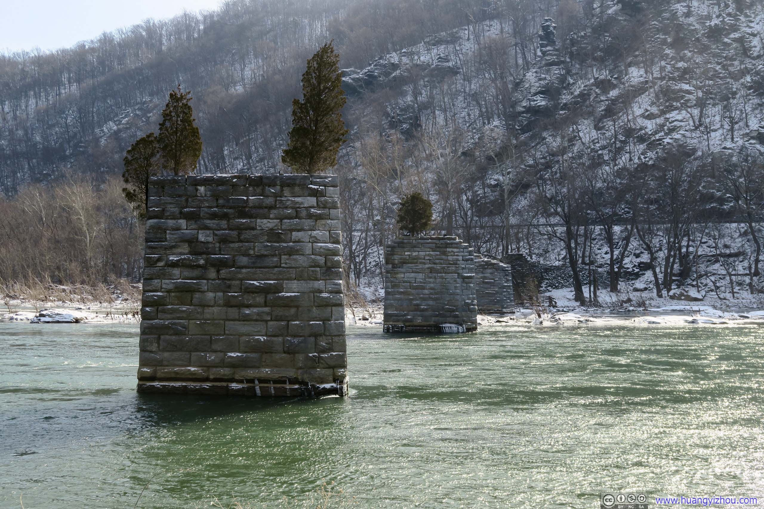
Shenandoah River Bridge PylonsA bridge that’s destroyed by floods 1936 and was never rebuilt.

Potomac River

Distant Sandy Hook BridgeOne of the two major road bridges in the Harpers Ferry area, connecting Maryland to Virginia.
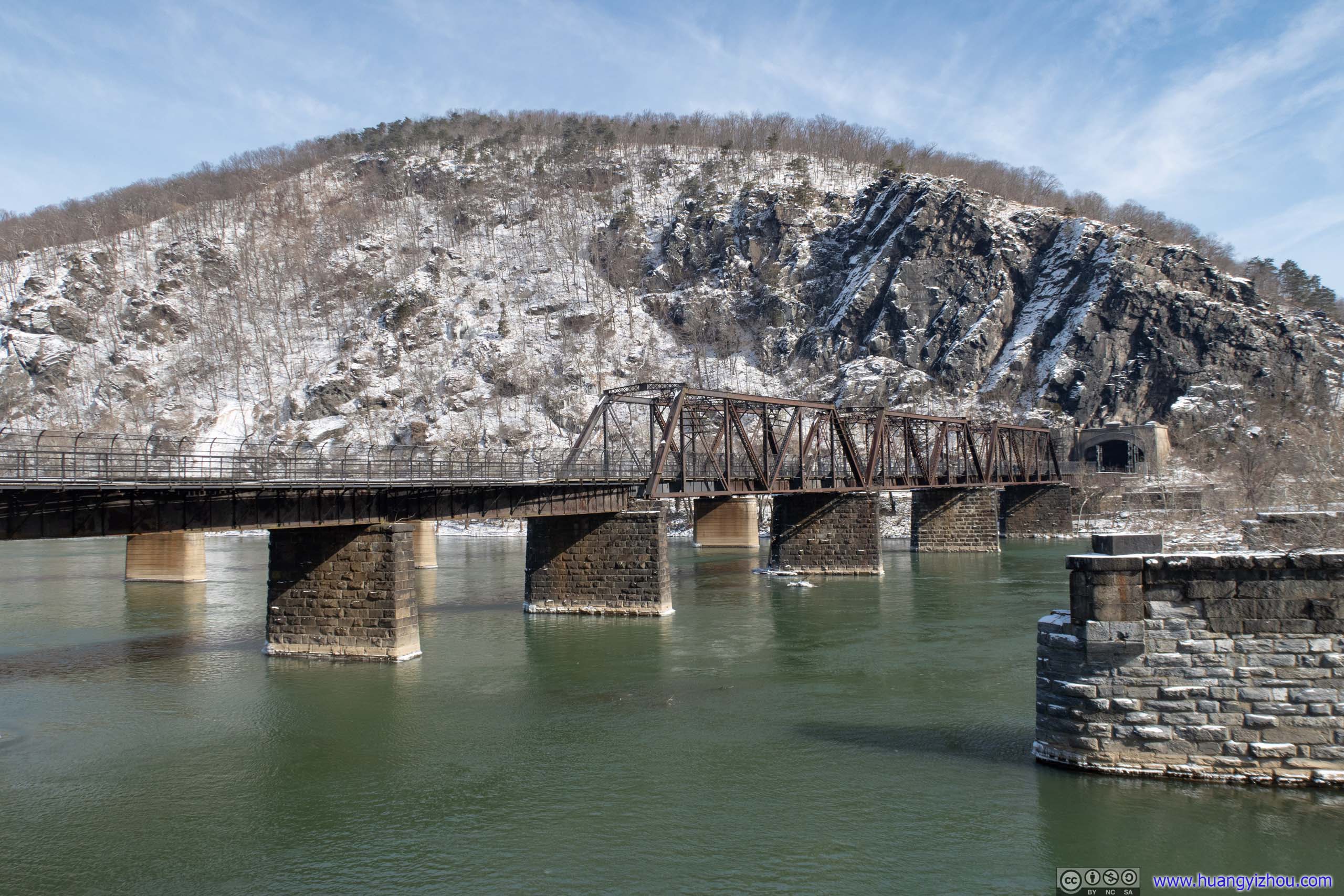
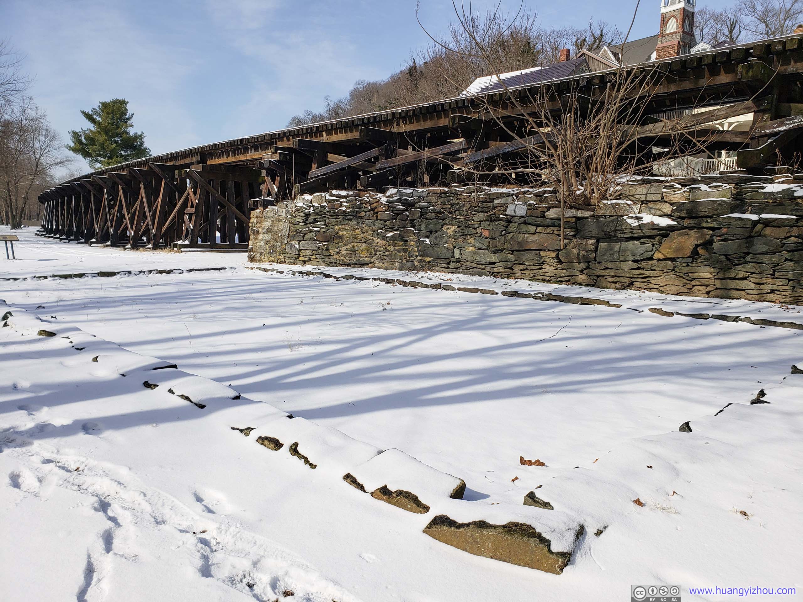
Railroad Bridge
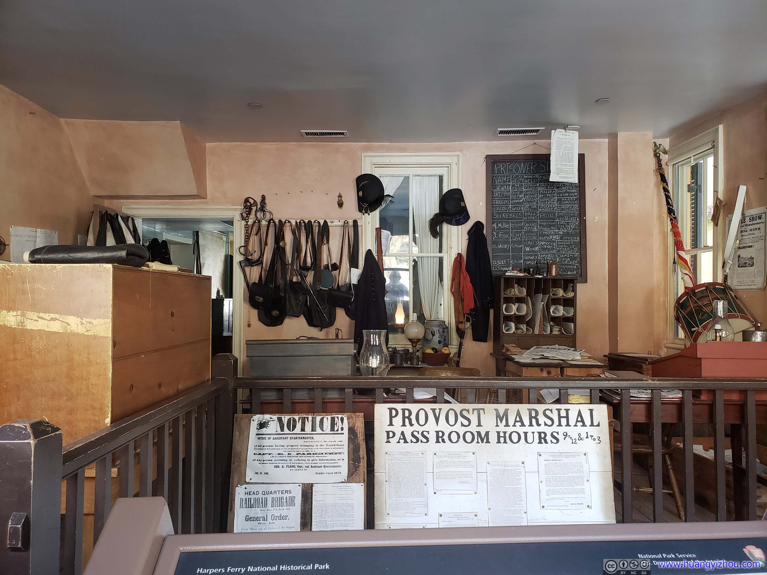
Provost Marshal Office

BuildingThe existing one seemed to be an expansion of a previous house. It’s a rather interesting way of preservation.
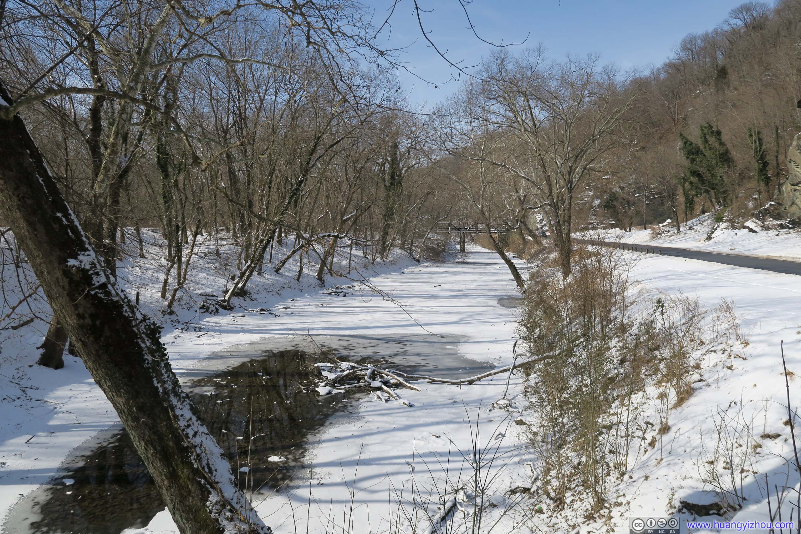
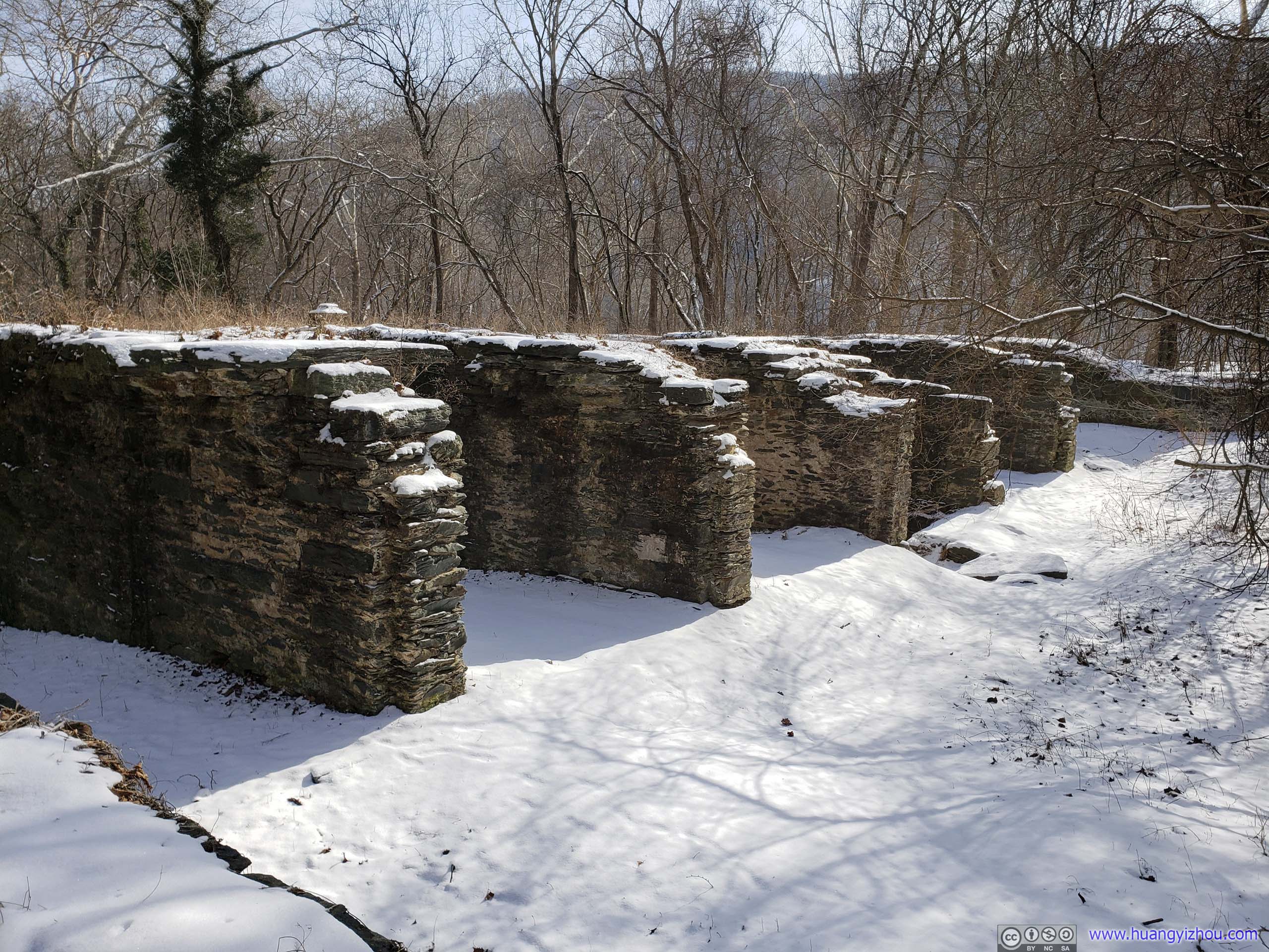
 Shenandoah CanalBefore C&O Canal, a series of bypasses along Shenandoah and Potomac River already existed. This segment of Shenandoah Canal was one of those.
Remains of Shenandoah Pulp FactoryConstructed by Thomas Savery between 1887 and 1888 on the former site of Shenandoah Canal’s lower locks, grinding woods into pulp for the paper industry. The mill closed in 1935 for unprofitability and was destroyed by flood in 1936. It’s the last remnant of water-powered industry in Harpers Ferry.

RailwayShenandoah Subdivision, which wasn’t as often used as B&O mainline.
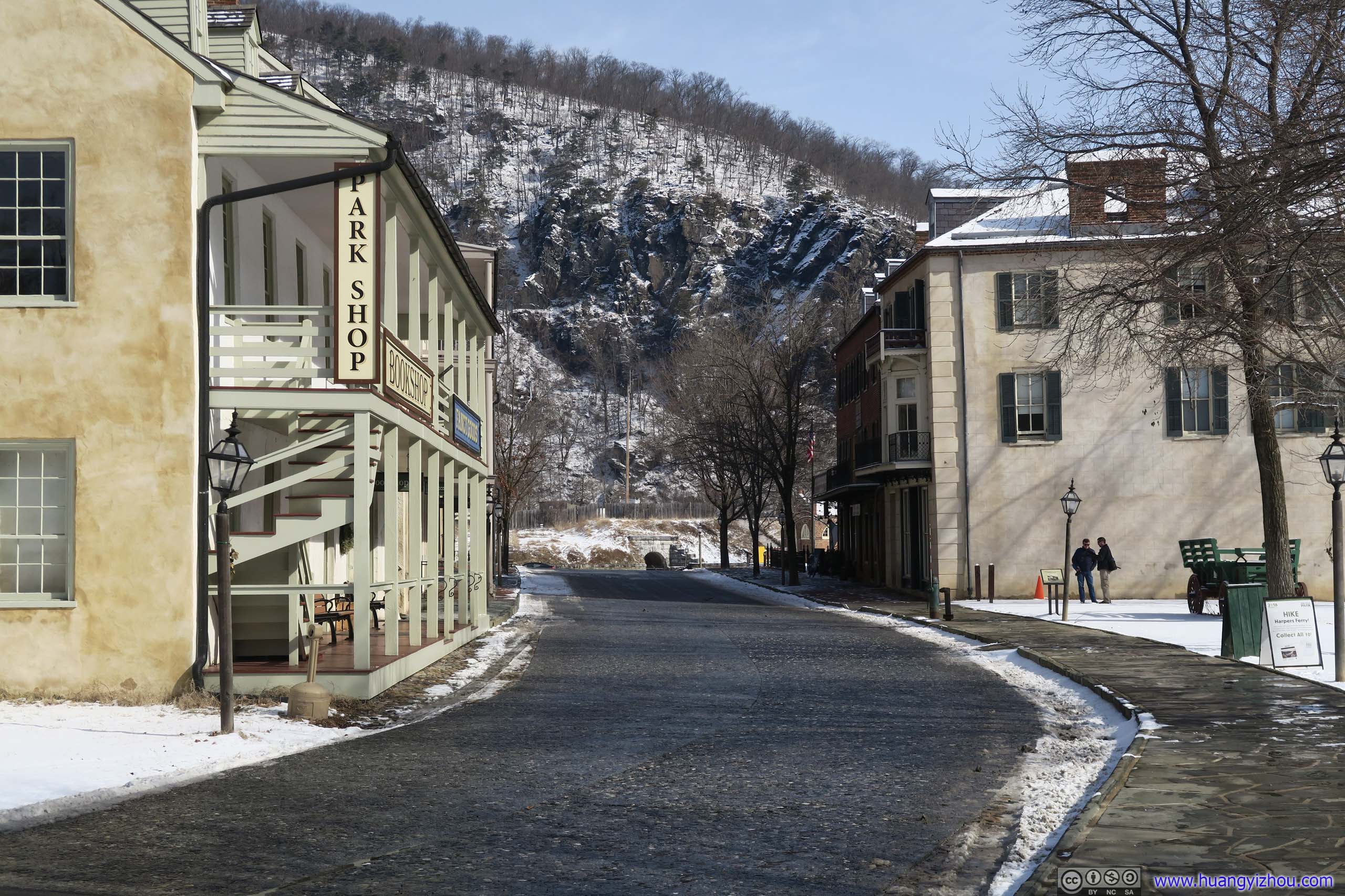
At the western end of Shenandoah Street there was an NPS managed parking lot. Most hikers to Loudoun Heights started from here.
Loudoun Heights Trail
Here’s GPS tracking for the entire day:
 Shenandoah RiverWith lots of snow-covered rocks.
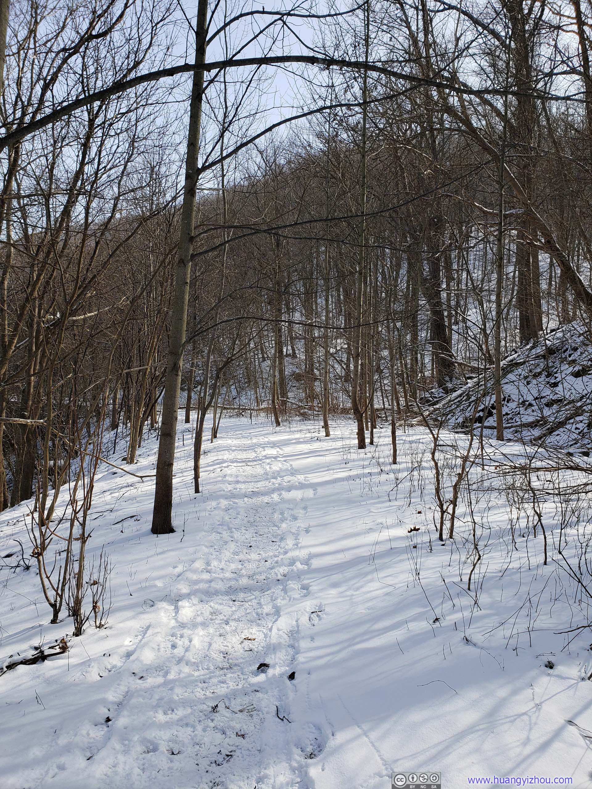
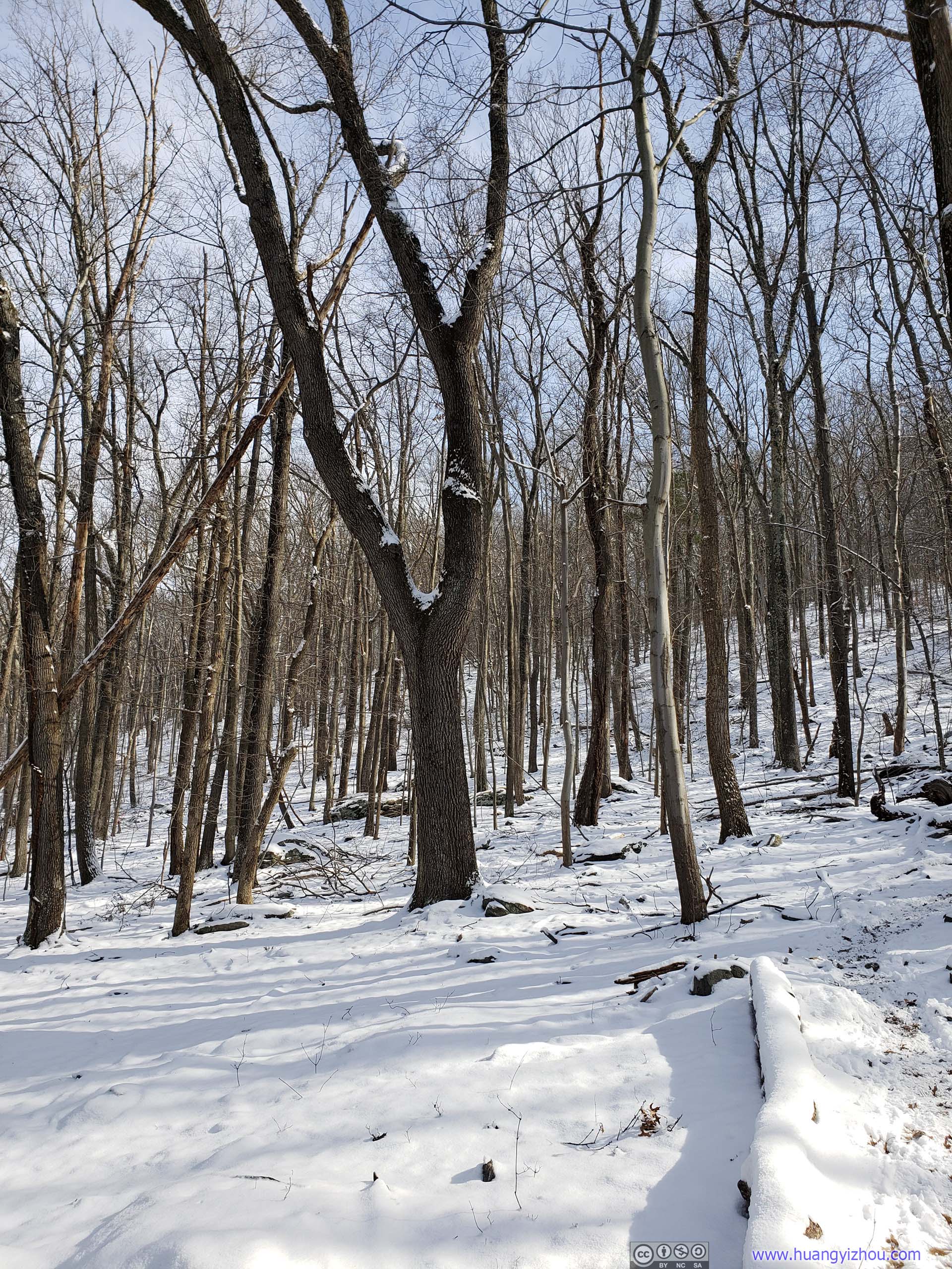
 Trail
Trail
Snow was only a few inches and melting on the trail, which was pretty beaten from fellow hikers, so no specialty gear was necessary.
And apart from traffic below and some shooting range nearby, I was enjoying some good solitude.
By the way, the first part of the trail was also Appalachian Trail.

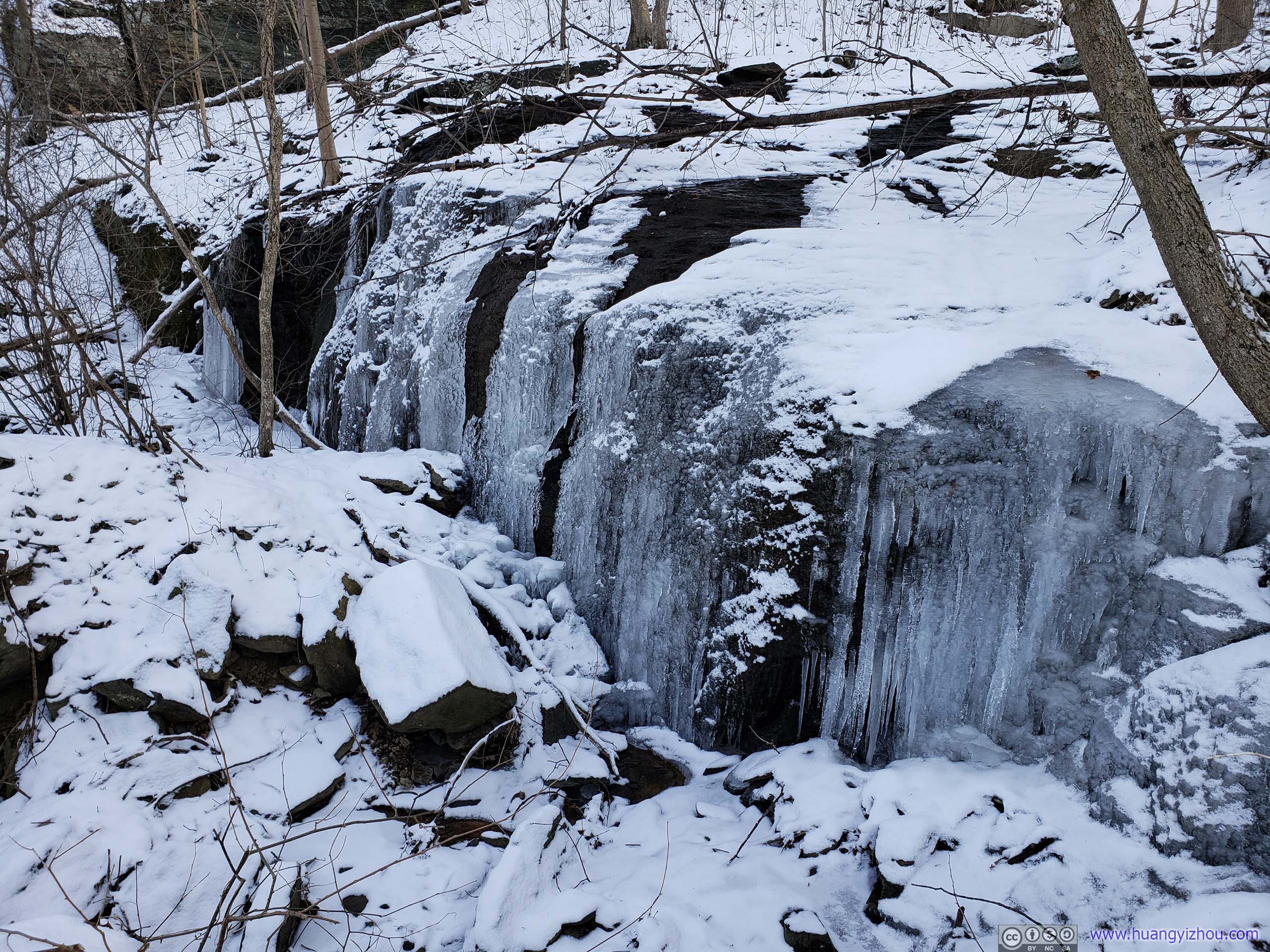
Waterflow below Ice SheetI love the crystal clear colors of the ice.
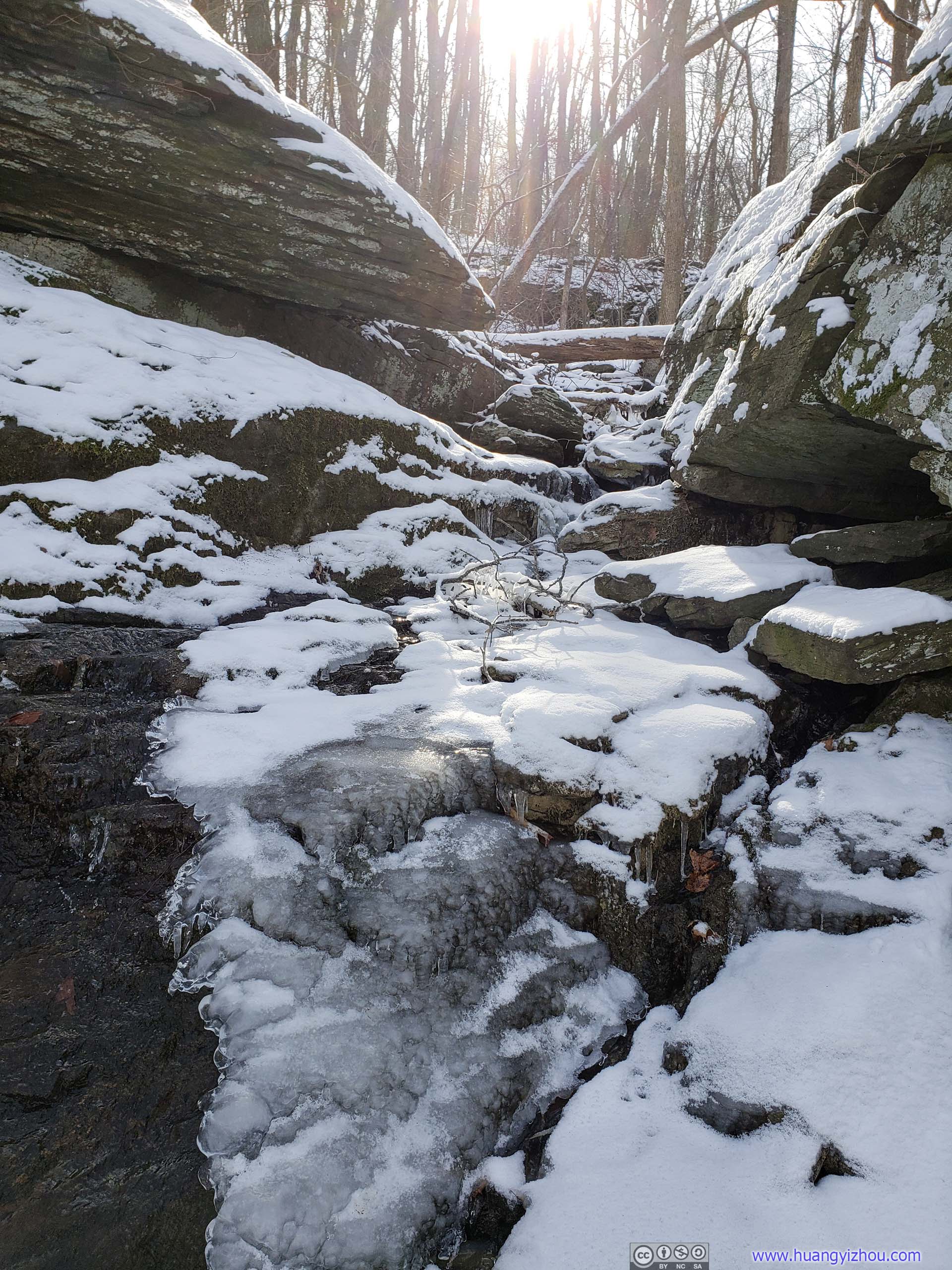
 Creek
Creek
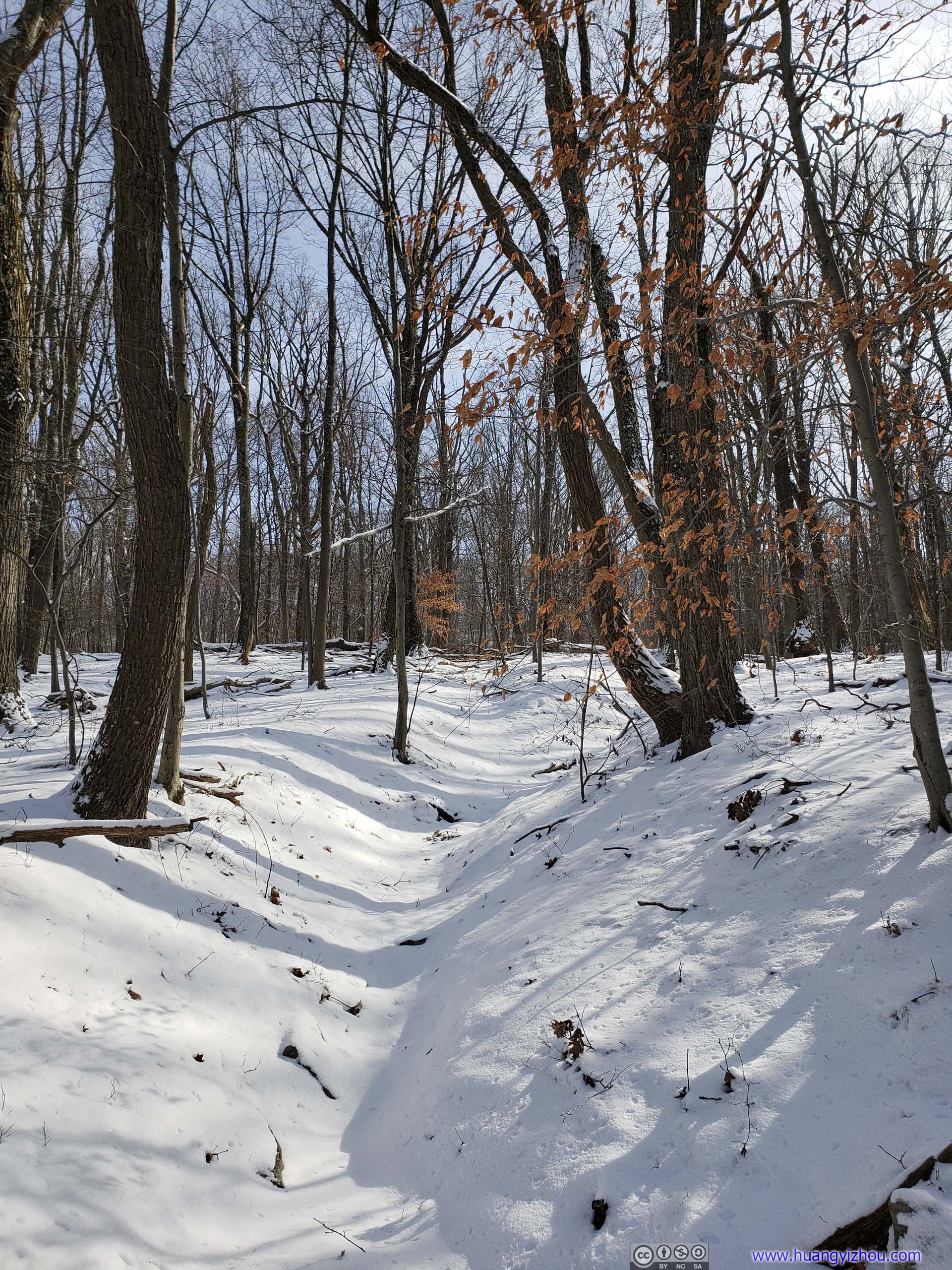
ForestA binary tree!


 Trail
Trail
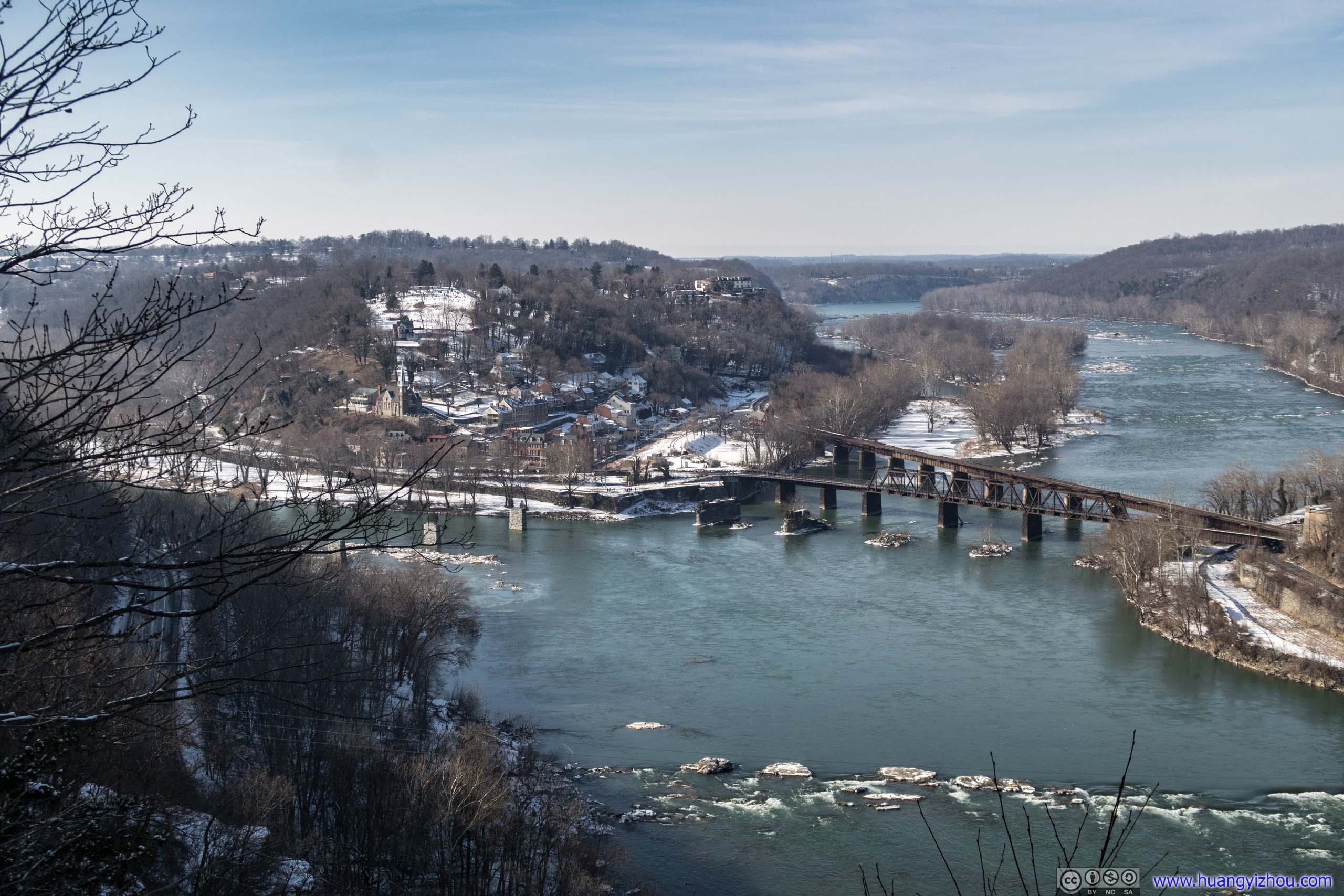
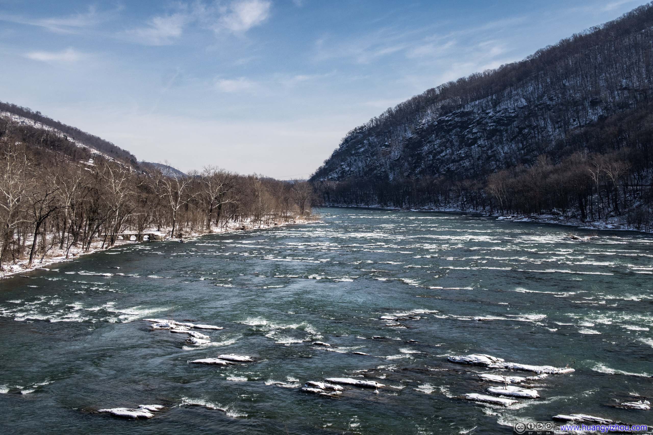
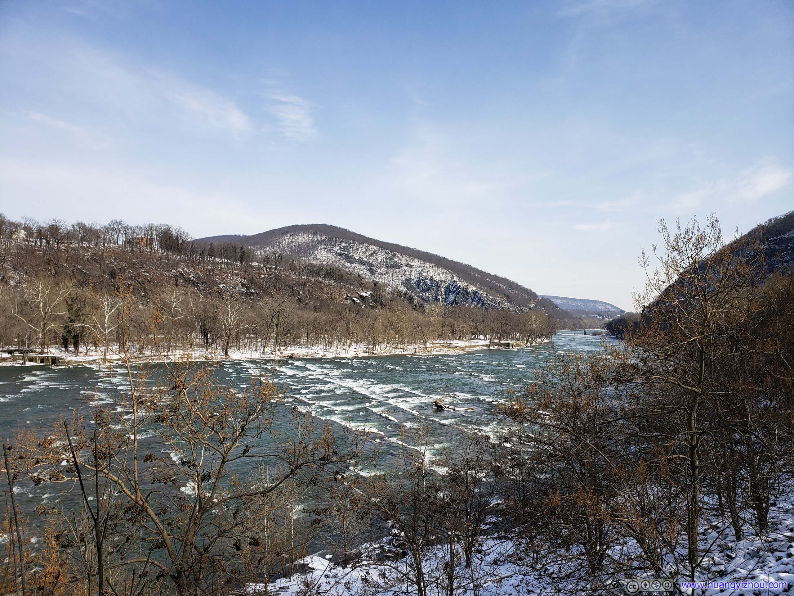
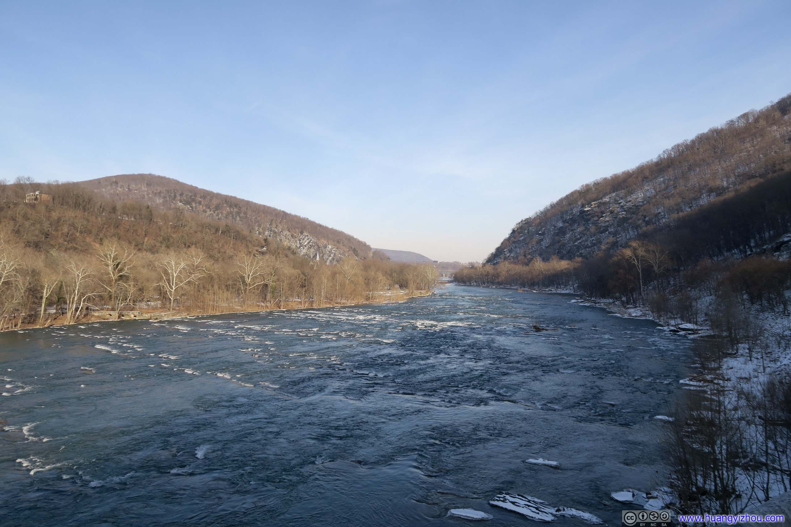
Two hours after I crossed Shenandoah River (including a lunch break), I reached the end of trail, Split Rock. It offered views of the town of Harpers Ferry with two rivers that surrounded it. Maybe not as spectacular as from Maryland Heights across the river, but still rewarding.

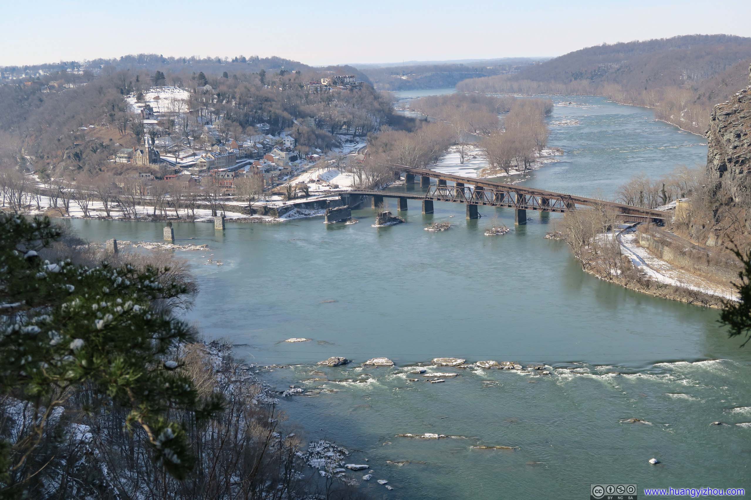 Split Rock Overlooking Harpers Ferry
The return trip wasn’t too eventful, only that snow was melting at a visible speed, even on this northern slope of the hill.

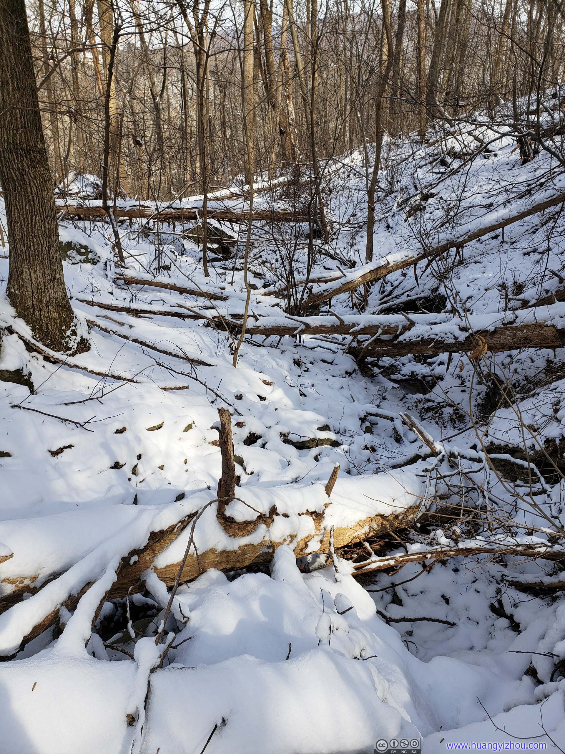
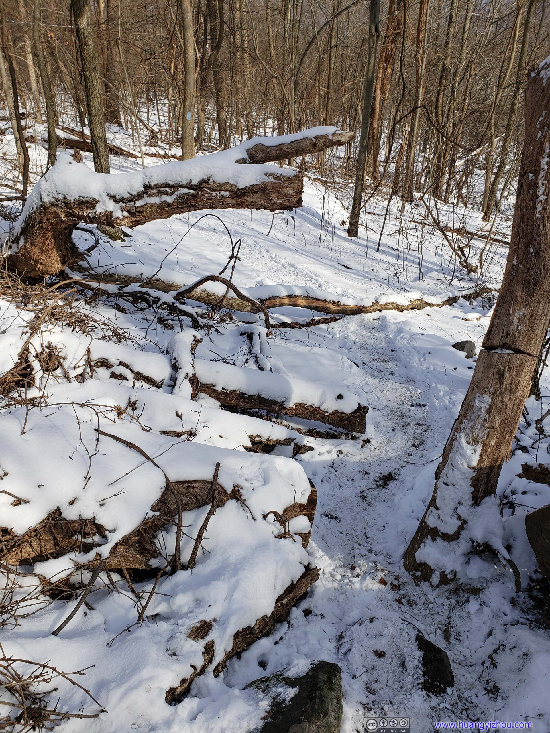
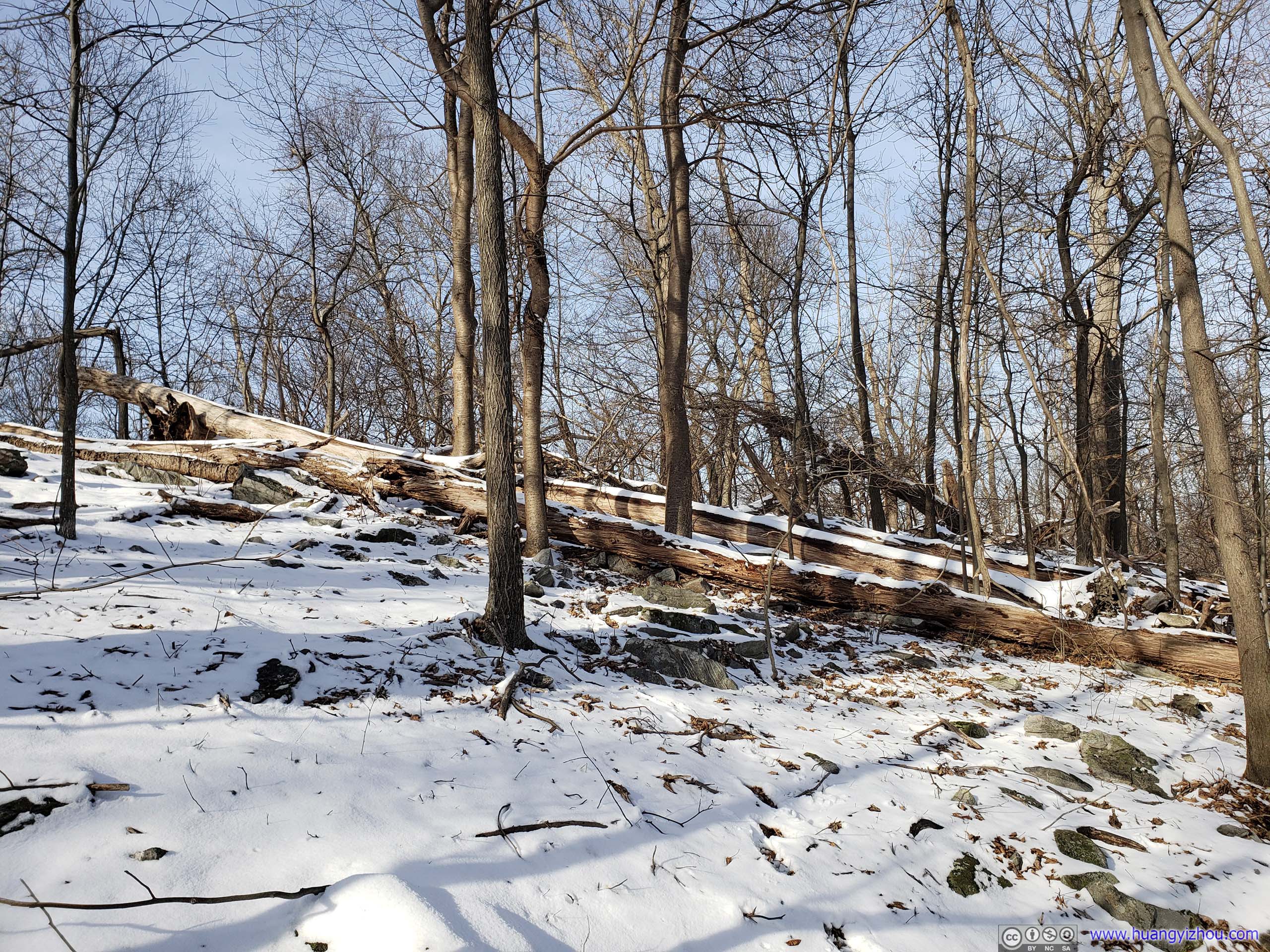 Fallen Trees in Forest
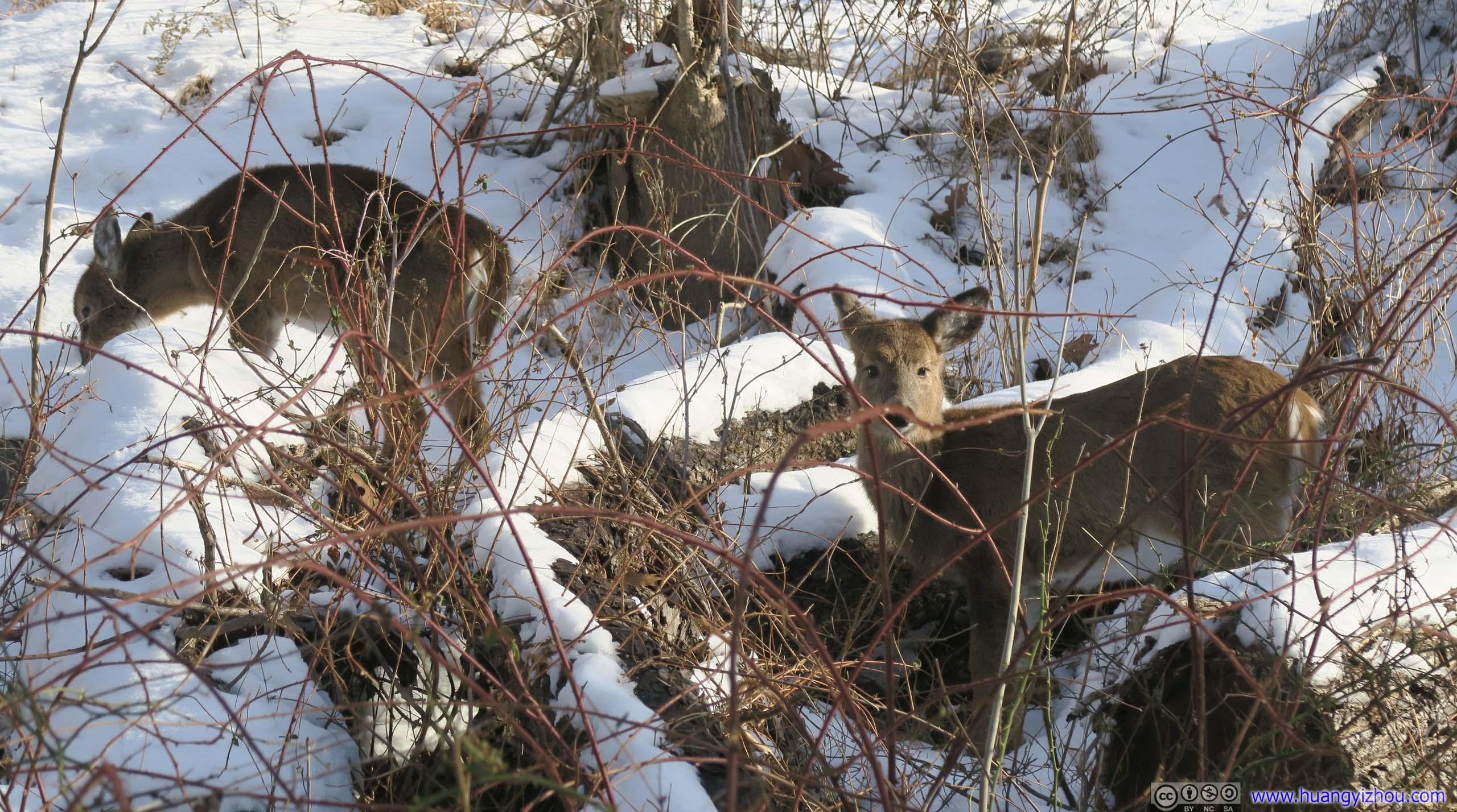
Deer in BushesI wasn’t sure they would be having good luck finding food underneath this snow.
Icicle
Once back in Harpers Ferry, I took some more tour of the town before heading back home. That included NPS Service Information Center and the hill behind the town.
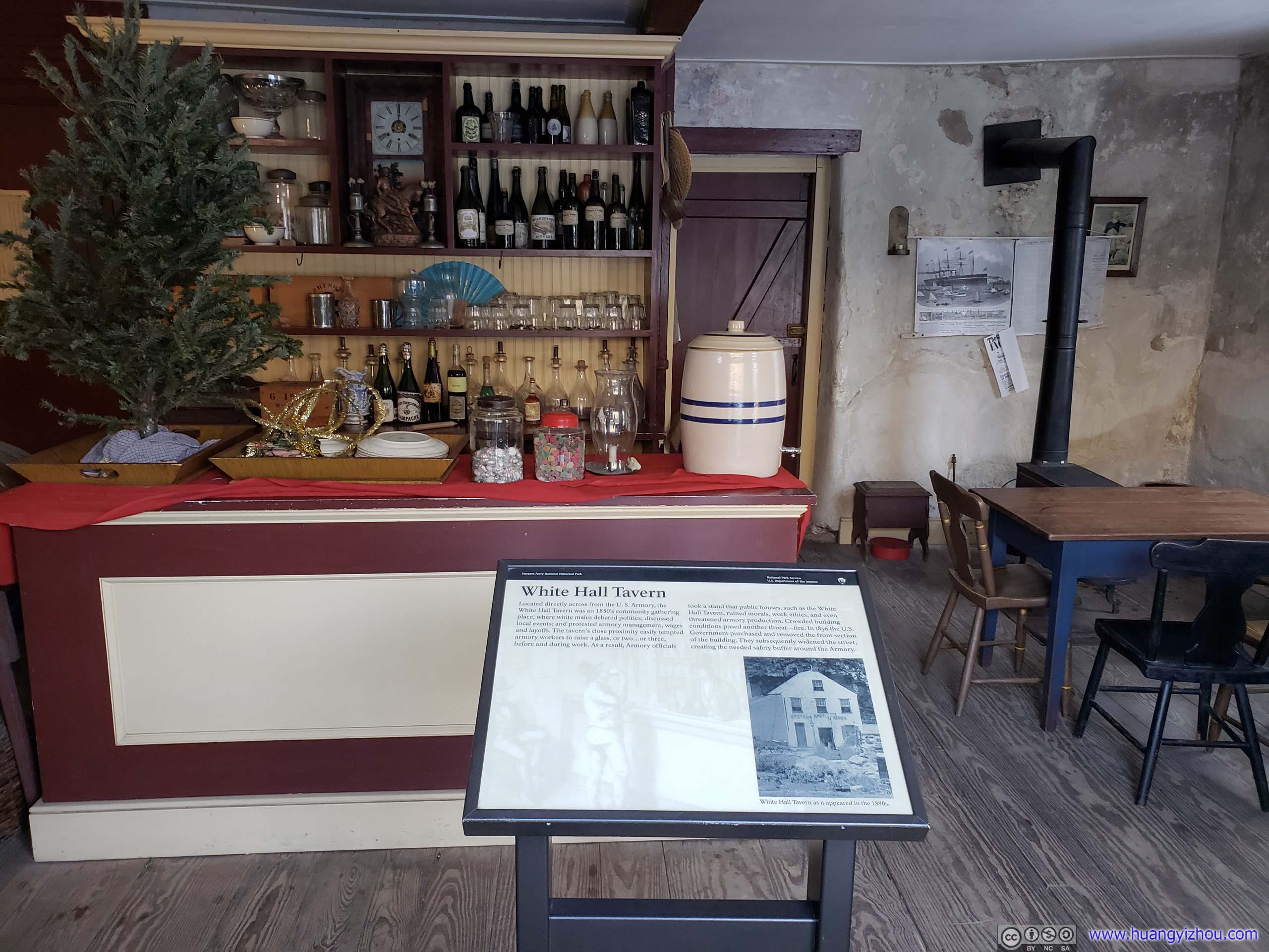
White Hall TavernLocated directly across from the U.S. Armory, the White Hall Tavern was an 1850’s community gathering place, where white males debated politics; discussed local events; and protested armory management, wages and layoffs. The tavern’s close proximity easily tempted armory workers to raise a glass, or two… or three, before and during work. As a result, Armory officials took a stand that public houses, such as White Hall Tavern, ruined morals, work ethics, and even threatened armory production. Crowded building conditions posed another threat – fire. In 1856 the U.S. Government purchased and removed the front section of the building. They subsequently widened the street, creating the needed safety buffer around the Armory.

Harper HouseIn 1775, town founder Robert Harper chose this site for his home. The house was completed in 1782. Unfortunately, he died that same year and never lived here. The Harper House is the oldest surviving structure in Harpers Ferry and has undergone many transformations from tavern, residence, rental property, abandoned ruin to restored exhibit.
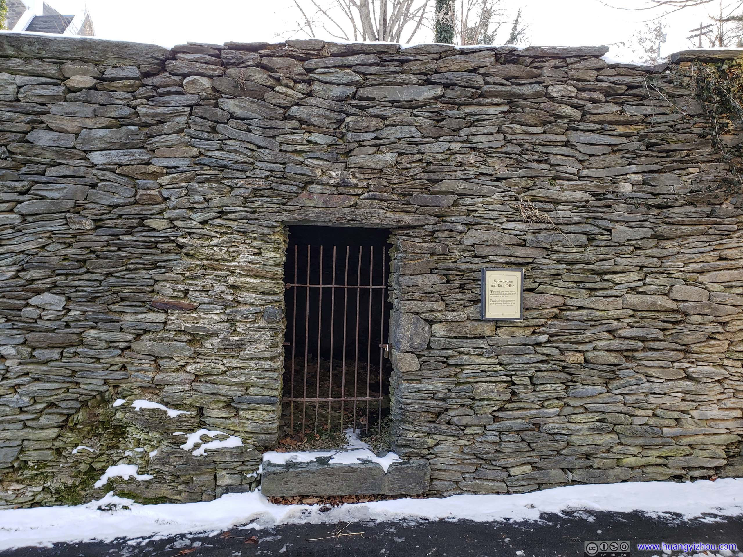
Springhouses and Root CellarsCarved into the hillside for keeping things cool.
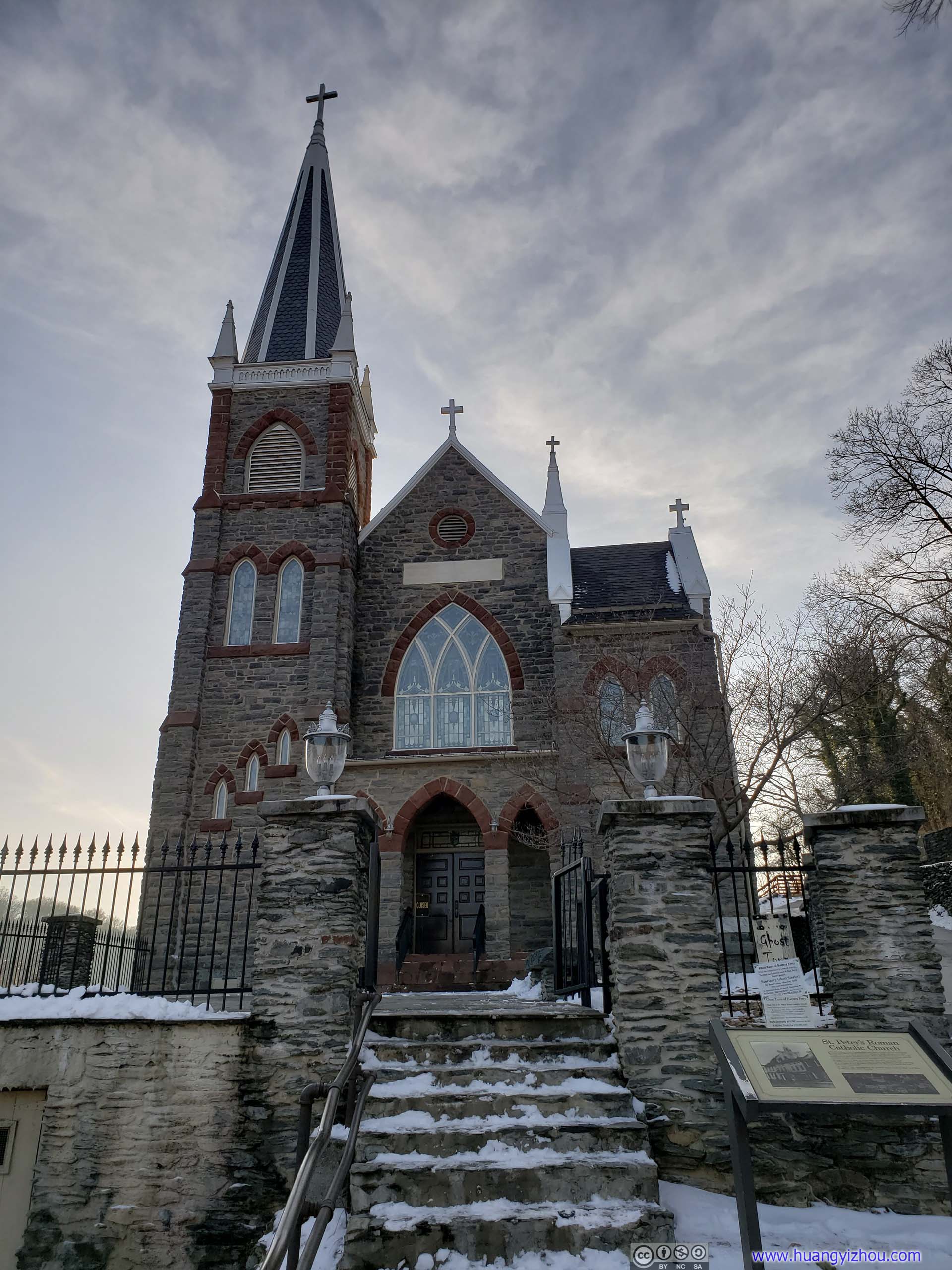
St. Peter’s Roman Catholic ChurchThe construction of canal and railroad brought an influx of Irish immigrants to the town and thus this church was erected in 1833. During the Civil War, the church was famously flying the British Union Jack Flag to signal its neutrality and thus escaped the war relatively unscathed. The church building was renovated in 1896.
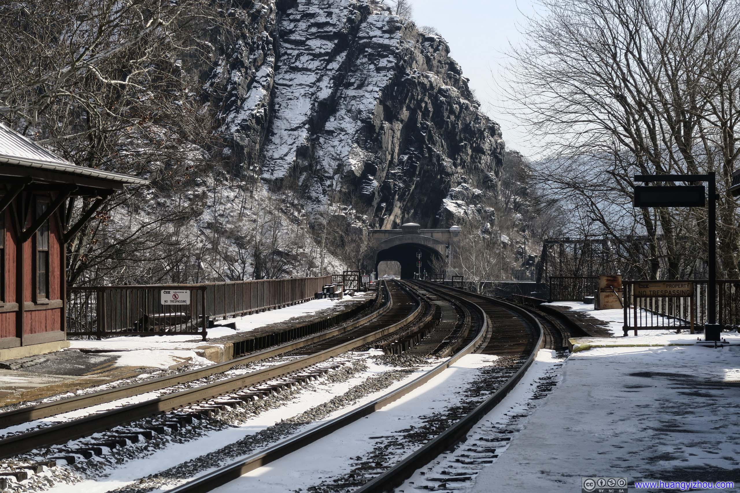
Finally at the train station, I ventured across Potomac River to take a closer look at Harpers Ferry Tunnel.
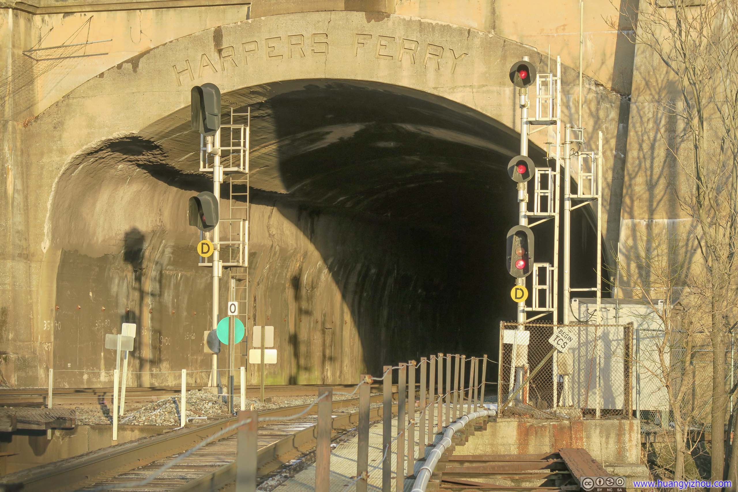
Harpers Ferry TunnelSnow had molten on this side of the mountain facing setting sun.
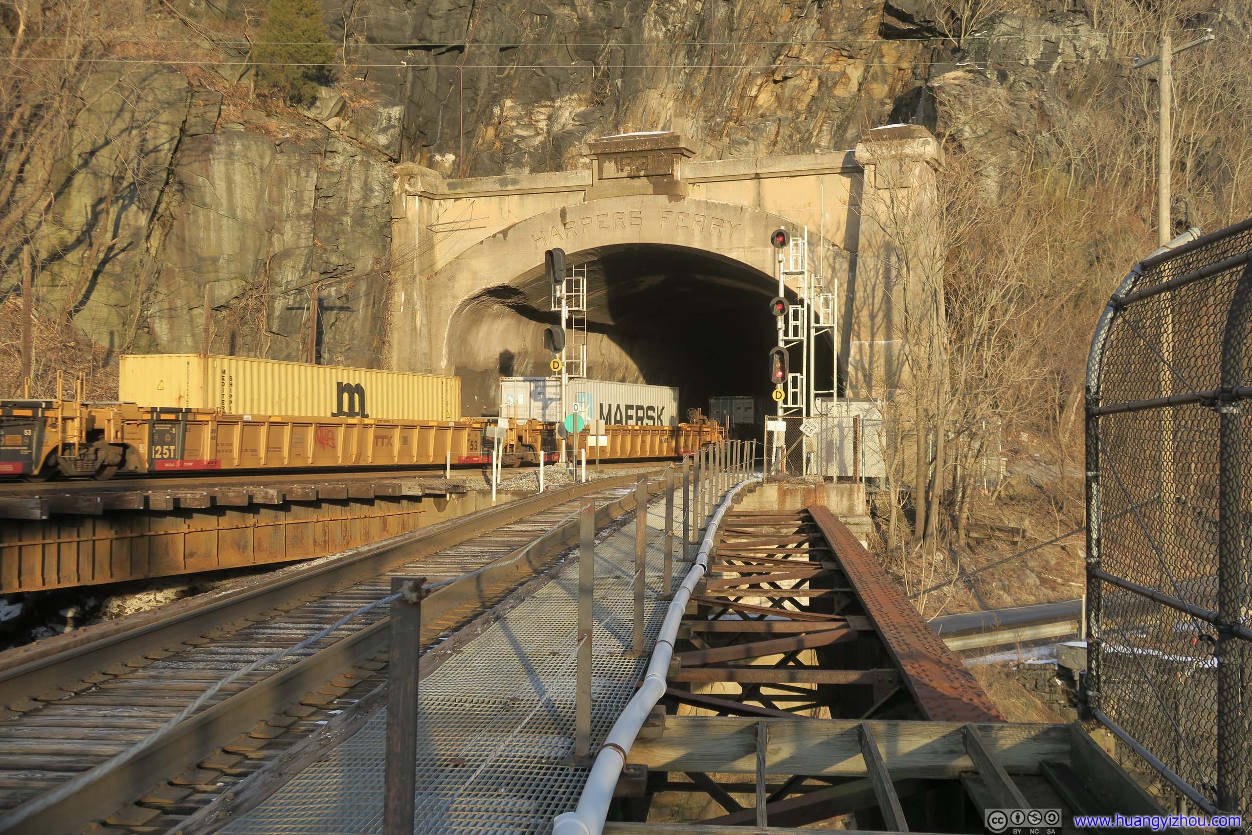
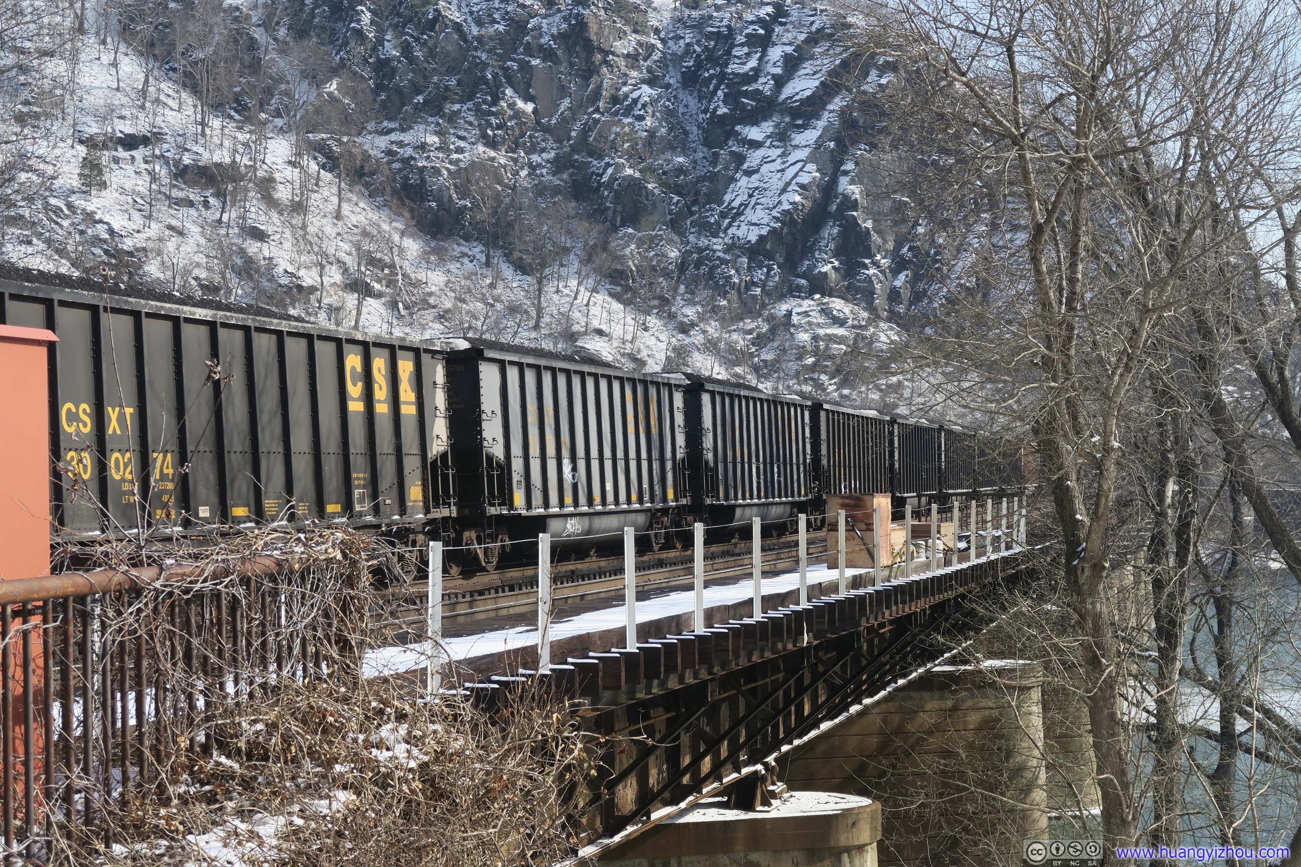
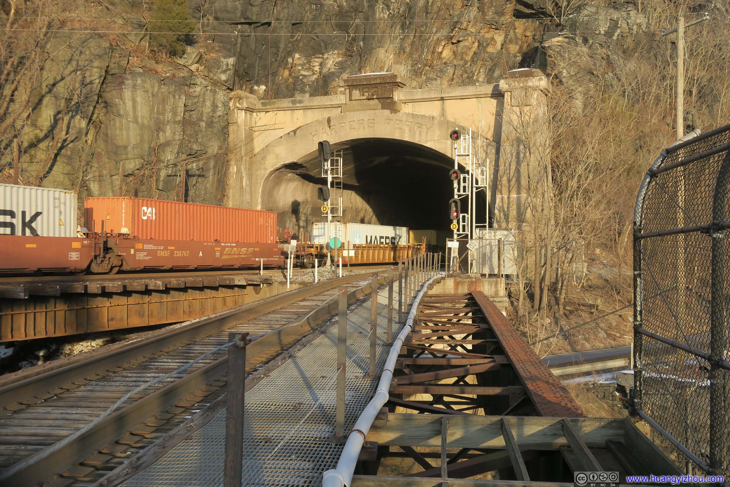 Freight Train Passing By
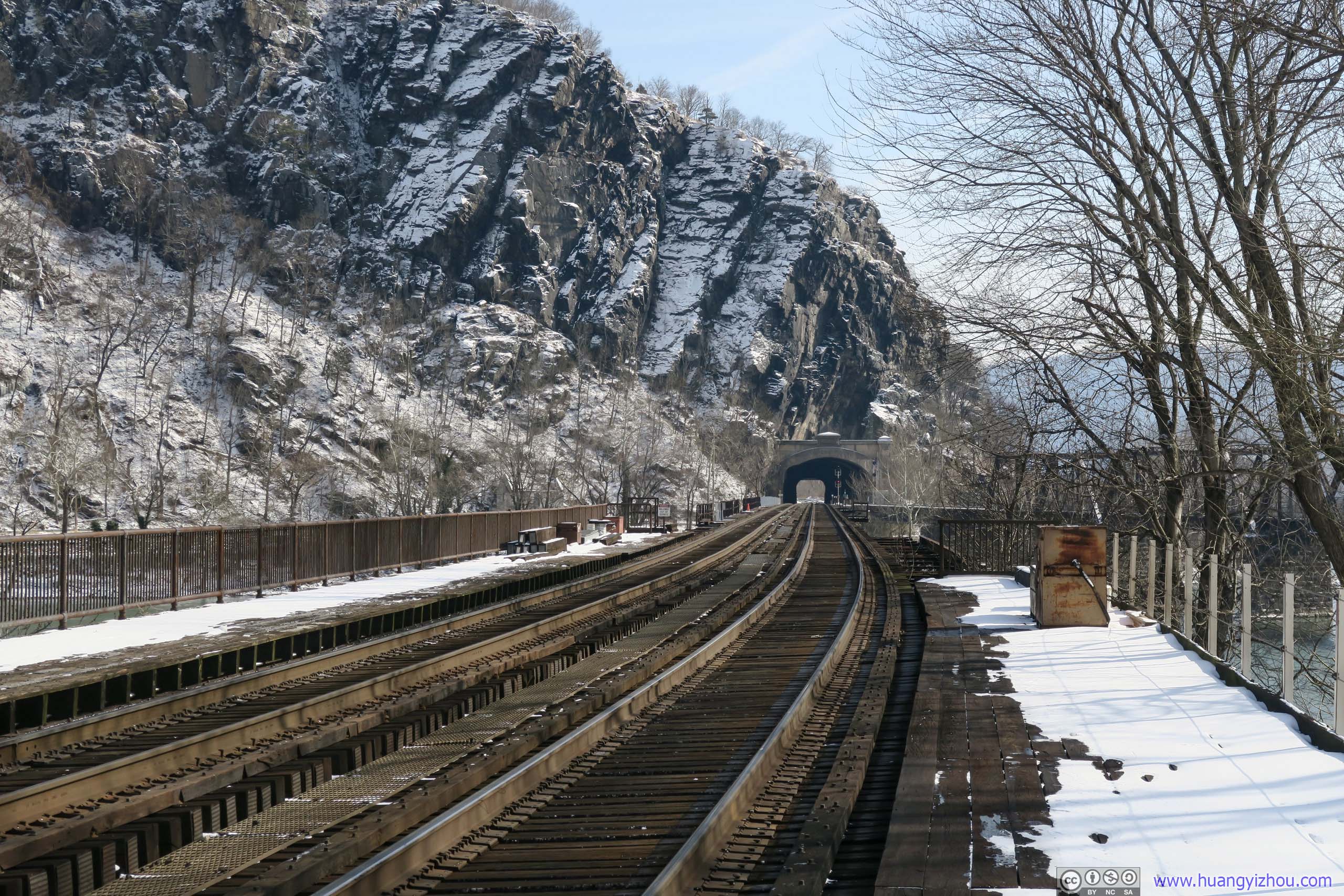
There were two bridges heading out of Harpers Ferry Tunnel. The dual-track bridge carried only railroad traffic continuing North as B&O’s mainline. The single-track bridge continued West as Shenandoah division. The latter also carried a footpath for people to walk across Potomac River, which was part of the Appalachian Trail.
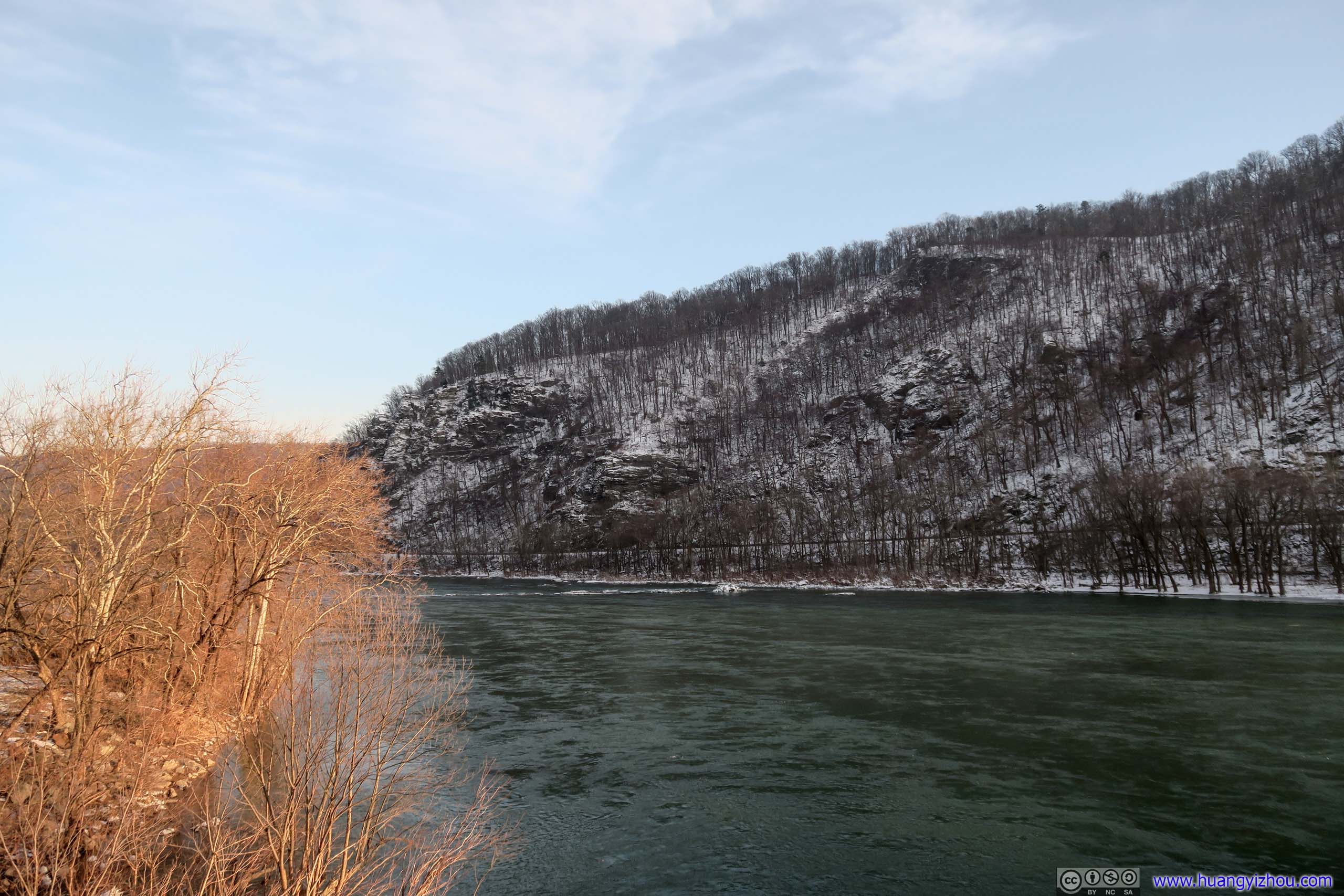
 Hills of Loudoun HeightsThe ones I just climbed hours ago.
END
![]() Hiking Loudoun Heights Trail from Harpers Ferry by Huang's Site is licensed under a Creative Commons Attribution-NonCommercial-ShareAlike 4.0 International License.
Hiking Loudoun Heights Trail from Harpers Ferry by Huang's Site is licensed under a Creative Commons Attribution-NonCommercial-ShareAlike 4.0 International License.