
Updated on January 1, 2024
Day 5 of 2023 Trip to Hawaii, Road to Hana
Fifth day of my January 2023 trip to Hawaii. We would spend the day on a road trip driving “Road to Hana”, the crown-jewel of Hawaii driving tours.
Southern Maui Coast
After the incident with our rental car breaking down the previous day, today we were onto a fresh start as we took on the road trip along Hana Highway. This was a winding, and at times narrow road leading to the town of Hana at the eastern side of the island of Maui, traveling among lush rainforests, coastal cliffs and numerous waterfalls.
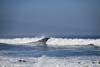
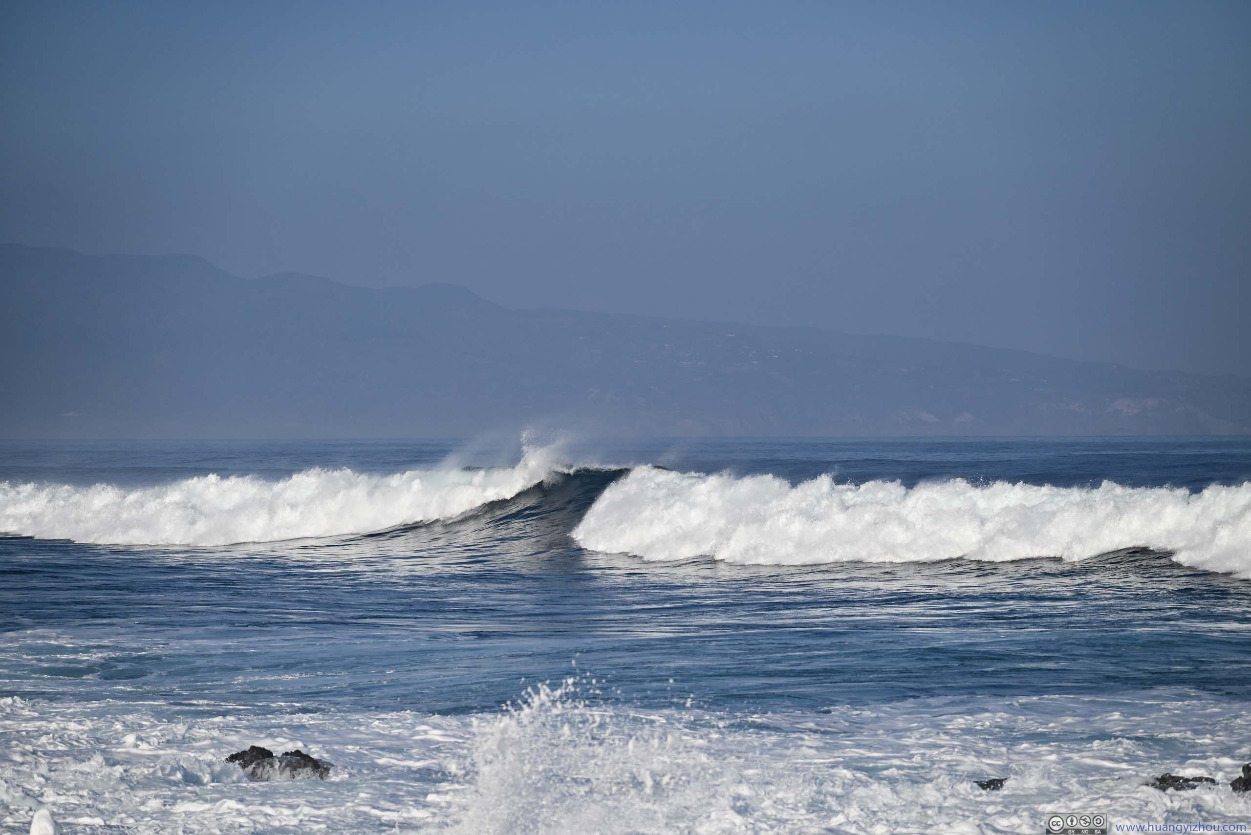
We set off from our hotel in Kahului at just past 8am. Our first stop of the day was Ho’okipa Beach Park, along Maui’s northern coast. Like three days ago at Oahu’s northern coast, the waves were spectacularly huge (glad I was learning paddleboard surfing at a more tranquil beach the previous day). The backdrop of West Maui mountains against the rising sun was sure a nice sight to start the day, in addition to a courageous surfer riding the waves.
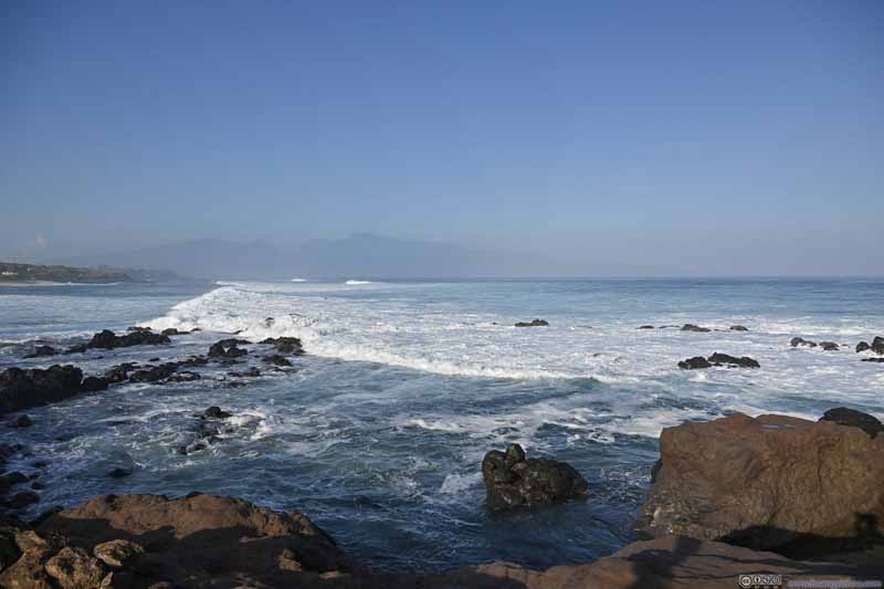 Waves off Ho’okipa Beach ParkWest Maui Mountains in the background.
 Rocks off Ho’okipa Beach
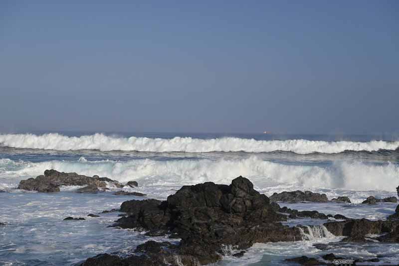 Incoming Waves
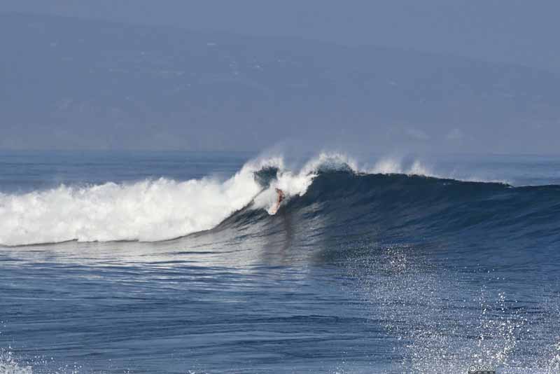 Surfer
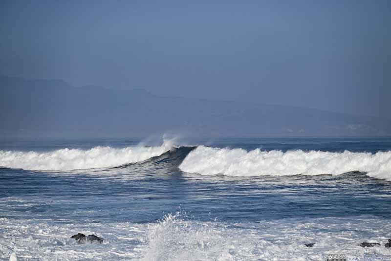 Incoming Waves

Click here to display photos from Ho’okipa Beach Park.
Waves off Ho’okipa Beach ParkWest Maui Mountains in the background.
Rocks off Ho’okipa Beach

Incoming Waves

Surfer
Incoming Waves
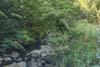
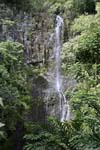
The typical “road to Hana” experience started after the village of Ulumalu (County Road 365), where the road was curvy (officially, there are 620 curves along the 64-mile road), at times narrow (portions of the road were one-lane with no center marking). Due to the nature of this road, many attractions had very limited parking spaces. In particular, ample precipitation on the windward side of the island created multiple creeks that flew along the gullies on the eastern slope of Haleakala, forming multiple waterfalls along Hana Highway, some becoming major attractions along the way. During our visit, finding a parking spot at most of these waterfalls was almost impossible. In addition, it hadn’t rained a lot in the previous few days so many of the waterfalls were hardly more than a trickle. As a result, we didn’t stop at many of the smaller attractions along the way. Photos in the slideshow below were captured from the car.
 Haipua’ena Falls
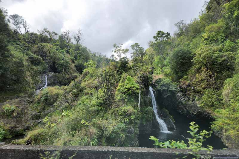 Hanawi Falls
 Overlooking Honomanu Bay
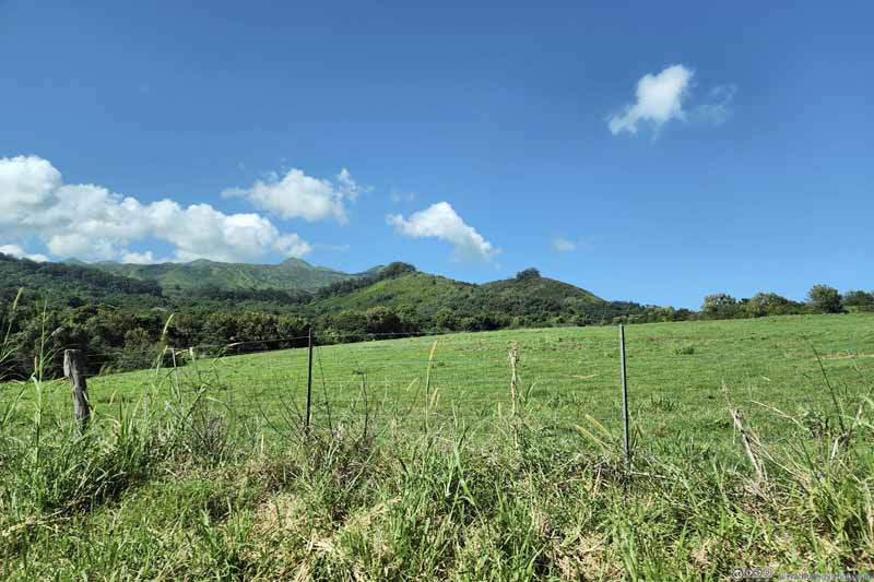 Fields outside Hana
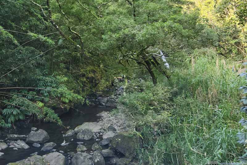
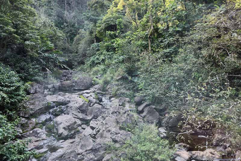 Ha’ipua’ena Stream
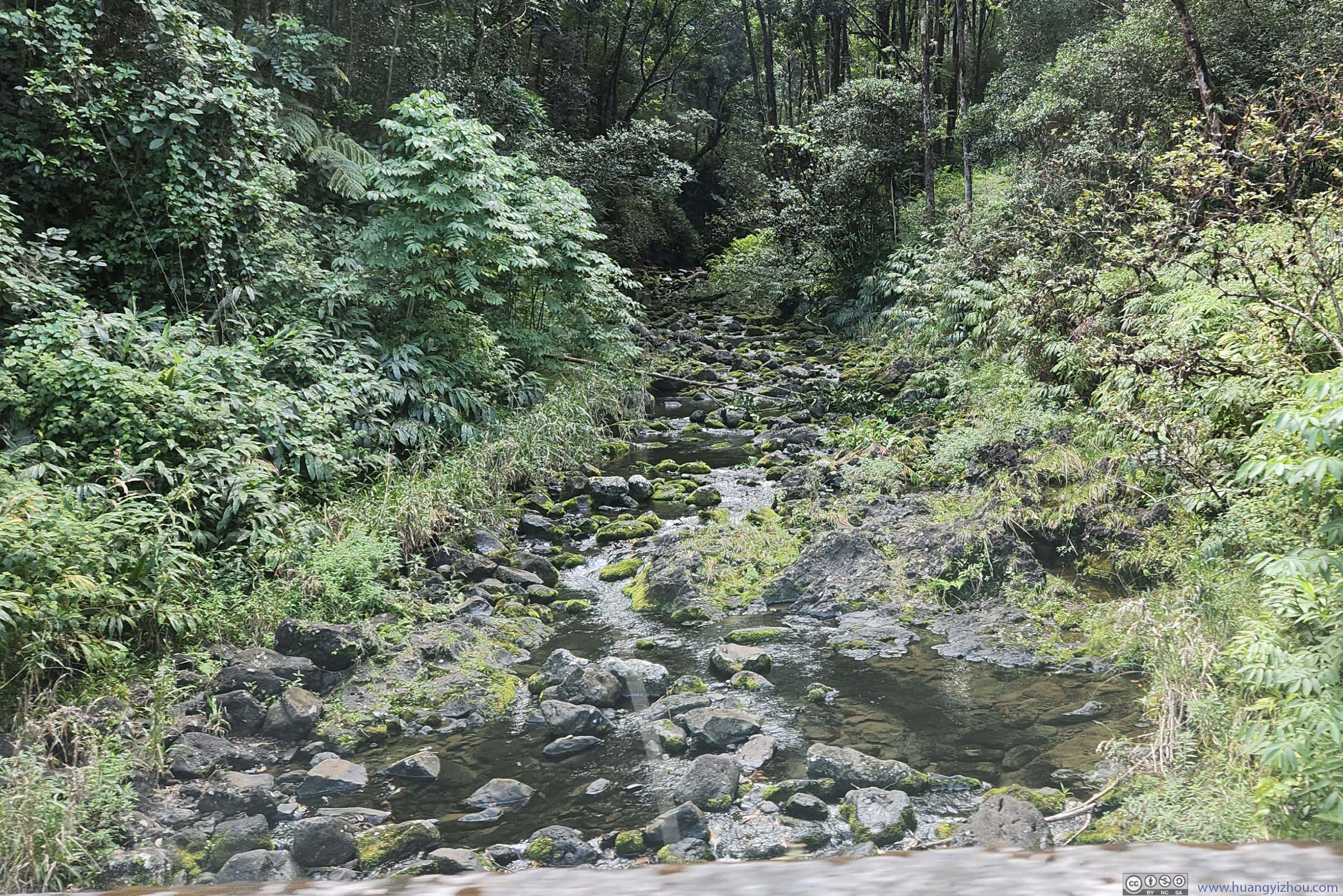
 Makapipi Stream
Click here to display photos of the slideshow
Haipua’ena Falls

Hanawi Falls

Overlooking Honomanu Bay
Fields outside Hana

Ha’ipua’ena Stream
Makapipi Stream
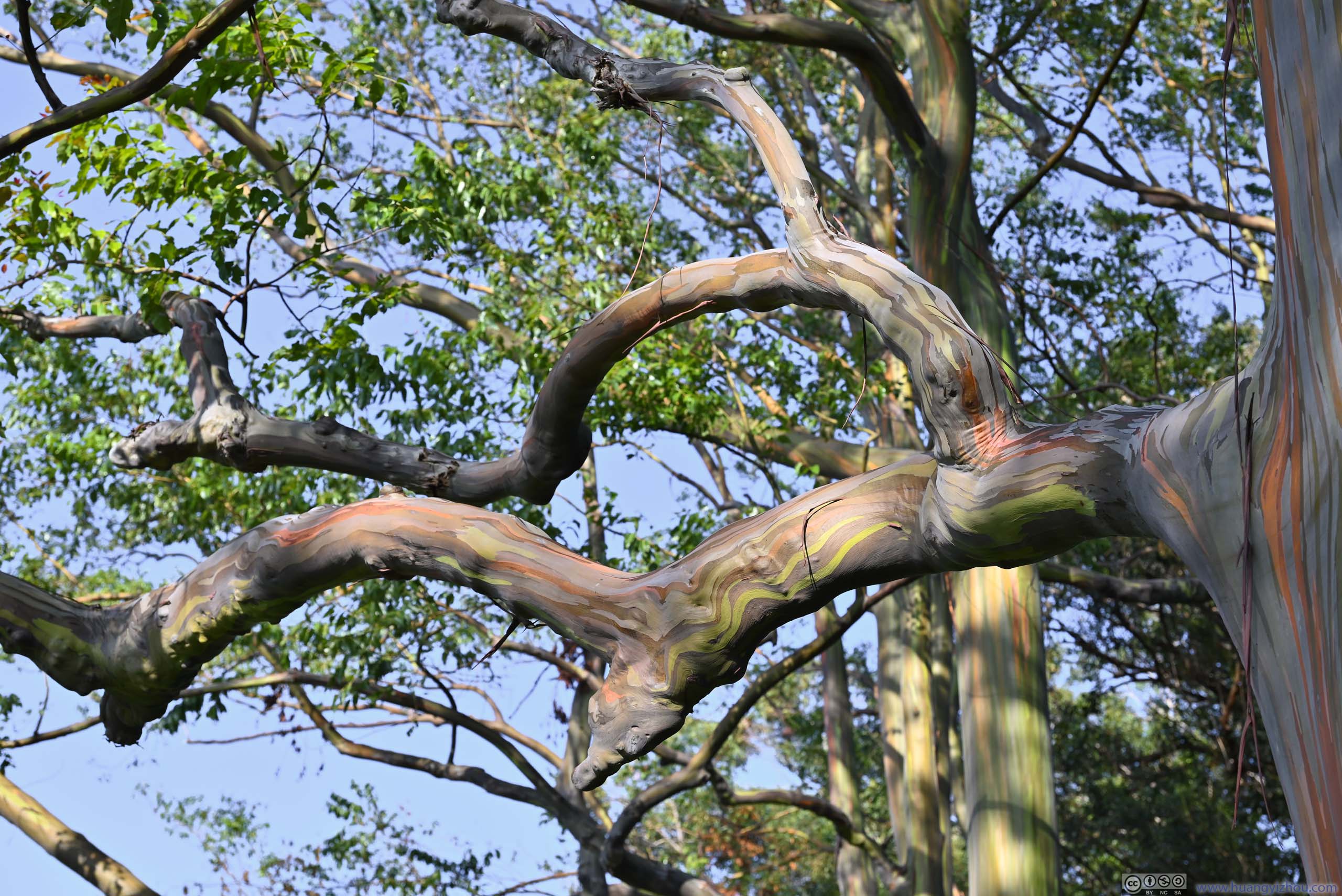
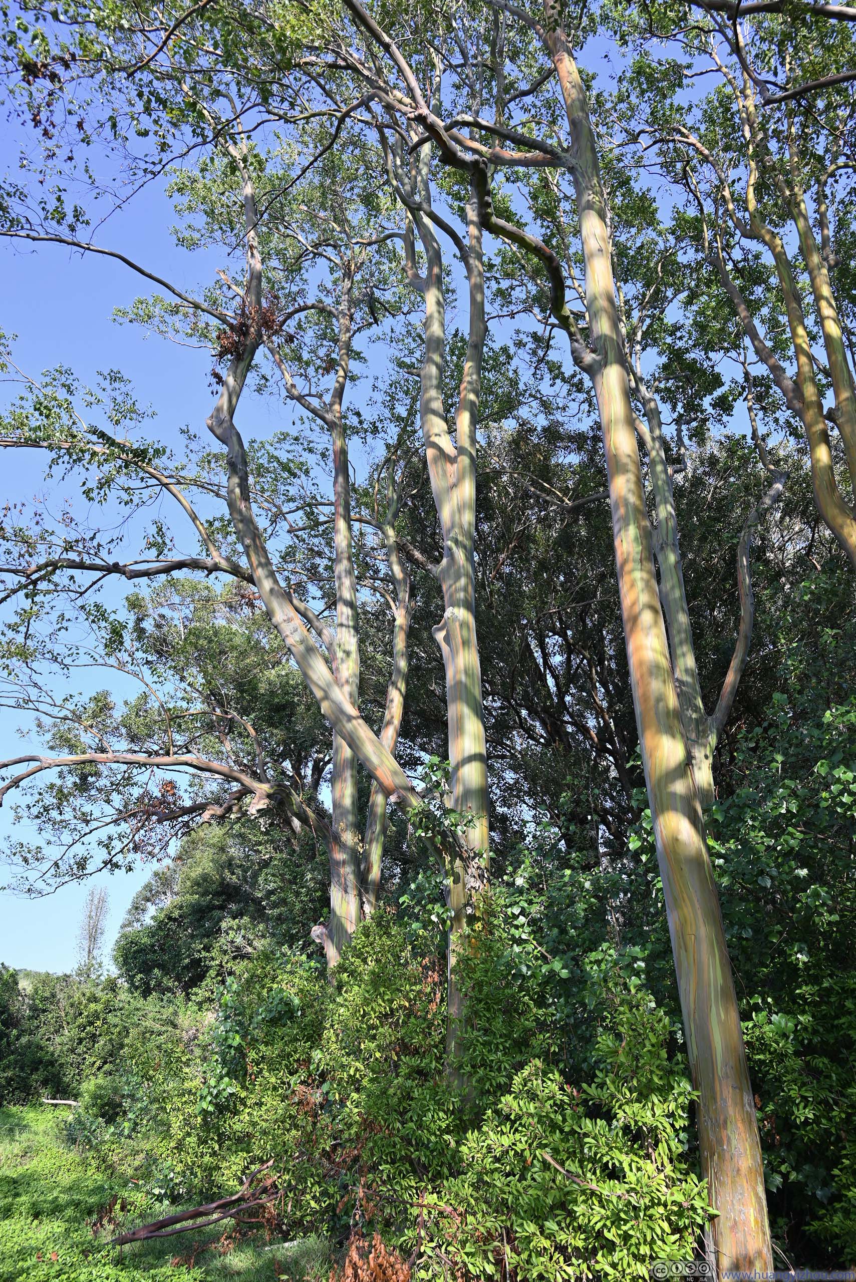
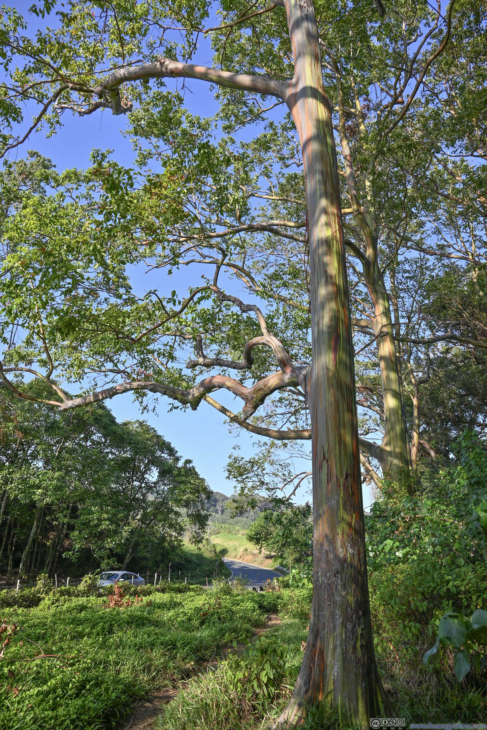
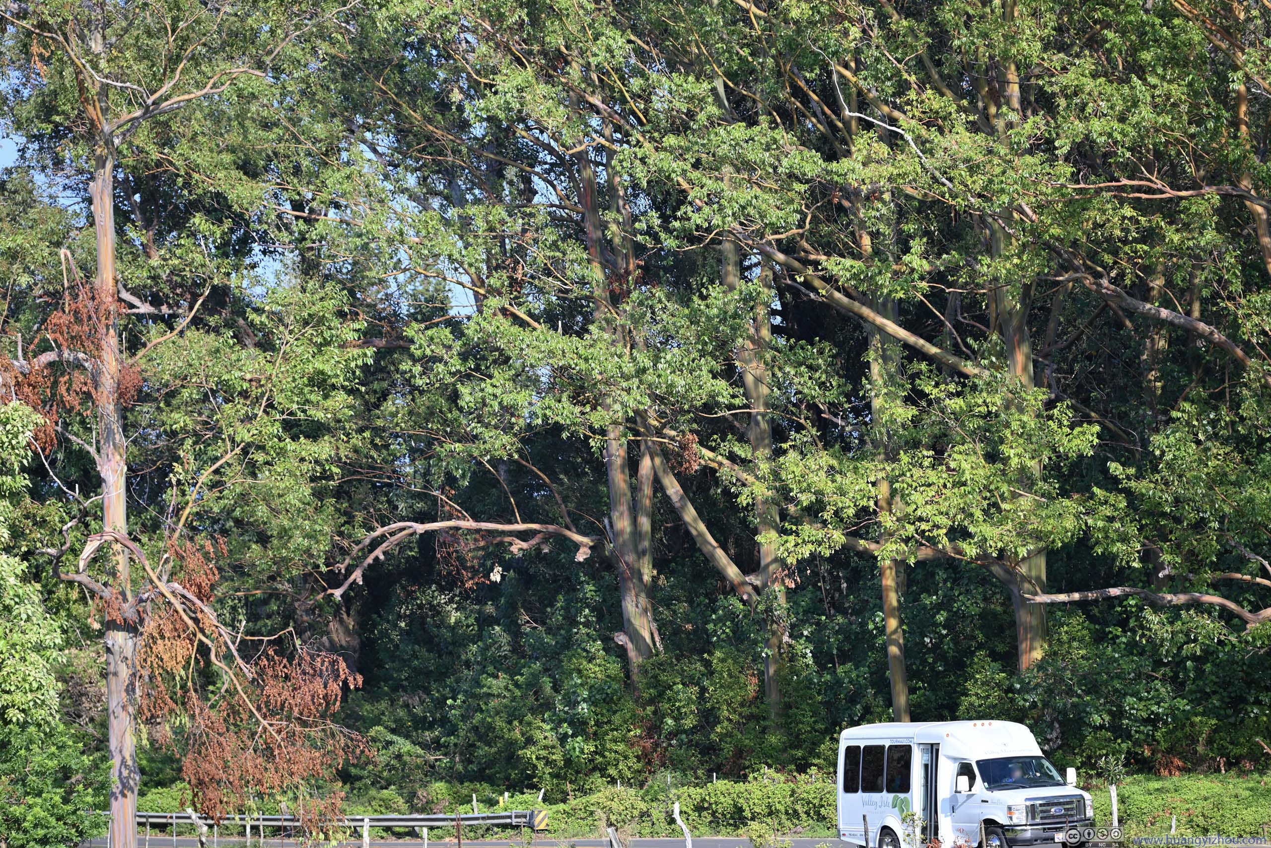
Of the few stops that we did make, one of them was “Eucalyptus Rainbow Trees”, a kind of tree characterized by its multi-colored bark. Pretty appropriate for the rainbow state of Hawaii.
Eucalyptus Rainbow Trees


Click here to display photos of the Eucalyptus Rainbow Trees.
Eucalyptus Rainbow Trees
 Eucalyptus Rainbow Trees
Eucalyptus Rainbow Trees
Then we made a stop at Kaumahina State Wayside Park, since it had a huge (by Hana highway standards) parking lot. The park offered a preview of a few bays down the road, through a clearing in between the trees. It’s against the light so the views weren’t that impressive.
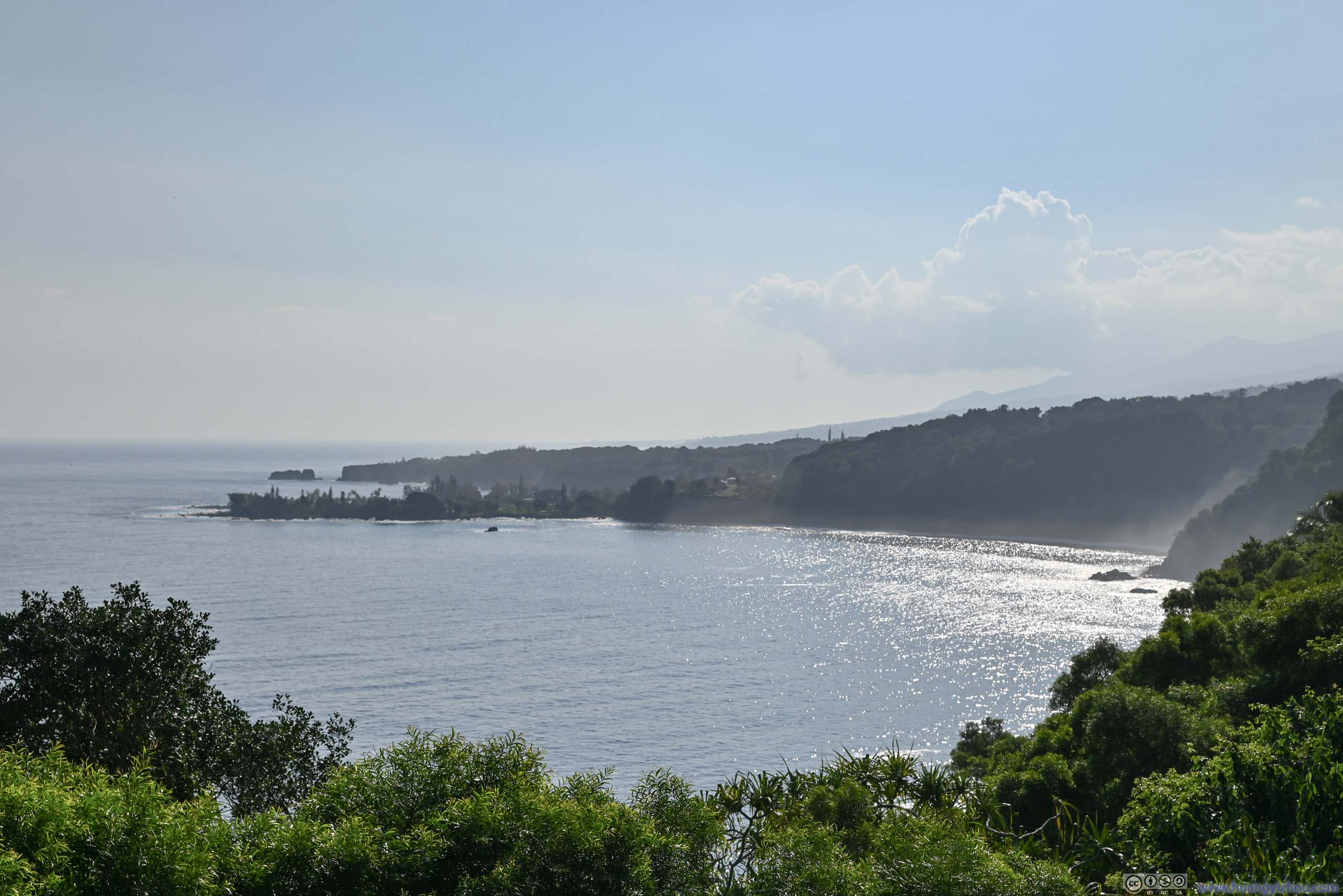
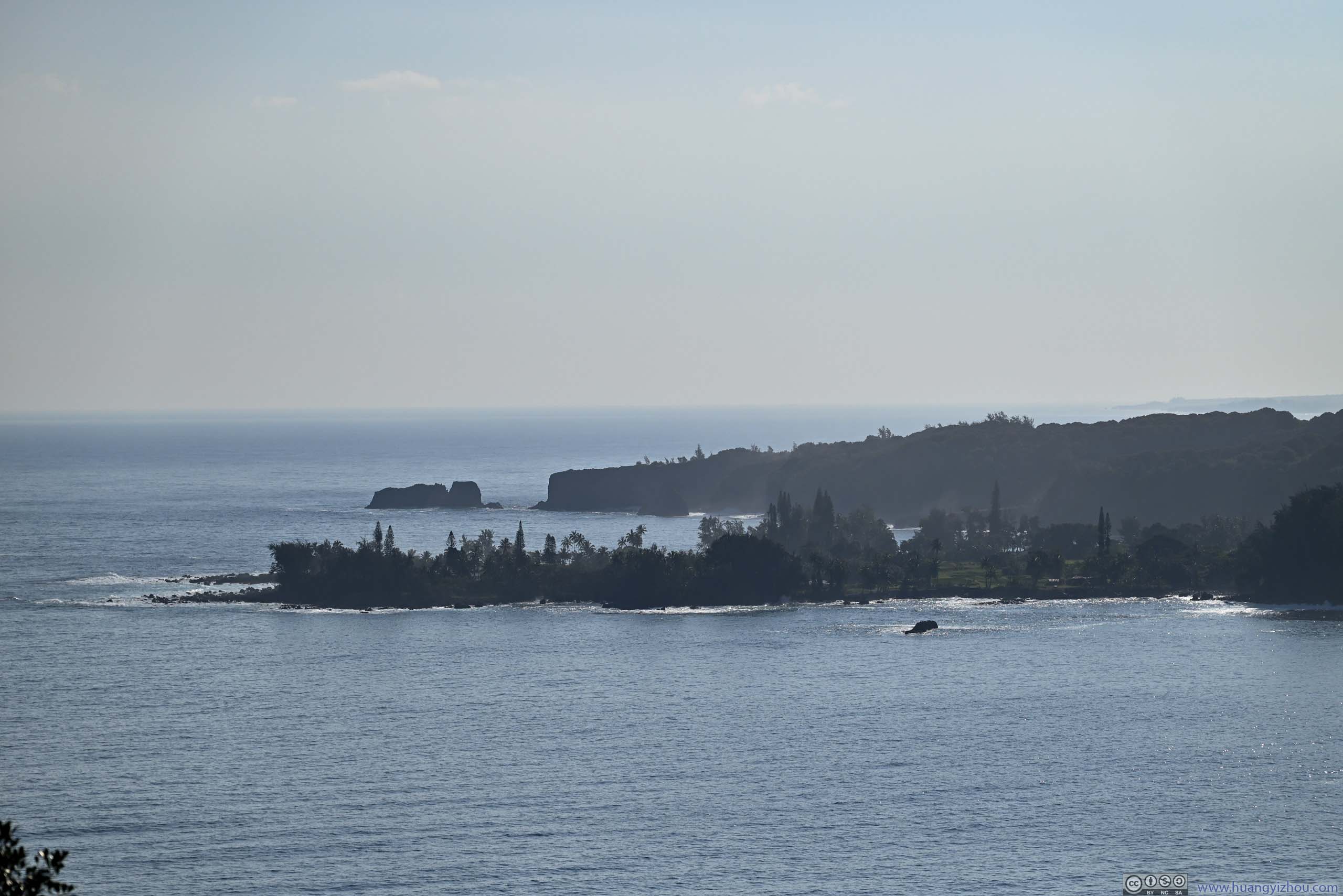 Ke’anae Peninsula and Distant Pauwalu Point
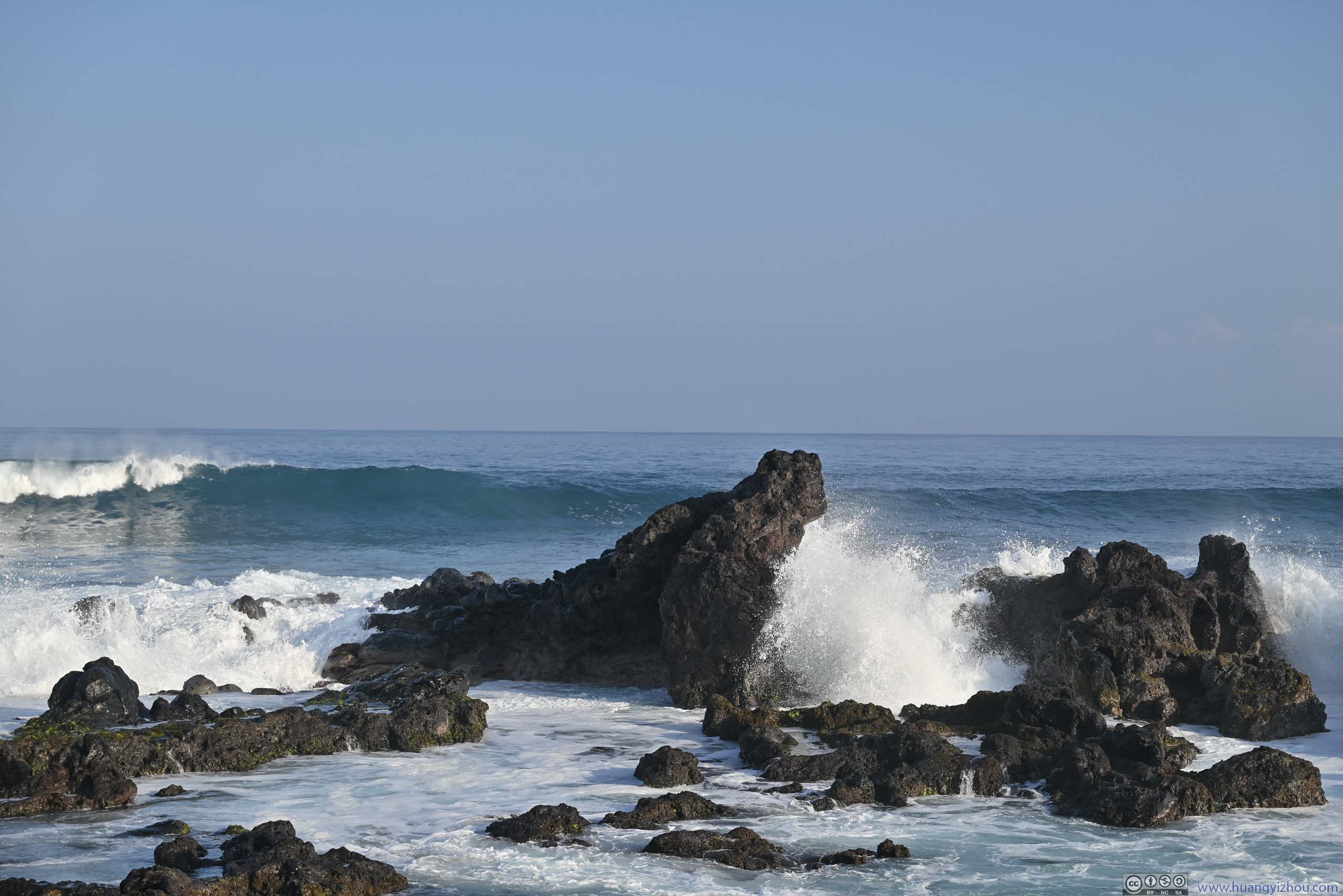
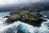
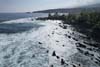
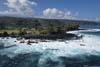
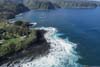
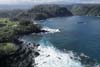
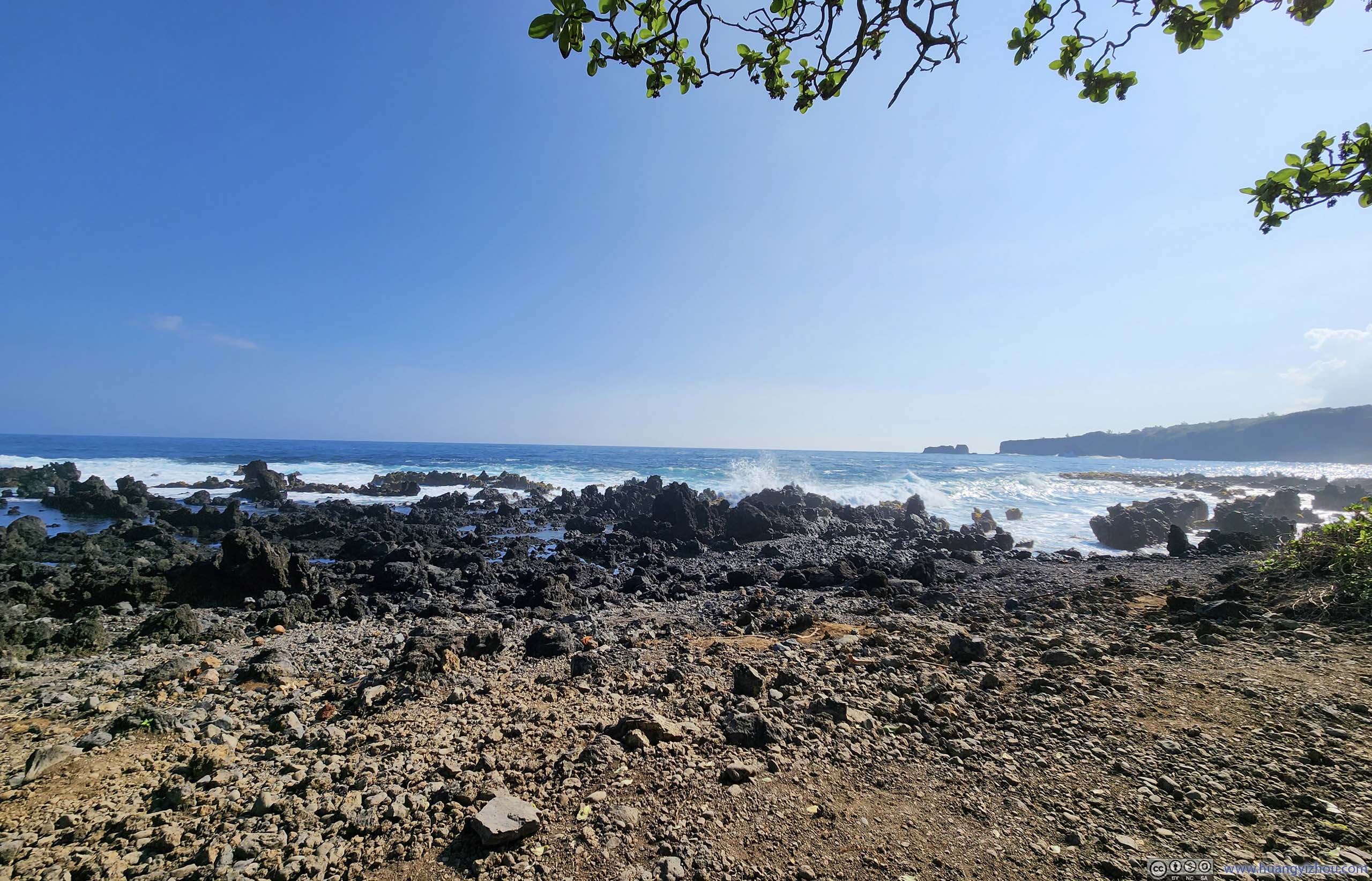
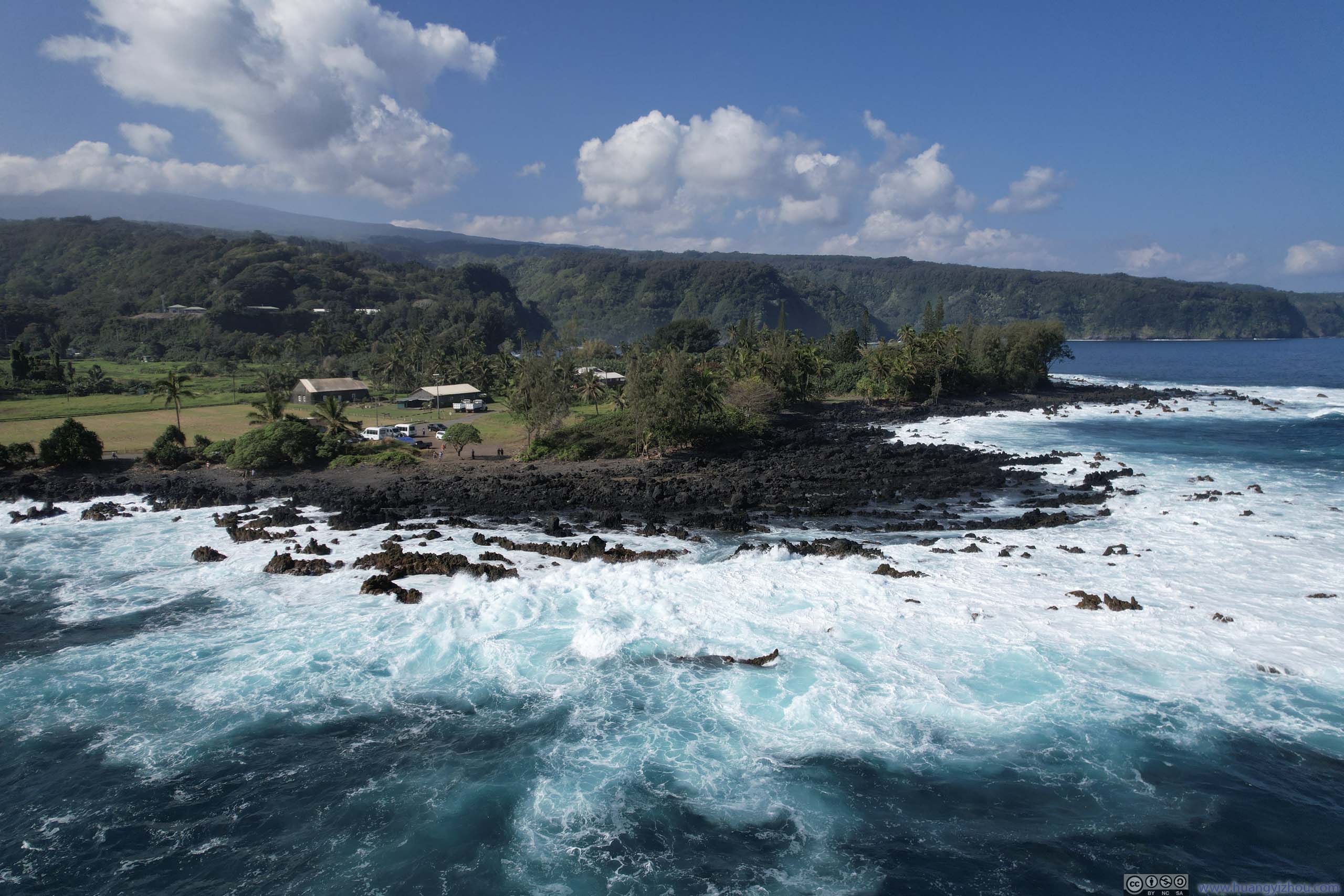
After Kaumahina park, we decided to take a detour and visit Ke’anae Peninsula. This would be our last sight of the ocean until the town of Hana, about 20 miles later. Here I launched my drone and took some photos and videos overlooking the peninsula, of the tumultuous waves pounding its shoreline made of volcanic deposits into white splashy bubbles.
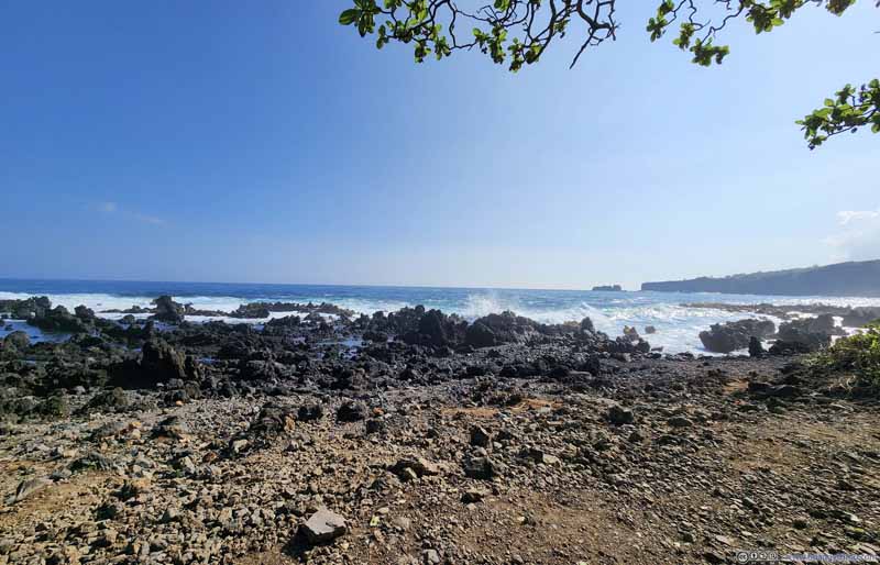 Coast of Ke’anae Peninsula
Captured on land. The black rocks were likely from volcanic activities that also created Ke’anae Peninsula.
Coast of Ke’anae Peninsula
Captured on land. The black rocks were likely from volcanic activities that also created Ke’anae Peninsula.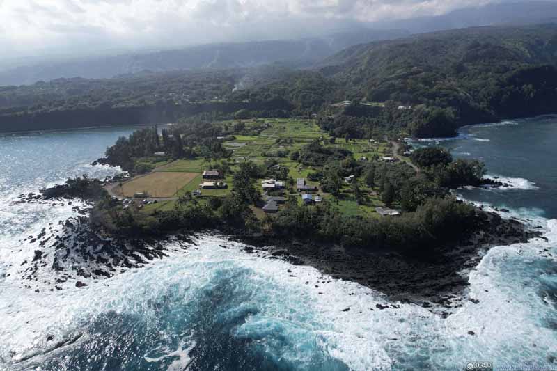 Overlooking Ke’anae Peninsula
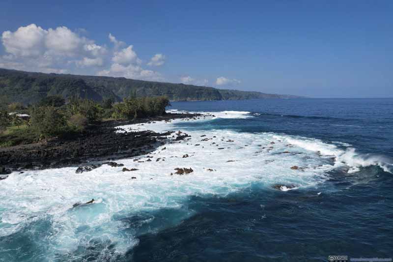 Waves Pounding Ke’anae Peninsula
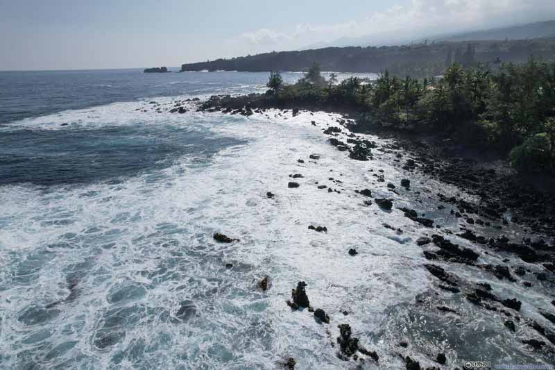 Waves Pounding Ke’anae Peninsula
 Waves Pounding Ke’anae Peninsula
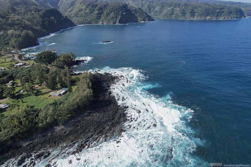 Waves Pounding Ke’anae Peninsula
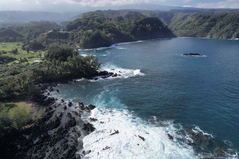 Nua’ailua Bay

Click here to display photos from Ke’anae Peninsula.
Coast of Ke’anae Peninsula

Overlooking Ke’anae Peninsula

Waves Pounding Ke’anae Peninsula

Waves Pounding Ke’anae Peninsula
Waves Pounding Ke’anae Peninsula

Waves Pounding Ke’anae Peninsula

Nua’ailua Bay
And here’s a video:
1 minute and 4 seconds, 2160p60fps, 2.5x playback speed, 16Mbps/136MB for H265, 17Mbps/143MB for H264.
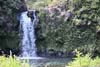
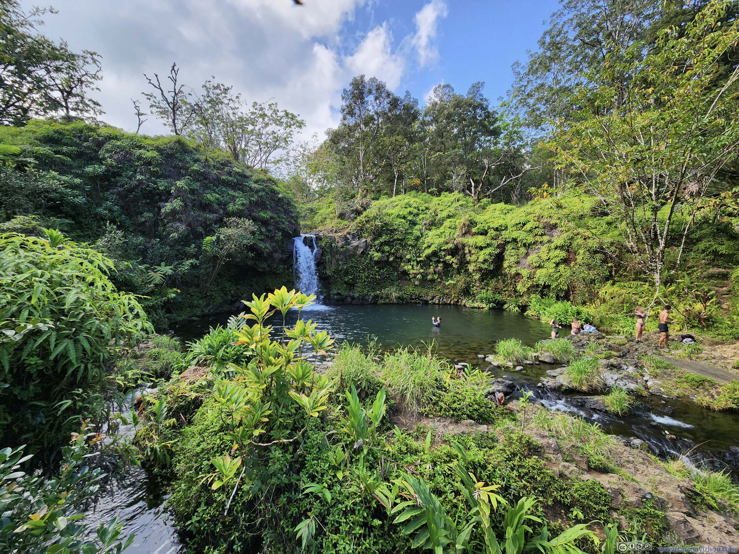
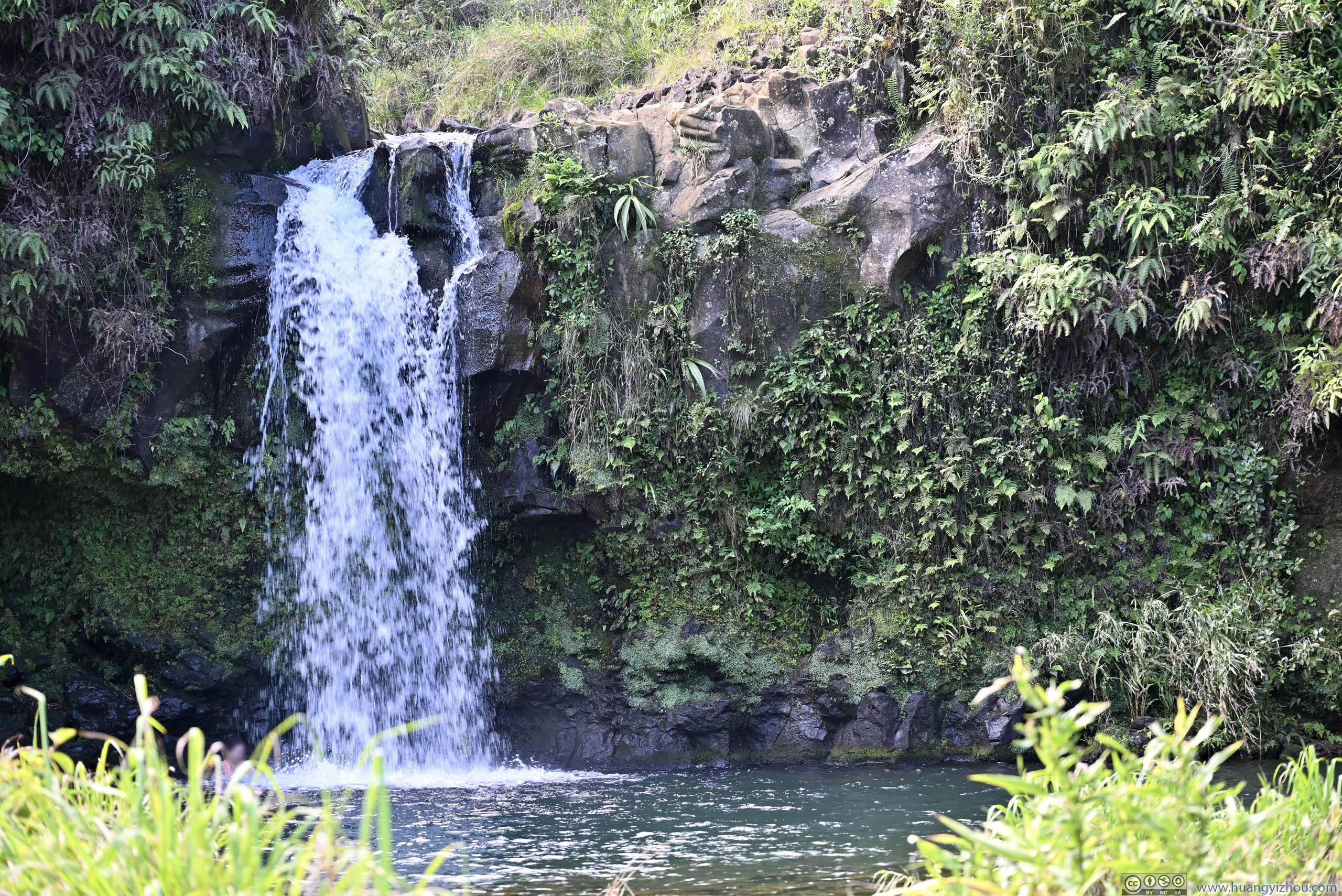
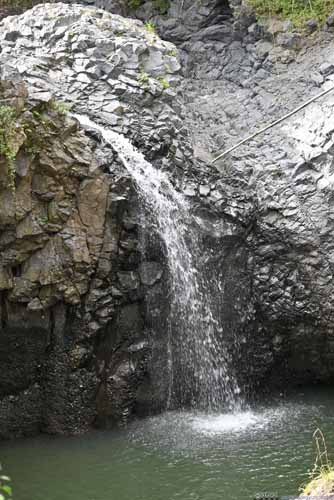
Our next stop was Pua’a Ka’a Falls, one of the few waterfalls with a proper parking lot. It came with a pond where some people were taking a swim. But since we didn’t bring any swim gear, we quickly moved on.
 Pua’a Ka’a Falls
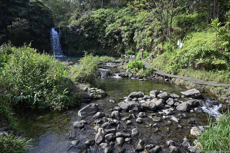 Pua’a Ka’a Falls
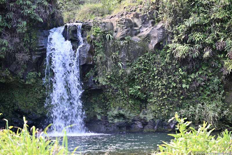 Pua’a Ka’a Falls

Click here to display photos from Pua’a Ka’a Falls.
Pua’a Ka’a Falls

Pua’a Ka’a Falls
Pua’a Ka’a Falls
Just outside the town of Hana, a major attraction was the black sand beach of Wai’ānapanapa State Park. However, due to its popularity, the park required advanced reservation for entry slots (for non-residents), and there were only 4 different slots for a given day that would severely limit the flexibility of this road trip. With so much else to see along Hana Highway, we decided to skip it.
And with that, we reached the town of Hana just past noon. We made a brief stop at Hana Beach Park, one of the few spots along the way with cellular coverage, where we planned our next moves for the day.
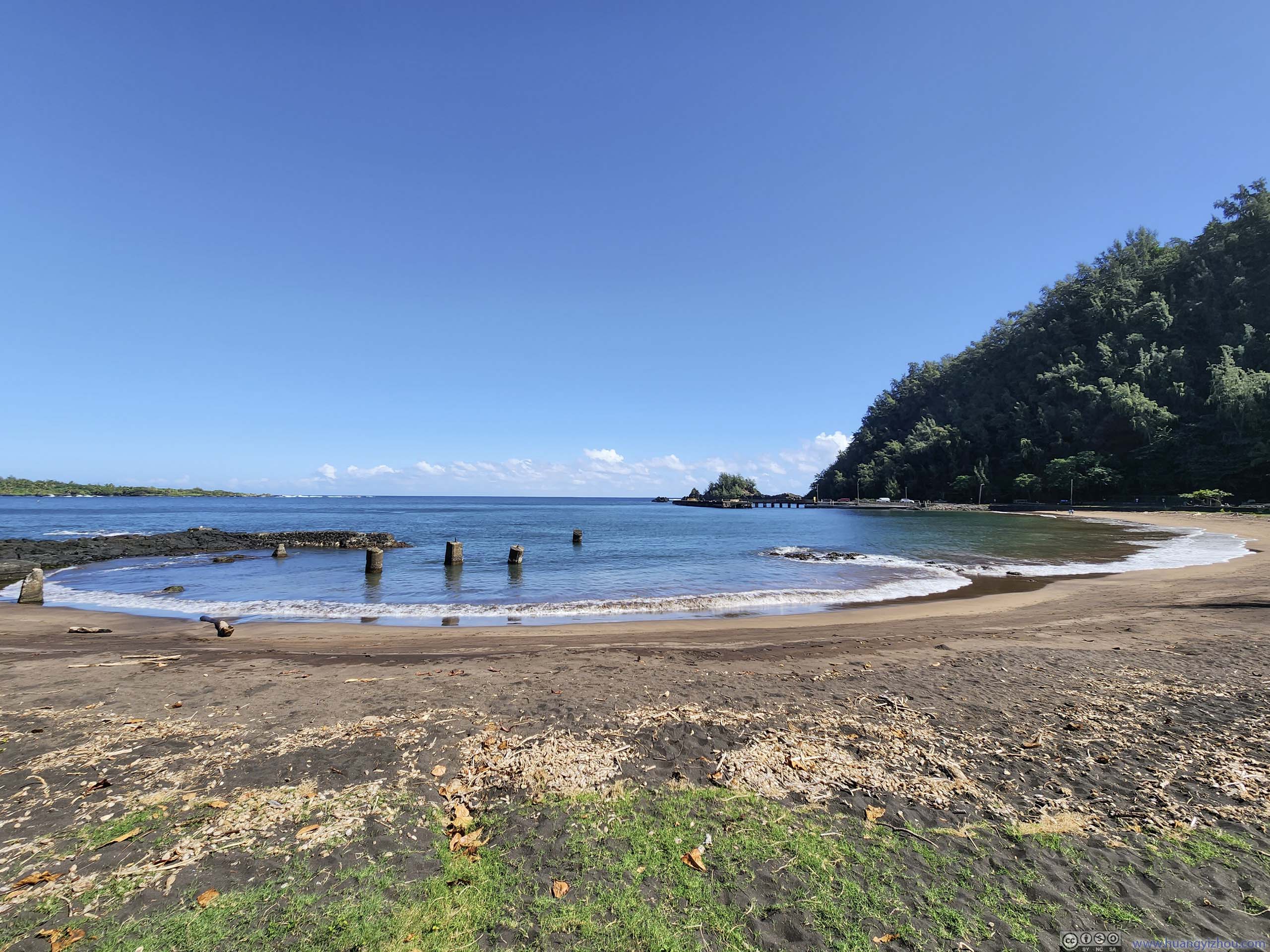
Hana Bay
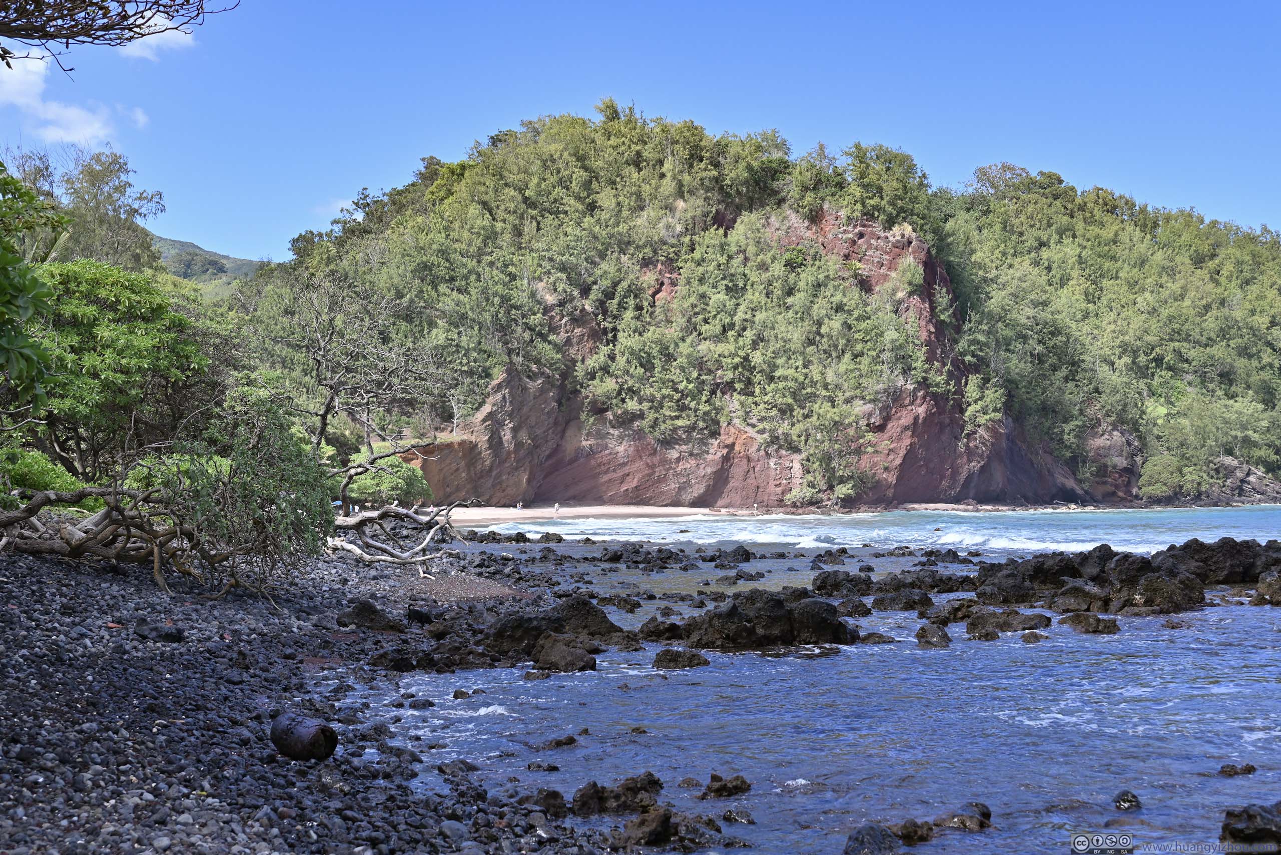
Our next stop of the day was “Koki Beach Park”, where one of my friends decided to try out “Huli Huli Chicken”, which was the name and the only menu item of a restaurant in the park.

LunchMy friend demanded that we tried out this “Huli Huli Chicken” at Koki Beach Park.
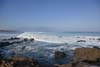
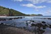
After lunch, we checked out the nearby beach of the park. The blackish rocks were similar to previously at Ke’anae Peninsula, but the waves here were larger and we spotted another surfer.
 Coastline
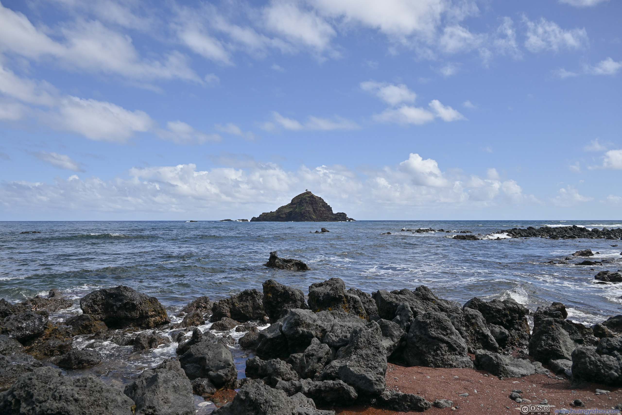
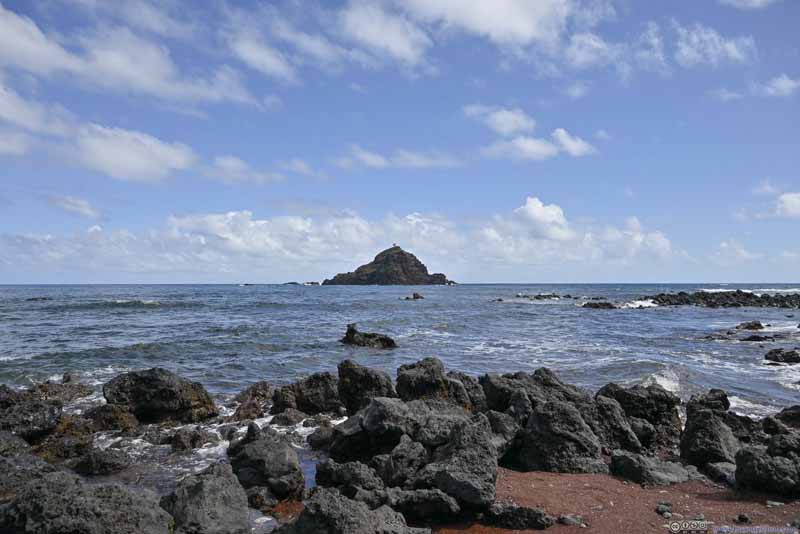 Alau Island
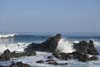
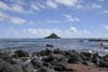
 Koki BeachThe rock formations in the background looked pretty impressive.
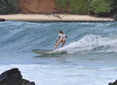
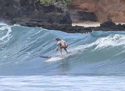

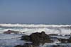
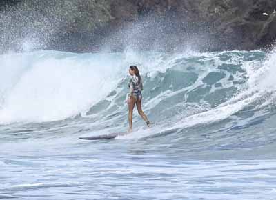 Surfer

Click here to display photos from Koki Beach Park.
Coastline
Alau Island
Koki BeachThe rock formations in the background looked pretty impressive.


 Surfer
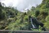
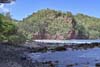
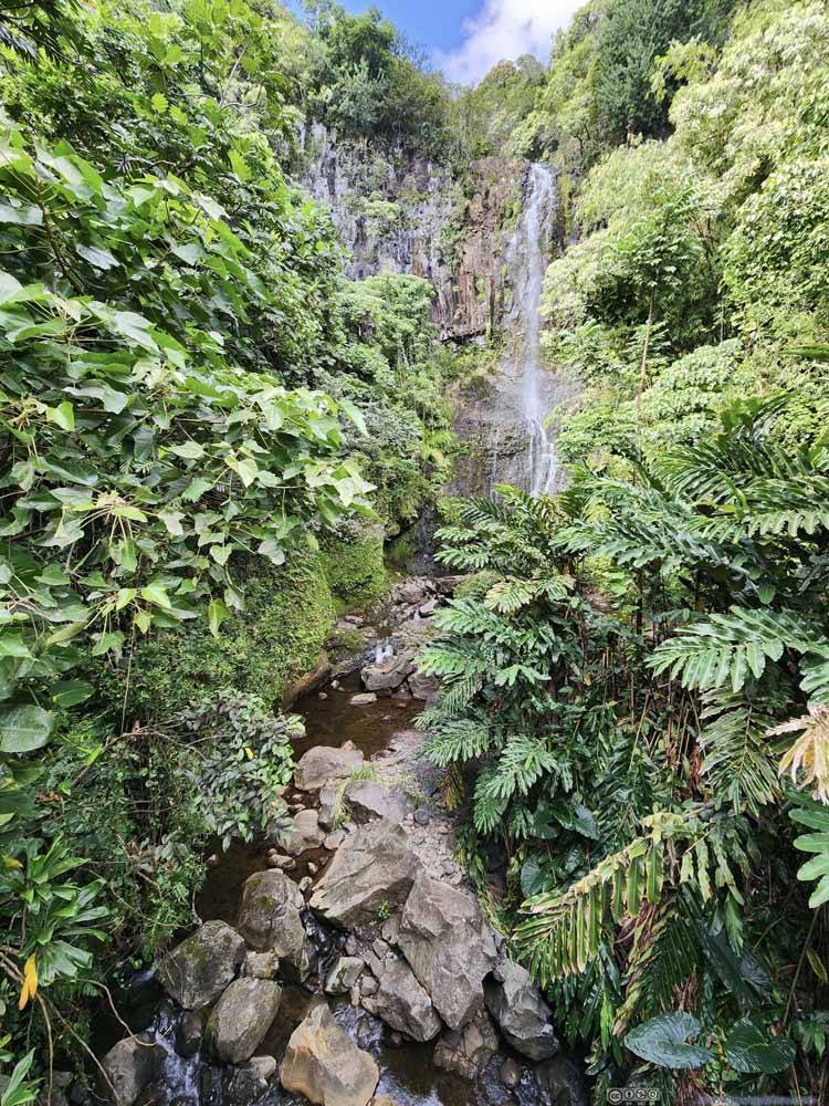
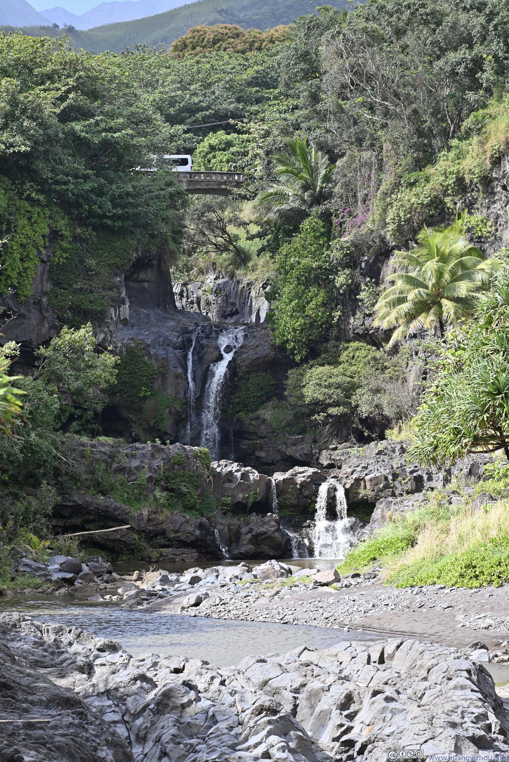
After leaving the town of Hana, our next stop was Wailua Falls, one of the highest waterfalls along Hana Highway, with a decent-sized parking area next to it. Since it’s the most spectacular waterfall of the day, one of my friends decided to take a dip in it (while I battled the mosquitos in the car).
 Wailua FallsTaken from the roadbridge.
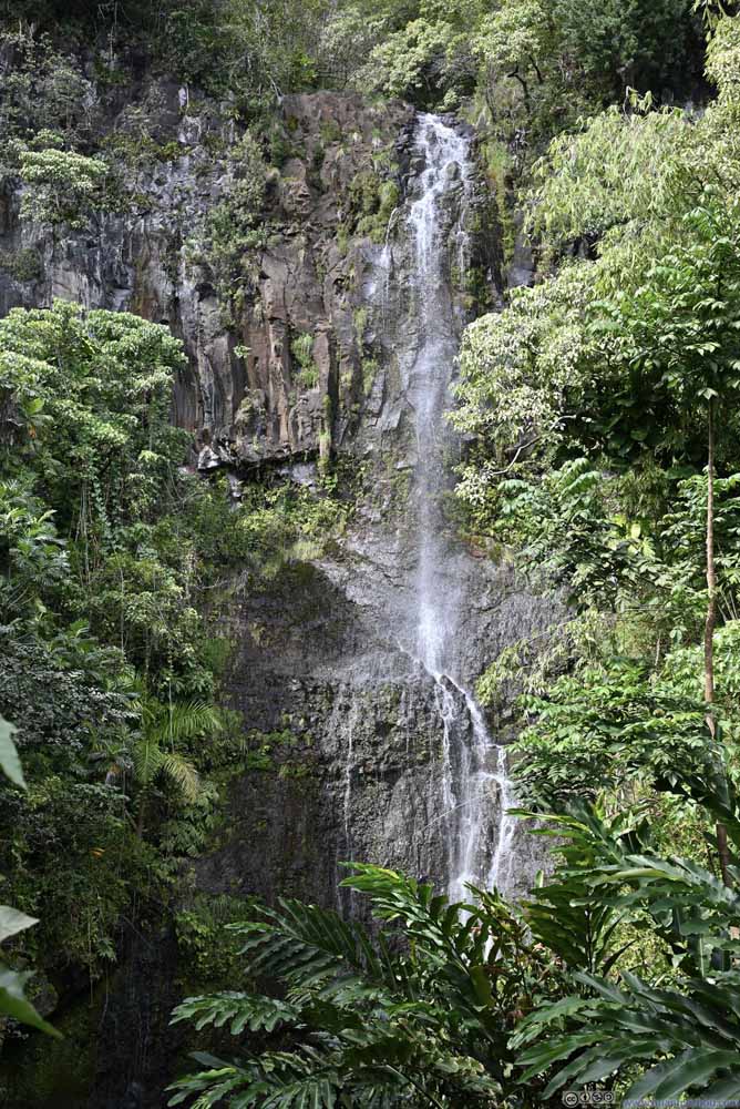 Wailua FallsTaken from the roadbridge.
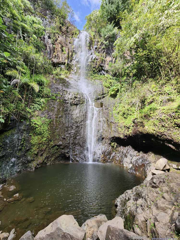 Wailua FallsTaken up close.
Click here to display photos of Wailua Falls.
Wailua FallsTaken from the roadbridge.
Wailua FallsTaken from the roadbridge.

Wailua FallsTaken up close.
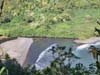
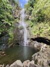
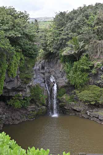
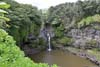
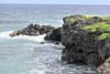
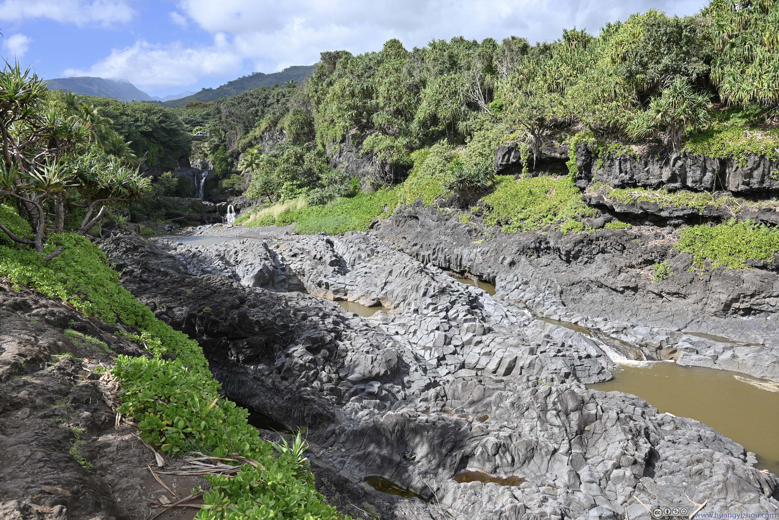
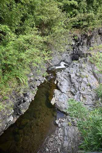
After that, our next stop was ‘Ohe’o Gulch, which was part of Haleakalā National Park. From its parking lot, a short (1km) loop trail would take one to the coast and ‘Ohe’o Gulch, while a longer (5.5km) out-and-back trail would take one into the mountains with two waterfalls. We checked out the coastal trail first.
The sight from the coast was pretty typical of the day, rugged coastline with blackish rocks. ‘Ohe’o Gulch featured a series of waterfalls that, like other waterfalls of the day, were pretty meager. On the map, ʻOheʻo Gulch featured “Seven Sacred Pools”, however, due to lack of water, I could hardly associate the muddy water with the name “sacred”.
 ʻOheʻo GulchI bet some of these ponds constitute “Seven Sacred Pools”.
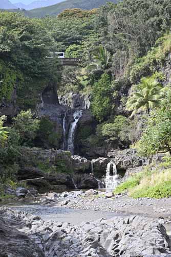
 Waterfall
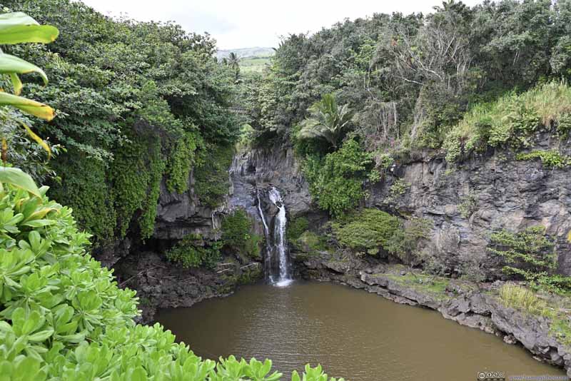 Waterfall
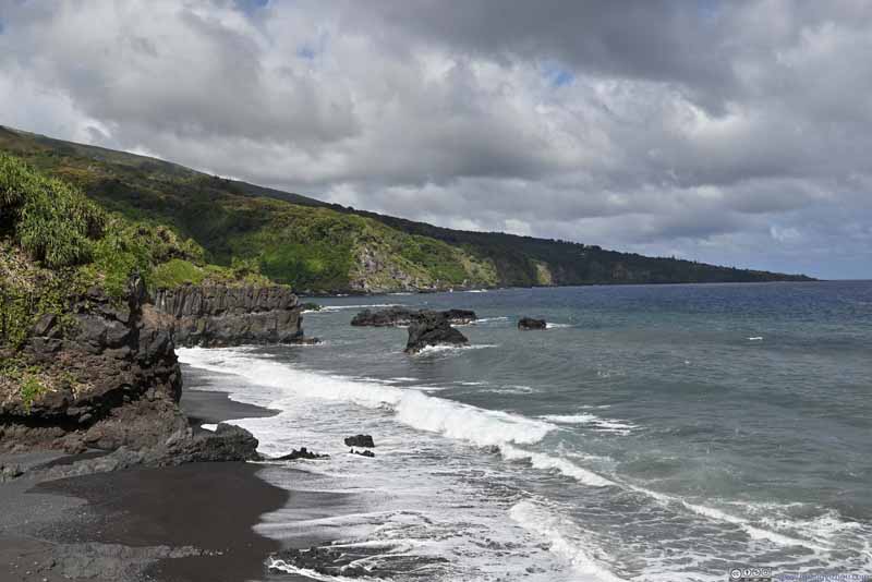 Coastline
 CoastlineAn arch in the lower-right corner.
 Traditional Hawaiian House


Click here to display photos from ‘Ohe’o Gulch.
ʻOheʻo GulchI bet some of these ponds constitute “Seven Sacred Pools”.
 Waterfall

Waterfall
Coastline
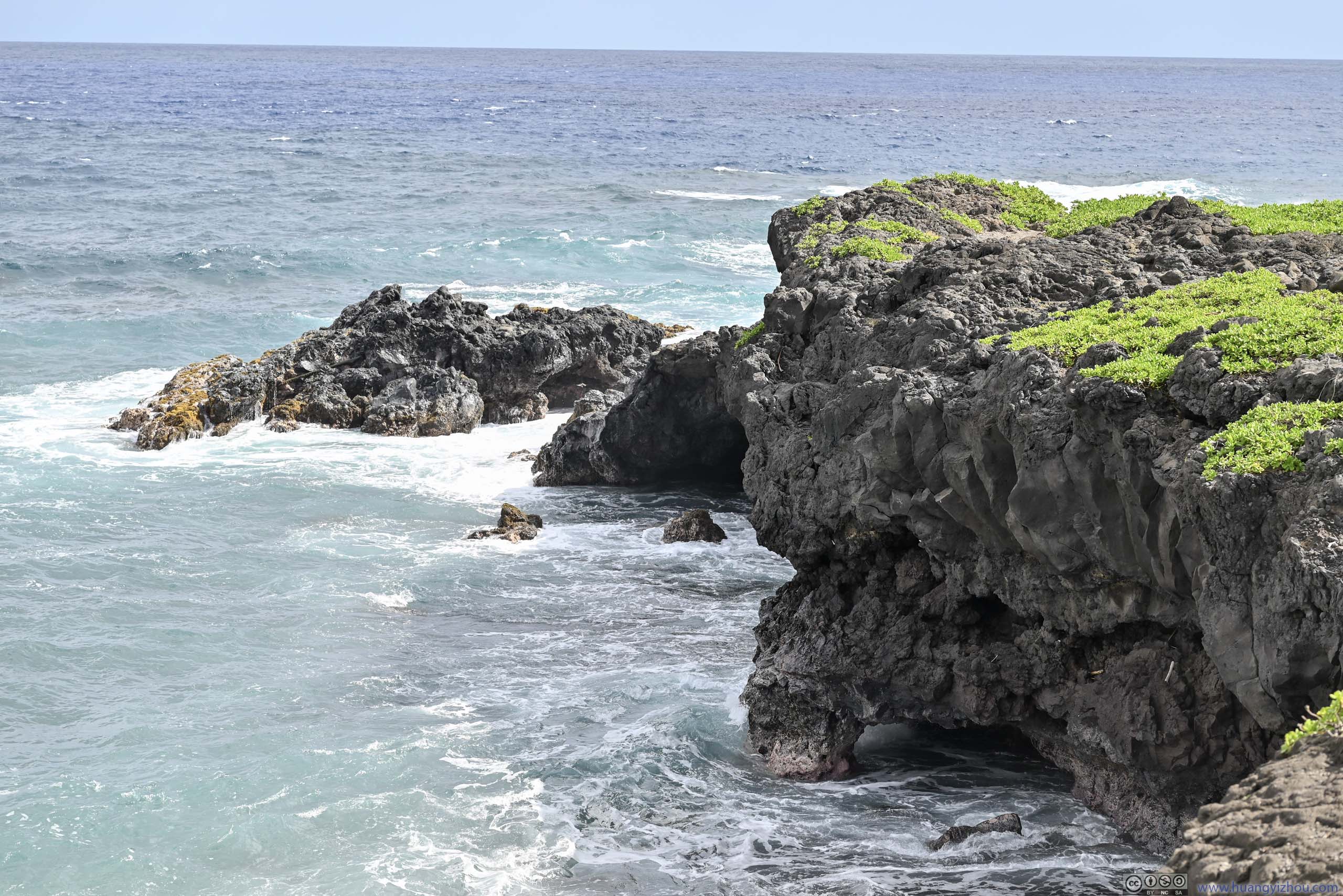
CoastlineAn arch in the lower-right corner.
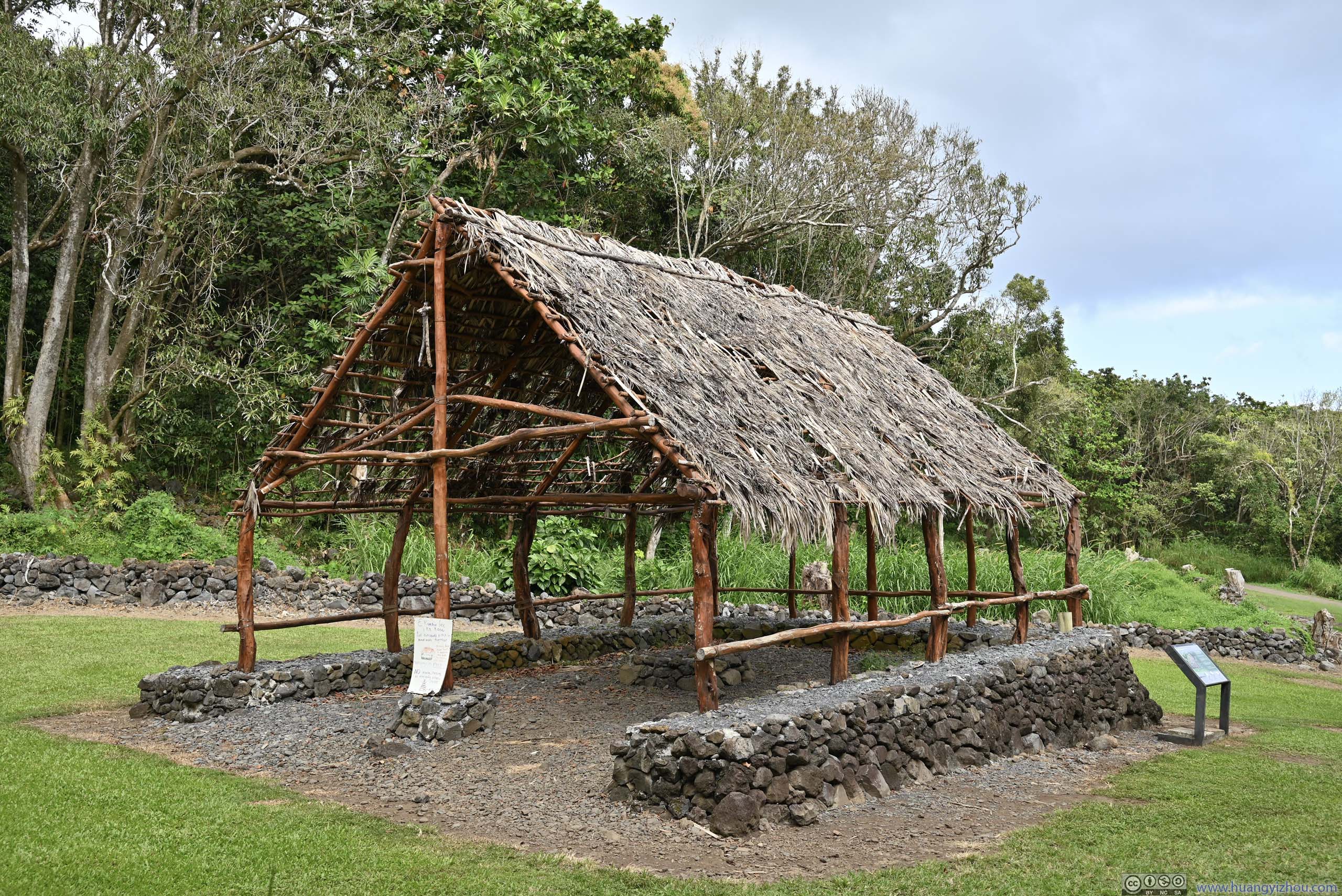
Traditional Hawaiian House
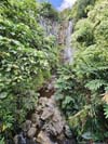
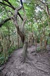
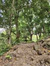
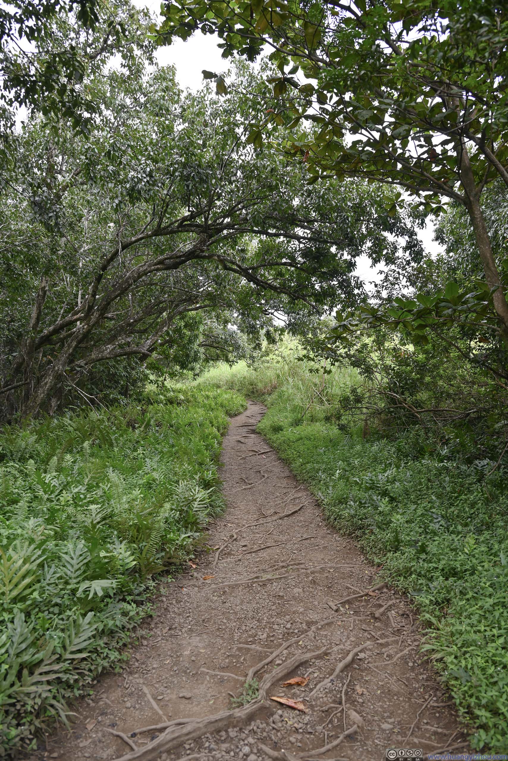
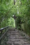
After that, we headed onto the longer trail into the mountains (with one of us feeling tired and staying behind at the parking lot). Shade along the trail kept out both the sun and the wind, with Hawaii weather it felt a bit hot going uphill.
 Trail
Trail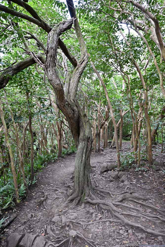 Twisted Tree
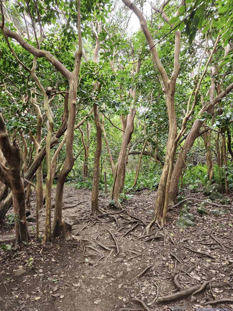 Trail in Forest
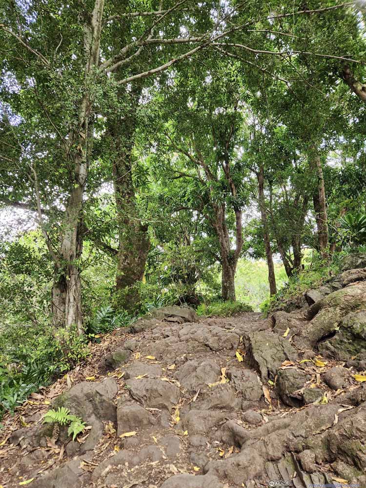 Trail
Trail


Click here to display photos of the trail.
Trail

Twisted Tree

Trail in Forest

Trail
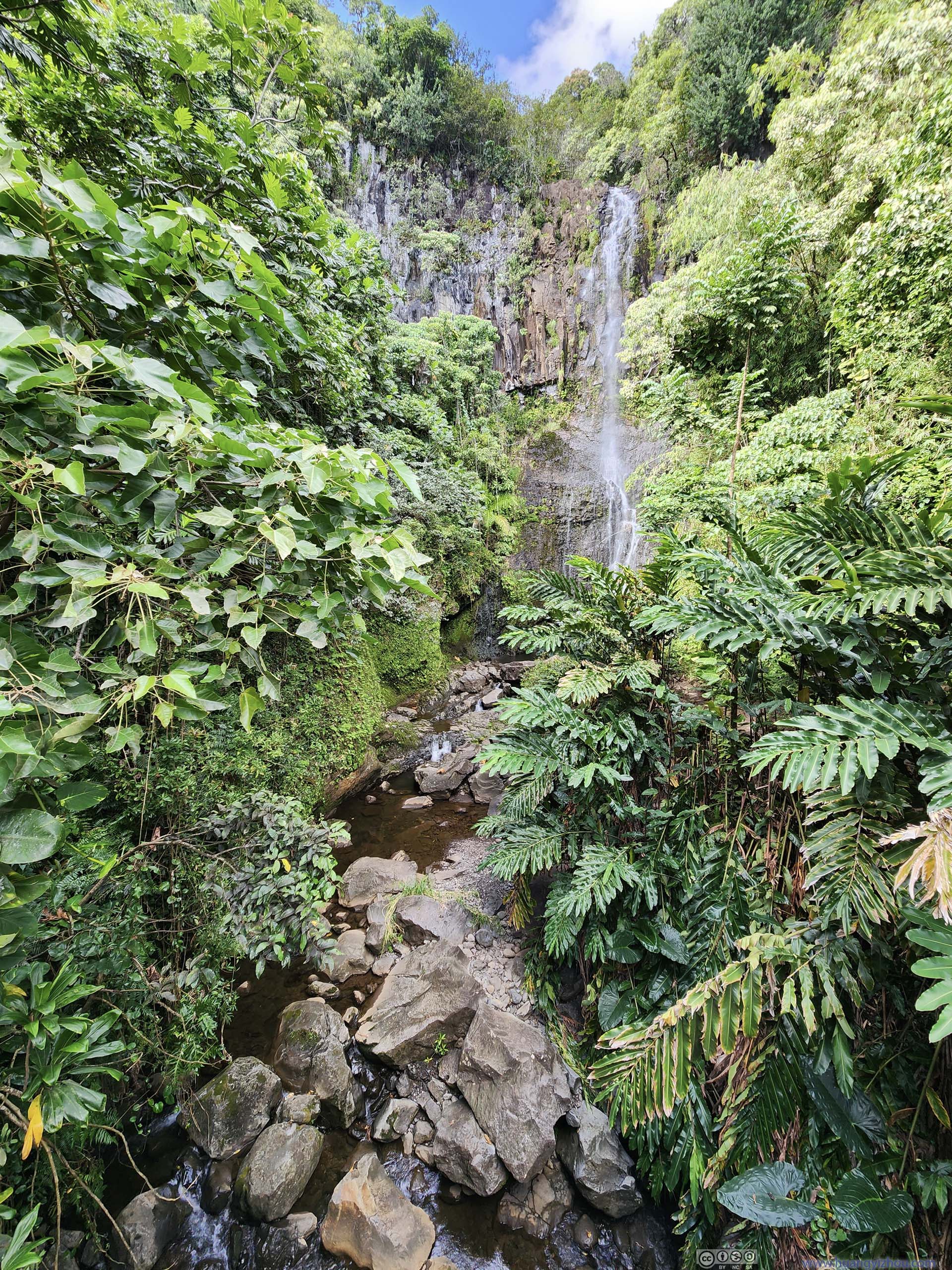
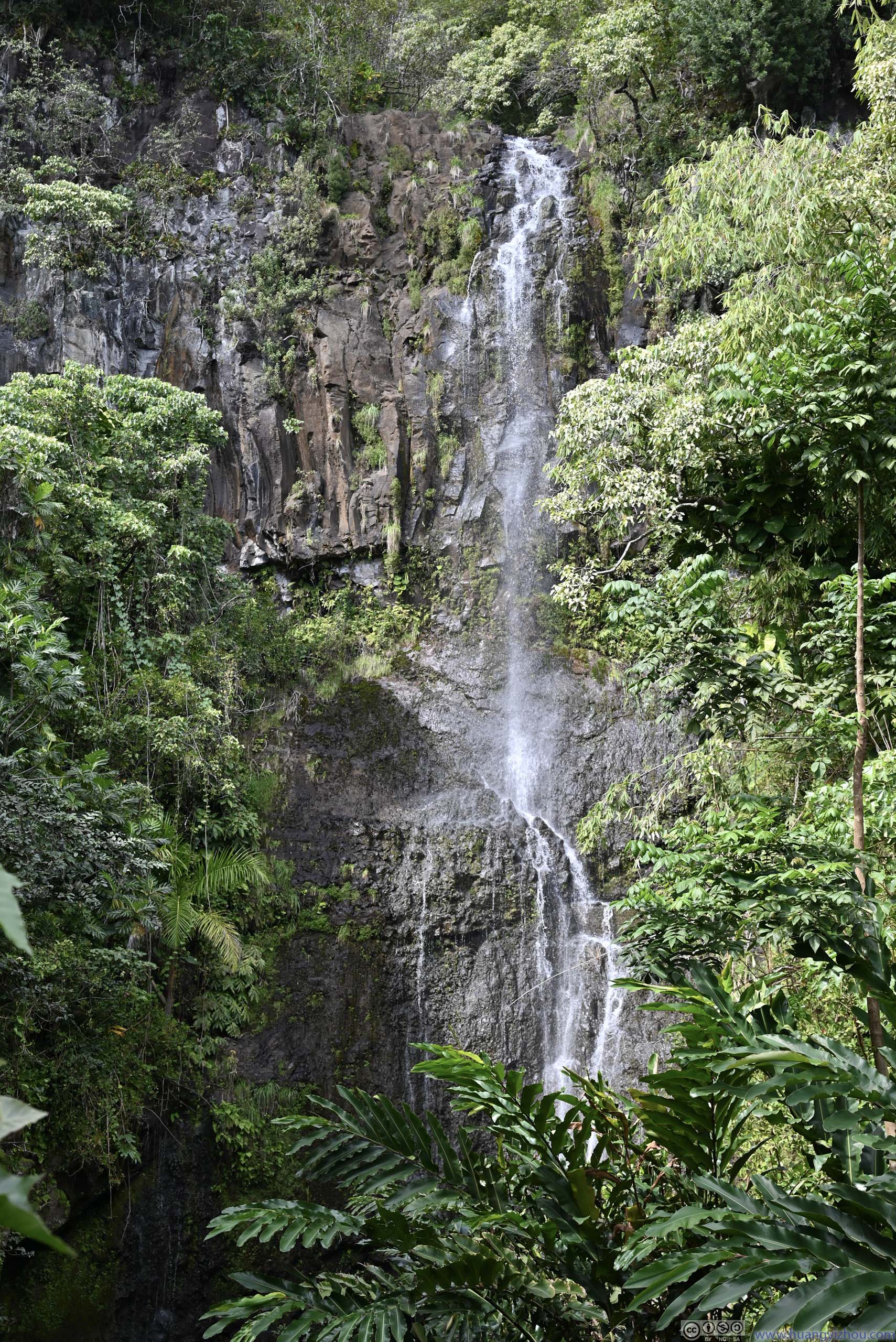
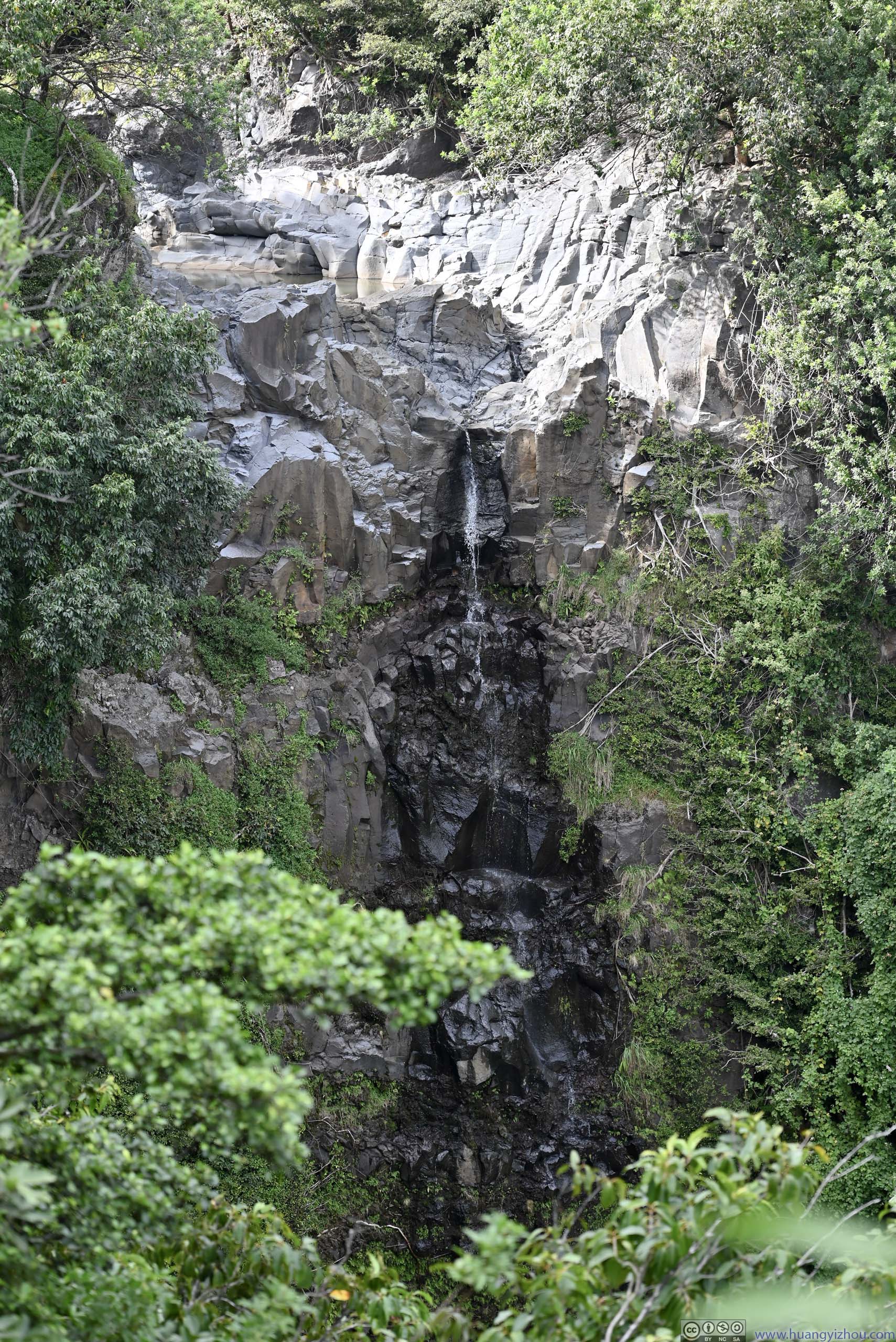
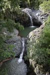
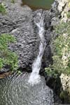
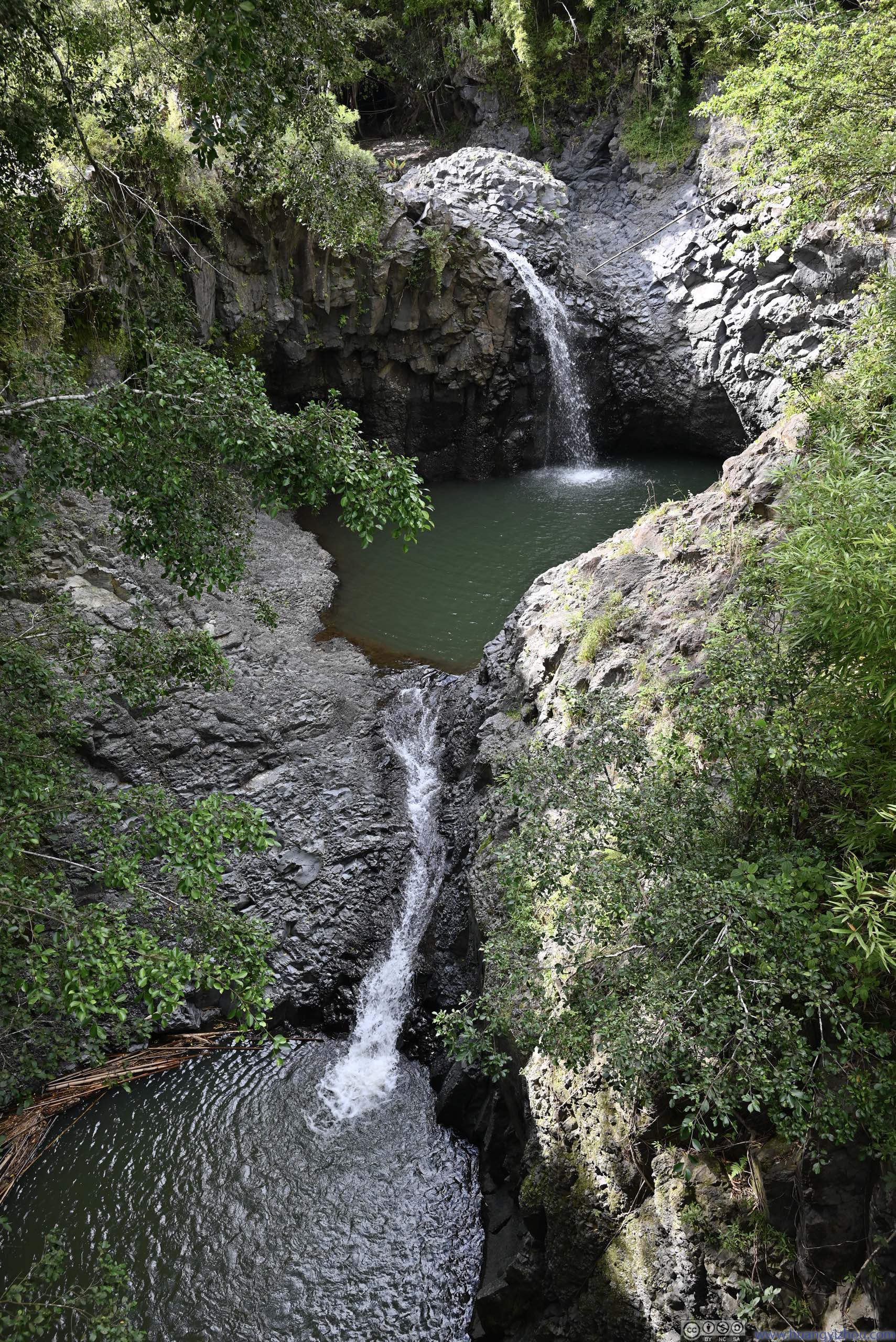
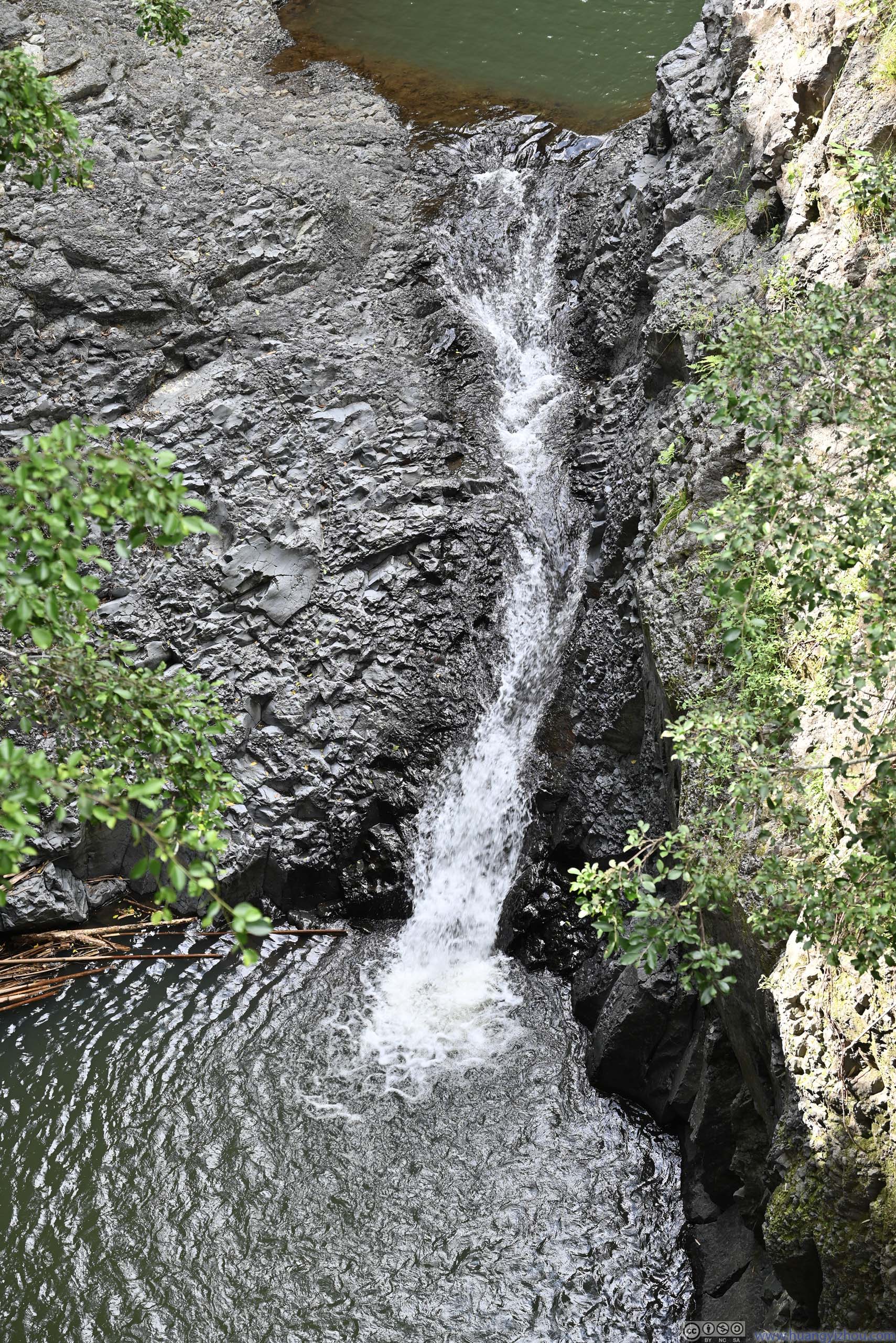
Just a short distance into the trail, we were at the overlook of Makahiku Falls. The view was somewhat obscured by vegetation. In addition, due to lack of water the waterfall was hardly striking compared to the pictures online.
Makahiku Falls
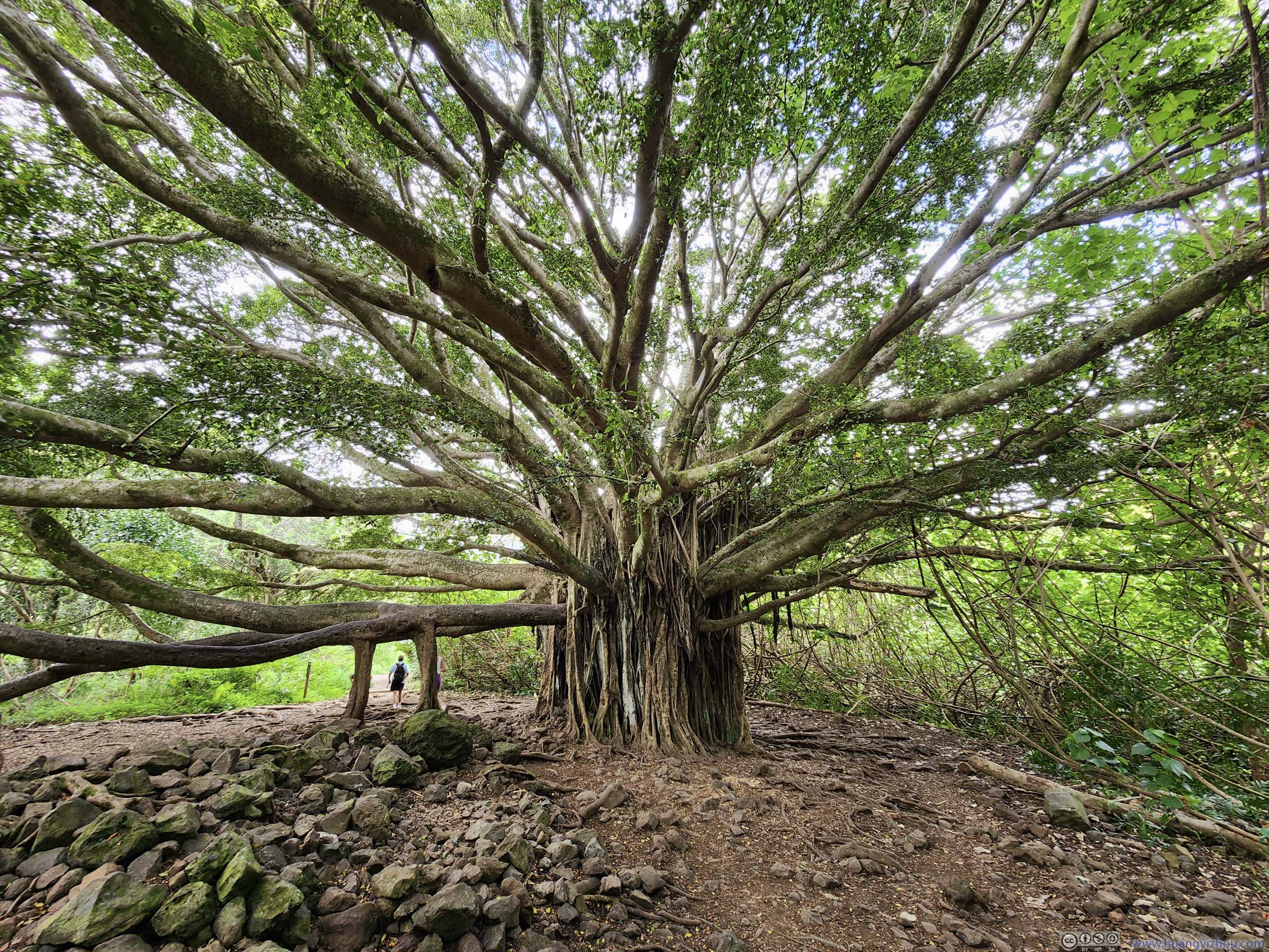
A short distance after the overlook of Makahiku Falls was a giant banyan tree. With the lack of water in the “waterfall”, this was probably the highlight of the hike.
Banyan Tree
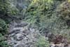
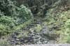
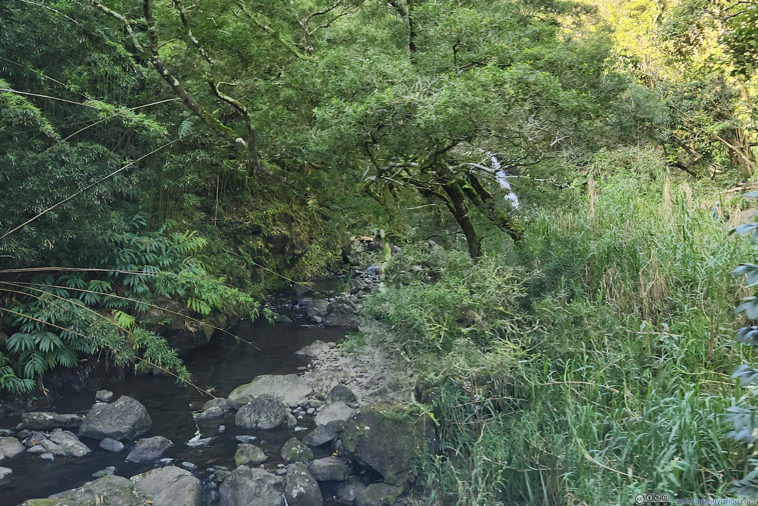
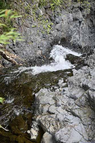
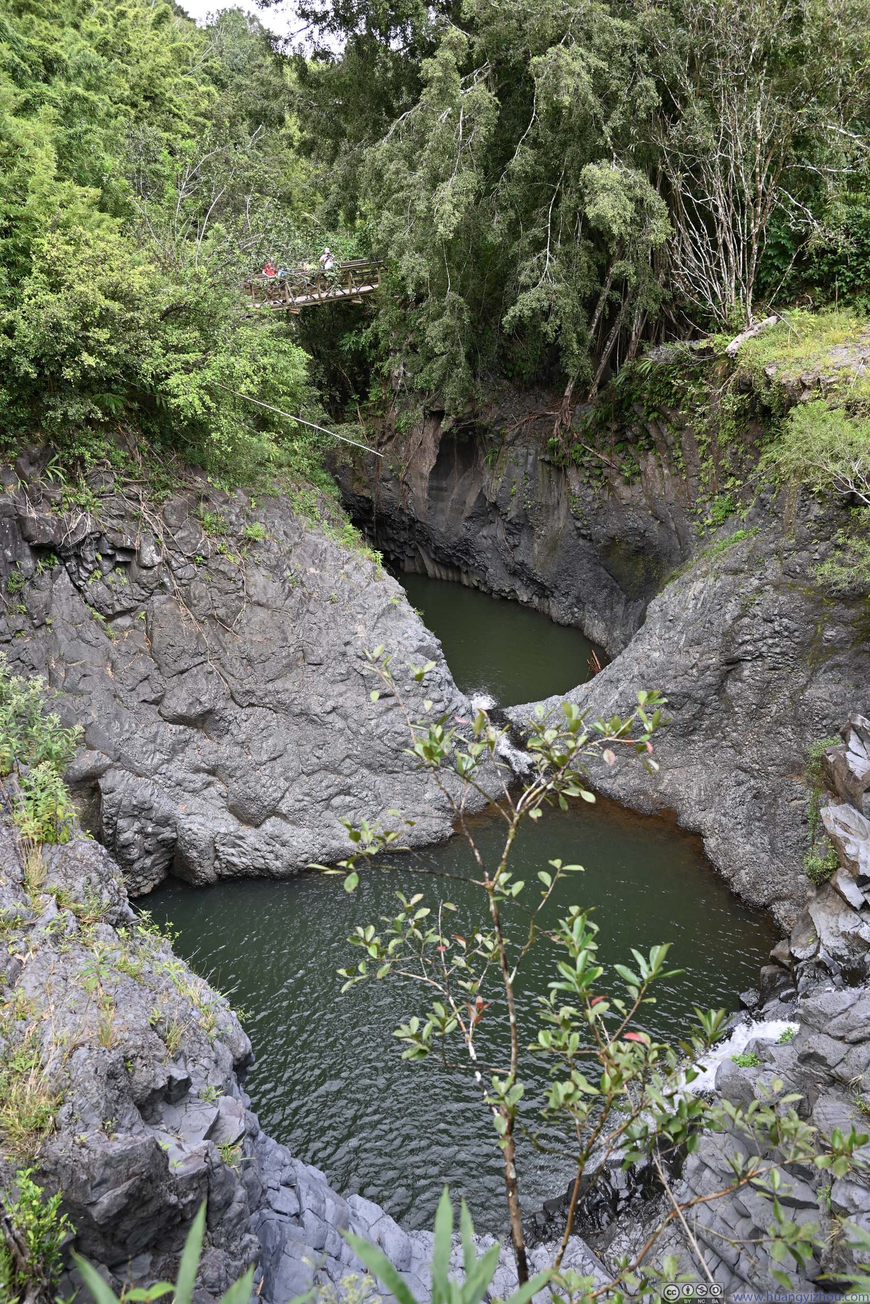
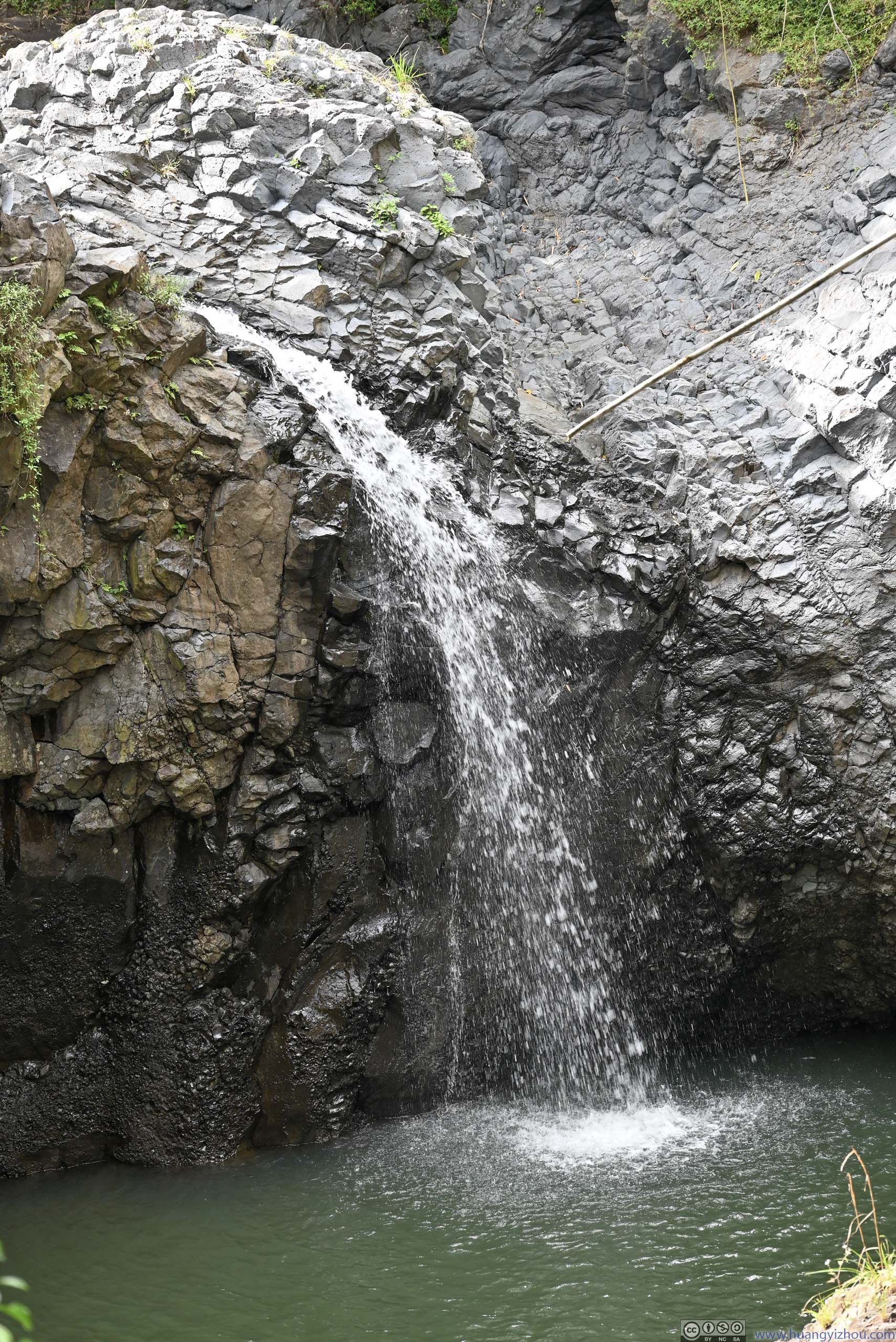
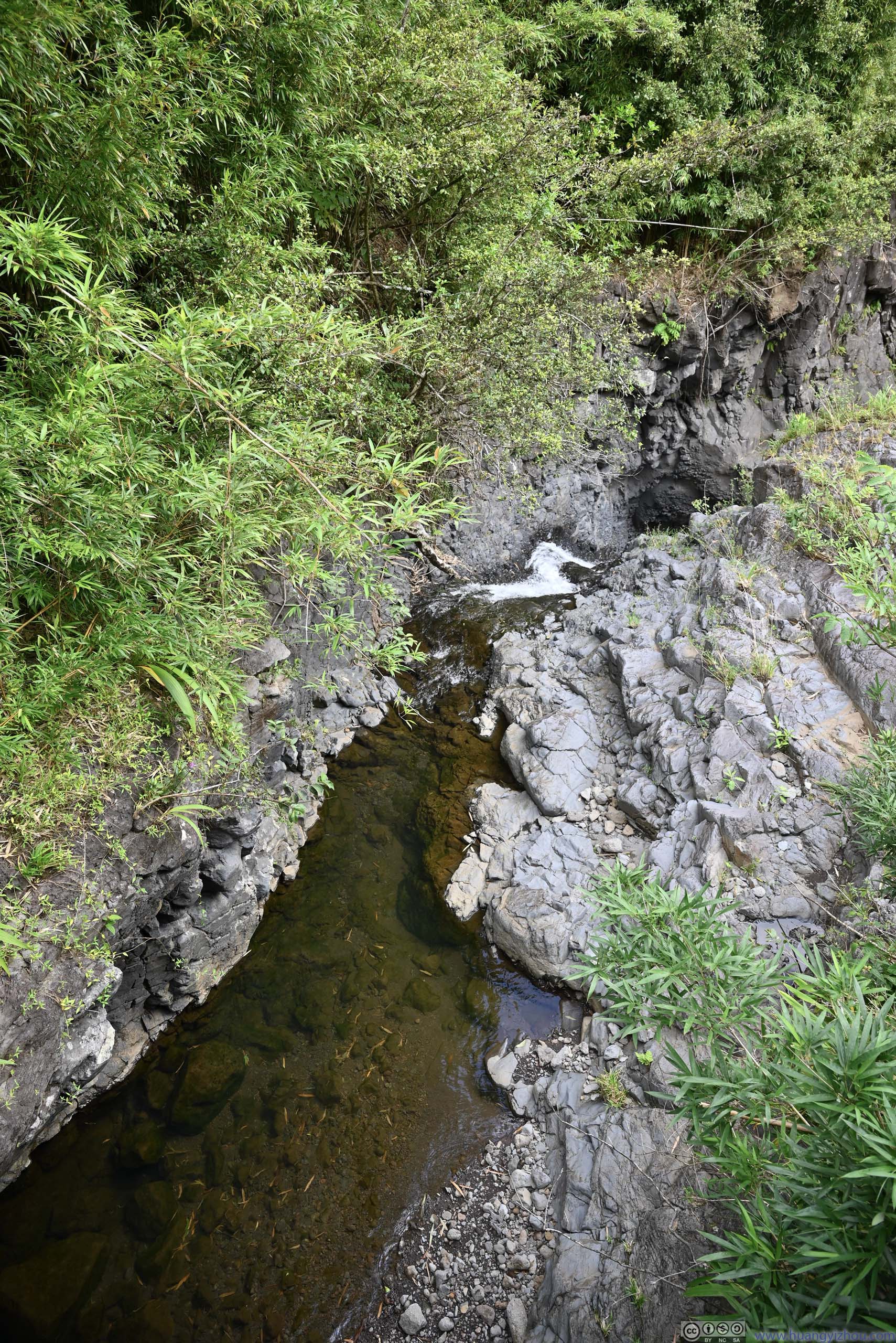
Just over halfway distance, the trail crossed two bridges over Pipiwai and Palikea Streams near their confluence. Water in these streams flew downstream towards ‘Ohe’o Gulch, but since water here was clearer, I named them “more sacred pools”.
 Ponds
Ponds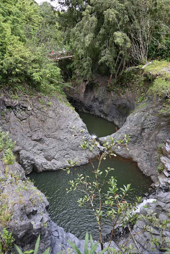 Ponds
Ponds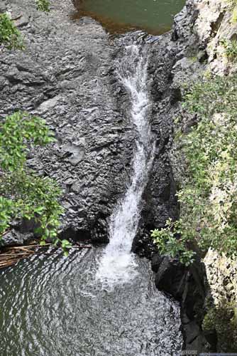
 Waterfalls and Pipiwai Stream

Click here to display photos of the slideshow
Ponds
Ponds
 Waterfalls and Pipiwai Stream
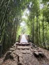
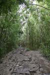
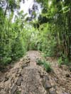
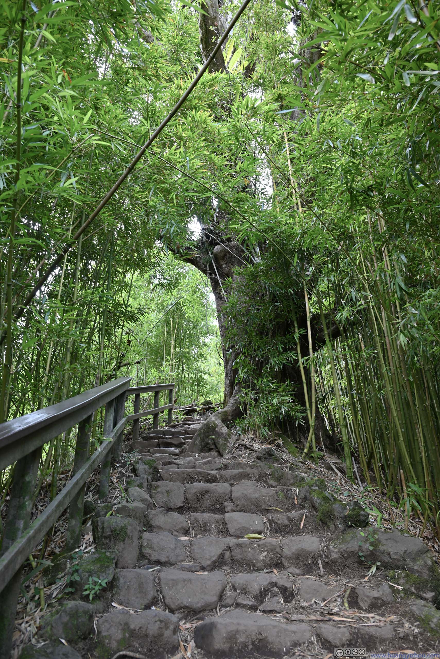
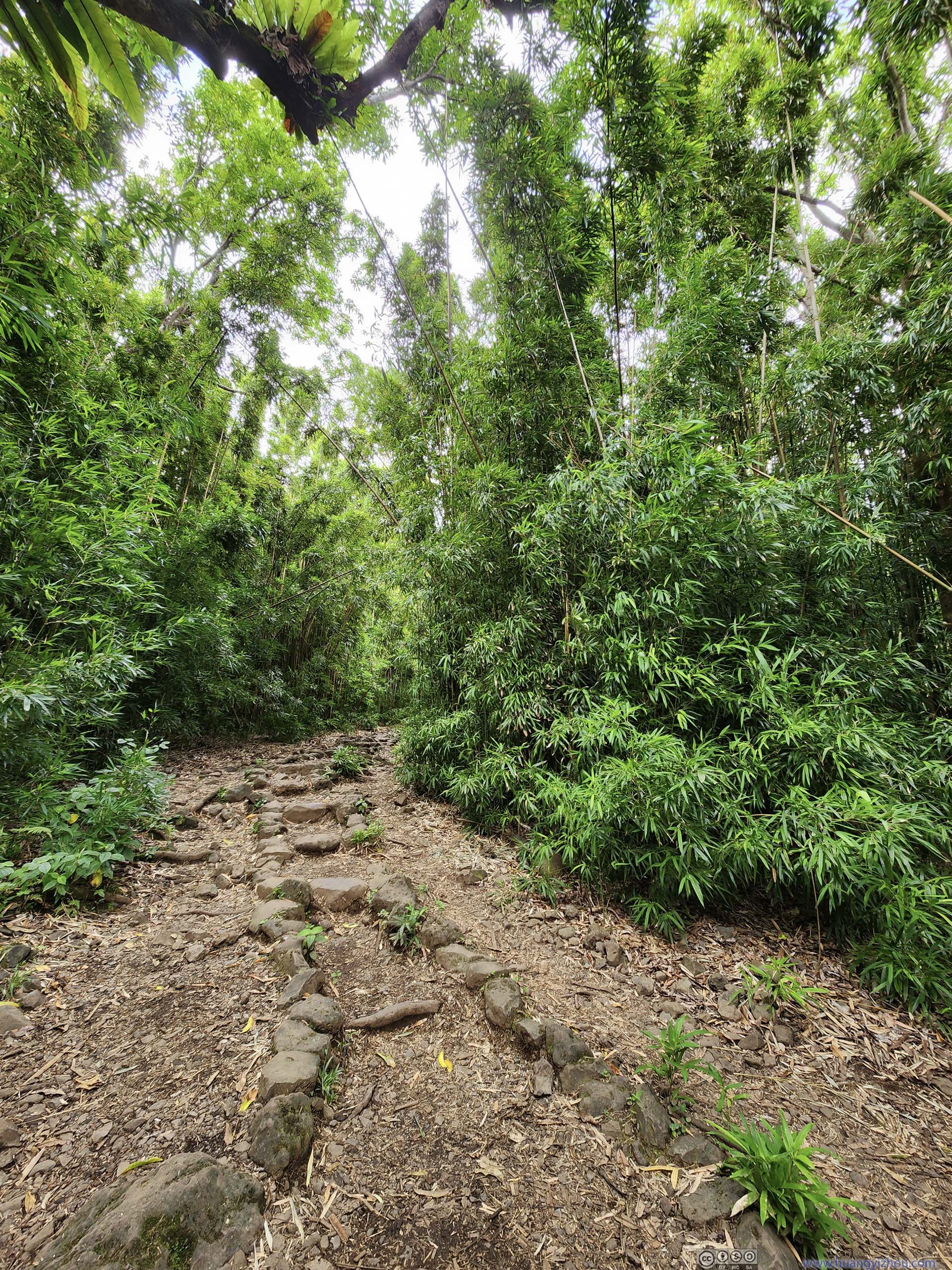
After the bridges was a bamboo forest, which was a rare sight in the states, a sign of Hawaiian islands’ biodiversity.
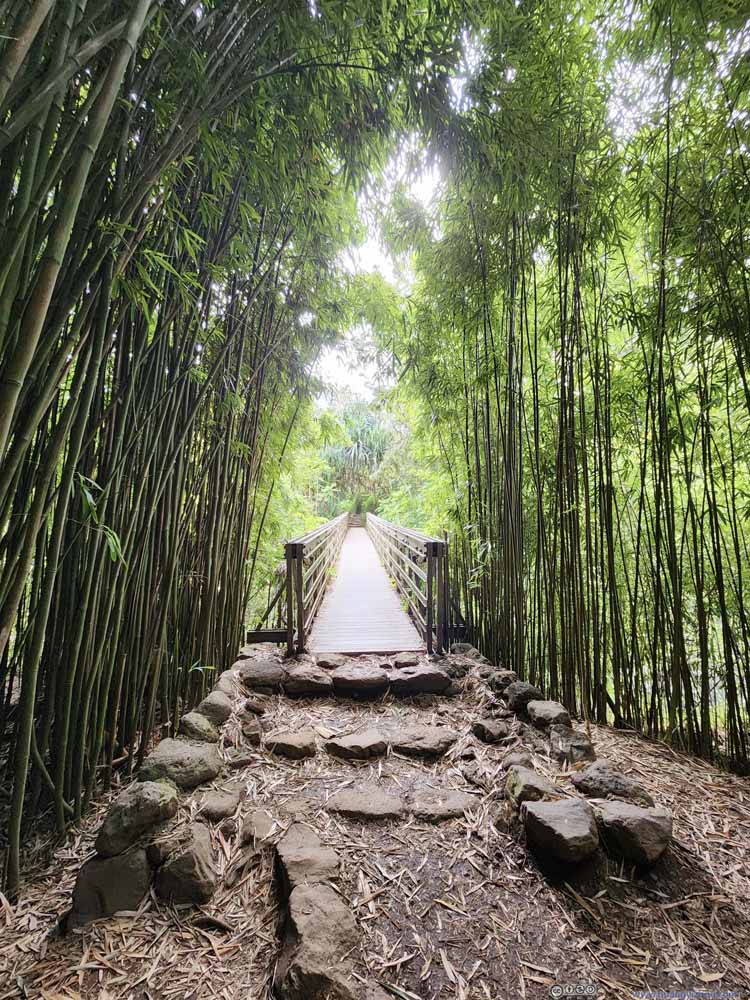 Bridge in Bamboo Forest
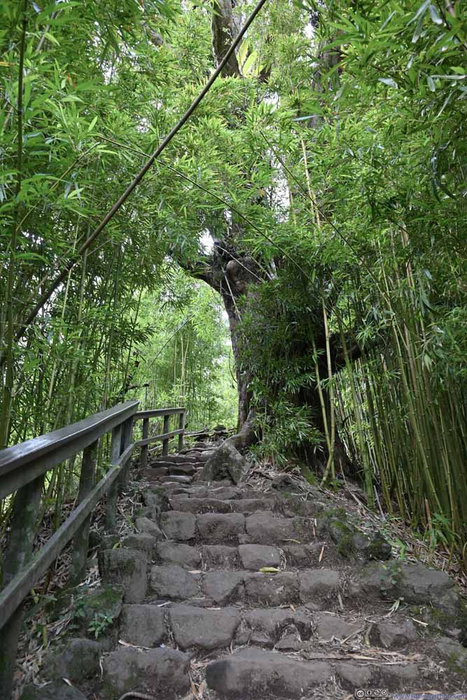 Bamboo Forest
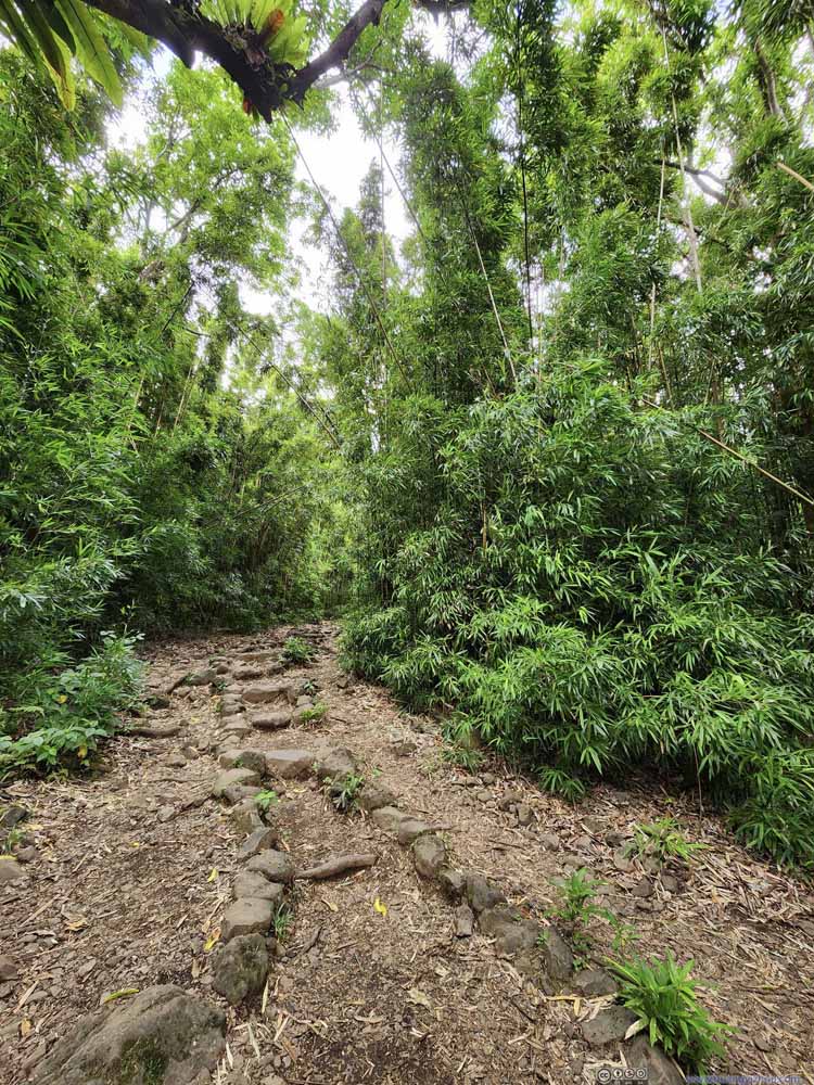 Bamboo Forest
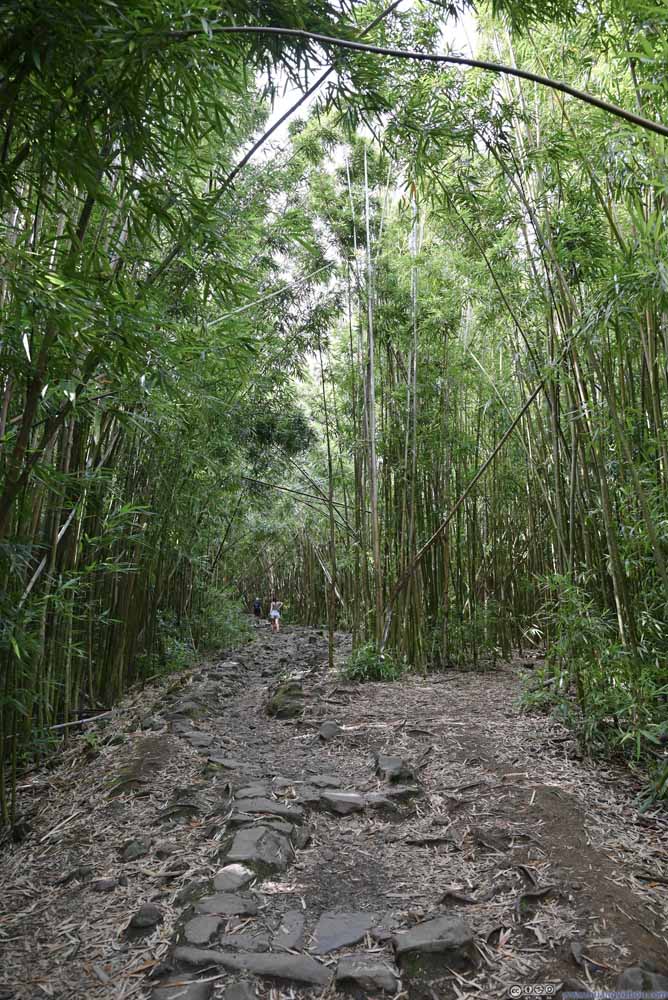 Bamboo Forest
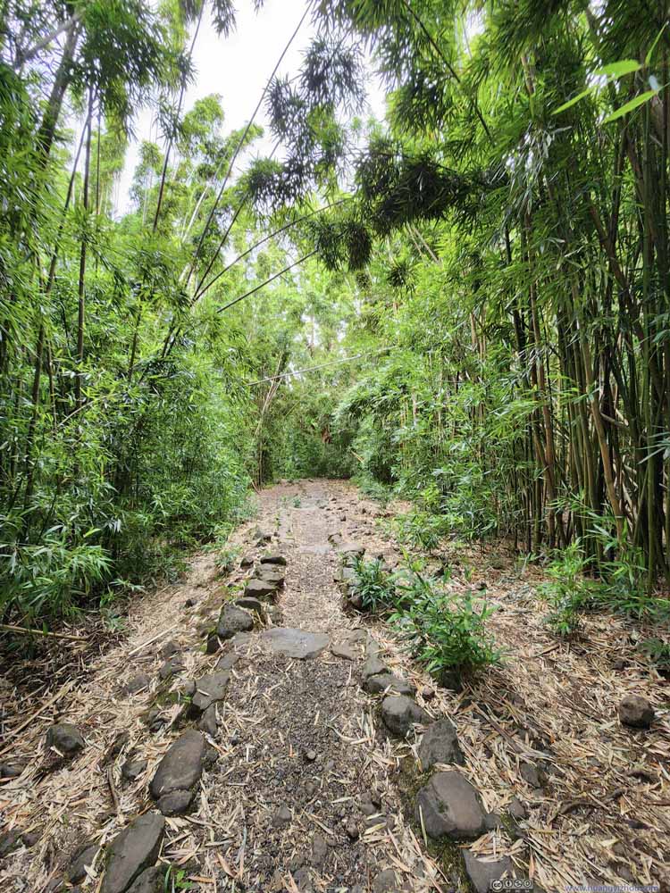 Bamboo Forest

Click here to display photos of the slideshow

Bridge in Bamboo Forest
Bamboo Forest
Bamboo Forest

Bamboo Forest

Bamboo Forest
At this time, we were 40 minutes into the hike, and about 2/3 of the way towards the end of the trail, Waimoku Falls. From our experience with other waterfalls of the day, we figured the sights of Waimoku Falls would hardly be impressive. In addition, we didn’t want to keep our friend waiting too long at the parking lot, so we decided to head back. We went slightly faster on the descent, and it took us about 30 minutes to reach the parking lot.
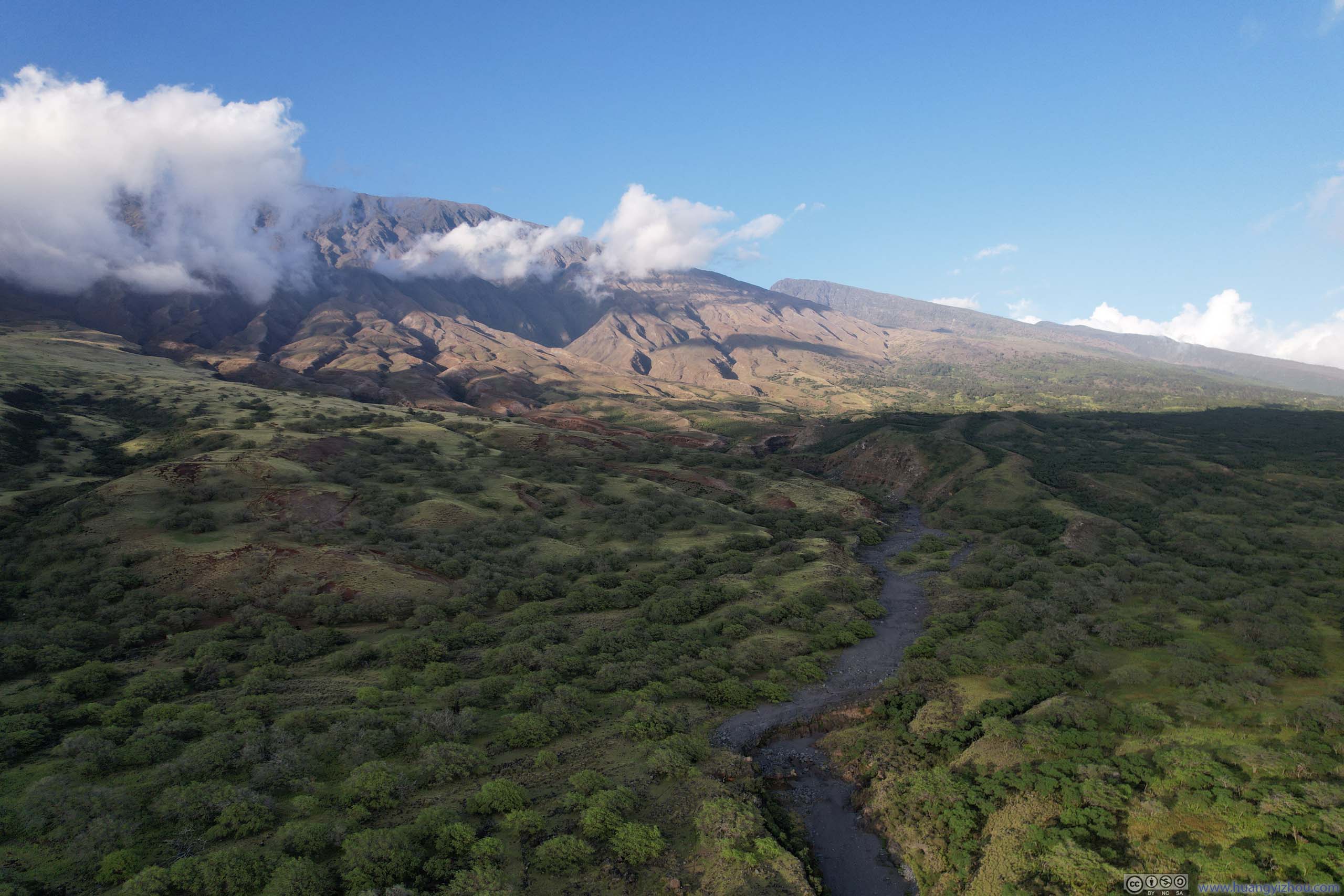
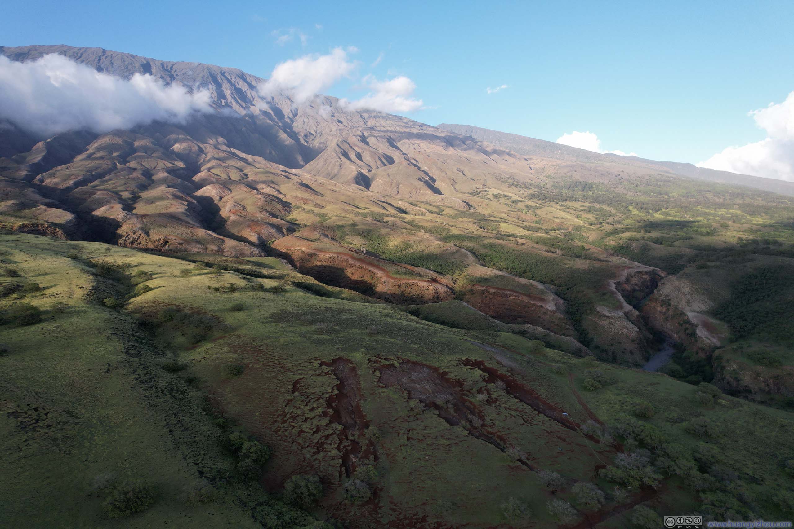
By the time we left Haleakalā National Park, it’s past 4pm. There were two options for us to go back to Kahului, tracing our way back along Hana Highway, or taking Pi’ilani Highway (Hawaii Route 31) west to loop around Haleakalā.
The second option was also known as “back road to Hana”. Portions of the road were narrow, unpaved, near steep cliffs, pothole-ridden, or in a combination of previously listed conditions (the road was still maintained by the County of Maui). As a result, “Hana Highway” was generally the recommended route heading back from ‘Ohe’o Gulch.
However, with our rental car incident the previous day, we got “upgraded” from a Nissan Sentra to a Jeep Wrangler. We thought if there were cars making it through Pi’ilani Highway, then a Jeep Wrangler would certainly make it (otherwise there was hardly any utility for the “upgrade”).
In the end, we did make it unscathed. Here are some of my opinions:
- I think it’s unwise to drive the road during or after moderate to heavy rainfall. There were sections where water or rockfall could pose significant danger.
- Provided it’s dry, an average but cautious driver should easily make it in a car with moderately high ground clearance (think, Toyota RAV4, Jeep Cherokee).
- Provided it’s dry, an good and cautious driver should make it in most cars (think, Toyota Camry). Despite most of the cars we passed were SUV’s, we did see a couple of sedans, including a Chevrolet Camaro.
- The most dangerous section was to the east of Kalepa Gulch, within Haleakalā National Park, due to its rockfall potential and exposure.
Throughout the day, I used a windscreen-mounted GoPro to record the entire road trip, including the exciting/challenging sections of Pi’ilani Highway along the cliff. Below was the video hosted on YouTube.
Unfortunately, some of my video files got corrupted. As a result, I lost recording for about 40 minutes of driving, including most (if not all) of the challenging sections of Pi’ilani Highway. 😭 Below were the timestamps of the video:
- 1:04 Road to Hana Mile Marker Zero (intersection with Kaupakalua Road)
- 1:28 Parking Lot for Twin Falls
- 3:35 Eucalyptus Rainbow Trees
- 5:18 Waikamoi Nature Trailhead
- 5:32 Haipua’ena Falls
- 6:14 Puohokamoa Falls
- 6:31 Nu’yenle’e waterfalls
- 6:53 Kaumahina State Wayside Park
- The first 20 seconds (real time) after leaving Kaumahina State Wayside Park wasn’t recorded.
- 8:01 An unofficial overlook of Honomanu Bay
- 9:09 Entering a detour to Keanae Peninsula
- 9:40 Leaving Keanae Peninsula and continue on Hana Highway
- 10:53 Upper Waikani Falls (one of the few waterfalls visible from car)
- 11:48 Wailua Iki Falls
- 12:43 Pua’a Ka’a State Wayside
- 13:30 Hanawi Falls (one of the few waterfalls visible from car)
- 13:57 Makapipi Falls
- 16:57 Spur to Wai’ānapanapa State Park (Black Sand Beach)
- 17:29 Temporarily leaving Hana Highway, heading for Hana Bay.
- 17:50 Hana bay
- 18:01 Back to Hana Highway
- 18:31 Temporarily leaving Hana Highway, heading for Koki Beach Park.
- 18:46 Koki Beach Park
- 19:11 Back to Hana Highway
- 21:08 Wailua Falls
- 23:01 ‘Ohe’o Gulch
- 23:11 National Park Entrance for ‘Ohe’o Gulch
- 24:25 Ka‘āpahu Bay
- 24:57 Just as I reached the start of the exciting/challenging part of Pi’ilani Highway (Back Road to Hana), my recording file got corrupted. As a result, I lost video recording for the next 40 minutes of driving.
- 25:06 The video resumes from approximately “Huakini Bay”.
- 26:08 Manawainui Gulch
- 28:38 A roadside turnout where we watched sunset.
- The video stopped at around mile mark 20 along Kula Highway as it got dark.
In case one didn’t want to keep up with the ads on YouTube, here’s the same video hosted on my server:
30 minutes and 22 seconds, 2160p30fps, H264 only, 16Mbps/3.49GB.
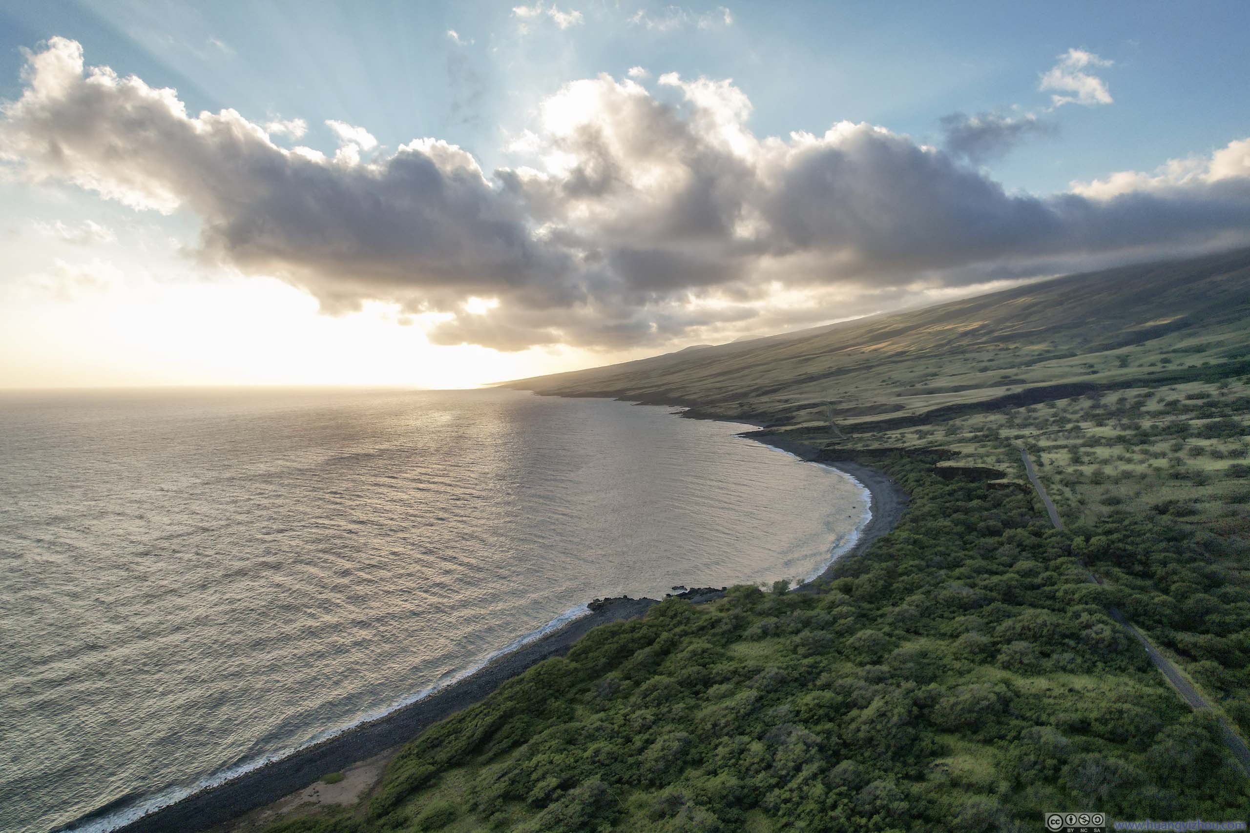
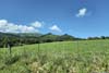
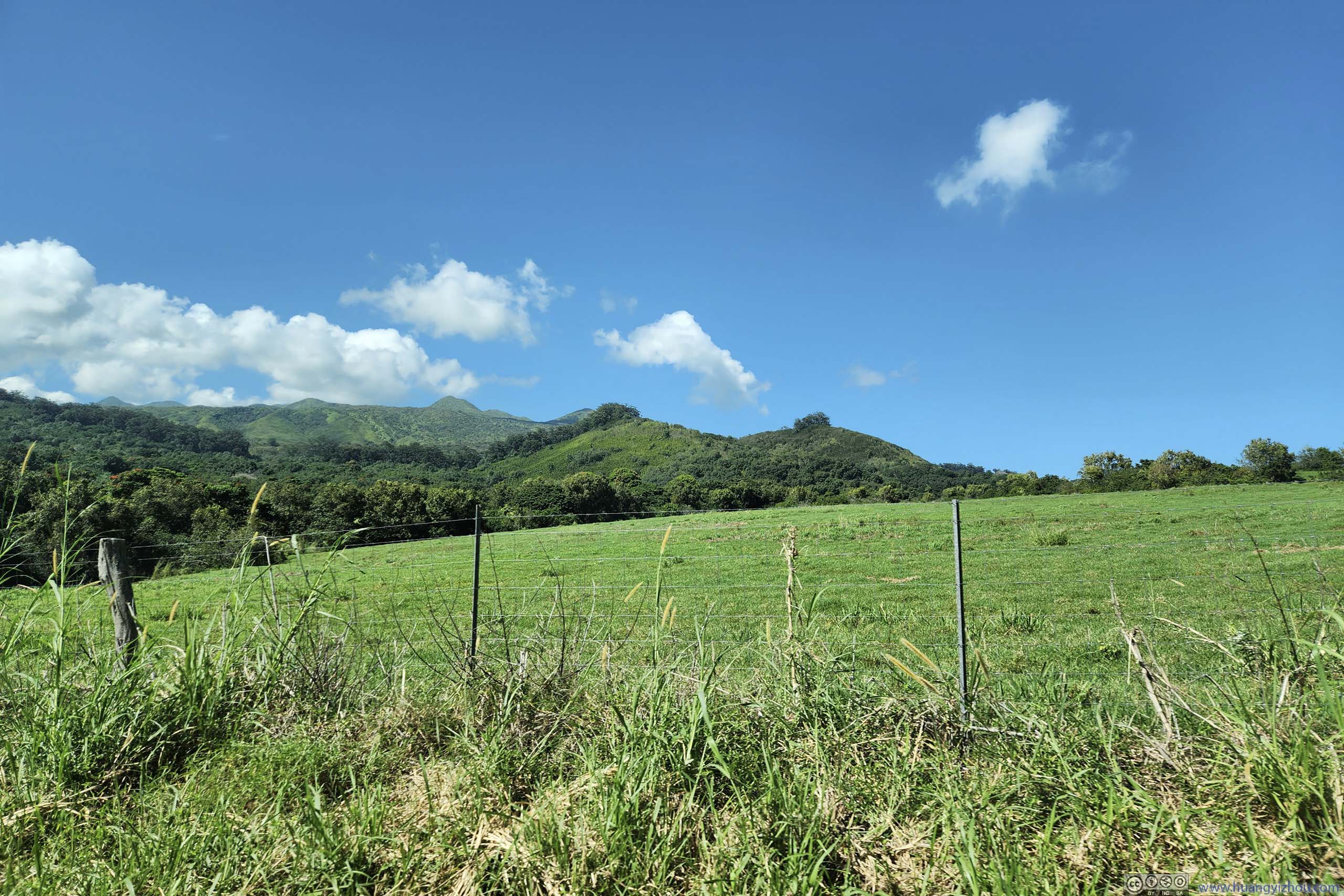
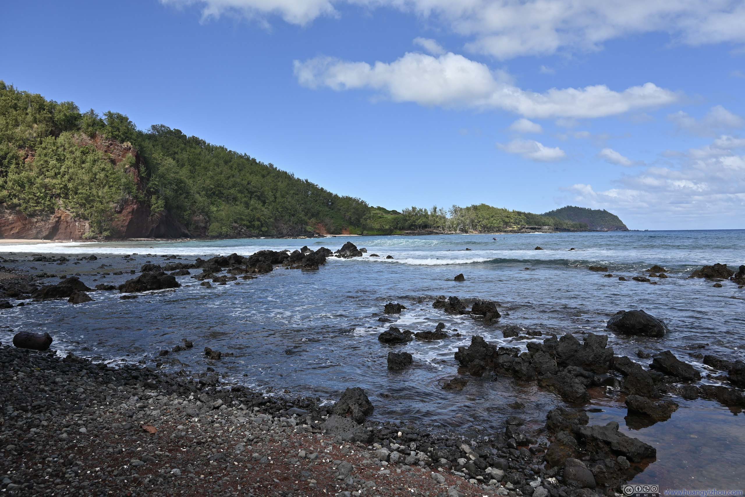
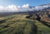
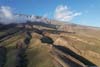
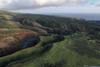
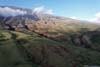
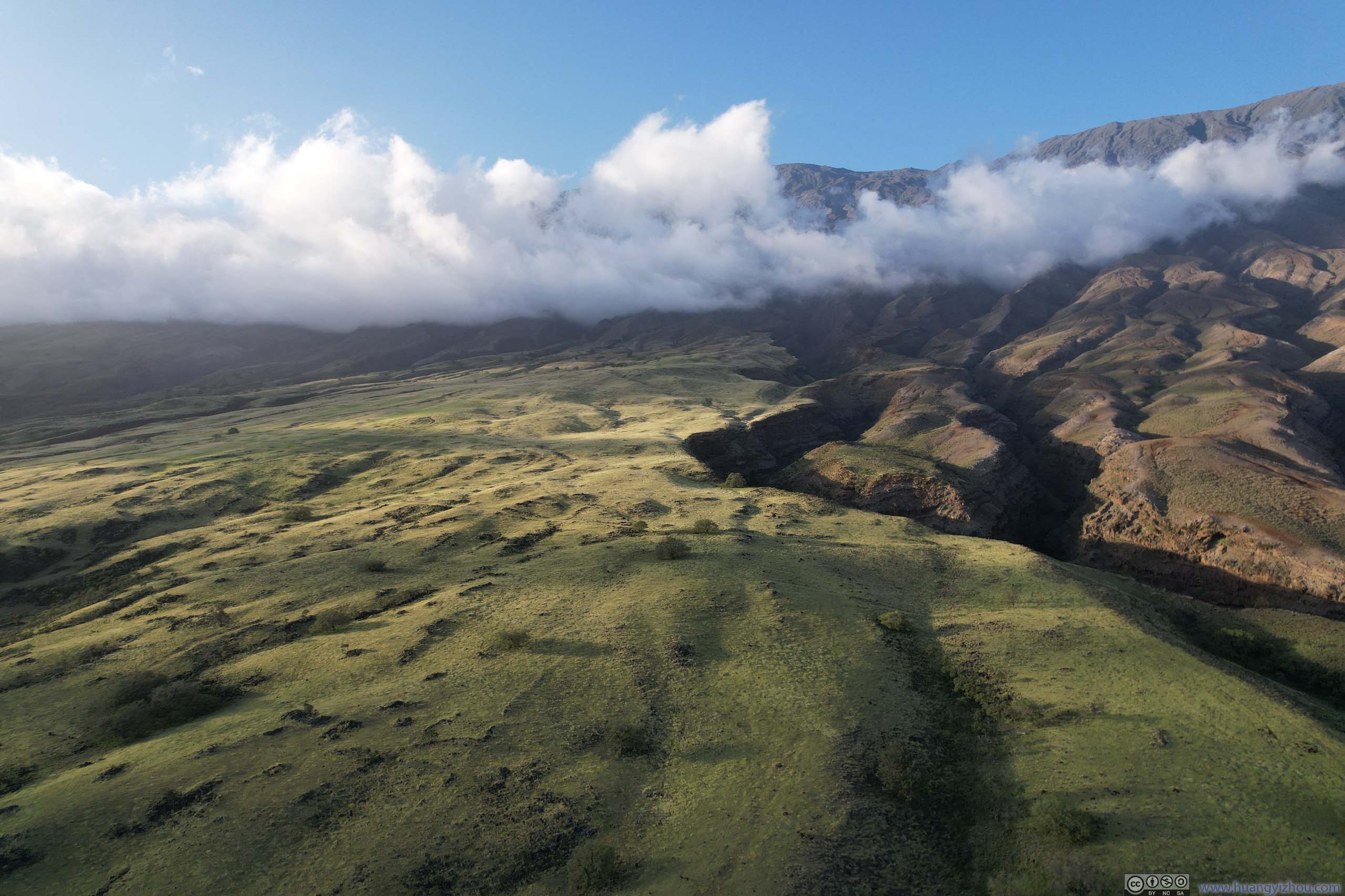
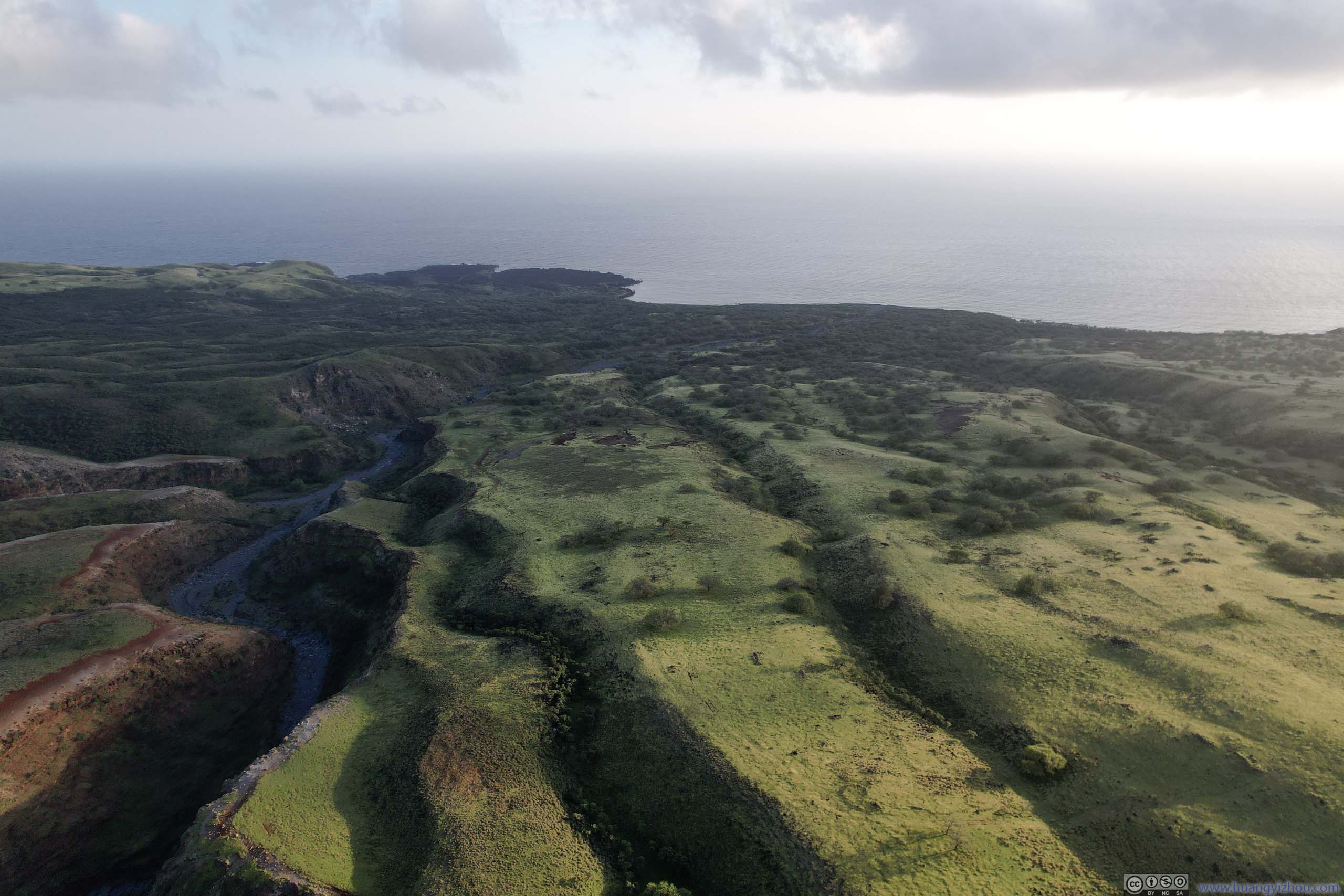
After leaving the scary sections behind, the road condition improved and we found ourselves in a completely different landscape than earlier today. Instead of lush rainforest, the relative lack of precipitation meant the southern slope of Haleakalā was decorated with shallow bushes, offering unobscured views down the horizon. The setting sun through patchy clouds cast a warm layer of gold onto the fields, making it a perfect wilderness scene.
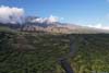
Along the way, we found a spot to pull over where I launched my drone for an aerial tour of the gullies at the southern slope of Haleakalā, together with the coast off it.
 Southern Slope of Haleakala against Light
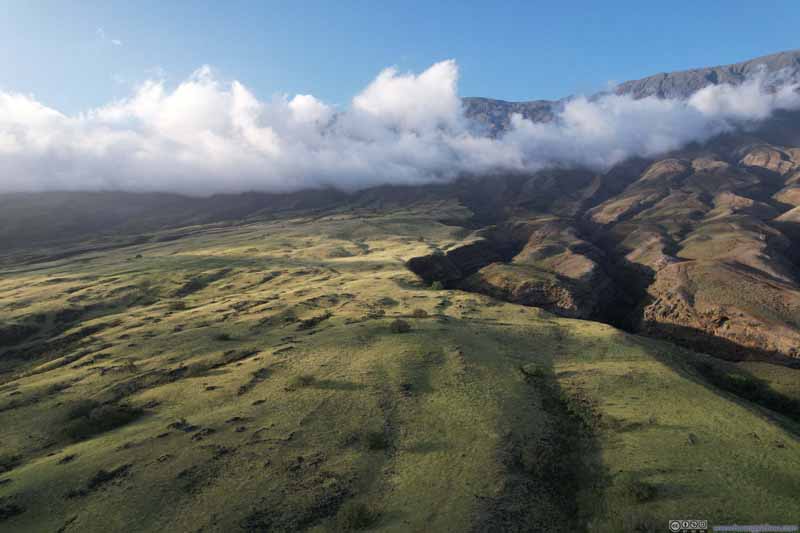 Southern Slope of Haleakala
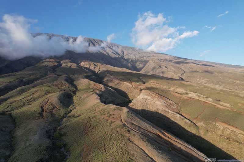 Southern Slope of HaleakalaErosion that cut out these mini gullies.
 Southern Slope of HaleakalaErosion that cut out these mini gullies.
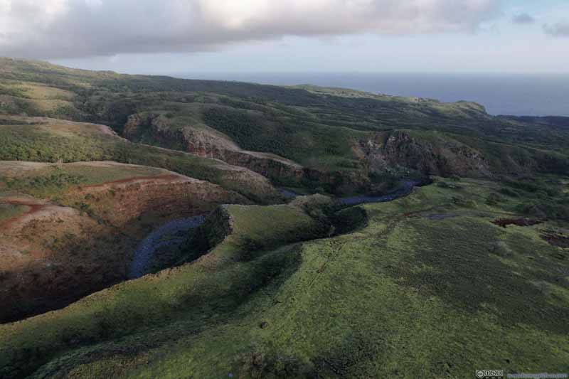 Southern Slope of HaleakalaSouthern Slope of Haleakala
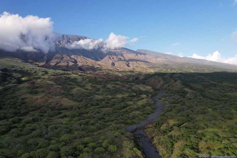 Southern Slope of Haleakala
 Southern Slope of Haleakala
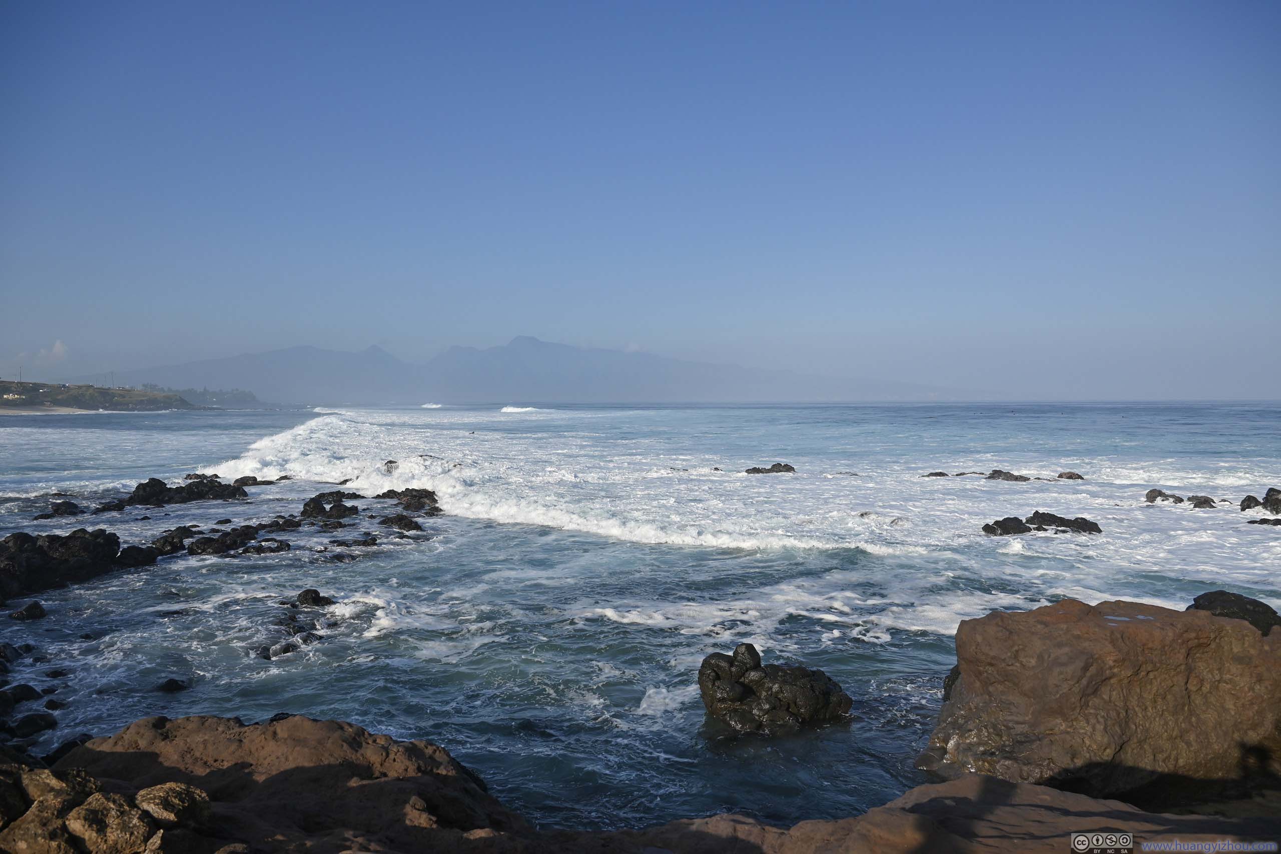
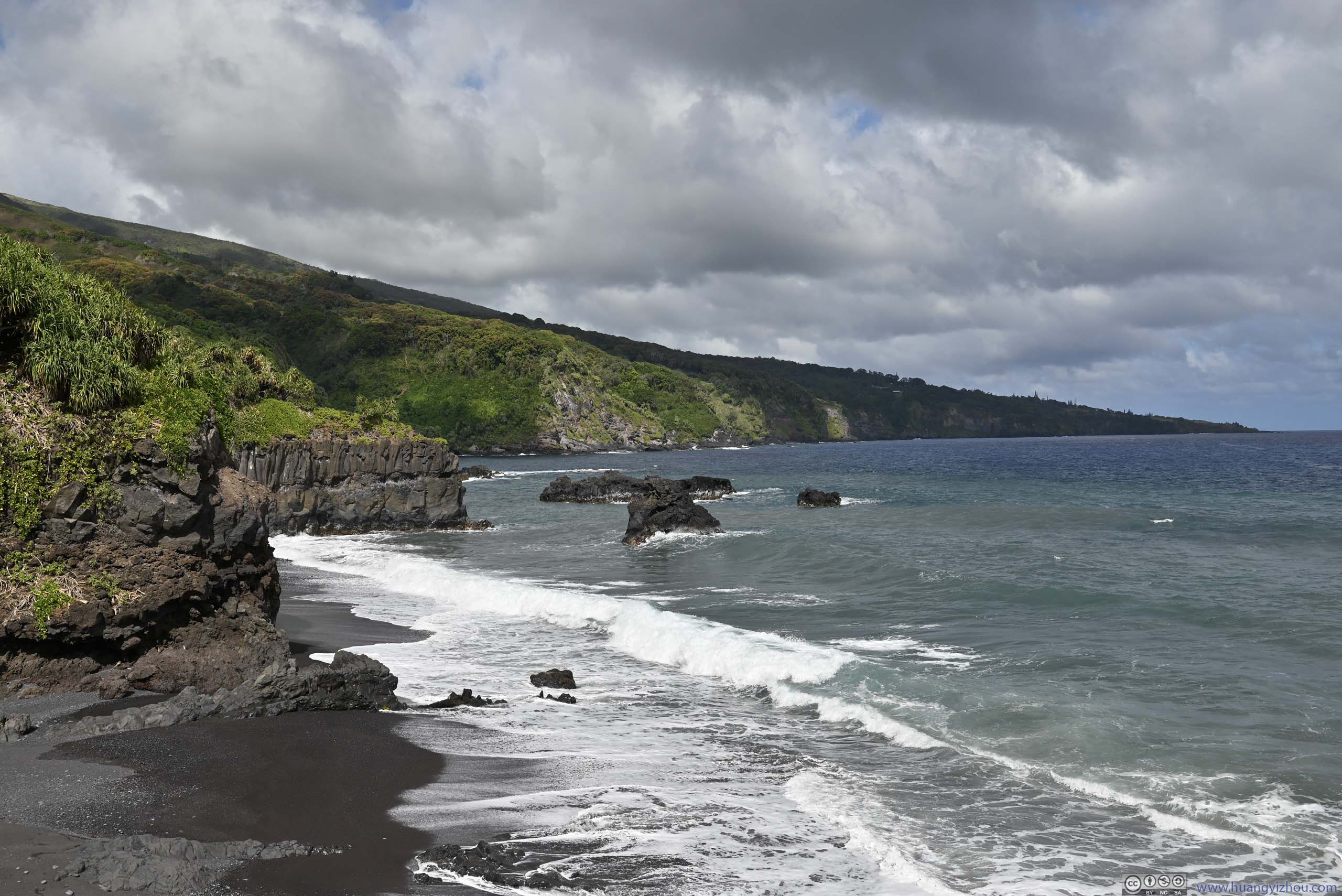
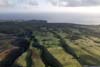
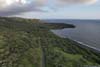
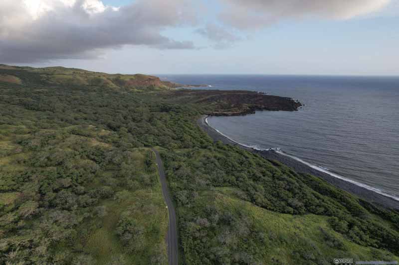 Southern Maui Coast
 Southern Maui Coast
Click here to display photos of the slideshow

Southern Slope of Haleakala against Light
Southern Slope of Haleakala

Southern Slope of HaleakalaErosion that cut out these mini gullies.
Southern Slope of HaleakalaErosion that cut out these mini gullies.

Southern Slope of HaleakalaSouthern Slope of Haleakala
Southern Slope of Haleakala
Southern Slope of Haleakala
Southern Maui Coast

Southern Maui Coast
Southern Slope of Haleakala near Sunset
And here’s a video:
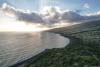
Continuing on through this beautiful landscape, at just past 6pm, we found another spot to pull over, this time we watched sunset over Kaho‘olawe Island to the west.
Sunset over Kaho‘olawe Island
Fields of Southwest Maui near Sunset
After the sunset, it took us nearly an hour to get back to our hotel in Kahului. This section following Hawaii Route 37 wasn’t that scenic (it was dark anyways), so we passed through it without stopping. After a dinner near downtown Kahului, we called it a day.
END
![]() Day 5 of 2023 Trip to Hawaii, Road to Hana by Huang's Site is licensed under a Creative Commons Attribution-NonCommercial-ShareAlike 4.0 International License.
Day 5 of 2023 Trip to Hawaii, Road to Hana by Huang's Site is licensed under a Creative Commons Attribution-NonCommercial-ShareAlike 4.0 International License.